Metroad 10 Northern Beaches |
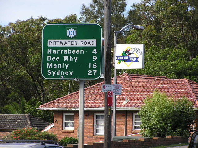
Pittwater Rd southbound at Narrabeen. April 2004.
In 2013, RMS will be implementing a new alpha-numeric route numbering system. For more information, visit the RMS Website. |
|
Forthcoming alpha-numeric route number: |
|
Length: 23km
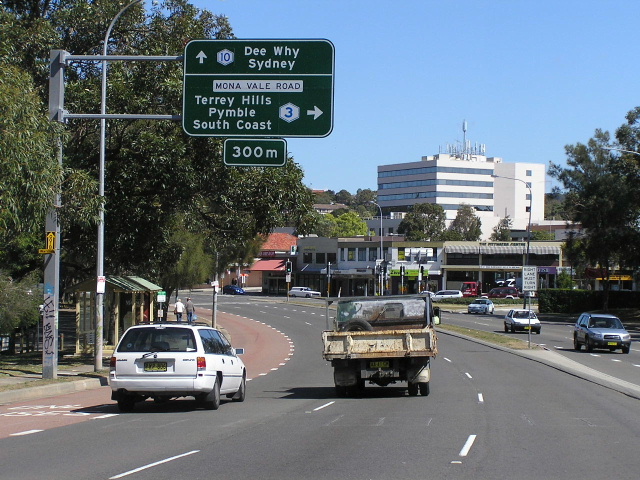
Northern Terminus: Pittwater Road (Metroad 10) & Mona Vale Rd (Metroad 3), Mona Vale
Southern Terminus: Warringah Freeway (Metroad 1) & Falcon St (Metroad 10), Neutral Bay
Route Taken: From Neutral Bay via Military Rd, Spit Rd, Spit Bridge, Manly Rd, Burnt Bridge Ck Deviation, Condamine St, Pittwater Rd to Mona Vale
RTA Internal Classification: Main Road 164
Focal Points:
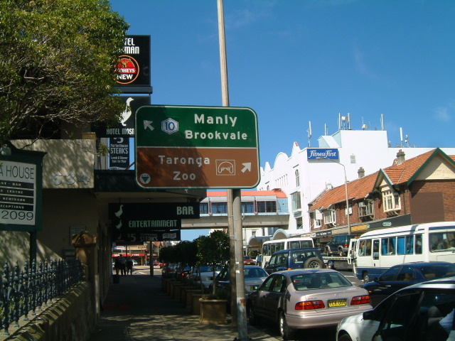
Northbound: (Mosman), Manly, Brookvale, (Dee Why), Mona Vale
Southbound: (Dee Why), Manly, (Balgowlah/Mosman), Sydney
Route Overiew:
Metroad 10 is a predominantly north-south radial route serving the North Shore and Manly/Warringah/Pittwater areas. However, due to acess arrangements to the Warringah Freeway, Metroad 10 becomes an east-west route, then turns to the north again, before meeting the Gore Hill Freeway at Artarmon. Almost the entire route is 4-6 lane divided carriageway, with short 4-lane undivided sections at Narrabeen Lagoon, Spit Bridge and along Falcon Street at Crows Nest.
The development of the route can be traced back to the late 1800's when the majority of Pittwater Rd was constructed, following the establishment of a ferry service across Middle Harbour at The Spit in 1850. In October 1923, a two lane timber opening bridge was opened, replacing the ferry service at The Spit. As part of the project the current southern approach was constructed, bypassing the old route of Parriwi Rd. The northern approach then consisted of Avona Crescent and Old Sydney Rd up to Seaforth. The bridge was tolled until March 1930.
During the late 1920's and 1930's the newly formed Main Roads Board undertook comprehensive reconstruction of the main road system. As part of this, Pittwater Rd and Condamine Street were reconstructed in cement concrete as far north as Narrabeen Lagoon during 1929. The northern approach to Spit Bridge was also reconstructed, with Old Sydney Rd/Avona Crescent becoming one-way southbound and Battle Bvd/Palmerston Place/Ponsonby Pde becoming one-way northbound. This work was completed in March 1932, in time for the extra road traffic generated by the opening fo the Sydney Harbour Bridge.
During the post war years the traffic grew at amazing levels and the existing 2-lane opening bridge became a major bottleneck. Traffic was often backed up as far as Spit Junction when the bridge opened. A new bridge and northern approach was required, and construction commenced in September 1951. The existing southern approach was widened to 6 lanes, with a new 6-lane cutting (Manly Rd) constructed to carry traffic to/from Sydney Rd and the Spit Bridge. The new four lane, opening bridge opened, toll-free, in November 1958.
During the 1960's Military and Spit Roads were widened to 6 lanes after the tram services were replaced by buses. In 1974, the route recieved its first route number, State Route 14. The exact route and details of its subsequent changes in alignment are detailed in the State Route 14 page under Decomissioned Routes.
By the late 1970's traffic on the route had increased remarkedly in the absence of any non-road based public transport to the area. The major bottleneck was through Balgowlah, where traffic from Manly Rd had to use Sydney Rd through Balgowlah shops and then the four-lane Condamine Street to get to Manly Vale. A bypass of this area, known as Burnt Bridge Creek Deviation was originally proposed as part of the County of Cumberland Planning Scheme in 1951. It was finally constructed during the mid 80's and opened to traffic in March 1985, along with assosciated widening of Condamine St to Pittwater Rd. Also completed in 1985 was the widening of Bilgola Bends, permitting the extension of articulated bus services to Avalon and Palm Beach.
It was during the 1990's that the RTA introduced the Sydney Metroad system, however Metroad 10 was not part of the original 6 Metroads. Instead, Metroad 10 was not introduced until 1998. It originally extended from Neutral Bay, via Falcon St and Pacific Highway, to the intersection of Pacific Hwy, Gore Hill Fwy and Longueville Rd at Lane Cove. This was done to provide a connection between Metroad 10 and Metroads 1 and 2, as there was no north-facing ramps at the Warringah Freeway/Falcon St interchange. With the opening of the Lane Cove Tunnel in March 2007, north-facing ramps at that interchange were opened to traffic, enabling through traffic to bypass Crows Nest/St Leonards and so Metroad 10 was truncated at the Warringah Freeway.
 |
Barrenjoey Rd southbound approaching the beginning of Metroad 10 at Mona Vale. Sep 2005. |
 |
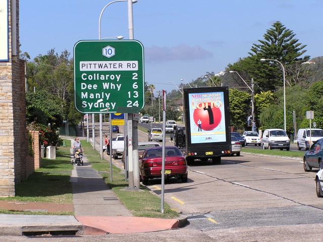
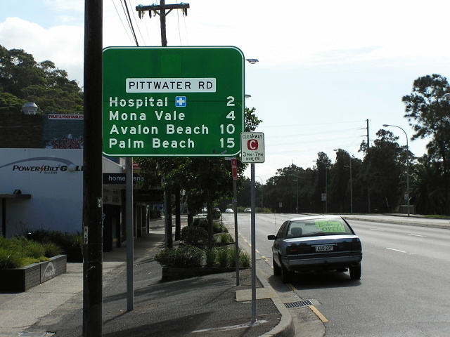
The first RD sign heading south from Mona Vale Rd. April 2004. |
 |
Looking south at Warriewood Road. April 2004. |
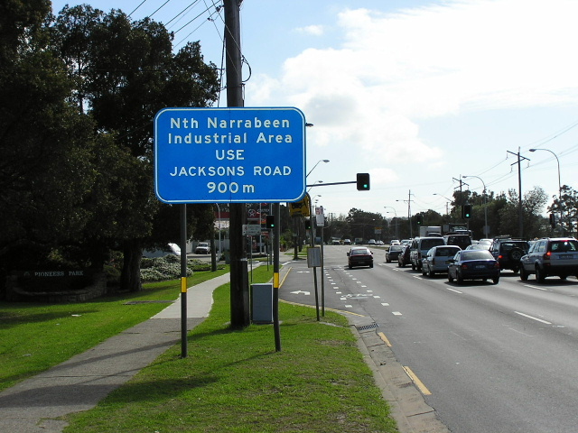 |
Pittwater Rd northbound at Lake Park Rd, North Narrabeen. April 2004. |
 |
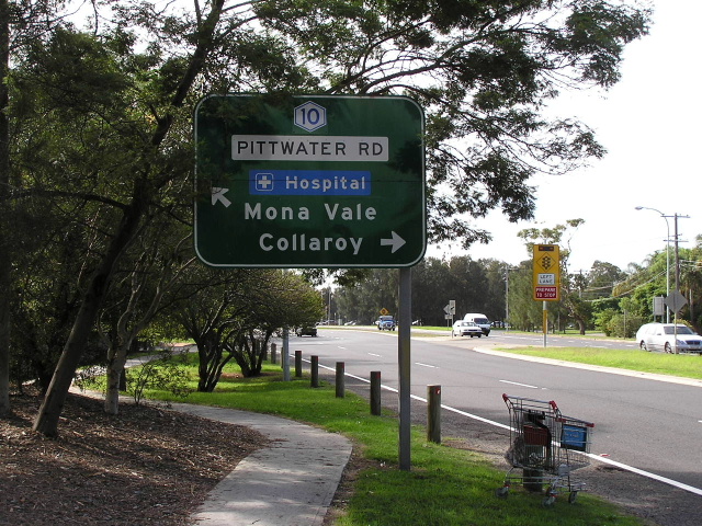
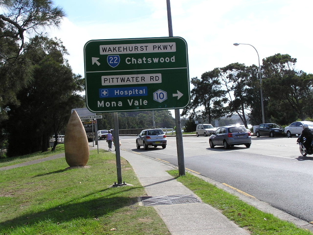
RD sign heading north from Wakehurst Parkway. Note the blank coverplate erroneous installed over a SR14 shield. April 2004. |
 |
Pittwater Rd southbound approaching Wakehurst Pkwy. April 2004. |
 |
Signage for Metroad 10 on Wakehurst Pkwy. April 2004. |
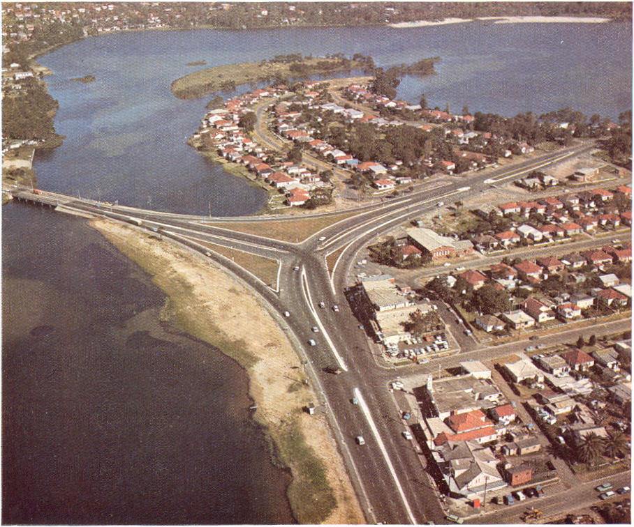 |
1968 aerial view of the Pittwater Rd/Wakehurst Pkwy intersection. |
Same intersection in the early 1900s. |
|
 |
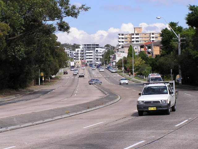
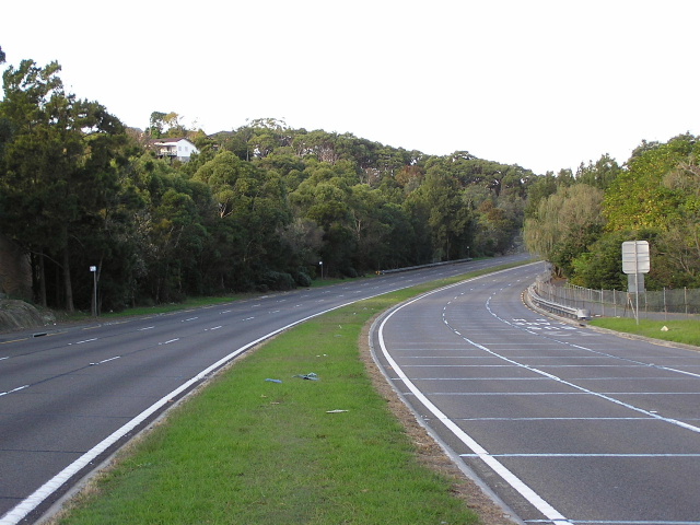
Pittwater Rd northbound approaching Wakehurst Pkwy. April 2004. |
 |
Looking south from Dee Why Lagoon. April 2004. |
 |
Diagrammatic sign showing you how to make right turns in Dee Why. April 2004. |
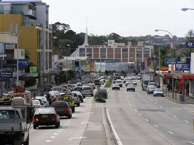 |
Looking north through Dee Why. April 2004. |
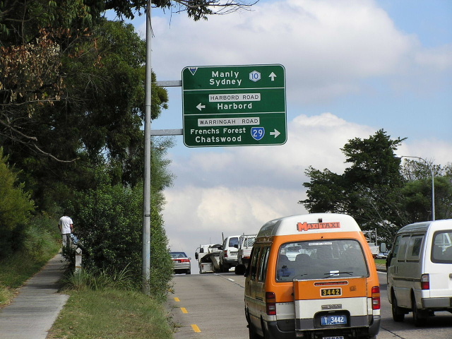 |
Pitttwater Rd southbound approaching Warringah Rd & Harbord Rd. April 2004. |
 |
Harbord Rd northbound approaching Metroad 10 at Brookvale. April 2004. |
 |
RD sign on Pittwater Rd southbound outside Brookvale Oval. April 2004. |
 |
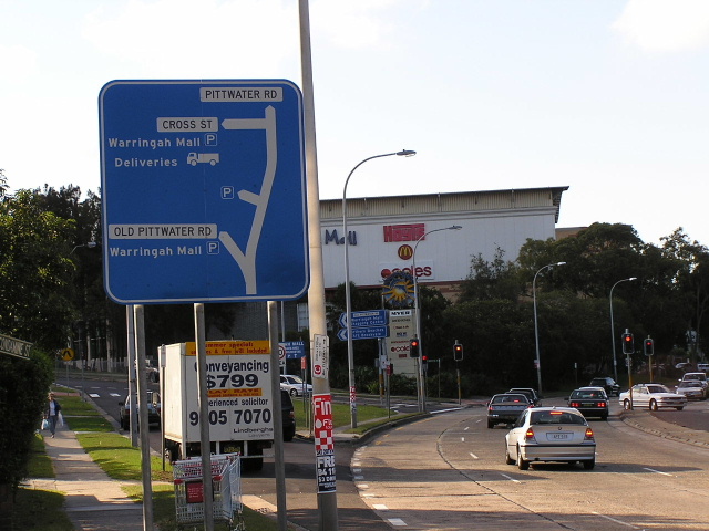
Pittwater Rd southbound approaching Condamine St outside Warringah Mall. April 2004. |
 |
Condamine St looking north at Old Pittwater Rd, North Manly. April 2004. |
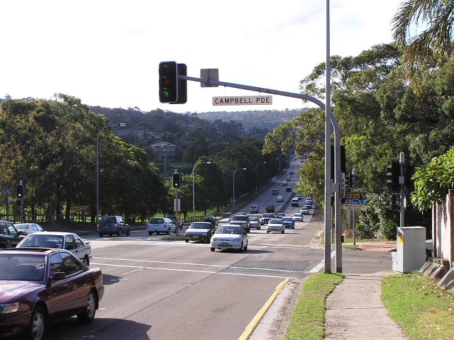 |
Condamine St looking north from Campbell Pde, Manly Vale. April 2004. |
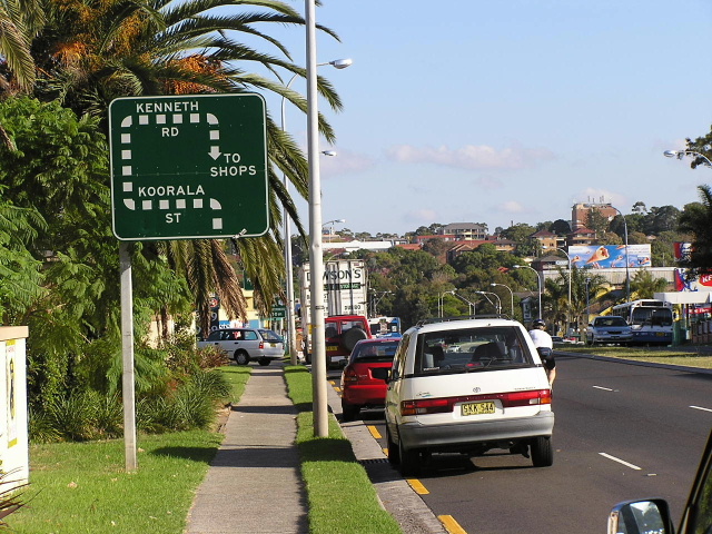 |
Unusual diagrammatic sign on Condamine St southbound approaching Koorala St. April 2004. |
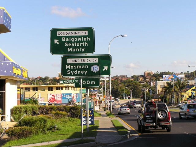 |
Condamine St southbound approaching the Burnt Bridge Creek Deviation at Balgowlah. April 2004. |
 |
Looking north-east along the Burnt Bridge Creek Deviation. April 2004. |
 |
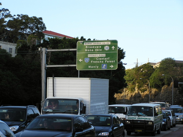
Sydney Rd eastbound approaching Metroad 10 at Seaforth. Sep 2003. |
 |
Unusual style AD sign mounted on the footbridge across Sydney Rd outside the former Balgowlah Boys High School. April 2004. |
 |
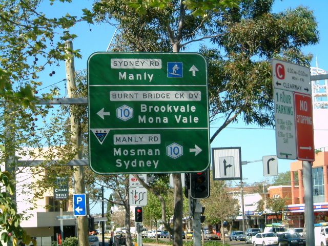
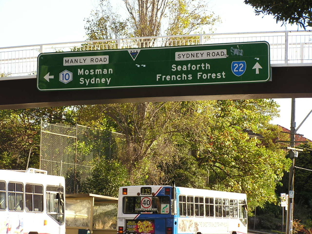
Manly Rd northbound approaching Sydney Rd. April 2004. |
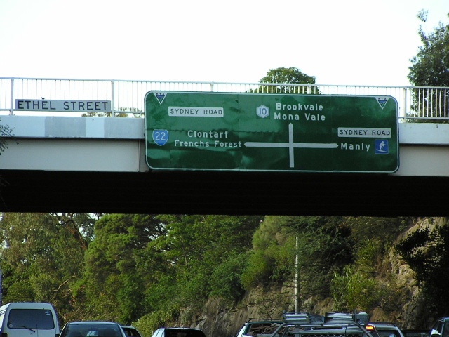 |
Unusual diagrammatic AD sign on the Ethel St overpass. April 2004. |
 |
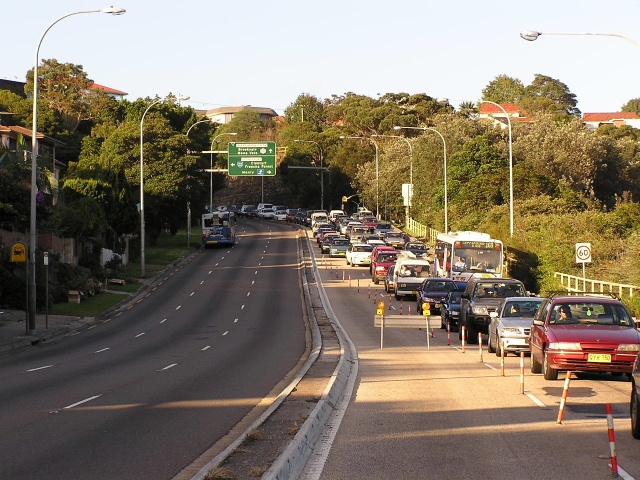
Looking south along Manly Rd from the Ethel St overpass. Dec 2005. |
 |
Looking north along Manly Rd from Avona Crescent in the afternoon peak. Note how three southbound lanes narrows into one to cross Spit Bridge in the afternoon peak - 3 lanes southbound are available in the morning peak. The right-most lane in the picture is a bus lane that ends before the bridge. April 2004. |
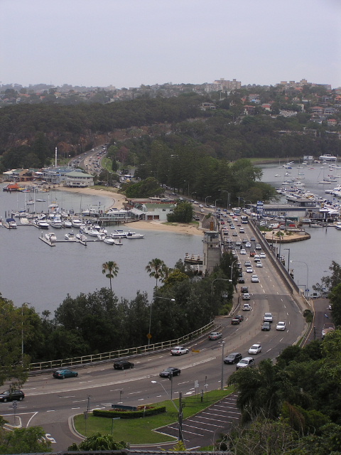 |
Great view of Spit Bridge and approaches from Edgecliffe Esplanade. Dec 2005. |
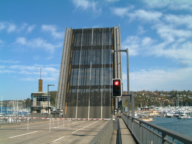 |
While walking across the Spit Bridge (en route to Manly) i was lucky enough to witness it opening from up close. Sep 2003. |
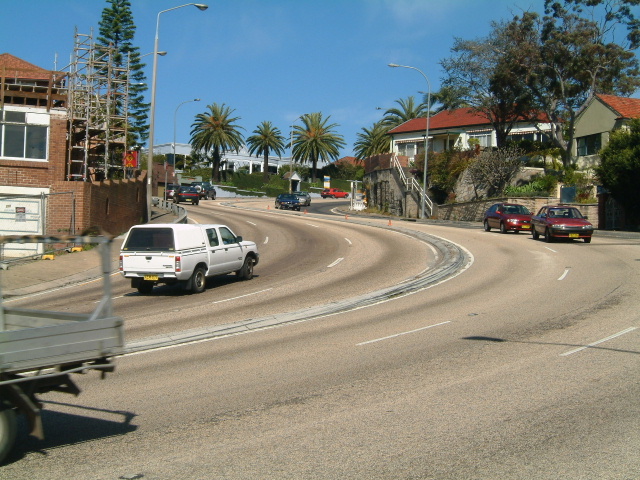 |
The notorious S-bend at the top of Spit Hill on Spit Road near Ida Ave. I don't know how the bendy buses get round these corners. Sep 2003. |
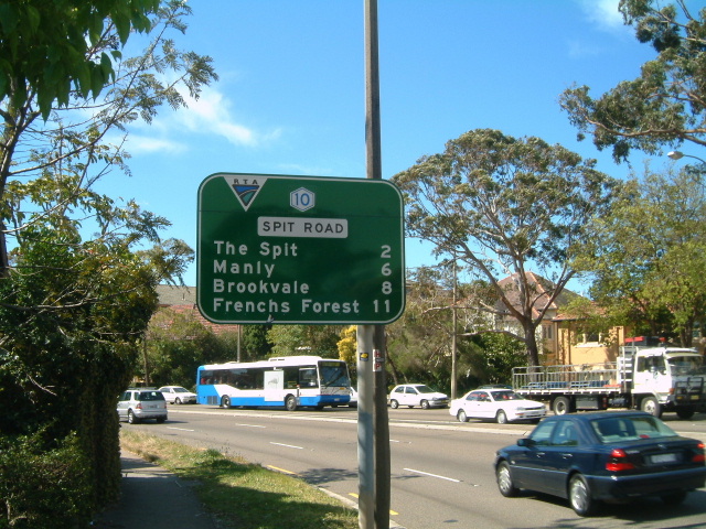 |
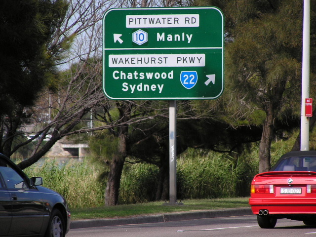
The last distance sign on Metroad 10, heading north from Spit Junction. Sep 2003. |
 |
Stray Metroad 10 on Ourimbah Rd eastbound approaching Cowles Rd at Mosman. Ourimbah Rd is part of an alternative route to Metroad 10 between Mosman and Crows Nest. Feb 2006. |
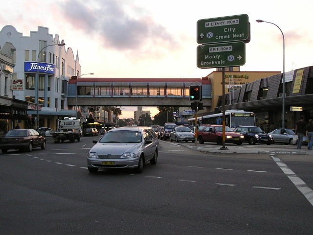 |
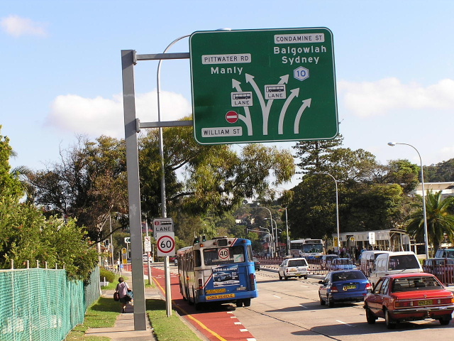
Looking west at Spit Junction. April 2004. |
 |
Signage on Military Rd eastbound approaching Spit Junction. Sep 2003. |
 |
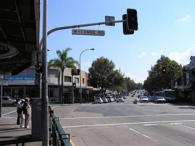
Looking east at the tidal flow system at Neutral Bay Junction (Wycombe Rd). April 2004. |
 |
Looking west from Wycombe Rd in Neutral Bay. April 2004. |
 |
Looking east along Falcon Street into Neutral Bay. This is the westbound carriageway of Metroad 10 - eastbound traffic utilises Military Rd between Merlin and Watson Streets. March 2006. |
Last updated 25 March 2007 © Ozroads 2004-2007. |