METROAD 4
Former alignment: Ashfield to Broadway (1992-2000)
Lifespan: September 1992 - December 2000 (8 years)
Length: 7km
Eastern Terminus: Broadway & Harris St, Ultimo
Western Terminus: Parramatta Rd & Wattle St & Frederick St, Ashfield
Route taken: Great Western Highway (Parramatta Rd/Broadway)
Focal Points: Parramatta, Sydney
RTA Internal Classification: State Highway 5
Route overview:
This section of the Great Western Highway was the first road constructed out of the City of Sydney in the early 1800's and ever since has been the major western route in Sydney. The County of Cumberland Planning Scheme proposed to bypass the Great Western Hwy with the Western Freeway in 1951, and much of that job has been completed. However, plans for a surface freeway from Concord to the City were cancelled by the Wran Labour Government in February 1977.
The Great Western Highway received the NR32 shield, reinforcing its role as the major western road, in 1955. In September 1992, Metroad 4 replaced NR32 along its entire length in Sydney, including this section of the Gt Western Hwy. In December 2000, the final stage of the City West Link opened to traffic and the RTA switched Metroad 4 onto the new route. There are no longer any remnants of signage on this route but I am lucky enough to have the following pics from when Metroad 4 did traverse this section of road.
Photos of the former alignment of Metroad 4 |
|
 |
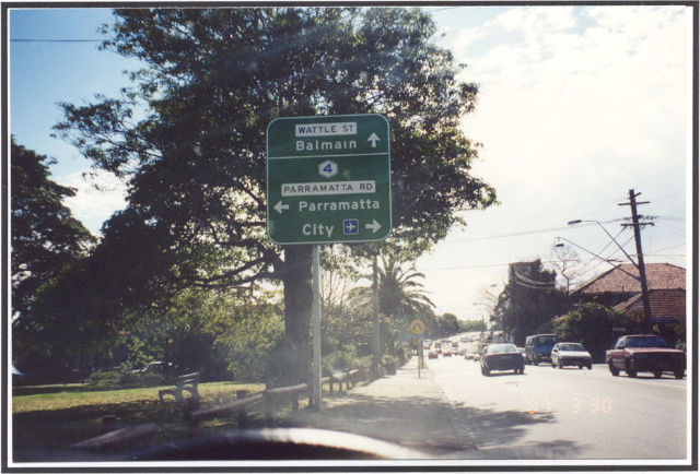
Parramatta Rd eastbound approaching where Metroad 4 now turns left onto Wattle St. Photo taken 1997. |
 |
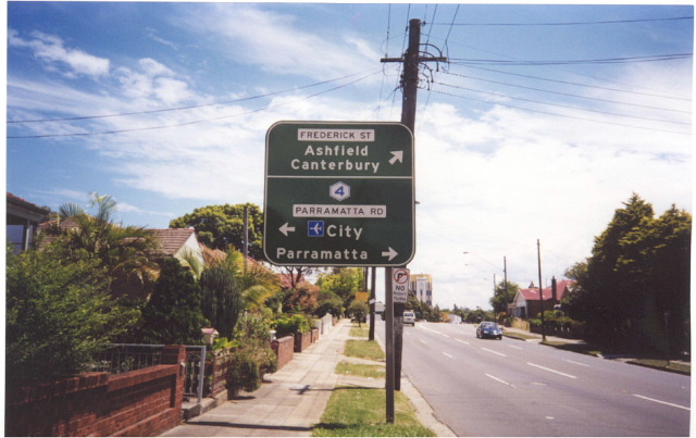
Frederick St northbound approaching Parramatta Rd showing Metroad 4 going both ways. Photo taken 1997. |
 |
Wattle St southbound approaching Parramatta Rd. Wattle St is now Metroad 4. Photo taken 2000. |
 |
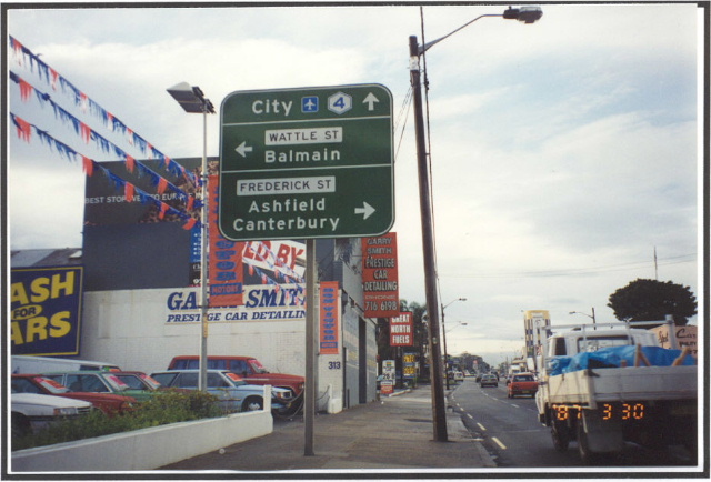
Parramatta Rd ID sign showing Metroad 4 on the now decomisisoned section. Photo taken 1997. |
 |
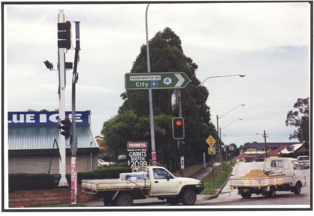
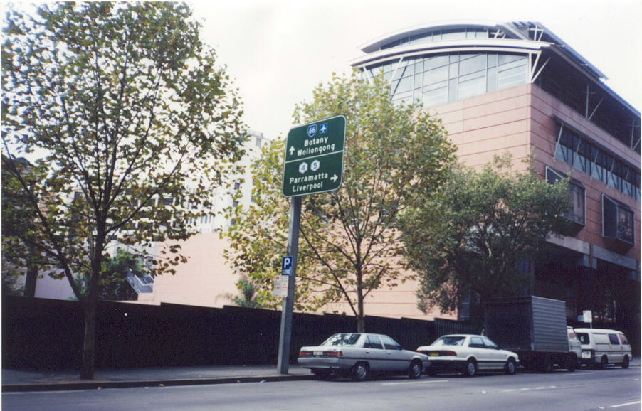
Parramatta Rd eastbound approaching Liverpool Rd (Hume Highway) at Summer Hill. Photo taken 2000. |
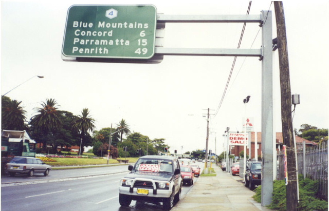 |
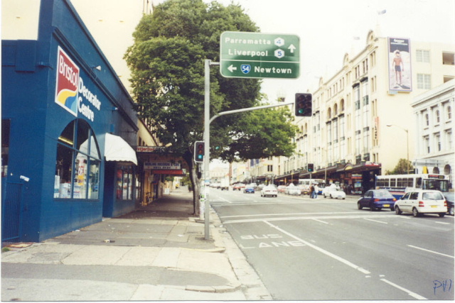
Parramatta Rd westbound from Liverpool Rd. Note the use of "Blue Mtns" instead of the road name. The use of these remote focal points was part of the original plan of the Metroads but failed to really catch on. Photo taken 2000. |
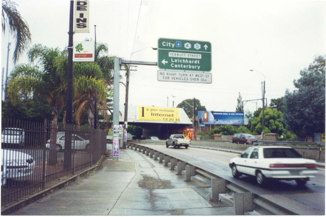 |
Parramatta Rd eastbound approaching Tebbutt St, Petersham. Photo taken 2000. |
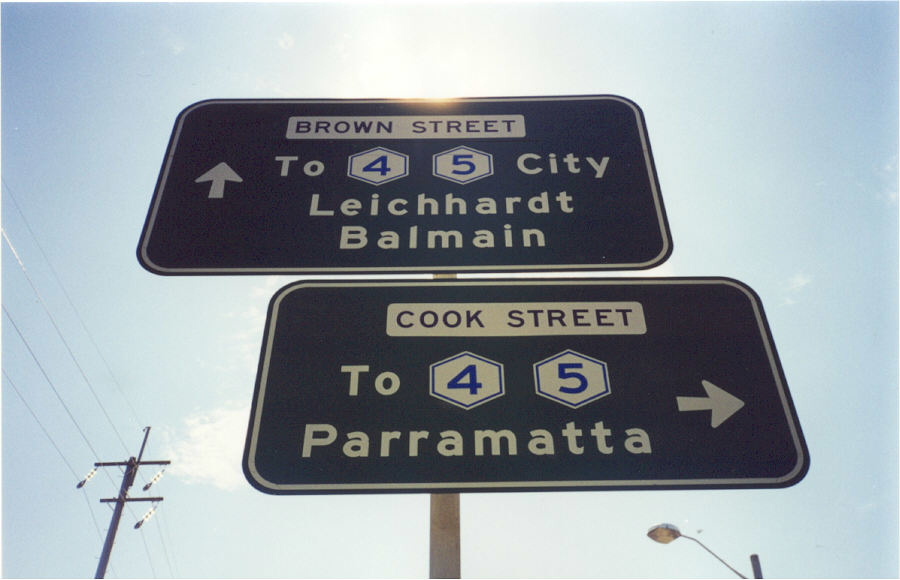 |
ID signs showing Metroad 4 at the intersection of Brown St & Cook St, Petersham. These suburban streets make up the approaches to the overpass across Parramatta Rd between Old Canterbury Rd and Tebbutt St. 2000. |
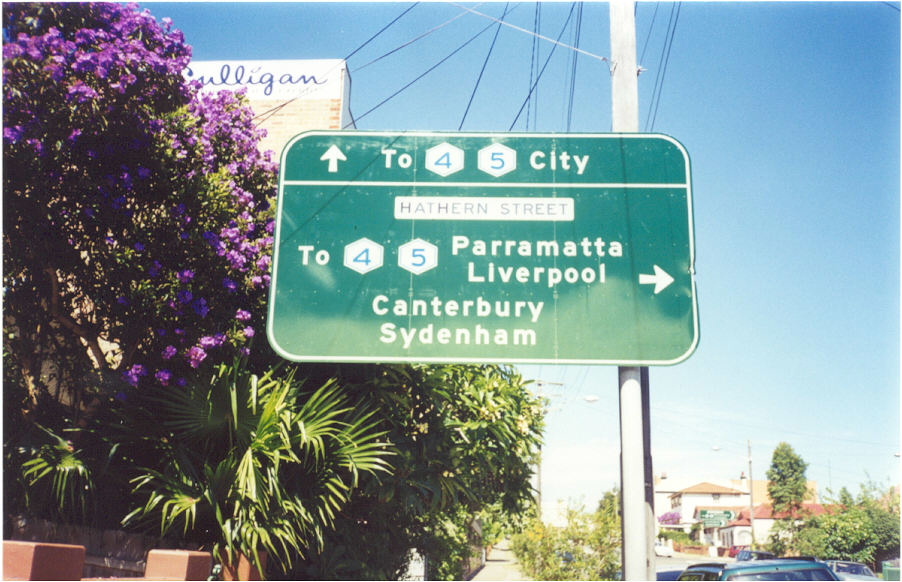 |
AD sign showing Metroad 4 at the intersection of Tebbutt St and Hathern St on the north side of Parramatta Rd overpass. 2000. |
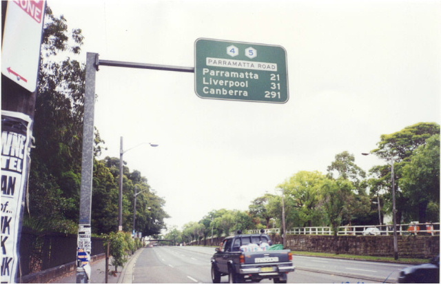 |
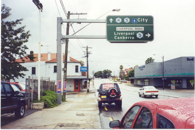
First westbound distance sign on Parramatta Rd. I used to be fascinated by the focal point Canberra being on this sign :p Photo taken 2000. |
 |
Broadway looking west to City Rd (Princes Hwy) at Chippendale. Photo taken 2000. |
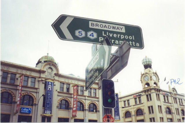 |
Broadway ID sign, oddly enough with the Metroad 4 and Metroad 5 shields around the wrong way. Photo taken 2000. |
Photocopy of a 1994 photo of northbound AD sign on Wattle St showing Metroad 4 down Broadway. |
|
Photocopy of a 1994 photo of northbound ID signs on Wattle St showing Metroad 4 down Broadway. |
|
 |
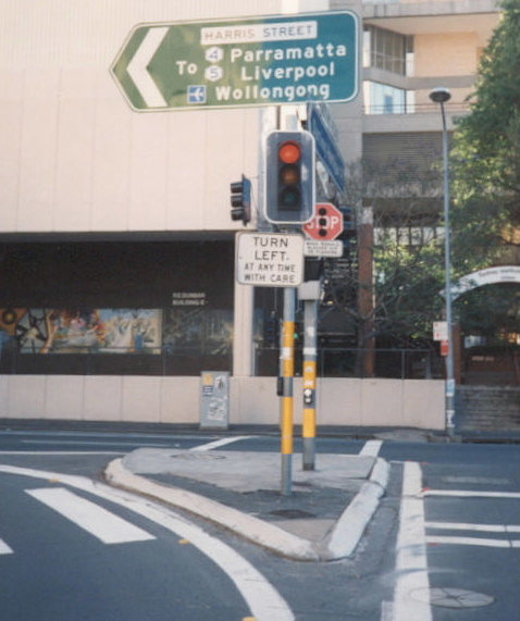
Harris St southbound approaching Broadway and the start former start of Metroad 4. Photo taken 2000. |
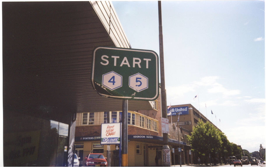 |
Unusual "Start Metroad 4/5" sign on Broadway at its intersection with Harris St. There wasnt even and END sign to go with this one. Photo taken 2000. |
 |
Harris St ID sign at Ultimo Rd, showing the plethora of routes that Harris St leads too. Photo taken 2000. |
 |
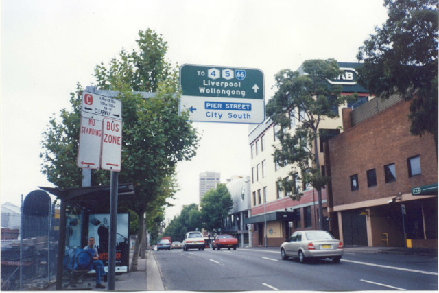
Harris St ID sign at Pier St this time. Photo taken 2000. |
 |
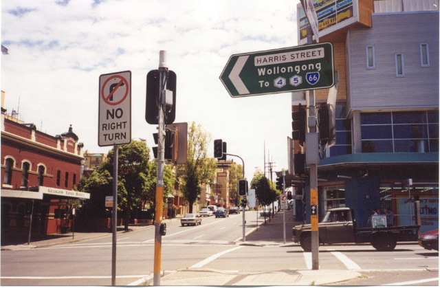
Harris St southbound showing Metroad 4 shield for Broadway. Photo taken 2000. |
 |
Photocopy of a 1994 photo of the Harris St gantry on the Western Distributor. The WD is actually Metroad 4 now and "to Met 4" is no longer signposted down Harris St (duh!). |