Riddoch Highway |
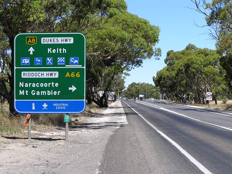
AD sign on Dukes Highway (A8) approaching the junction with Riddoch Highway (A66) at Keith. Photo taken: January 2005.
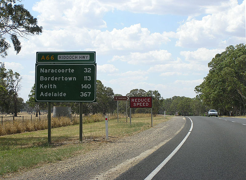
Length: 238km
Northern Terminus: Dukes Highway (A8) & Riddoch Highway (A66), Keith
Southern Terminus: Sea Pde & Standish St (B66), Port MacDonnell
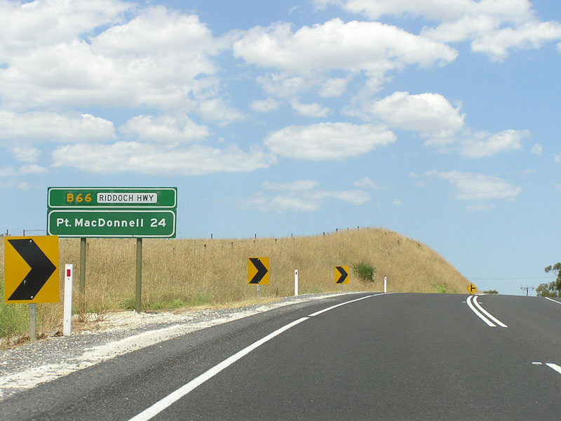
Route taken: Riddoch Highway (including Penola Road & Bay Road through Mt Gambier)
Focal Points: Adelaide, Keith, Naracoorte, Penola, Mt Gambier, Port MacDonnell
Responsibility: State Government
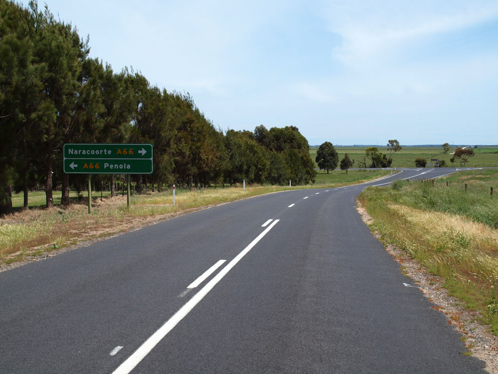
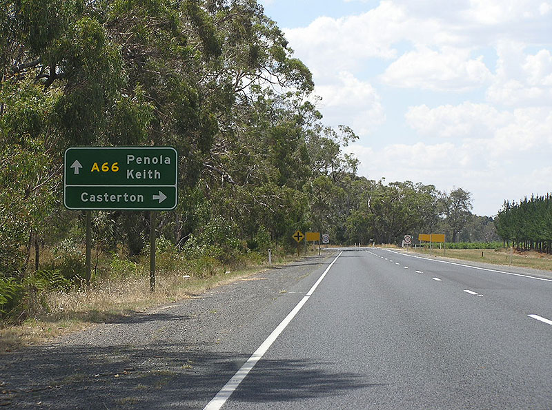
A66/B66 is a north-south route through south-eastern South Australia, linking the Dukes Highway at Keith with the south-eastern towns of Naracoorte, Penola, Mount Gambier and Port Macdonnell. North of Mount Gambier, the route is signposted as A66 as it forms part of the higher standard route from Mount Gambier to Adelaide, whilst south of Mount Gambier the route is signed as B66. The entirity of the route is also signed as Riddoch Highway.
The route is generally constructed to a two-lane rural highway standard through flat terrain. Overtaking lanes are more prevalent south of Penola, including a short section of realigned dual carriageway at a notorious black spot south of Tarpeena.
Prior to the implementation of alpha-numeric route marking in 1998/99, the route had no route number. Ten years later, a large number of signs omitting reference to A66 or B66 still remain, typical of the majority of rural routes in South Australia.
The Riddoch Highway was named in 1996 after a prominent local landholder from the late 19th and early 20th centuries, Member of Parliament and pioneer of the local wine industry, John Riddoch.
Notable Events:
1956 - Riddoch Highway constructed between Naracoorte and Keith.1
1983 - Riddoch Highway reconstruction program completed.1
12 December 1996 - Riddoch Highway named.2
1998/99 - Route A66/B66 introduced
References:
1. Donovan, P. (1991) Highways: a history of the South Australian Highways Department, SA Dept. of Roads and Transport.
2. South Australian Gazeteer - Place Names Online, Riddoch Highway, Accessed: 24 October 2009.
|
Photos of route A66/B66 |
|
| |
AD sign on Dukes Highway (A8) approaching the junction with Riddoch Highway (A66) at Keith. Riddoch Highway bypasses Keith town centre to the west. |
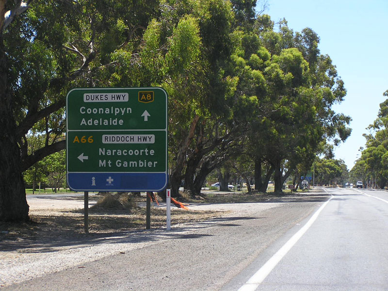 |
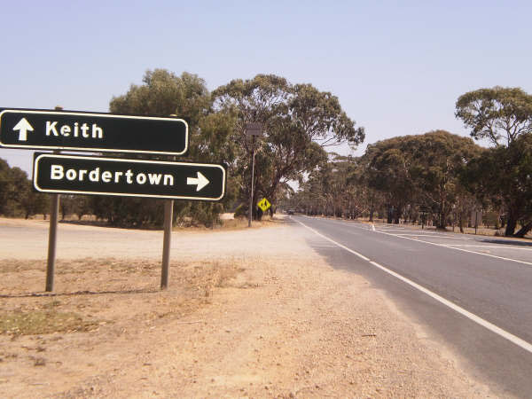
AD sign on Dukes Highway (A8) approaching the junction with Riddoch Highway (A66) at Keith. |
 |
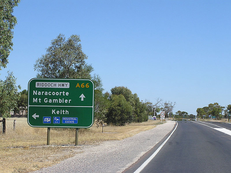
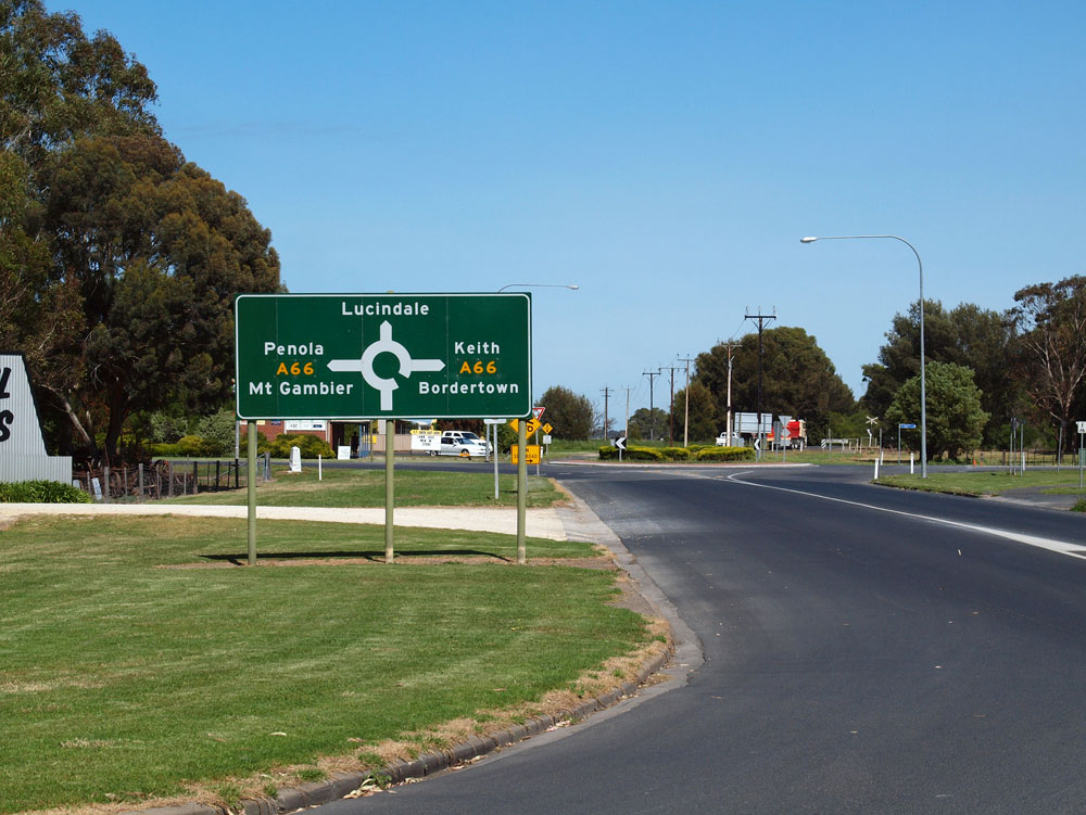
AD sign northbound on Riddoch Highway (A66) approaching its terminus at Dukes Highway, Keith. |
 |
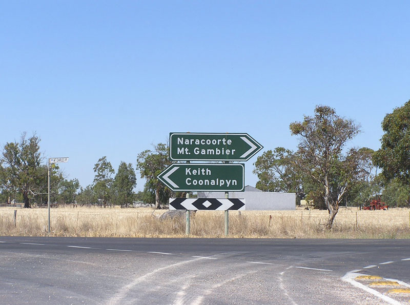
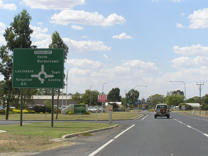
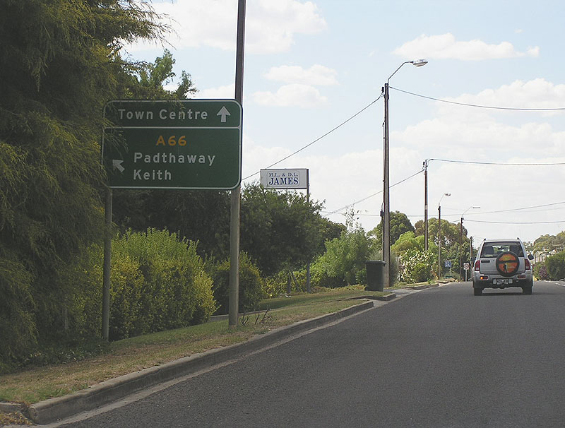
Riddoch Highway (A66) southbound approaching the junction with Naracoorte Rd at Keith. The Riddoch Highway bypassed Keith town centre to the west. Photo taken: January 2005. |
 |
Older ID signs, pre-dating the introduction of A66, at the intersection of Riddoch Highway & Mt Charles Rd, Keith. Source: Kimberley McArthur, February 2009. |
 |
RD signs on Riddoch Highway, heading south from Keith. Unusually, the road name and route number were previously located on top of this sign but have since been moved. |
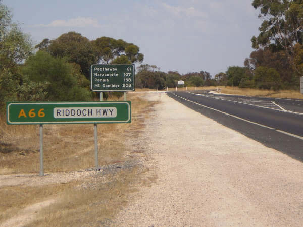
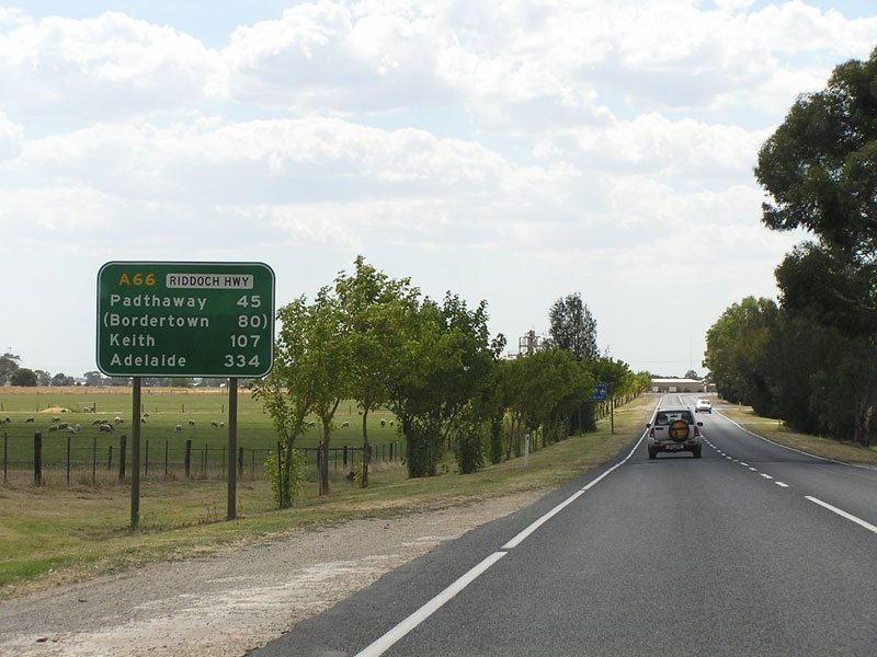
| Older RD sign northbound on Riddoch Highway, leaving the small village of Padthaway. |
|
 |
Older AD sign assembly, pre-dating the introduction of A66, northbound on Riddoch Highway at the junction with Padthaway-Mundulla Road, Padthaway. |
 |
Older ID sign assembly at the intersection of Riddoch Highway & Memorial Dr, Padthaway. Source: Kimberley McArthur, February 2009. |
 |
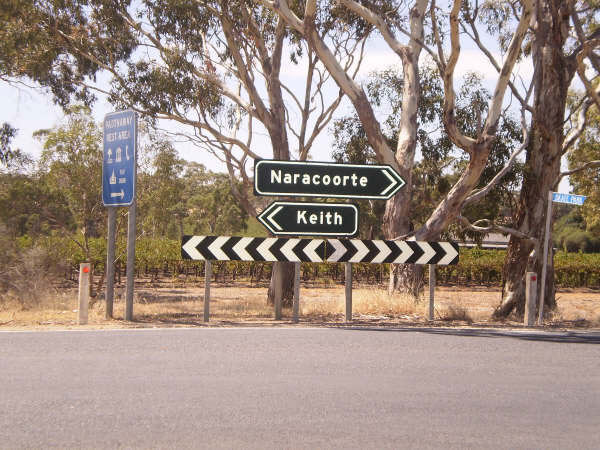
Riddoch Highway heading north from Naracoorte. |
 |
Riddoch Highway (Stewart Tce) looking south towards Park Terrace, Naracoorte. Photo taken: January 2005. |
 |
Riddoch Highway (Stewart Tce) looking south towards the junction with Macdonnell St, Naracoorte. Macdonnell Street was the route of the main road through Naracoorte prior to the construction of the current alignment via Stewart Tce and Deviation Rd. Source: Peter Renshaw, October 2011. |
 |
Riddoch Highway (Stewart Tce) southbound approaching the junction with Wimmera Highway (Smith St) & Lucindale Rd, Naracoorte. Note the missing C240 route marker for the left turn. Photo taken: January 2005. |
 |
AD sign westbound on Wimmera Highway approaching the junction with Riddoch Highway at Naracoorte. This is the western terminus of route C240, although it is not shown on any signage at this junction. Source: Peter Renshaw, October 2011. |
 |
Riddoch Highway northbound approaching the junction with Wimmera Highway (Smith St) & Lucindale Rd, Naracoorte. Note the newer sign which includes the Riddoch Highway name plate but omits A66 and C240. Photo taken: January 2005. |
  |
Old and new AD signs southeastbound on Riddoch Highway (Deviation Road) approaching the junction with Gordon Street. Gordon Street was the original route through Naracoorte prior to the construction of the present route which skirts the western edge of the township. Top photo: January 2005. Bottom photo: Peter Renshaw, October 2011. |
 |
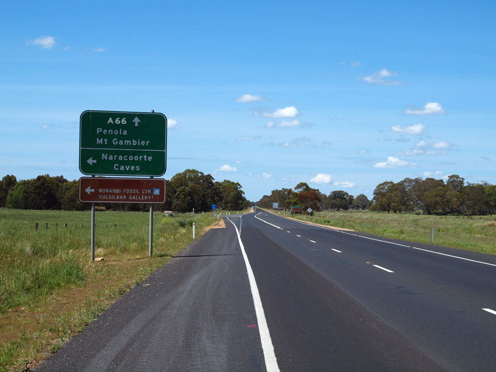
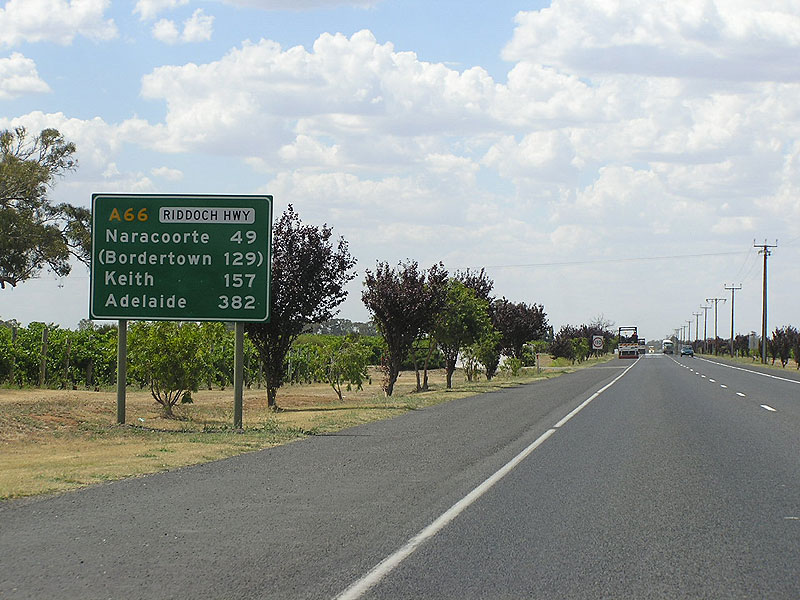
Riddoch Highway northbound approaching the junction with Penola Rd at Naracoorte. Note the use of Padthaway as a focal point instead of somewhere more important such as Bordertown. Photo taken: January 2005. |
 |
Older RD sign southbound on Riddoch Highway as you leave Naracoorte. Note the absence of an A66 route number and the unusual sign structure. Source: Peter Renshaw, October 2011. |
 |
Older AD sign assembly northbound on Riddoch Highway approaching the junction with Jenkins Tce at Naracoorte. Jenkins Tce skirts the eastern edge of the town centre, linking to the Wimmera Highway. Photo taken: January 2005. |
 |
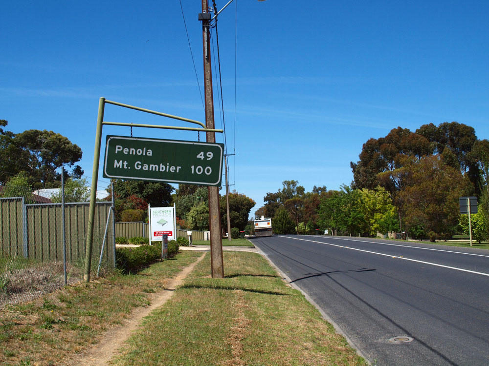
Tourist sign southbound on Riddoch Highway on the southern outskirts of Naracoorte. Note the coverplated distance. Source: Peter Renshaw, October 2011. |
 |
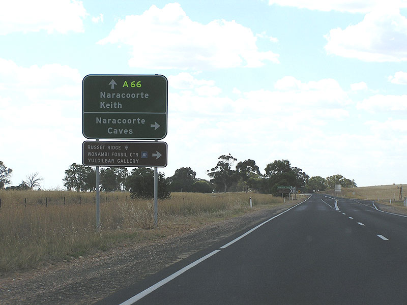
AD sign assembly southbound on Riddoch Highway approaching New Caves Road, 9km south of Naracoorte. Note the flourescent yellow route marker which is now quite faded after at least 7 years of exposure to the sun. Source: Peter Renshaw, October 2011. |
 |
AD sign westbound on New Caves Road approaching the junction with Riddoch Highway, 9km south of Naracoorte. Note the A66 route markers are on coverplates - perhaps this sign was designed with blank spaces in readiness for the introduction of alpha-numeric route marking. Source: Peter Renshaw, October 2011. |
 |
Newer AD sign with the lighter, flourescent-coloured A66 marker, northbound approaching the junction with New Caves Road, 9km south of Naracoorte. |
 |
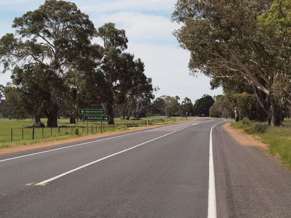
RD sign northbound on Riddoch Highway at Edenhope Rd (C212), 32km south of Naracoorte. Comaum Forest Rd leads to Edenhope. Photo taken: January 2005. |
 |
Riddoch Highway looking north towards the junction with Edenhope Rd, 32km south of Naracoorte. Note that this sign assembly is yet to show routes A66 (straight) and C212 (right). Source: Peter Renshaw, October 2011. |
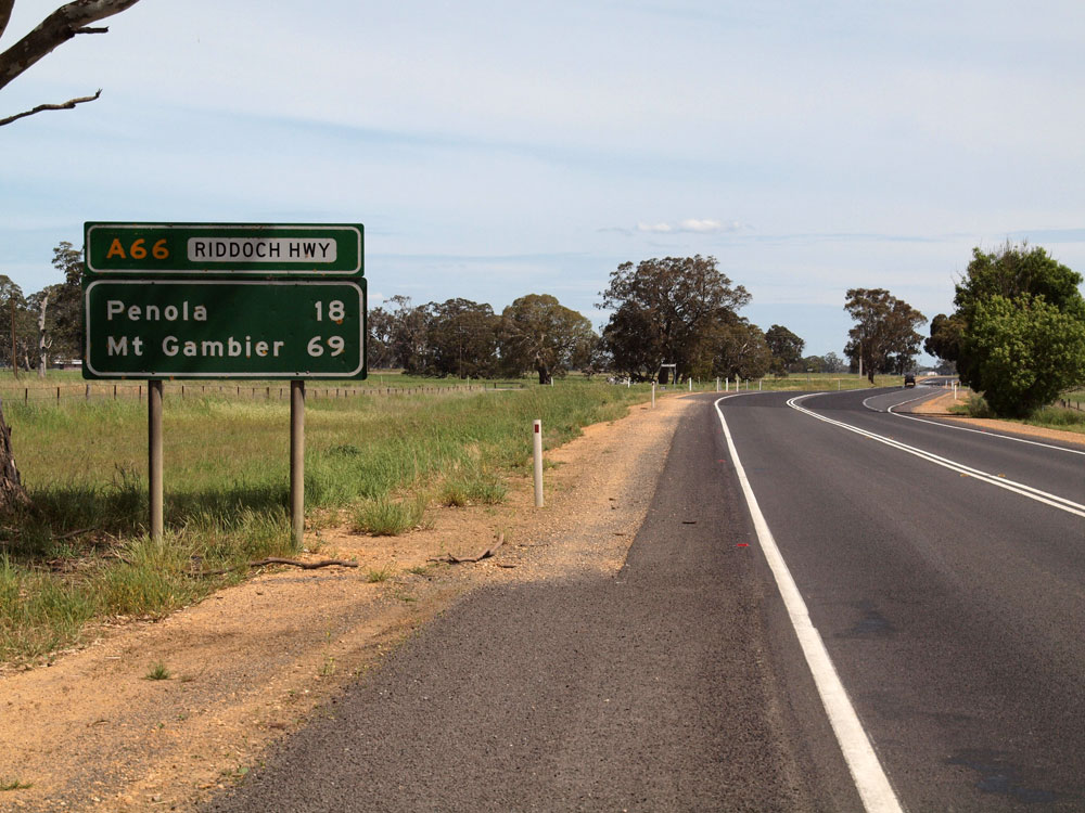 |
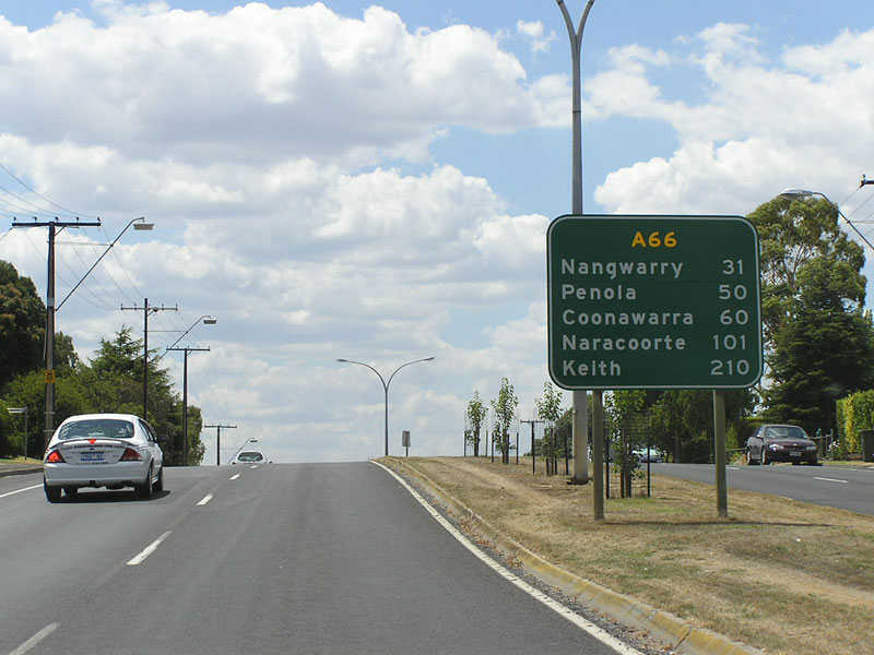
RD sign southbound on Riddoch Highway at Edenhope Rd, 18km north of Penola. Note the topknot provided to add both 'Riddoch Highway' and route A66 to this sign which pre-dates the alpha-numeric route marking system. |
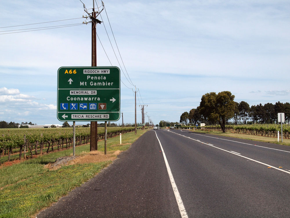 |
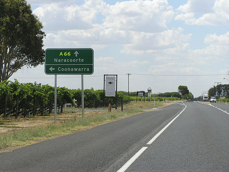
Riddoch Highway looking south towards the junction with Memorial Drive at Coonawarra. Source: Peter Renshaw, October 2011. |
 |
AD sign westbound on Memorial Drive approaching the junction with Riddoch Highway at Coonawarra. Source: Peter Renshaw, October 2011. |
 |
AD sign northbound on Riddoch Highway approaching Memorial Dr at Coonawarra.
Photo taken: January 2005. |
 |
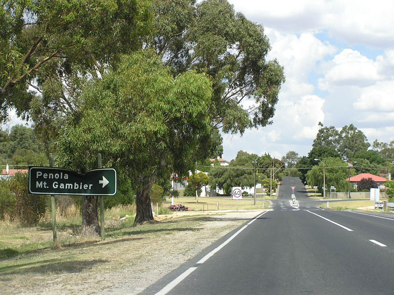
RD sign northbound on Riddoch Highway on the northern outskirts of Penola. Photo taken: January 2005. |
Riddoch Highway (Church St) looking north through the main street of Penola. Photo taken: January 2005. |
|
 |
Riddoch Highway (Church St) looking south at the junction with Riddoch Street, Penola. Source: Peter Renshaw, October 2011. |
 |
ID sign assembly at the intersection of Riddoch Highway (Church St) & Julian St, Penola. Julian St forms part of route C198 - a Victorian route that has been extended into South Australia to link with the Riddoch Highway and leads to Casterton. Photo taken: January 2005. |
 |
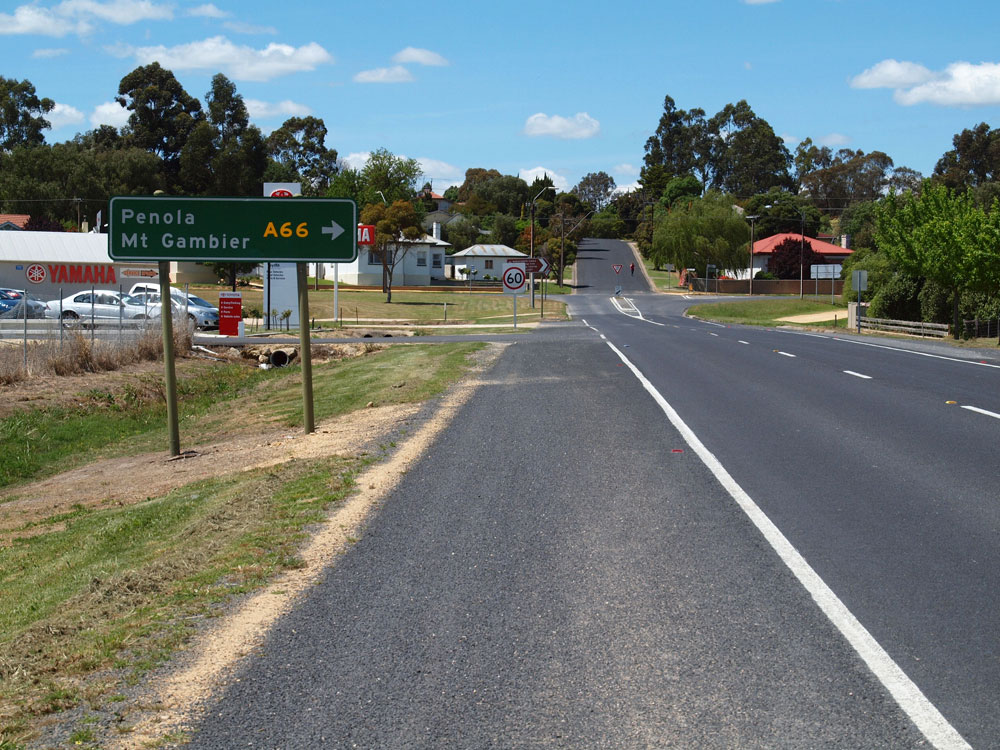
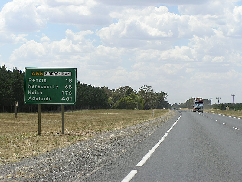
RD sign southbound on Riddoch Highway on the southern outskirts of Penola. Photo taken: January 2005. |
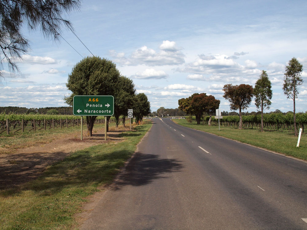
| Riddoch Highway (A66) northbound approaching the intersection with Tower Rd & Krongart Rd, 10km south of Penola. |
|
 |
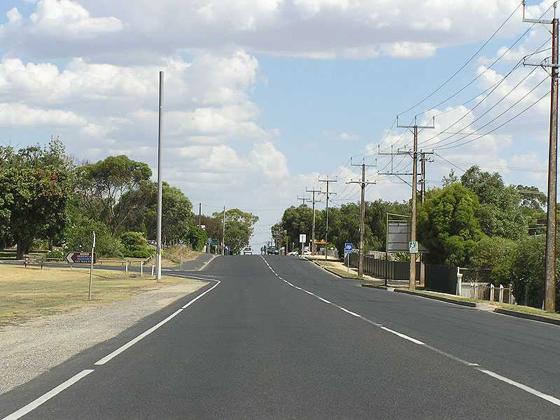
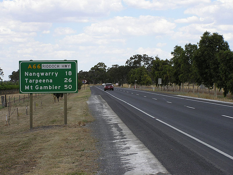
Riddoch Highway heading north from Nangwarry. Photo taken: January 2005. |
 |
Riddoch Highway looking north through Nangwarry. Photo taken: January 2005. |
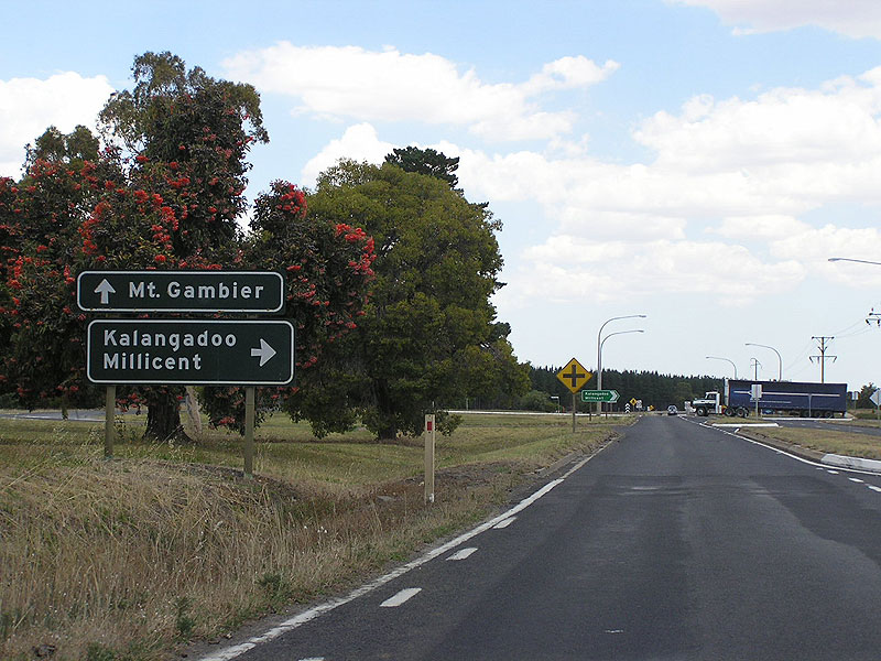 |
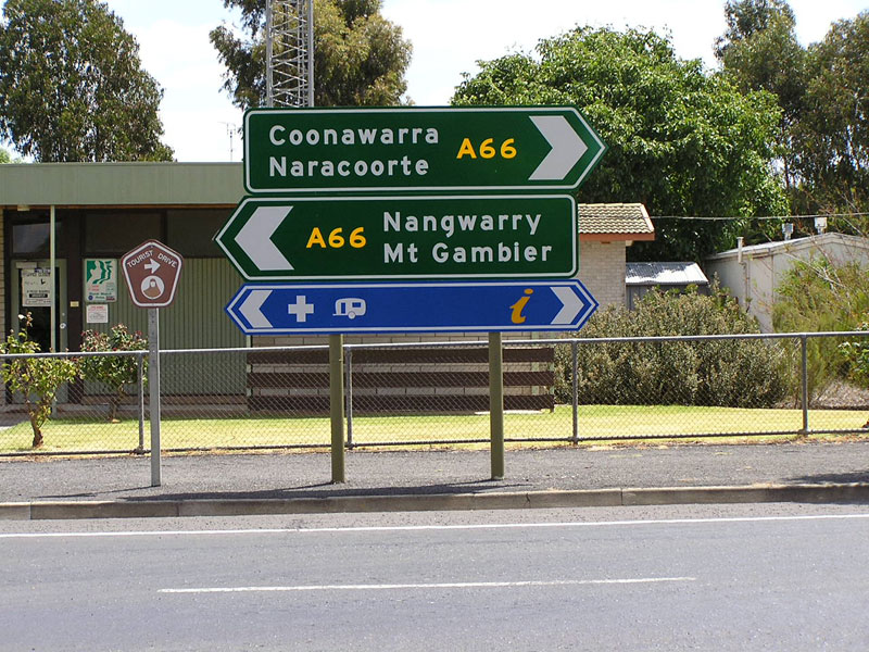
Riddoch Highway looking south to the junction with Kalangadoo-Nangwarry Rd at Nangwarry. |
 |
Riddoch Highway looking south on the southern outskirts of Nangwarry. Note that most of the sign through Nangwarry pre-date the introduction of A66. Photo taken: January 2005. |
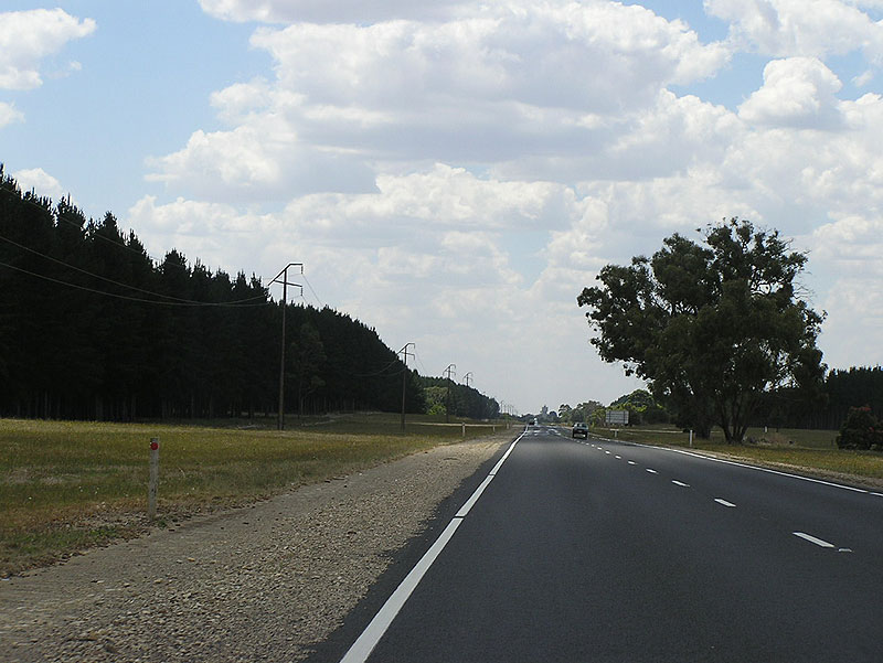 |
Riddoch Highway looking north between Tarpeena and Nangwarry. |
 |
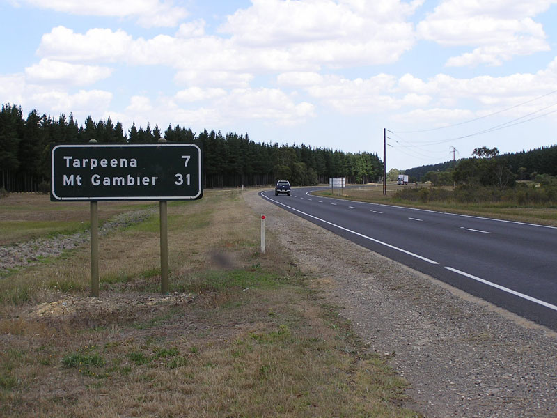
Typical SA rest area signage northbound on Riddoch Highway, 5km south of Tarpeena. Photo taken: January 2005. |
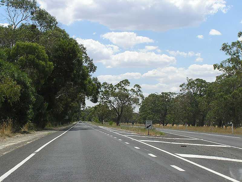 |
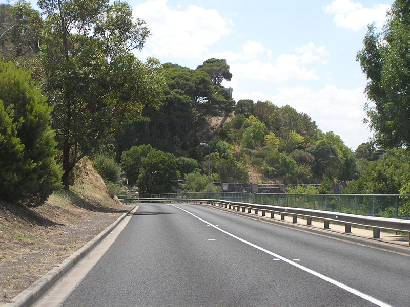
Riddoch Highway looking north at the short section of dual carriageway between Tarpeena and Mount Gambier. |
 |
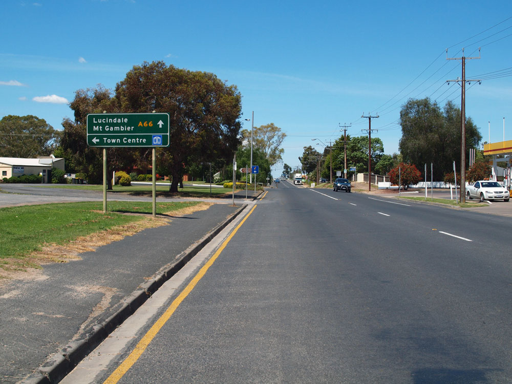
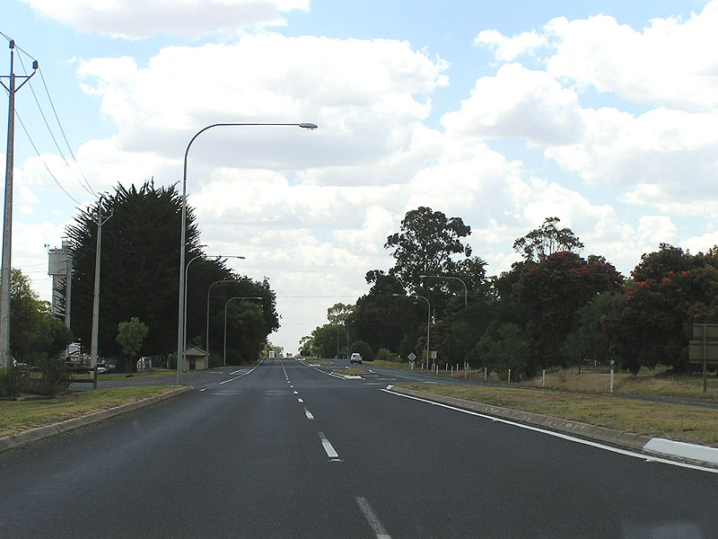
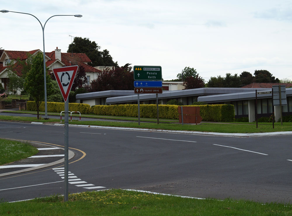
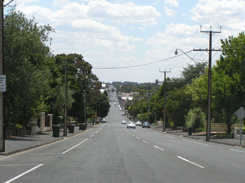
Riddoch Highway (Penola Rd) looking north through the northern outskirts of Mount Gambier. |
 |
RD sign northbound on Riddoch Highway at Mount Gambier. Photo taken: January 2005. |
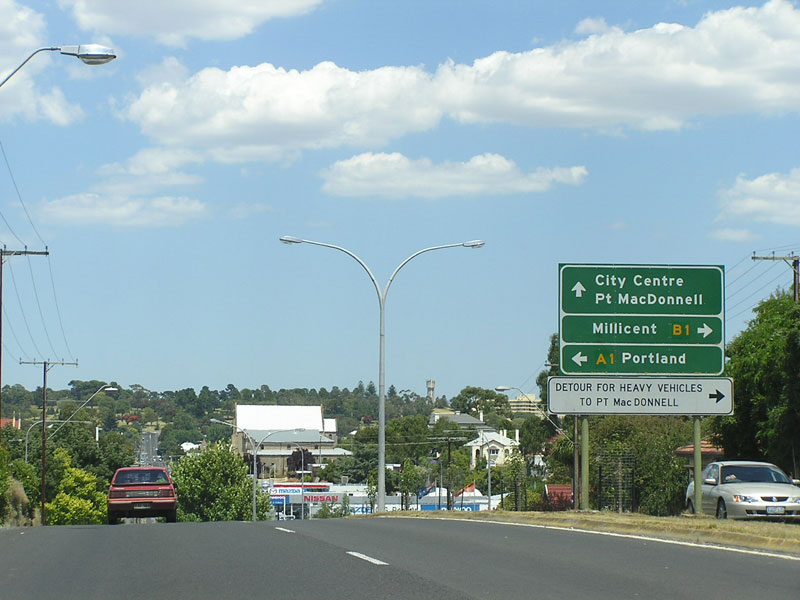 |
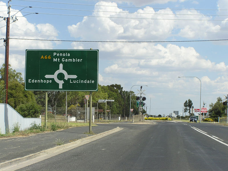
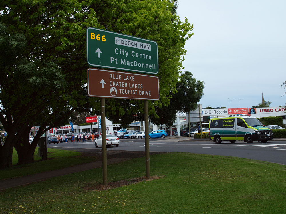
AD sign southbound on Riddoch Highway approaching the junction with Princes Highway at Mount Gambier. Note the omission of B66 for the through movement - this pre-dates the signposting of A66 and the A1/B1 route numbers cover the former National Route 1 shield. Photo taken: January 2005. |
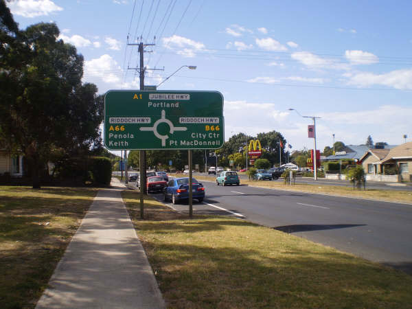 |
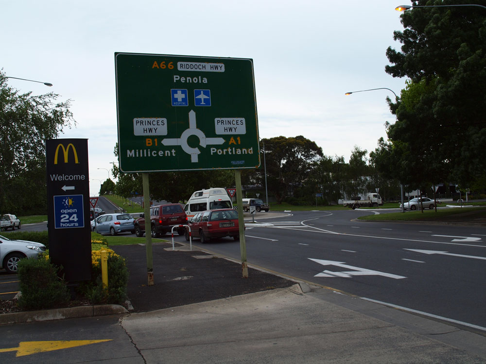
AD sign eastbound on Princes Highway (Jubilee Highway) approaching the junction with Riddoch Highway (Penola Rd) at Mount Gambier - the intersection where A66 becomes B66 and A1 becomes B1. Note the use of the local road name for Princes Highway but not for Riddoch Highway. Source: Kimberley McArthur, February 2009. |
   |
ID signs at the junction of Princes Highway & Riddoch Highway at Mount Gambier. Note the contrasting styles of older tourist signs in the bottom photo. Source: Peter Renshaw, October 2011. |
 |
AD sign northbound on Riddoch Highway (Penola Rd) approaching the junction with Princes Highway (Jubilee Highway) at Mount Gambier. Note the use of the Princes Highway name on this sign instead of Jubilee Highway. Source: Peter Renshaw, October 2011. |
 |
Riddoch Highway (Penola Rd) looking south towards Mount Gambier CBD. Source: Peter Renshaw, October 2011. |
 |
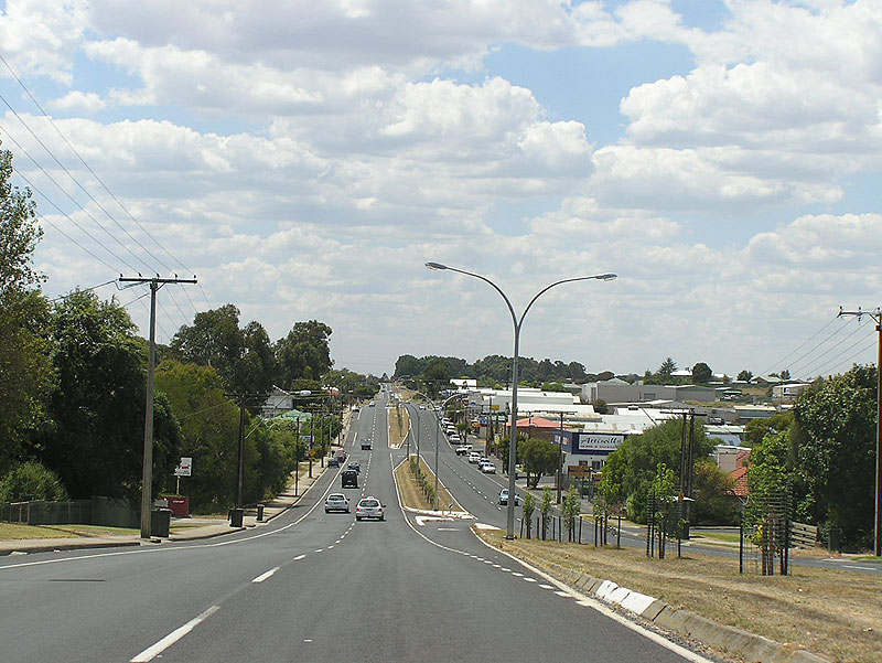
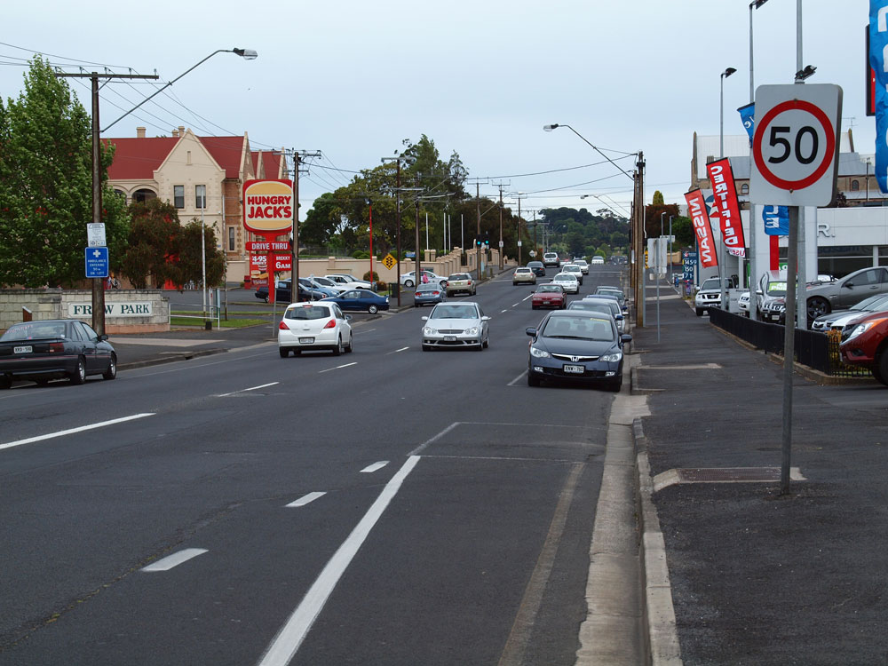
Riddoch Highway (Bay Rd) looking north towards Mount Gambier CBD. Photo taken: January 2005. |
 |
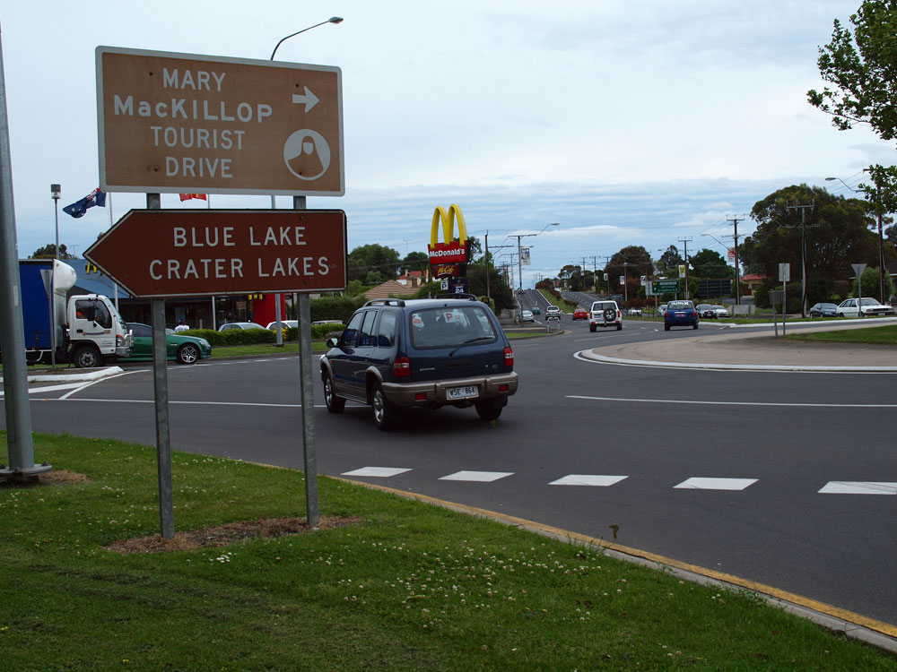
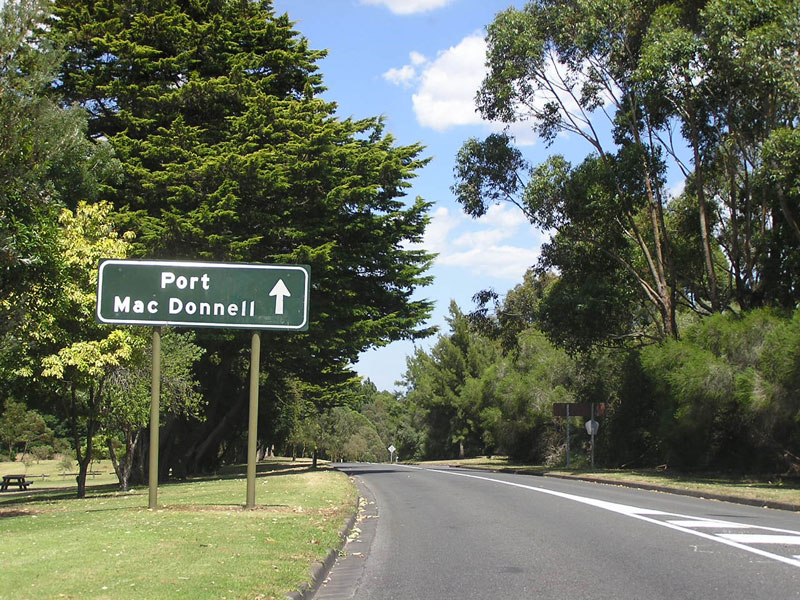
Riddoch Highway (Bay Rd) looking north through the blue lakes on the southern outskirts of Mt Gambier. Photo taken: January 2005. |
 |
ID sign facing southbound traffic at the intersection of Riddoch Highway (Bay Rd) & John Watson Dr on the southern outskirts of Mt Gambier. Note the omission of B66. Photo taken: January 2005. |
 |
RD sign southbound on Riddoch Highway (Bay Rd) as you leave Mt Gambier. Photo taken: January 2005. |
Last updated 8 February 2012 © Ozroads 2003-2012. |