National Highway Route 8 (Decommissioned) Section: South Australia |
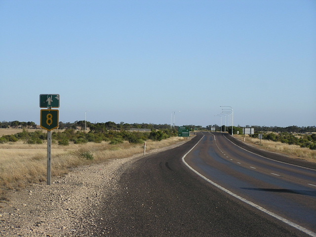
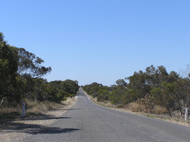
Remnant National Highway Route 8, eastbound on Dukes Highway at Mallee Highway, east of Tailem Bend. Photo taken: January 2005.
Lifespan: 1954-1999
Length: 198km (SA)
Eastern Terminus: South Australia/Victoria State Border, 18km east of Bordertown
Western Terminus: Princes Highway & Dukes Highway, 2km south of Tailem Bend
Interstate Continuation: Continued east through Victoria to Melbourne as the Western Highway
Focal Points: Tailem Bend, Coonalpyn, Keith, Bordertown, Melbourne
Route Overview and History:
National Highway Route 8 is the former designation for the Dukes Highway in South Australia and the Western Highway in Victoria.
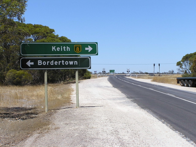
The Dukes Highway forms the majority of the Adelaide-Melbourne Link of the former National Highway in South Australia. It begins at the Princes Hwy, Tailem Bend, heading east through the lower Mallee through the towns of Coomandook, Coonalpyn, Tintinara, Keith and Bordertown before ending at the Victorian Border, 18km west of Bordertown. It is entirely single carriageway but with frequent overtaking lanes and most town centres bypassed. Dukes Highway now carries the National Highway Route A8 designation for its entire length, NHRA8 continuing over the border into Victoria as the Western Highway.
The highway traces it origins to the early 1920s races to record the fastest driving time between Adelaide and Melbourne, being much shorter than the original Coorong (Princes Highway) route. The Dukes Highway was included in the great plan initiated by D.V Fleming (first SA Commissioner for Highways) in 1925 to reconstruct and seal all of SA's major roads but nothing was commenced prior to the war. In 1939, at the beginning of the war, the need for serviceable roads became imperitive and a major reconstruction of the Dukes Highway was undertaken between Moorlands and the Victorian Border in 1940.
In 1954 the route's importance as an interstate highway was recognised; being signed as National Route 8 as part of a trial of National Route marking. The trial was a huge success and the signing of other routes in SA and the other states soon followed. This heightened status, however, was not backed up by more construction with the highway going through a dormant period following the war with the Highways Department's funds and resources focused on other, needier projects.
On the 20th of November 1974 the Dukes Highway was declared a National Highway as part of the Melbourne-Adelaide Link. From this time on, the road was to be fully federally funded while the Highways Department owned and managed it. A detailed planning study for the future development of the Dukes Highway was completed in January 1978 and work commenced on the first project, the Coomandook to Tailem Bend Deviation, in July 1979. Following the completion of this deviation in December 1980 work gradually progressed eastward with many of the town centres bypassed by a matter of metres and/or service roads installed. Sections of the $40 million, 9-year program were let to contractors and for the first time the Highways Department tendered for a contract in competition with private operators. The Department completed the last 4.7km, comprising the Bordertown Bypass, within budget and ahead of time. The highway was officially 'opened' on 4 February 1987 at a ceremony in Bordertown. Since then, work has continued to provide more frequent overtaking opportunities, especially along the section between Bordertown and the Victorian Border. Funding has been included in Auslink for pavement rehabilitation east of Bordertown and it is sorely needed.
Following the declaration of the National Highway system, the decision was made in 1979 to convert existing National Routes that formed part of the system to National Highway Routes - i.e. changing from the black and white route markers to the green and gold markers.
In 1998/99 Transport SA launched its rural route marking scheme, replacing the National Highway Route 8 designation with the National Highway A8 designation.
Notable events in the history of NH8:
1940 - Dukes Highway major reconstruction to highway standard
1954 - Signed as National Route 8
Nov 1974 - Declared a National Highway
1979 - National Route 8 becomes signed as National Highway Route 8
Dec 1980 - Coomandook to Tailem Bend deviation opened to traffic
1981 - Tailem Bend railway overpass
Feb 1987 - Bordertown Bypass & "opening" of Dukes Highway following a 9-year, $40 million upgrade program
1998/99 - National Highway Route 8 replaced by the alpha-numeric route marking scheme; became National Highway Route A8
Photos of the former National Highway Route 8 in SA |
|
 |
Interestingly one shield in this assembly was coverplated but one not. Maybe they ran out of coverplates on their way to the border? Intersection of Dukes Highway & North Terrace (East), Bordertown. Jan 2005. |
 |
On North Terrace (Old Dukes Hwy) heading east approaching the Dukes Hwy intersection, Bordertown. Jan 2005. |
 |
Intersection of North Terrace (Old Dukes Hwy) and McLeod St (B57), Bordertown. These signs date from prior to 1987 when Borderotwn was bypassed. Jan 2005. |
 |
Dukes Hwy heading east to the intersection with North Terrace (WEST) at Bordertown. Jan 2005. |
 |
The sign assembly heading south on the B57 approaching Dukes Hwy near Bordertown. Interesting to note that while one sign has an old NHR8 shield, the other has no shield at all! Jan 2005. |
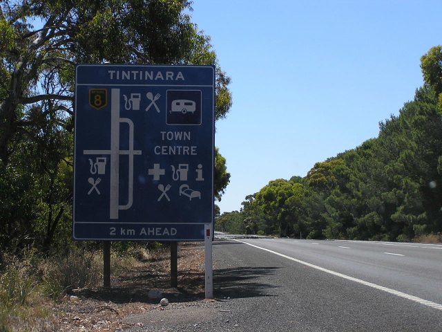 |
Dukes Hwy heading west approaching Tintinara. Jan 2005. |
|
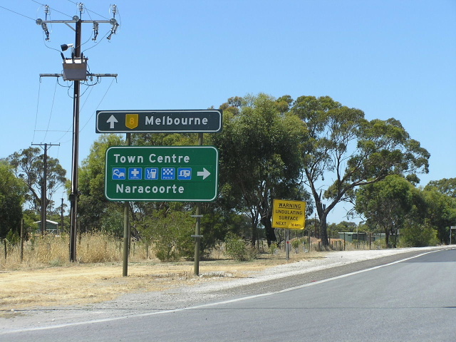
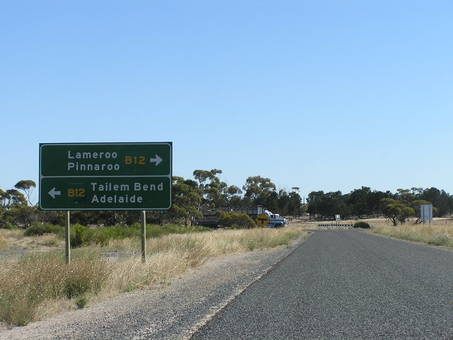
Very old trailblazer heading east approaching the Mallee Highway (B12) intersection near Tailem Bend. Jan 2005. |
Photos of the old alignment of Dukes Highway - Coomandook to Tailem Bend via Moorlands (bypassed in 1980) |
|
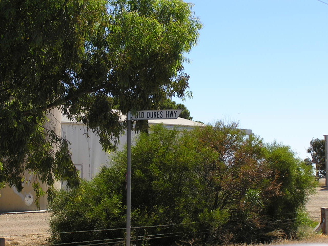 |
The council blade sign that points out "Old Dukes Highway" in Coomandook. Jan 2005. |
 |
Looking north on the outskirts of Coomandook of what, until December 1980, was the Dukes Highway. Note the yellow centre lines remaining. Jan 2005. |
 |
Looking north on the old highway approaching the Mallee Highway at Moorlands. The Dukes Hwy turned left here and headed to Tailem Bend along what is now the Mallee Highway. Jan 2005. |
Photos of the old alignment of Dukes Highway - Bordertown (bypassed in 1987) |
|
 |
Looking east along the old highway through Bordertown. This section is now the B57 but signage on the ground is non-existant. Jan 2005. |
Last updated 22 February 2012 © Ozroads 2003-2012. |