Launceston to Greens Beach |
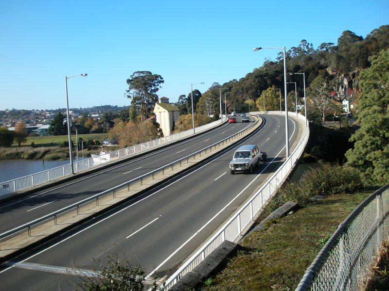
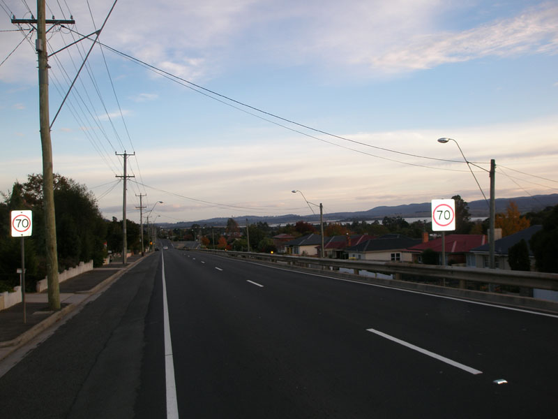
A7 (West Tamar Hwy) looking south at Paterson Bridge, which crosses Cataract Gorge on the north-western approach to Launceston. Source: Peter Renshaw, May 2007.
Introduced: 1980
Length: 64km
Northern Terminus: Greens Beach Road, Greens Beach
Southern Terminus: Bathurst Street (NH1/A8), Launceston
Route taken: York St/Brisbane St, West Tamar Highway, West Arm Rd, Greens Beach Rd
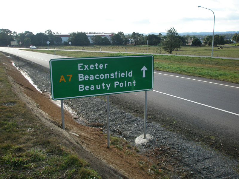
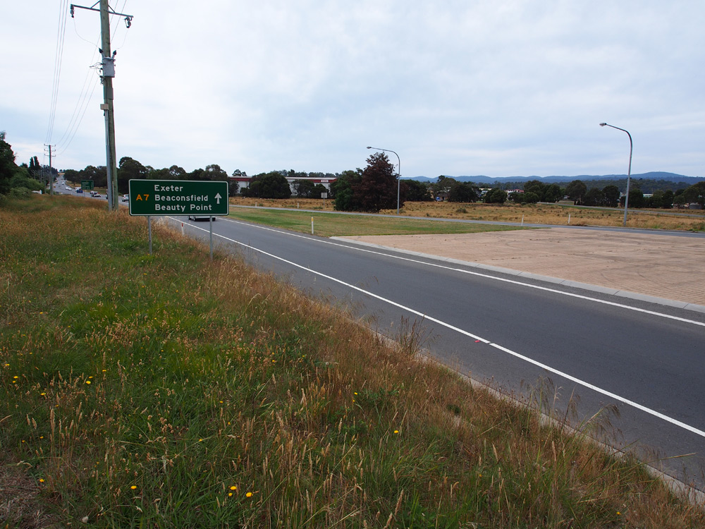
Focal Points: Launceston, Exeter, Beaconsfield, Beauty Point, Greens Beach
Responsibility: State Government (Launceston-Beauty Point), Local Government (Beauty Point-Greens Beach)
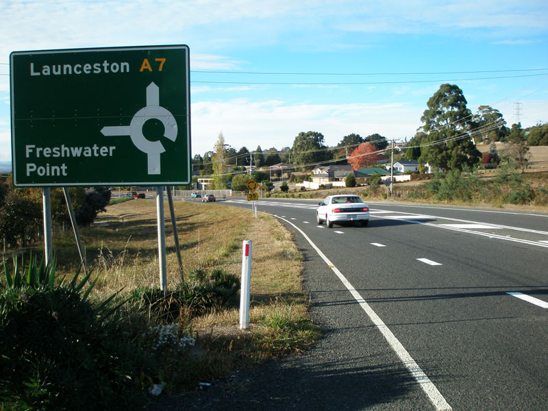
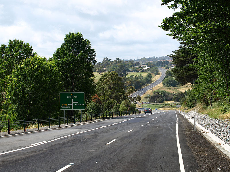
Route A7 is a principal north-south route, beginning in Launceston and skirting the western bank of the Tamar River before terminating at Greens Beach, near where the Tamar River meets Bass Strait. The majority of route A7 is also the West Tamar Highway.
Route A7 begins in Launceston CBD with a couplet of one-way streets - Brisbane Street for eastbound traffic and York Street for westbound traffic - at the junction with Wellington Street, continuing directly from route A3. Two blocks after its beginning - at Margaret Street - A7 joins the West Tamar Highway, which it follows for 47km north to Beauty Point, before continuing northwards to Greens Beach via several local government roads.
Route A7 was introduced in 1979 and there have since been no changes in its alignment. Improvements to the route have consisted generally of upgrades and duplications along the existing alignment.
Between Beaconsfield and Greens Beach, it is actually 5km shorter for through traffic to use route C720 to bypass Beauty Point. A7 at this point forms the two shorter angles of a triangle, whilst C720 forms the hypotenuse. C720 has also been constructed to a higher standard than route A7.
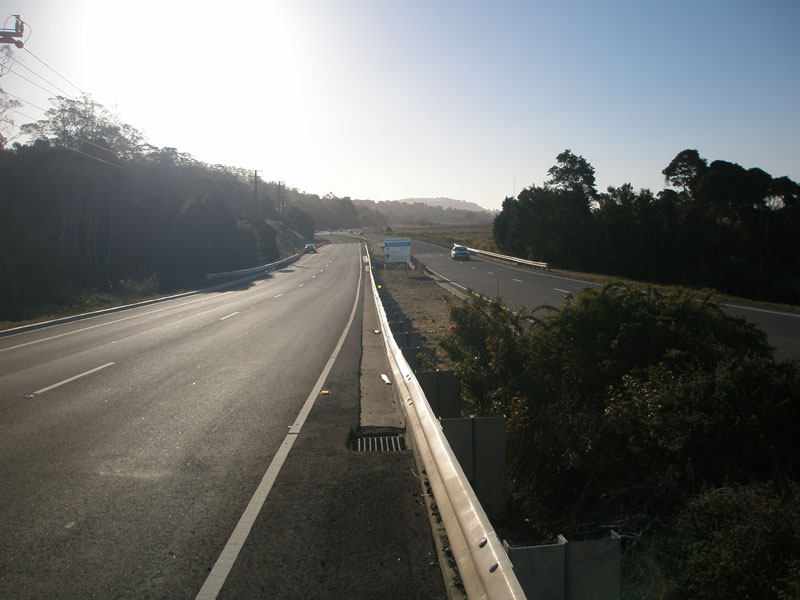
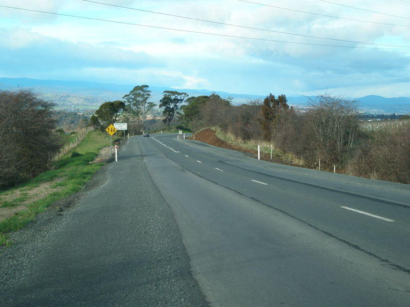
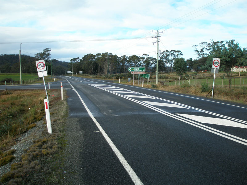
The road quality varies from excellent dual carriageways for the first 11km north from Launceston, to a narrow (but sealed) rural route with no line marking north of Kelso.
The exact location of the northern terminus of route A7 is of some debate - DIER information specifies simply 'Greens Beach' as the northern terminus. However, no A7 shields appear on signs north of Kelso.
Further Reading:
|
Photos of route A7 (Launceston to Greens Beach) |
|
York Street (A3) westbound approaching Wellington Street (NH1) in Launceston CBD. This is the beginning of route A7 and the end of route A3. Route A8 also terminates at this junction. Source: Peter Renshaw, April 2007. |
|
York Street (A7) westbound approaching Bathurst Street (A8) in Launceston CBD. This intersection is the northern terminus of NH1, as well as the beginning of route A8. Source: Peter Renshaw, April 2007. |
|
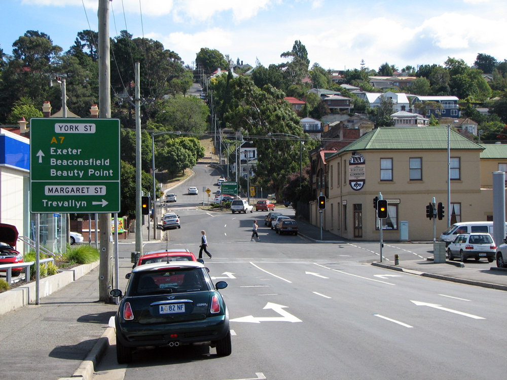 |
York Street (A7) westbound approaching Margaret Street in Launceston CBD. This intersection marks the southern terminus of the West Tamar Highway, which begins at the western boundary of Margaret Street. A right-turn into Margaret Street will lead you to Trevallyn via Kings Bridge - the precursor the current West Tamar Highway route via Paterson Bridge. Photo taken: March 2009. |
 |
West Tamar Highway (A7) westbound at the bifurcation of York Street in Launceston CBD. Photo taken: March 2009. |
 |
Brisbane Street (A7) looking east at the intersection with Margaret Street. This is the southern terminus of the West Tamar Highway. Route A7 terminates at the next block - the intersection with Bathurst St (A8). Source: Josh Geoghegan, Dec 2004. |
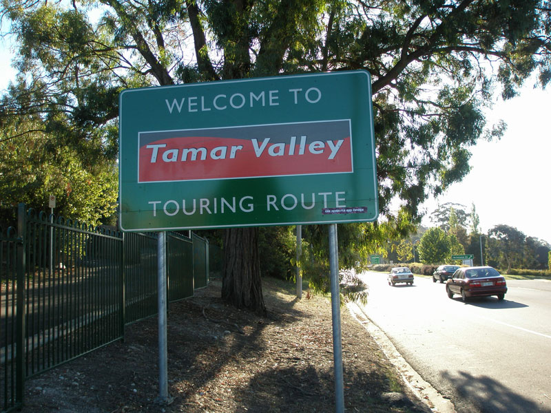 |
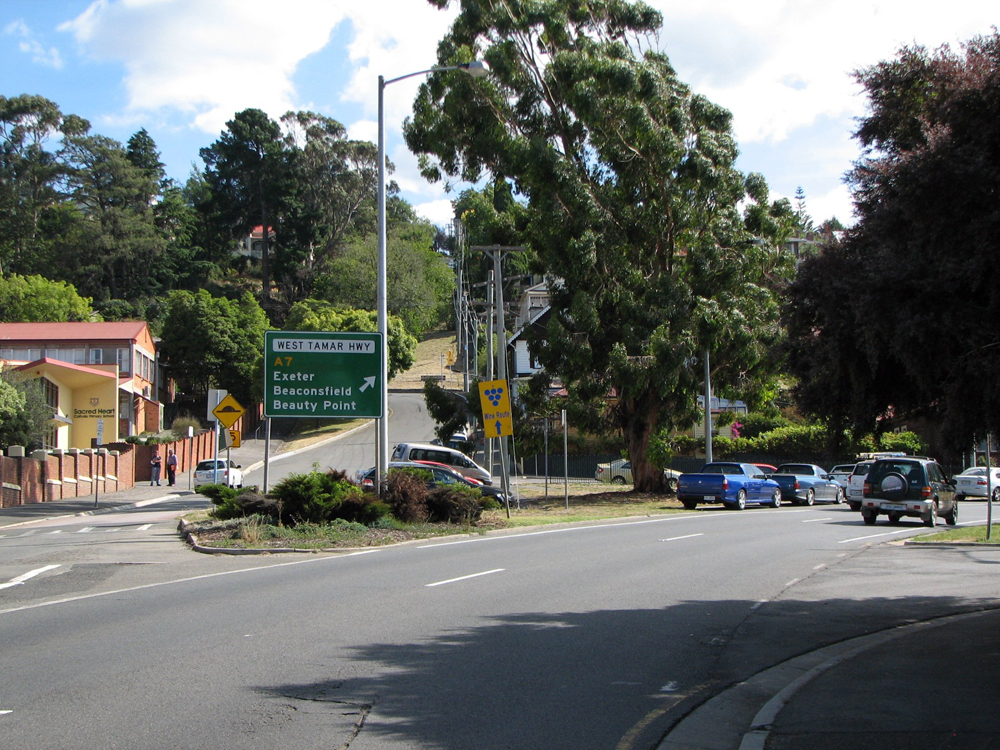
Just beyond the bifurcation of York Street is this welcome sign to the 'Tamar Valley Touring Route', which follows A7 north to Beauty Point. Source: Peter Renshaw, April 2007. |
 |
The first northbound distance sign on West Tamar Highway (A7), northbound approaching Paterson Bridge. Photo taken: March 2009. |
 |
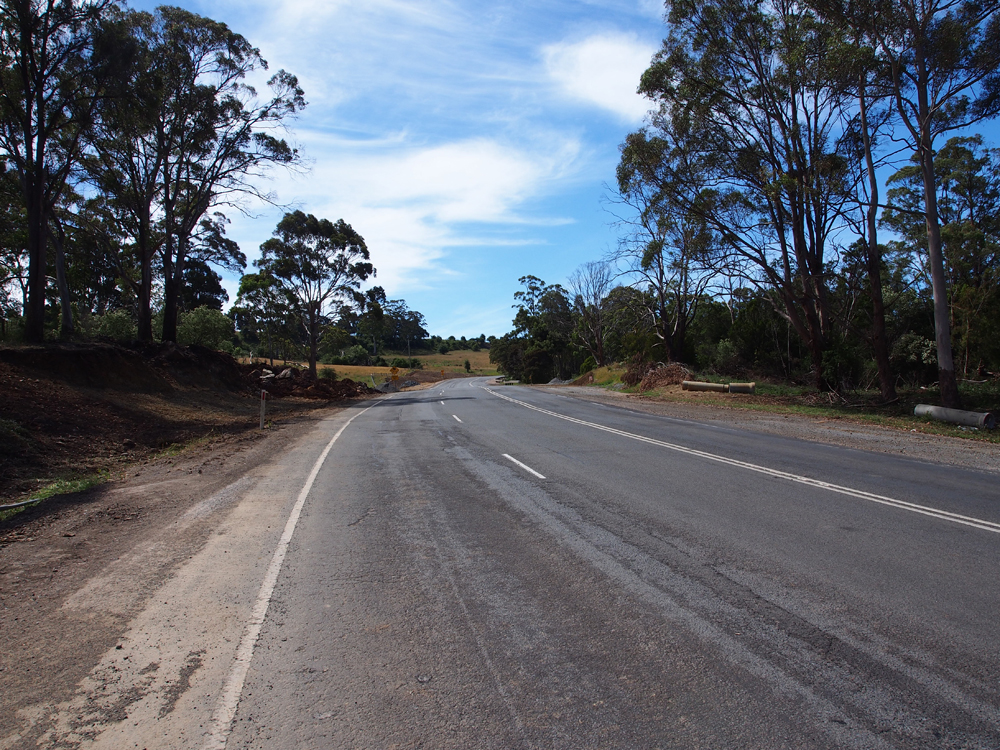
West Tamar Highway (A7) looking south from Paterson Bridge. Source: Peter Renshaw, April 2007. |
|
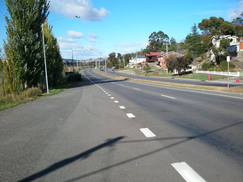
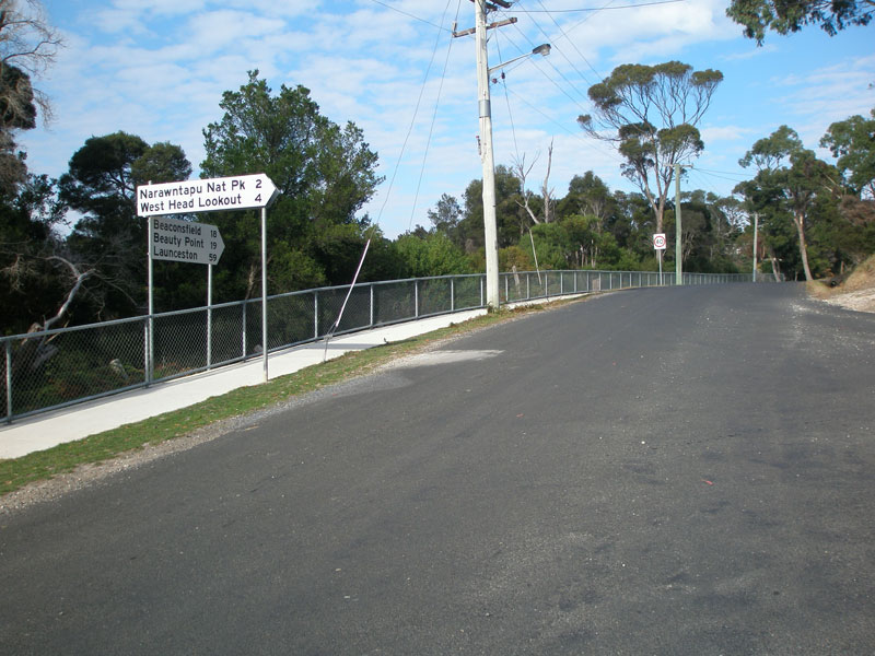
A southerly view of Paterson Bridge as the West Tamar Highway (A7) crosses Cataract Gorge. Source: Peter Renshaw, May 2007. |
 |
A welcome sign for southbound traffic as the West Tamar Highway (A7) enters Launceston LGA, north of Forest Rd, Trevallyn. Source: Peter Renshaw, May 2007. |
 |
West Tamar Highway (A7) looking south at the boundary of Launceston LGA. The welcome sign depicted in the above photo is hidden in the shadows. Source: Peter Renshaw, May 2007. |
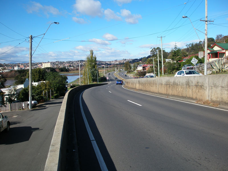 |
West Tamar Highway (A7) looking south towards Launceston from the southern end of the Trevallyn one-way couplet. Source: Peter Renshaw, May 2007. |
 |
West Tamar Highway (A7) looking north to the junction with Pomona Road in Riverside. Source: Peter Renshaw, April 2007. |
 |
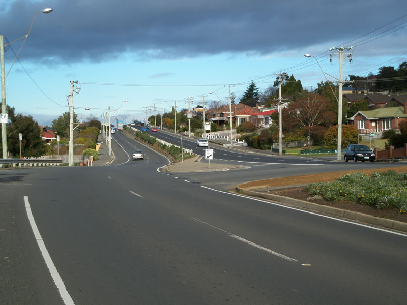
West Tamar Highway (A7) looking north at the junction with Pomona Road in Riverside. Note the split-level carriageways in the background. Source: Josh Geoghegan, Dec 2004. |
 |
West Tamar Highway (A7) looking north through Riverside. Note the split-level carriageways. Source: Peter Renshaw, April 2007. |
 |
West Tamar Highway (A7) looking south from Cleghorn Ave, Riverside. Source: Peter Renshaw, July 2007. |
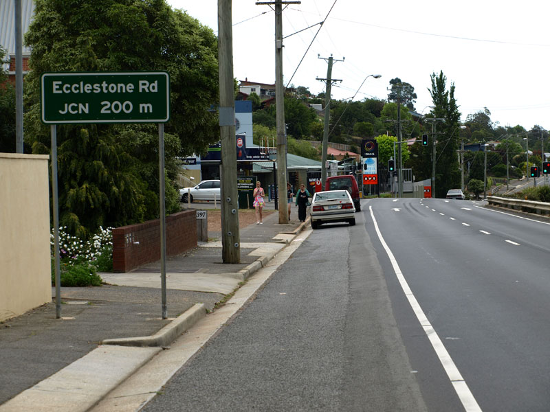 |
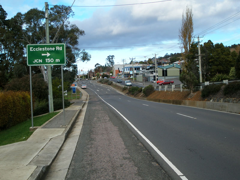
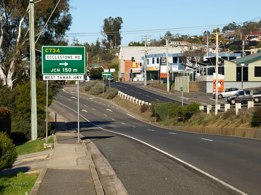
Old and new AD signs northbound on West Tamar Highway (A7) approaching Ecclestone Rd (C734) at Riverside North. It is unusual that the old sign makes no mention of C734, however this was fixed upon installation of the new signs. Note the apparently misplaced 'West Tamar Highway' name plate below the sign. Top photo: Peter Renshaw, November 2007. Bottom photo: Peter Renshaw, July 2010. |
Fingerboard sign for route C734 at the junction of West Tamar Highway & Ecclestone Rd in Riverside. Source: Peter Renshaw, April 2007. |
|
  |
Original and new fingerboard signs facing C734 (Ecclestone Rd) traffic at the junction with West Tamar Highway (A7) in Riverside North. Note the change to green background, which is used for signage within urban areas to increase its visibility. I reckon that those out-of-place 'West Tamar Highway' name plates from the previous photos probably belong on top of these two signs. Top photo: Peter Renshaw, April 2007. Bottom photo: Peter Renshaw, July 2010. |
 |
West Tamar Highway (A7) looking south at Ecclestone Rd (C734). Source: Peter Renshaw, April 2007. |
 |
West Tamar Highway (A7) looking north from Ecclestone Rd (C734). Source: Peter Renshaw, April 2007. |
  |
Old and new AD signs southbound on West Tamar Highway (A7) approaching Ecclestone Rd (C734) at Riverside North. It is unusual that the old sign makes no mention of C734, however this was fixed upon installation of the new signs. Note the apparently misplaced 'West Tamar Highway' name plate below the sign. Top photo: Peter Renshaw, July 2007. Bottom photo: Peter Renshaw, July 2010. |
 |
Tourism AD sign southbound on West Tamar Highway (A7) approaching Ecclestone Rd (C734). Source: Peter Renshaw, July 2007. |
 |
West Tamar Highway (A7) looking south into Riverside, from near Cormiston Road. Source: Peter Renshaw, July 2007. |
 |
West Tamar Highway (A7) looking north at Cormiston Creek. Until recently, this was the northern extent of the dual carriageways on this road. In March 2006, 3.5km of duplicated carriageways were opened to traffic between Cormiston Creek and Acropolis Drive, Legana. Source: Peter Renshaw, April 2007. |
 |
West Tamar Highway (A7) looking north near Tamar Island, showing recently completed dual carriageways. Source: Peter Renshaw, April 2007. |
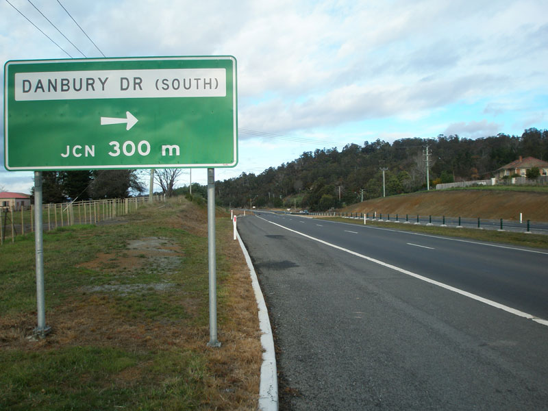 |
West Tamar Highway (A7) southbound approaching the southern junction with Danbury Drive, south of Legana. Source: Peter Renshaw, July 2007. |
 |
New RD sign southbound on West Tamar Highway (A7) after the Acropolis Drive roundabout, Legana. Source: Peter Renshaw, December 2012. |
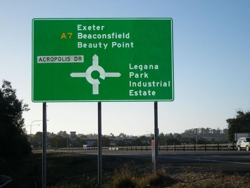 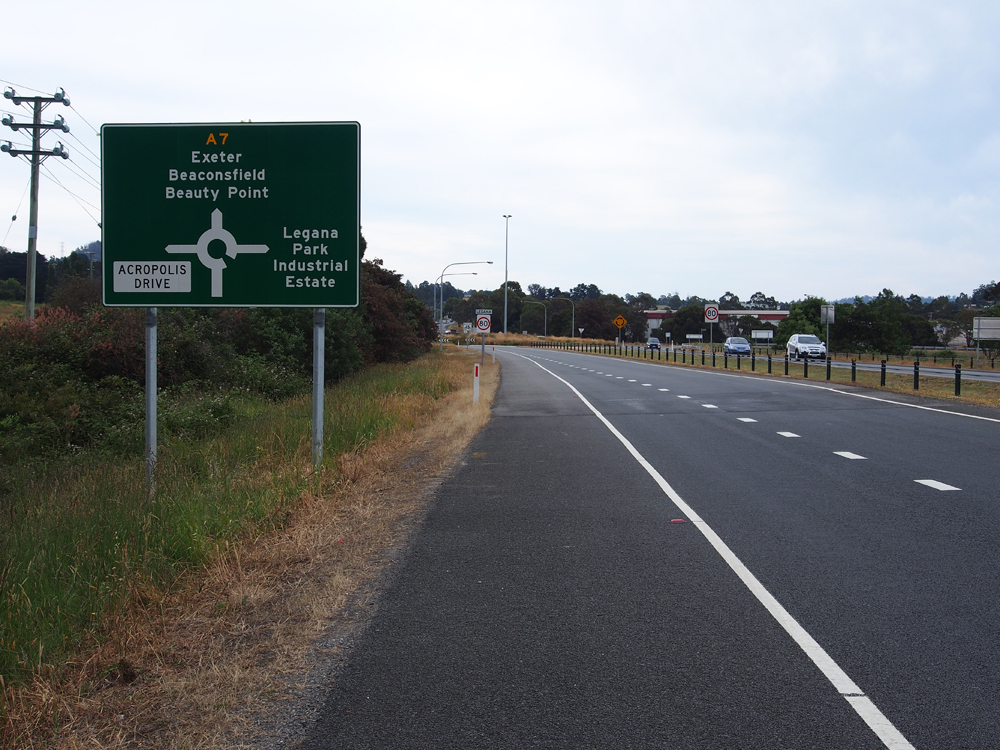 |
Old and new AD signs on West Tamar Highway (A7) approaching the roundabout at Acropolis Drive, Legana. This is the present northern extent of dual carriageways on the A7, following the works completed in 2006. The top photo shows the sign which was installed in 2006; the bottom photo shows its replacement erected in December 2012. Top photo: Peter Renshaw, April 2007. Bottom photo: Peter Renshaw, December 2012. |
  |
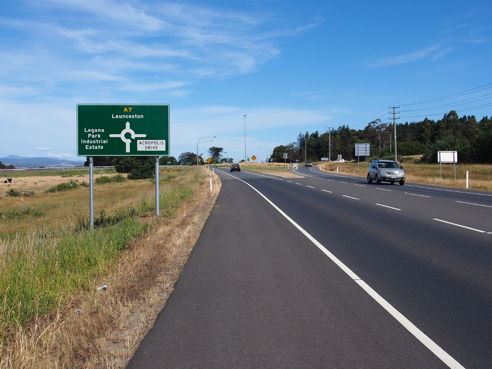
Old and new ID signs pointing A7 traffic south from the Acropolis Dr roundabout at Legana. The old ID sign dates from the 2006 duplication works; the new one was installed in December 2012. Top photo: Peter Renshaw, July 2007. Bottom photo: Peter Renshaw, December 2012. |
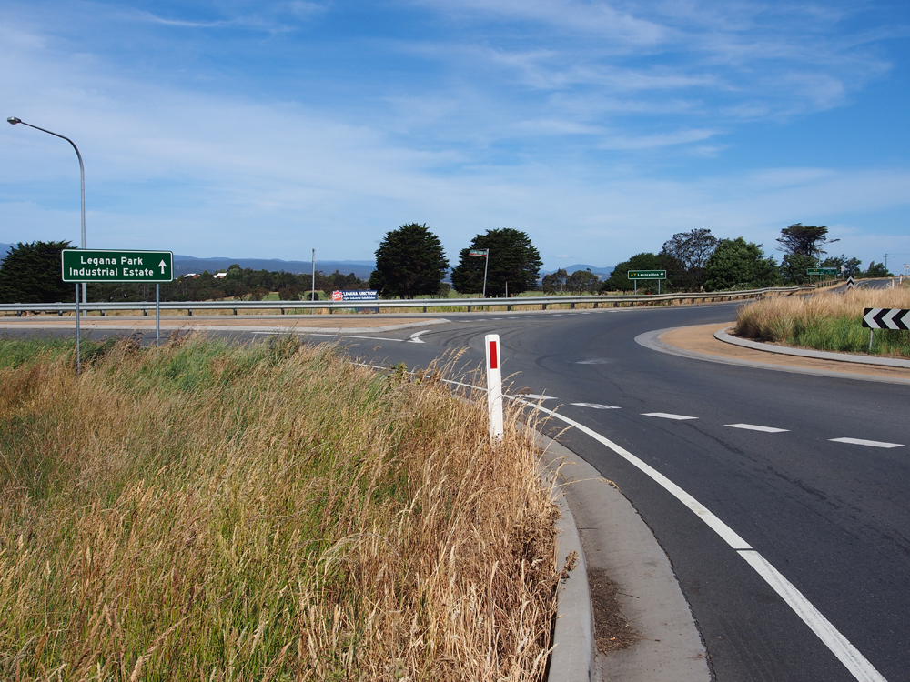 |
ID sign pointing traffic down Legana Park Dr at the roundabout junction with West Tamar Highway (A7) & Acropolis Drive, Legana. Source: Peter Renshaw, December 2012. |
  |
Old and new ID signs pointing A7 traffic north from the Acropolis Dr roundabout at Legana. The old ID sign dates from the 2006 duplication works; the new one was installed in December 2012. Top photo: Peter Renshaw, July 2007. Bottom photo: Peter Renshaw, December 2012. |
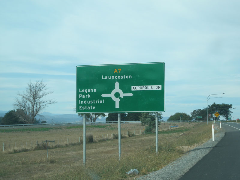  |
Old and new AD signs on West Tamar Highway (A7) approaching the roundabout at Acropolis Drive, Legana. The top photo shows the sign which was installed in 2006; the bottom photo shows its replacement erected in December 2012. Top photo: Peter Renshaw, April 2007. Bottom photo: Peter Renshaw, December 2012. |
 |
Brand new RD sign, erected in December 2012, heading north from Acropolis Drive, Legana. Source: Peter Renshaw, December 2012. |
 |
West Tamar Highway (A7) looking south through Legana towards the beginning of the dual carriageways at Acropolis Drive. Source: Peter Renshaw, December 2012. |
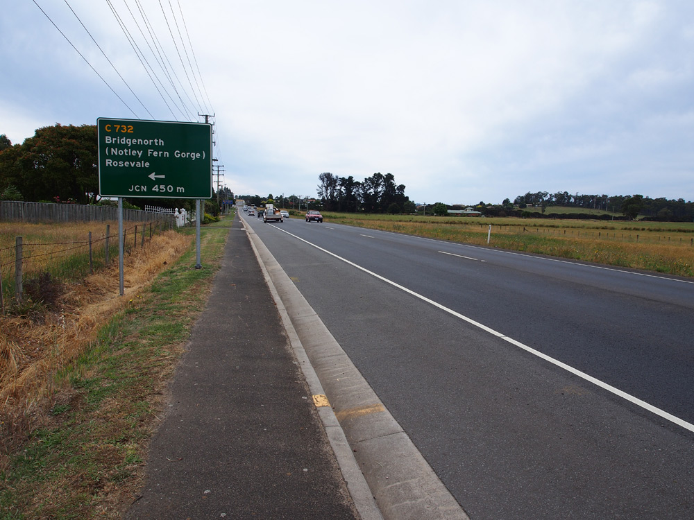 |
New AD sign northbound on West Tamar Highway (A7) approaching Bridgenorth Rd (C732) at Legana. Source: Peter Renshaw, December 2012. |
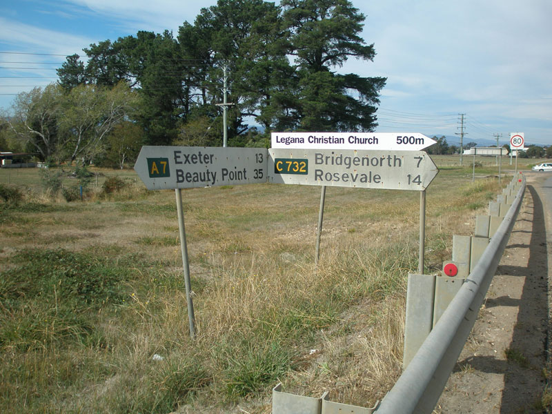 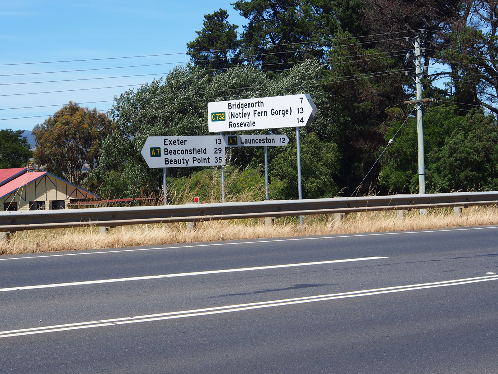 |
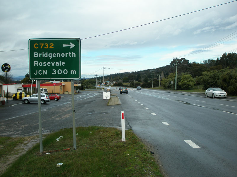
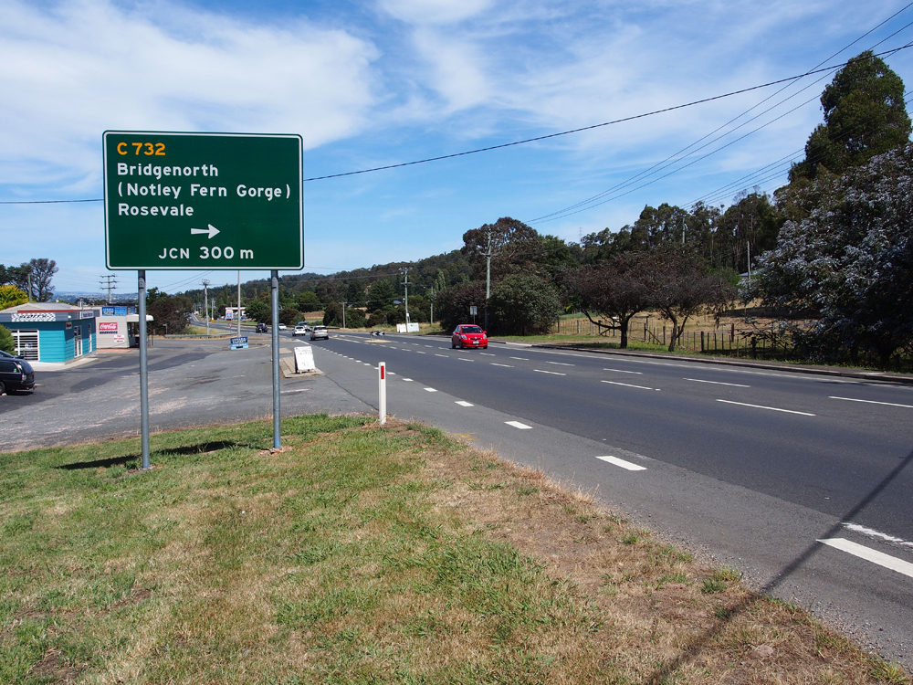
Old and new fingerboard sign assemblies at the junction of West Tamar Highway (A7) & Bridgenorth Rd (C732) at Legana. Top photo: Peter Renshaw, April 2007. Bottom photo: Peter Renshaw, December 2012. |
  |
Old and new AD signs southbound on West Tamar Highway (A7) approaching the junction with Bridgenorth Rd (C732) at Legana. Top photo: Peter Renshaw, July 2007. Bottom photo: Peter Renshaw, December 2012. |
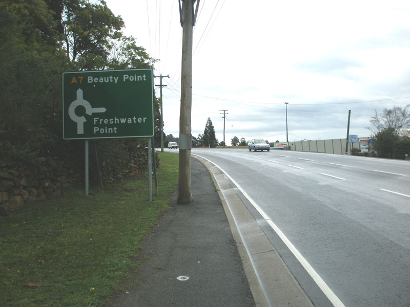  |
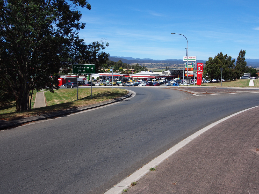
Old and new AD signs on West Tamar Highway (A7) northbound, approaching the junction with Freshwater Point Rd, Legana. Top photo: Peter Renshaw, July 2007. Bottom photo: Peter Renshaw, December 2012. |
    |
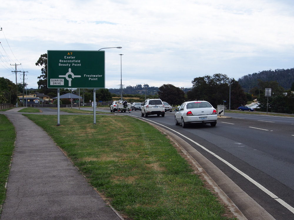
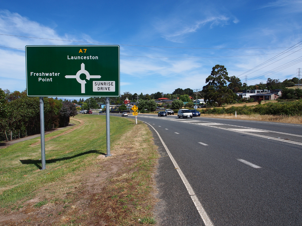
Brand new ID signs installed in December 2012 at the junction of West Tamar Highway (A7), Freshwater Point Rd & Sunrise Dr, Legana. This intersection did not previously have ID signs. Photos taken: December 2012. |
 |
West Tamar Highway (A7), looking south to the junction with Freshwater Point Rd, Legana. Source: Peter Renshaw, July 2007. |
  |
Old and new AD signs southbound on West Tamar Highway (A7) approaching the junction with Freshwater Point Rd in Legana. Note that Sunrise Drive has been added to the sign. Top photo: Peter Renshaw, April 2007. Bottom photo: Peter Renshaw, December 2012. |
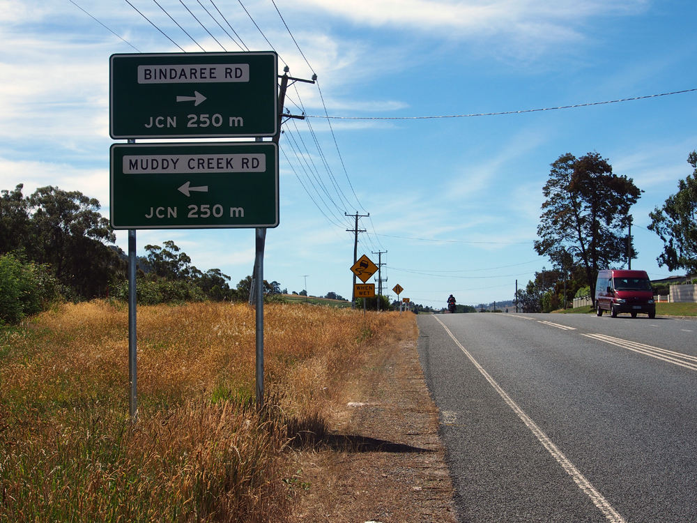 |
New AD sign assembly northbound on West Tamar Highway (A7) approaching the junctions with Bindaree Rd & Muddy Creek Rd, Legana. Source: Peter Renshaw, December 2012. |
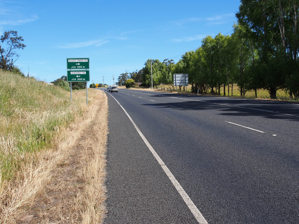 |
New AD sign assembly southbound on West Tamar Highway (A7) approaching the junctions with Bindaree Rd & Muddy Creek Rd, Legana. Source: Peter Renshaw, December 2012. |
 |
West Tamar Highway (A7) northbound approaching the junctions with Rosevears Dr (C733) & Atkinsons Rd, just north of Legana. Source: Peter Renshaw, April 2007. |
 |
Fingerboard signs at the intersection of West Tamar Highway (A7) & Atkinsons Rd, just north of Legana. Source: Peter Renshaw, December 2007. |
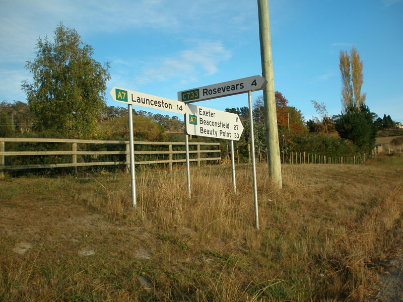 |
Fingerboard signs at the junction of West Tamar Highway (A7) & Rosevears Dr (C733), just north of Legana. Source: Peter Renshaw, April 2007. |
 |
West Tamar Highway (A7) southbound approaching the junction with Rosevears Dr (C733), just north of Legana. Source: Peter Renshaw, December 2007. |
 |
West Tamar Highway (A7) looking south approximately 800m south of Waldhorn Drive, 4km north of Legana. Source: Peter Renshaw, July 2007. |
 |
Fingerboard sign assembly at the junction of West Tamar Highway (A7) & Craythorne Road, 5km north of Legana. Source: Peter Renshaw, December 2012. |
 |
West Tamar Highway (A7) looking north at the junction of West Tamar Highway (A7) & Waldhorn Drive, 5km north of Legana. Source: Peter Renshaw, December 2012. |
 |
Fingerboard sign at the junction of West Tamar Highway (A7) & Waldhorn Drive, 5km north of Legana. Source: Peter Renshaw, December 2012. |
  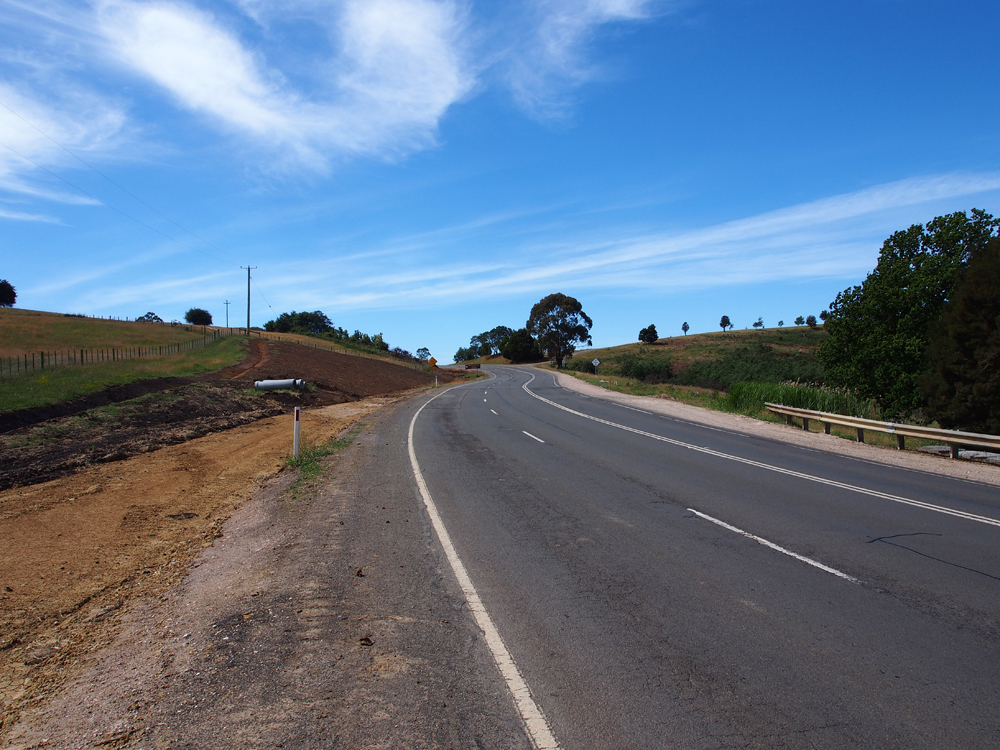 |
Three views, from south to north, of reconstruction and widening works underway on West Tamar Highway between Waldhorn Drive and Bradys Lookout. Photos taken: December 2012. |
 |
West Tamar Highway (A7) looking south from just south of Bradys Lookout. Source: Peter Renshaw, April 2007. |
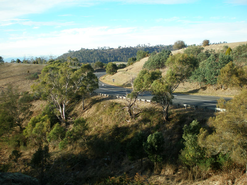 |
The view south from Bradys Lookout over the West Tamar Highway (A7) as it winds its way along the western edge of the Tamar Valley. Source: Peter Renshaw, April 2007. |
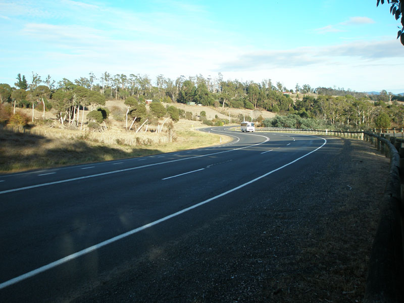 |
The view north from Bradys Lookout along the West Tamar Highway (A7) as it winds its way along the western edge of the Tamar Valley. Source: Peter Renshaw, April 2007. |
 |
Fingerboard sign assembly at the junction of West Tamar Highway (A7) & Lookout Rd, 800m north of Bradys Lookout. Source: Peter Renshaw, December 2012. |
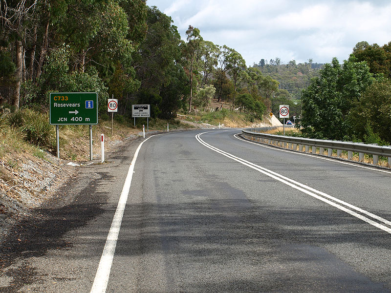 |
AD sign northbound on West Tamar Highway (A7) approaching Rosevears Dr (C733) at Lanena. Source: Peter Renshaw, December 2007. |
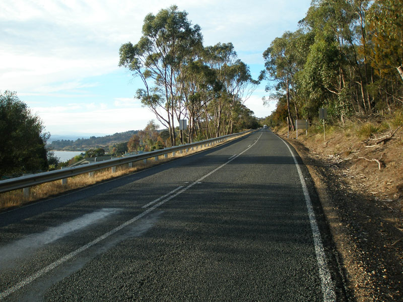 |
West Tamar Highway (A7) looking south from Rosevears Drive at Lanena. A glimpse of the Tamar River can be seen in the left of the photo. Source: Peter Renshaw, April 2007. |
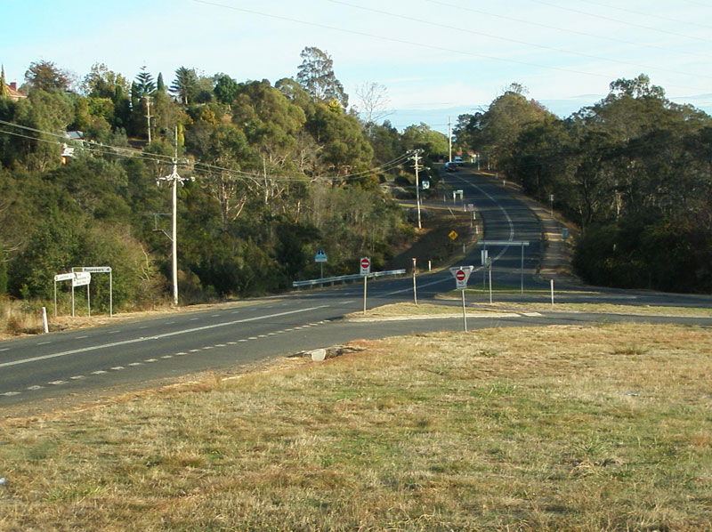 |
West Tamar Highway (A7) looking north at the junction with Rosevears Dr (C733), Lanena. Source: Peter Renshaw, April 2007. |
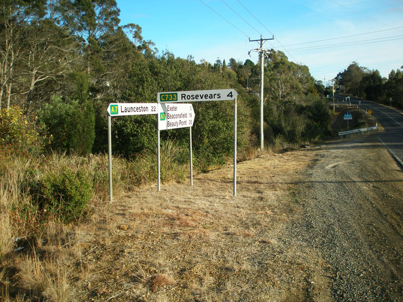 |
Fingerboard signs at the junction of West Tamar Highway (A7) & Rosevears Dr (C733), Lanena. Source: Peter Renshaw, April 2007. |
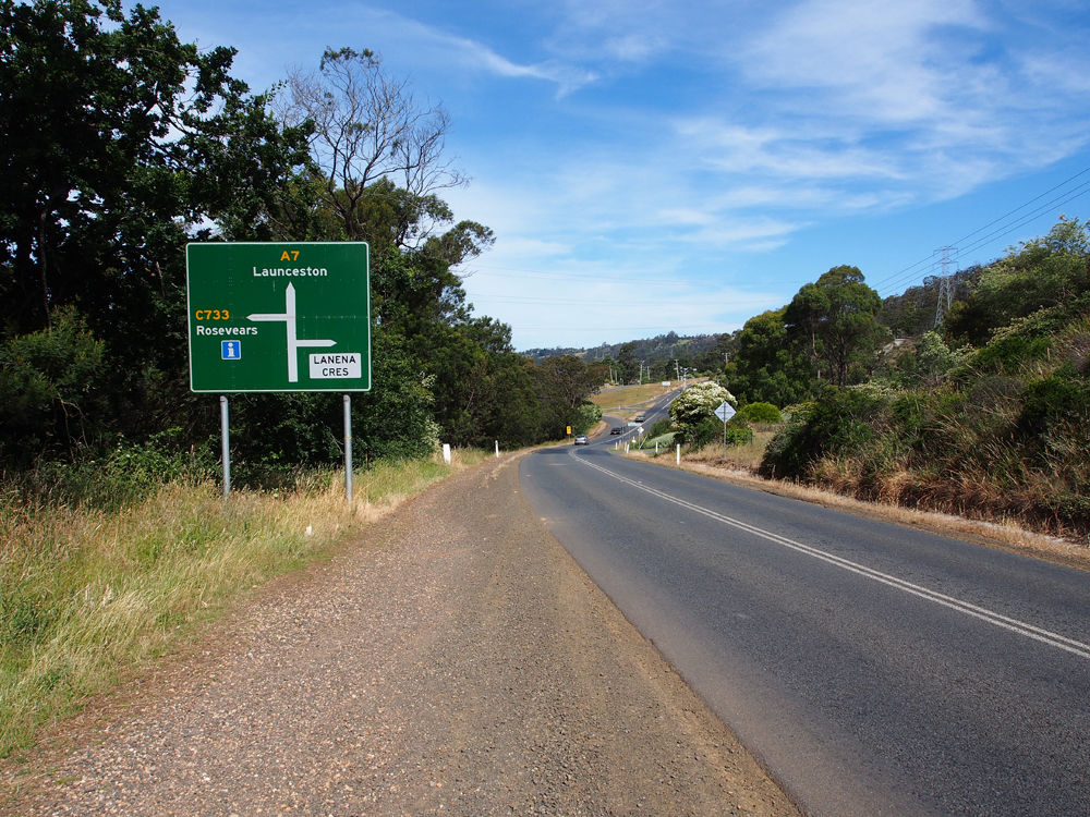 |
West Tamar Highway (A7) AD sign, southbound approaching Rosevears Dr (C733). Source: Peter Renshaw, December 2012. |
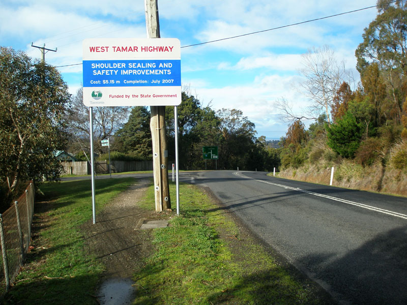 |
DIER project information sign southbound on West Tamar Highway (A7) at Lanena, explaining the $5 million worth of roadworks along the highway. Source: Peter Renshaw, July 2007. |
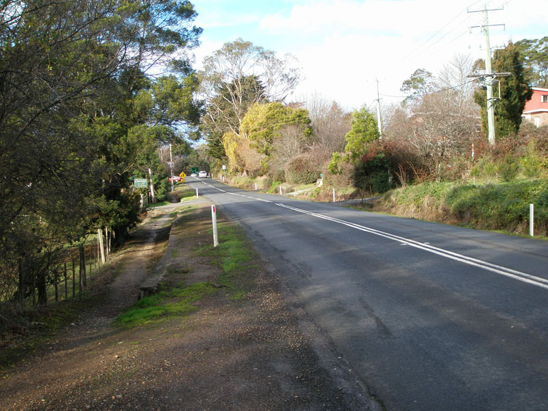 |
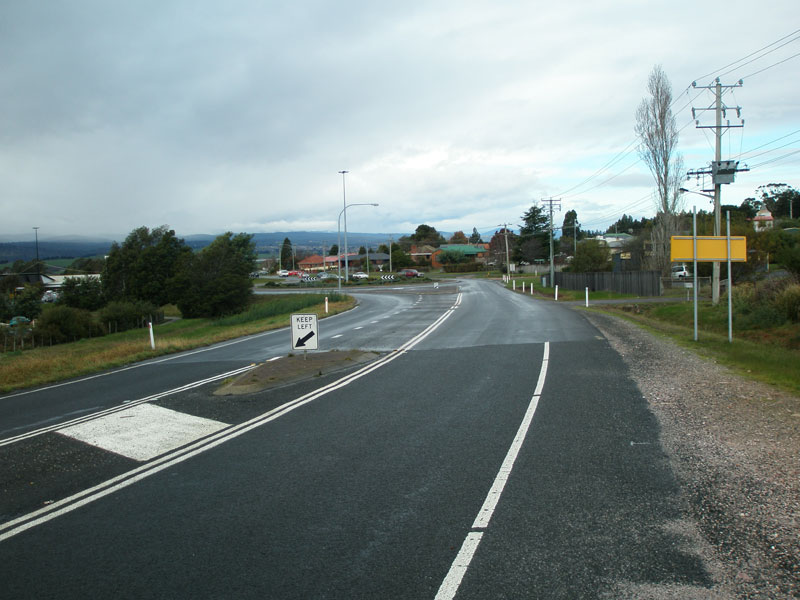
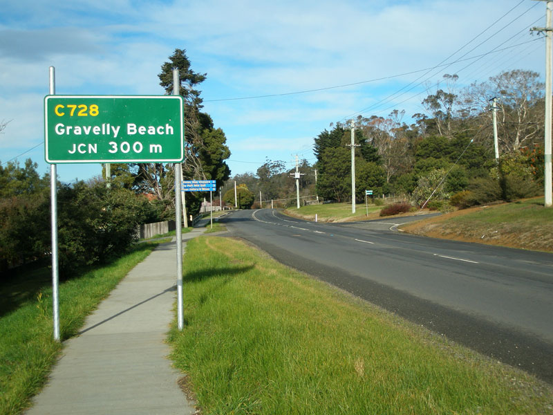
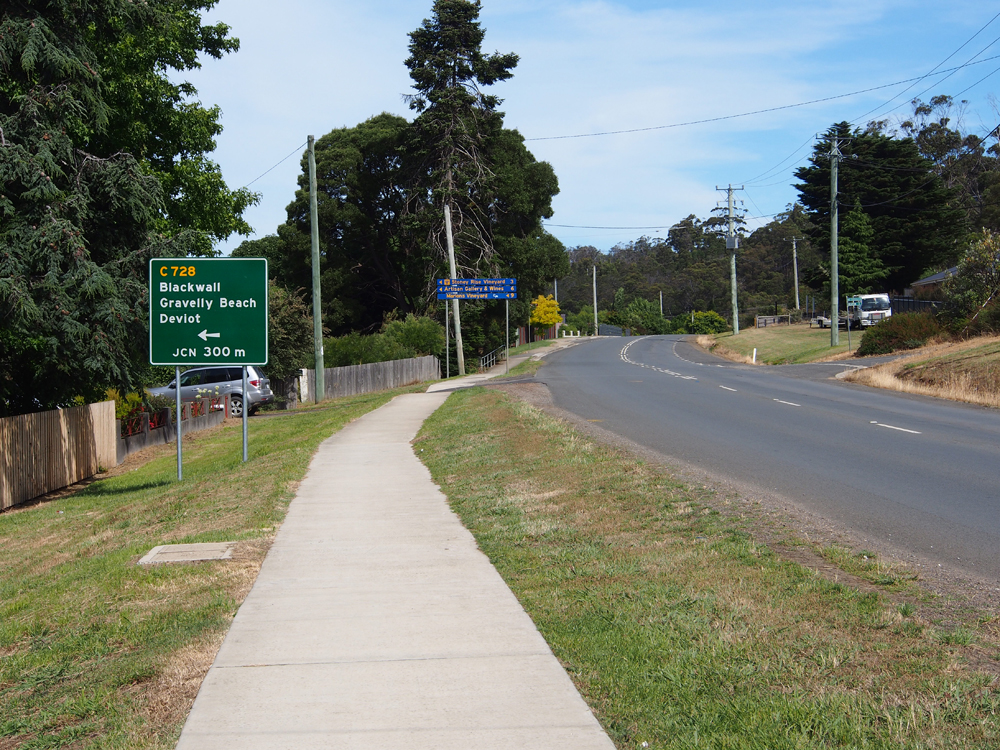
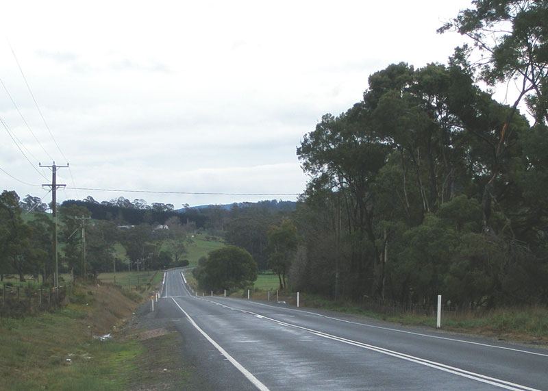
West Tamar Highway (A7) looking south through Lanena, between Gravelly Beach Rd (C728) and Rosevears Dr (C733). This narrow section of road is notorious for crashes and speeding fines, and is a 60km/h zone throughout. Source: Peter Renshaw, July 2007. |
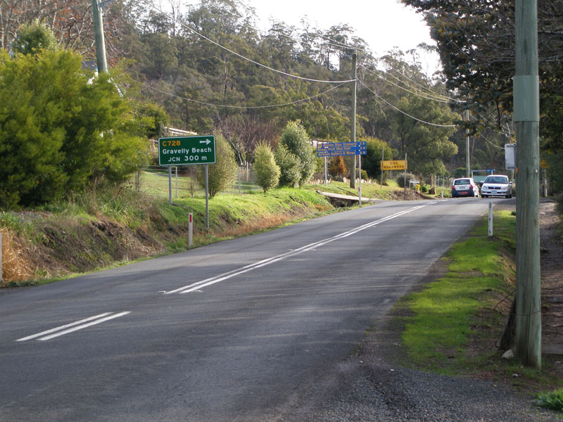 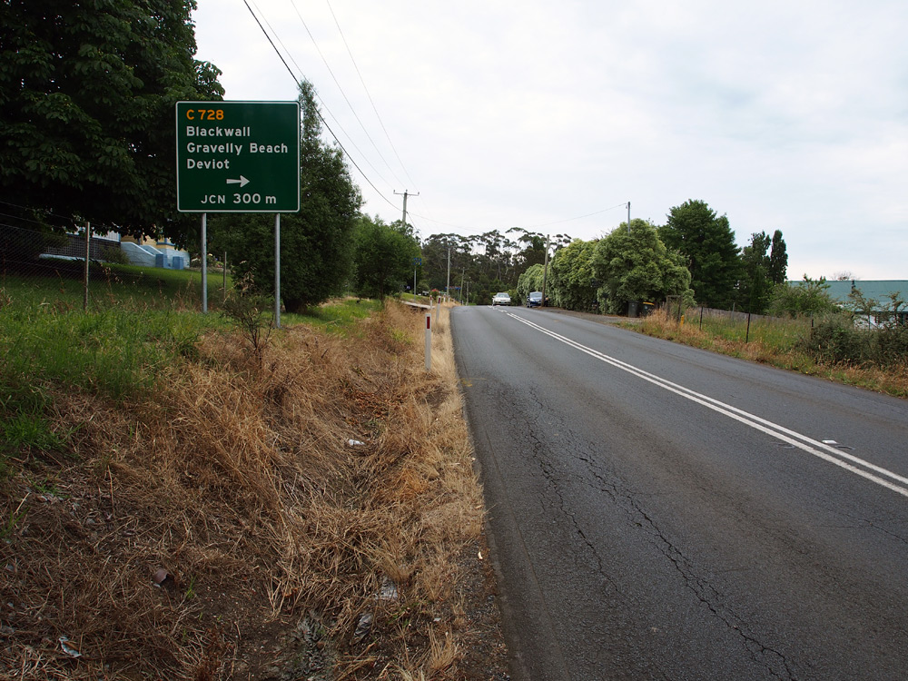 |
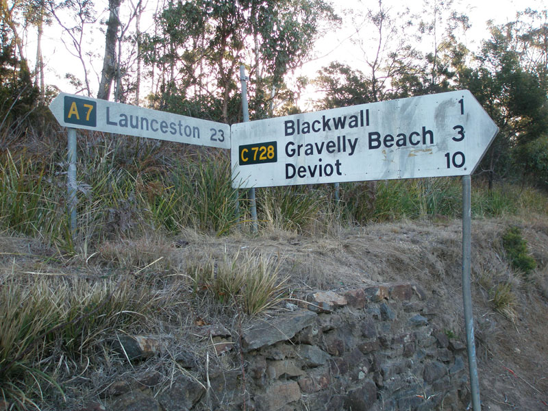
Old and new AD signs northbound on West Tamar Highway (A7) approaching Gravelly Beach Rd (C728) at Blackwall. Top photo: Peter Renshaw, July 2007. Bottom photo: Peter Renshaw, December 2012. |
 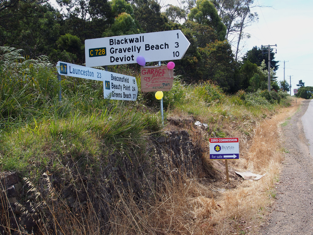 |
Old and new fingerboard sign assemblies at the junction of West Tamar Highway (A7) & Gravelly Beach Rd (C728), Blackwall. Top photo: Peter Renshaw, April 2007. Bottom photo: Peter Renshaw, December 2012. |
  |
Old and new AD signs southbound on West Tamar Highway (A7) approaching the junction with Gravelly Beach Rd (C728), Blackwall. Top photo: Peter Renshaw, July 2007. Bottom photo: Peter Renshaw, December 2012. |
 |
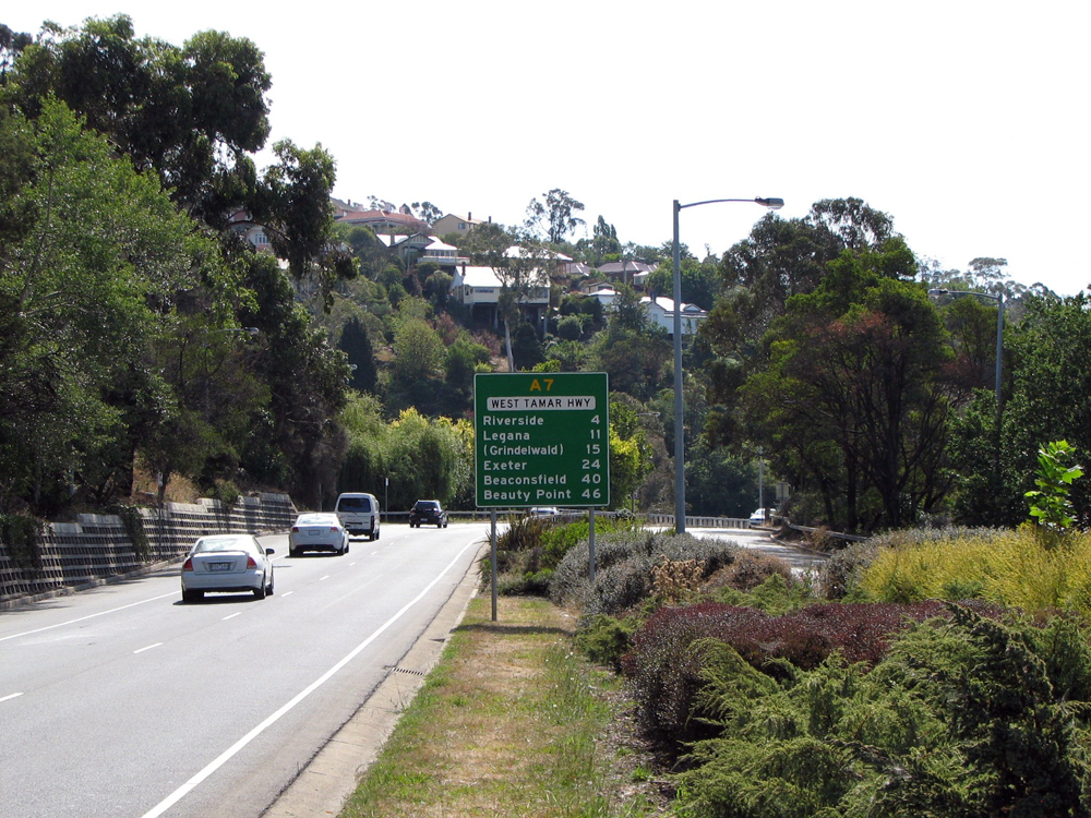
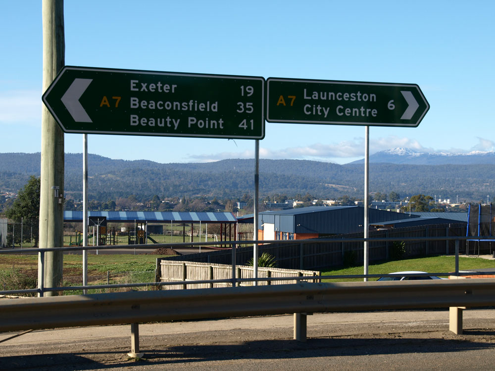
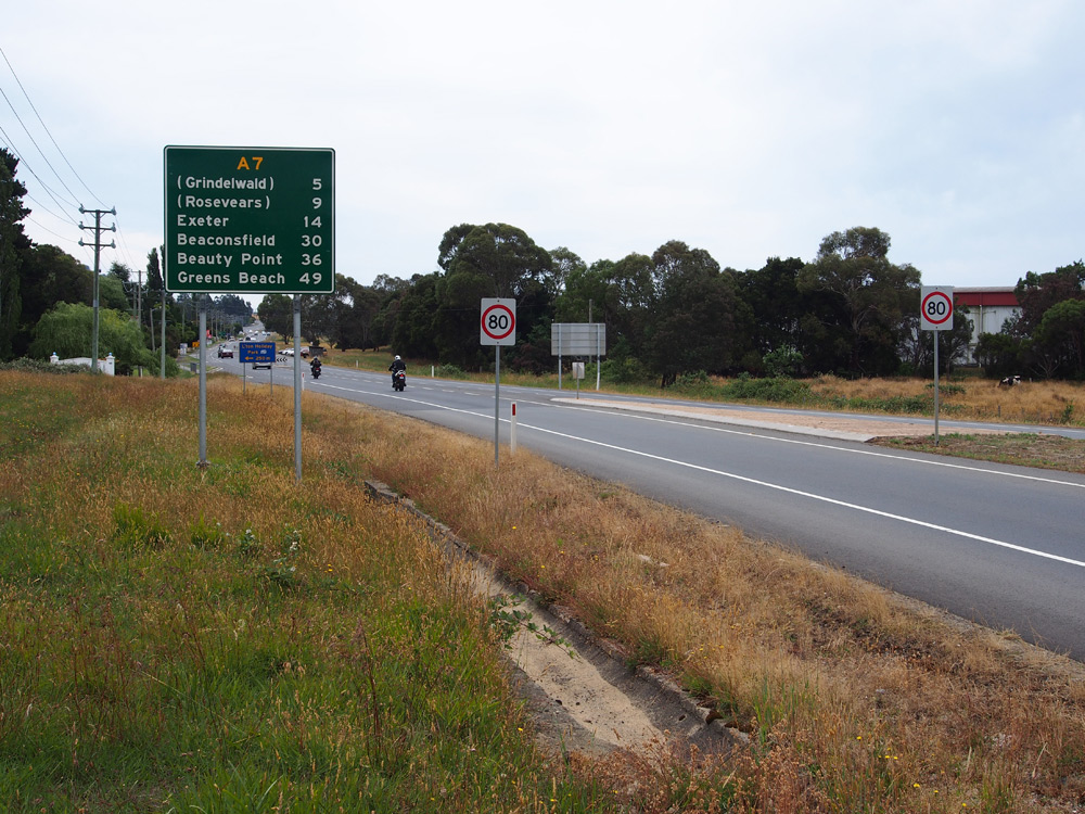
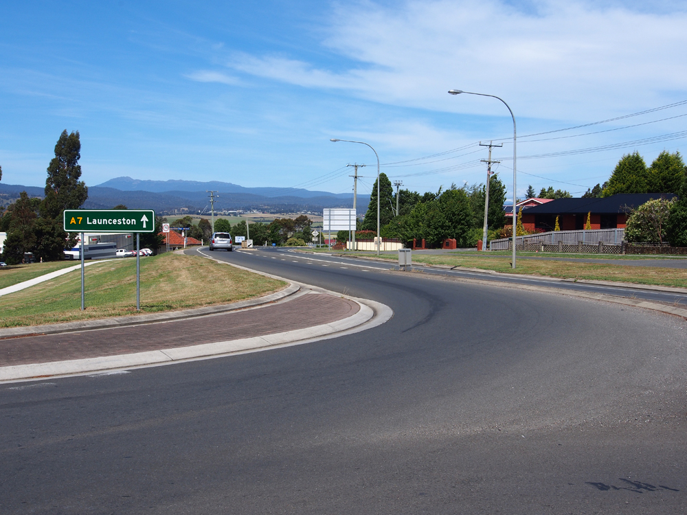
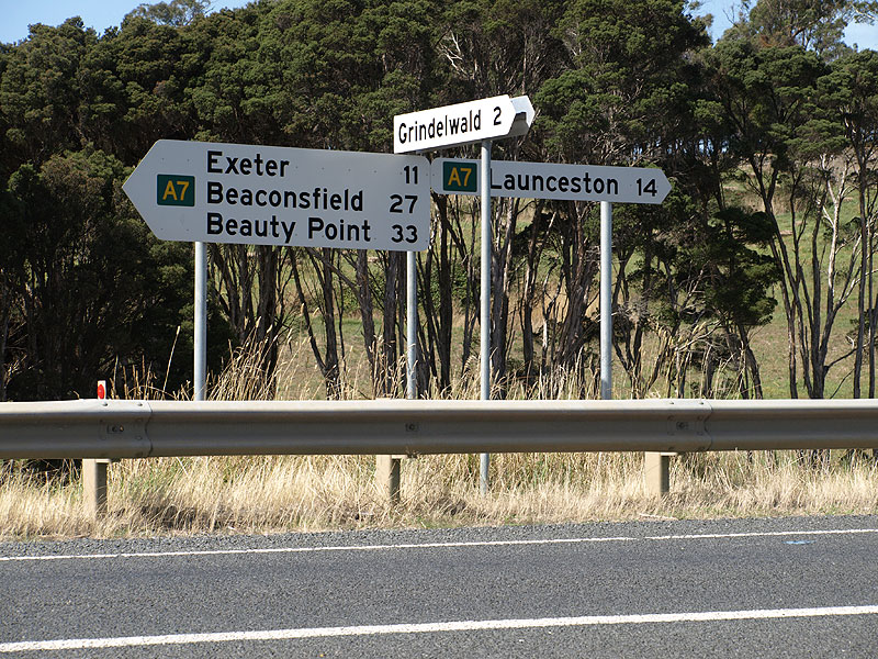
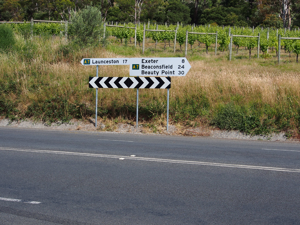
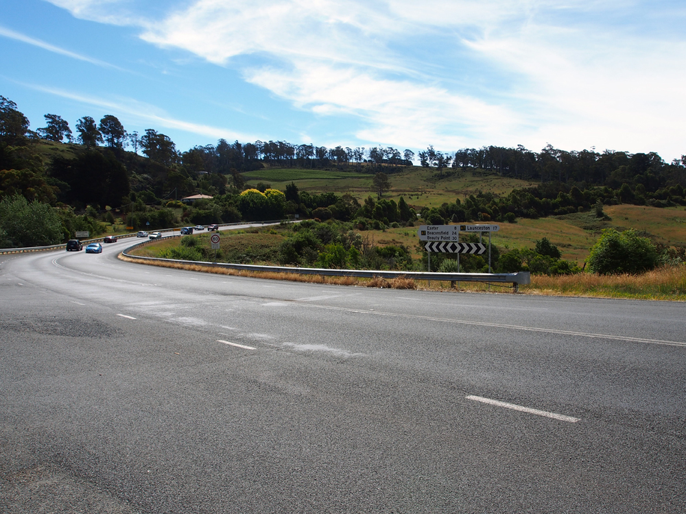
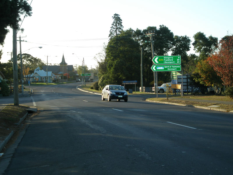
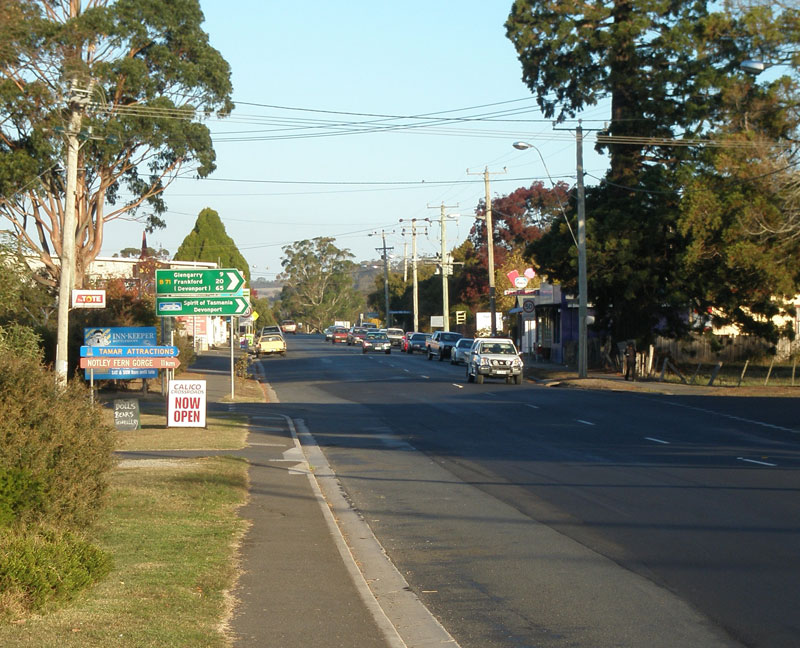
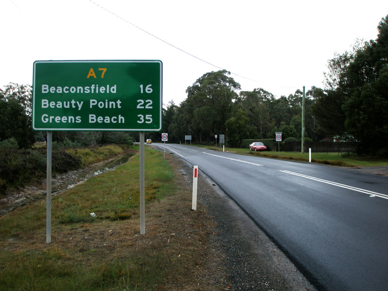
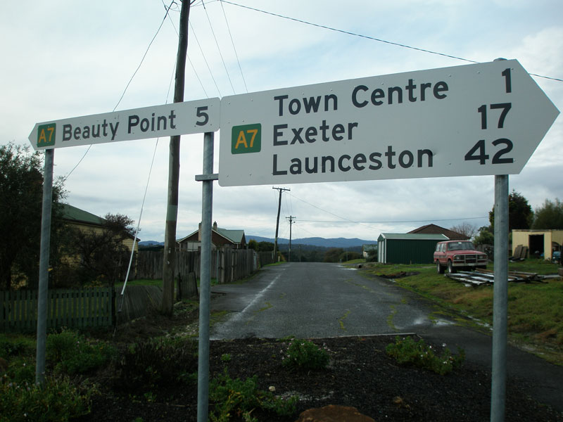
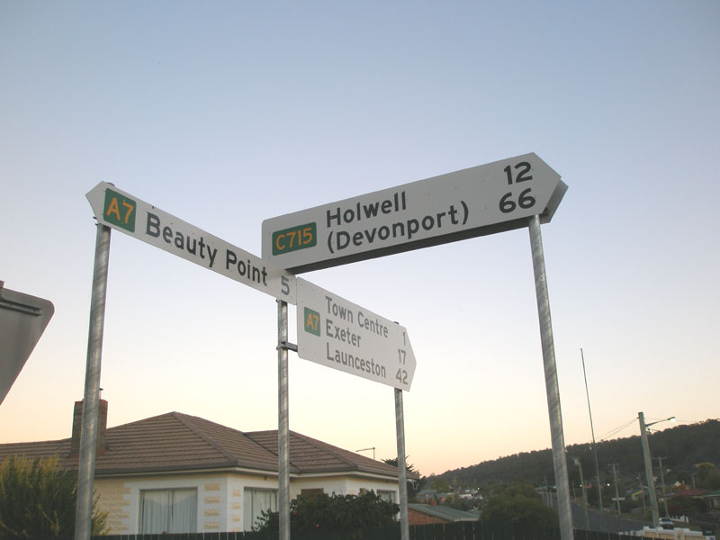
Distance sign on West Tamar Highway (A7), heading south from Exeter. Source: Peter Renshaw, July 2007. |
AD sign northbound on West Tamar Highway (A7) approaching the junction with Frankford Main Rd (B71) in Exeter. Note the ship symbol, which denotes the Spirit of Tasmania vehicular ferry between Devonport and Melbourne. Source: Peter Renshaw, April 2007. |
|
 |
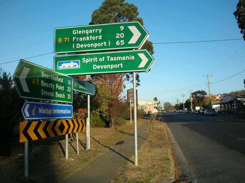
West Tamar Highway (A7) looking north to the junction with Frankford Main Rd (B71) in Exeter. Source: Peter Renshaw, April 2007. |
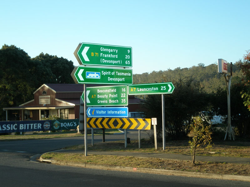 |
ID/fingerboard sign assembly at the junction of West Tamar Highway (A7) & Frankford Main Rd (B71) in Exter. Note that green fingerboard/ID signs are used for this 'major' rural junction. Source: Peter Renshaw, April 2007. |
 |
ID/fingerboard sign assembly at the junction of West Tamar Highway (A7) & Frankford Main Rd (B71) in Exter. Note that green fingerboard/ID signs are used for this 'major rural junction'. Source: Peter Renshaw, April 2007. |
 |
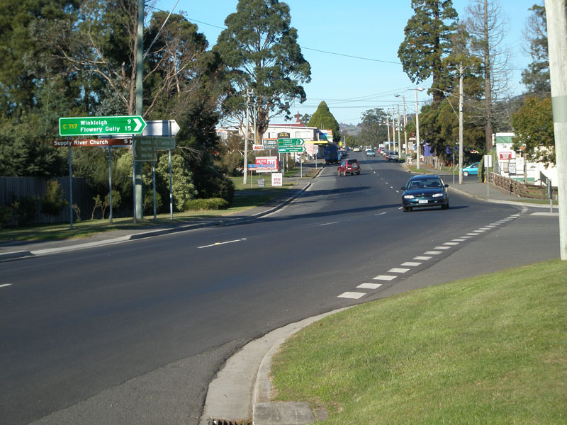
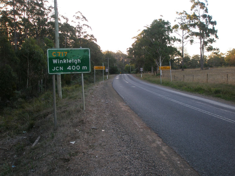
West Tamar Highway (A7) looking south from Winkleigh Rd (C717) in Exeter. Source: Peter Renshaw, April 2007. |
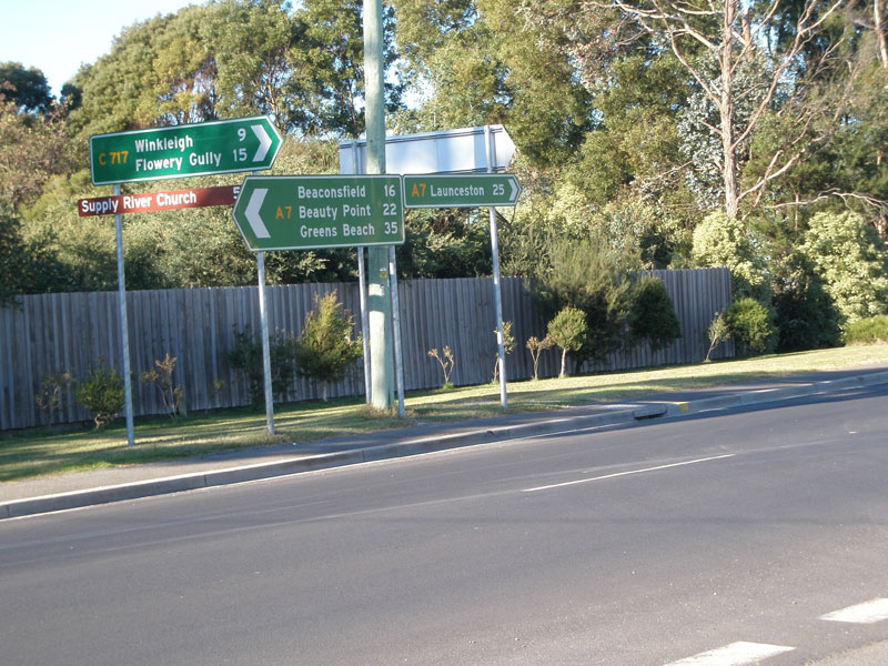 |
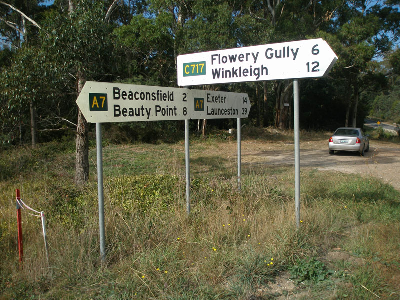
Fingerboard signs at the junction of West Tamar Highway (A7) and Winkleigh Rd (C717) in Exeter. Not sure why this junction also has green fingerboard signs - its not very important. Source: Peter Renshaw, June 2007. |
 |
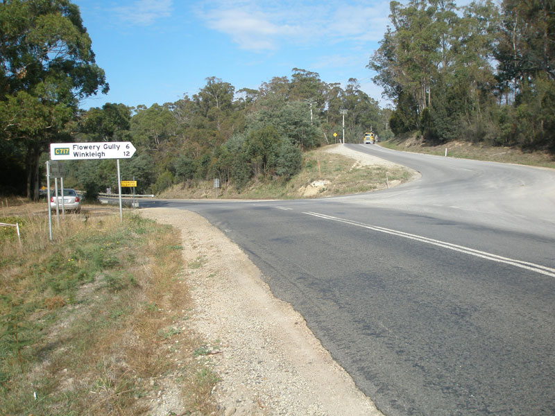
West Tamar Highway (A7) looking south to Winkleigh Rd (C717) in Exeter. Source: Peter Renshaw, June 2007. |
 |
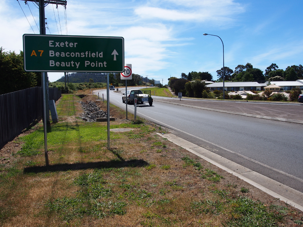
RD sign on West Tamar Highway (A7) heading north from Exeter. Source: Peter Renshaw, July 2007. |
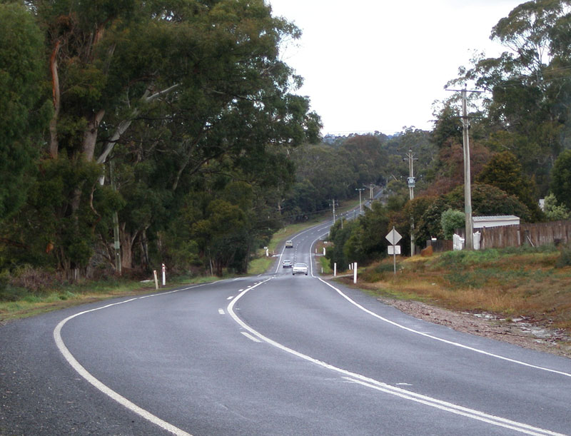 |
West Tamar Highway (A7) looking south about 1.5km north of Exeter. Source: Peter Renshaw, July 2007. |
 |
West Tamar Highway (A7) looking north to the bridge over Supply River about 3km north of Exeter. Source: Peter Renshaw, July 2007. |
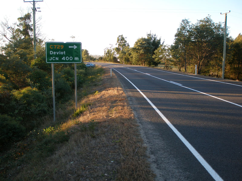 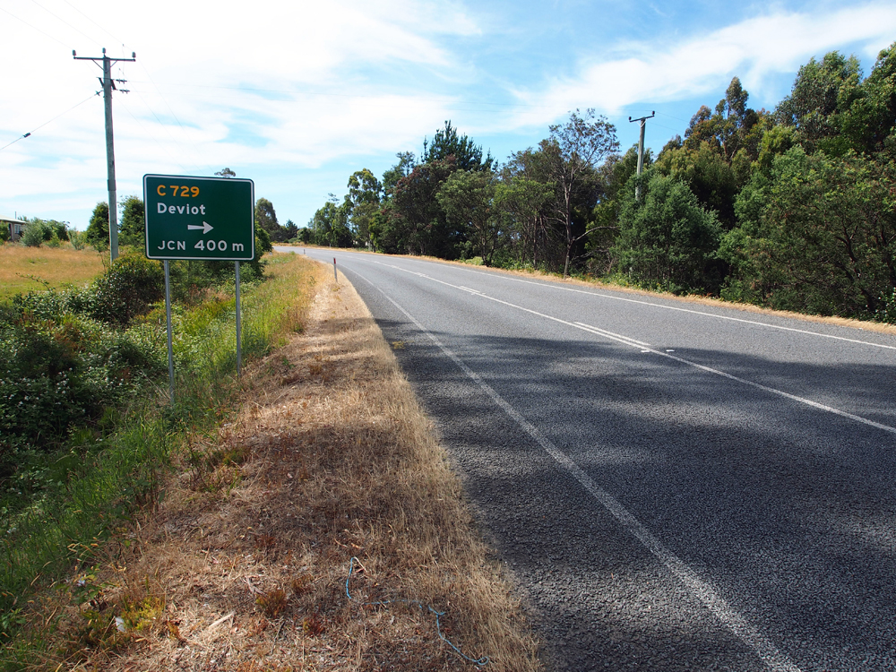 |
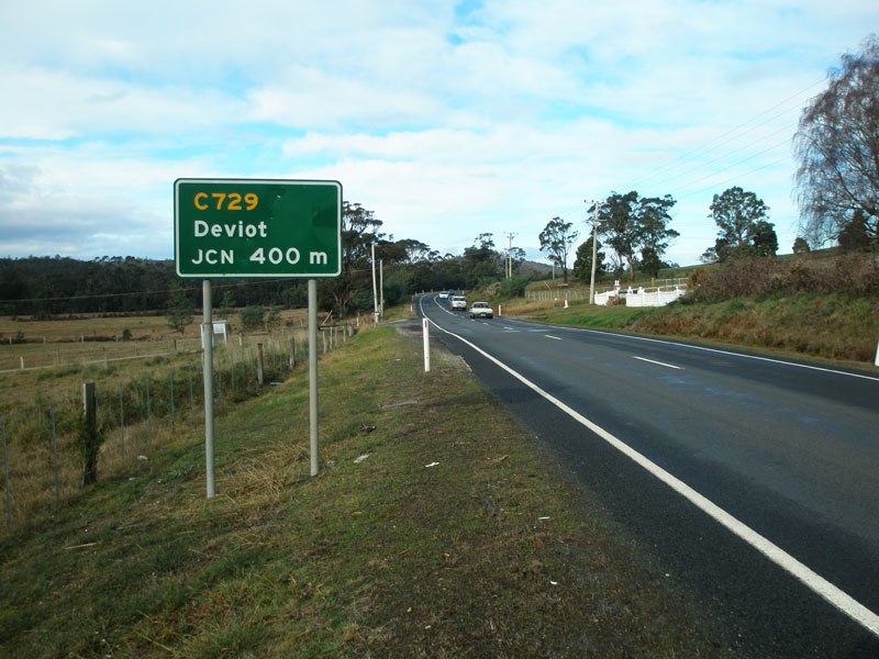
Old and new AD signs northbound on West Tamar Highway (A7) approaching the junction with Motor Road (C729), 6km north of Exeter. Top photo: Peter Renshaw, April 2007. Bottom photo: Peter Renshaw, December 2012. |
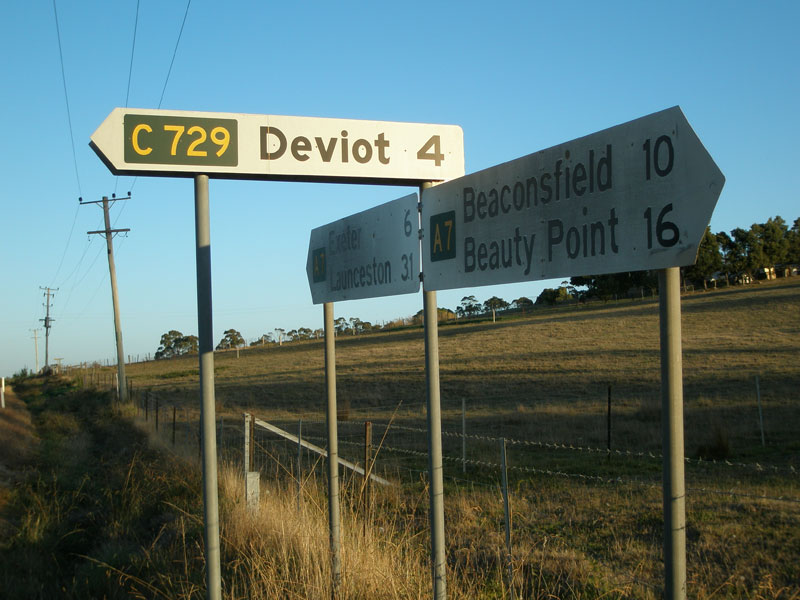 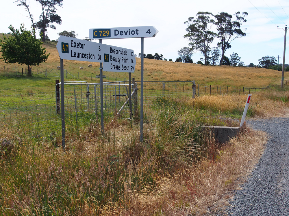 |
Old and new fingerboard sign assemblies at the junction of West Tamar Highway (A7) and Motor Rd (C729), 6km north of Exeter. Top photo: Peter Renshaw, April 2007. Bottom photo: Peter Renshaw, December 2012. |
  |
Old and new AD signs on West Tamar Highway (A7) southbound approaching Motor Rd (C729), 6km north of Exeter. Top photo: Peter Renshaw, July 2007. Bottom photo: Peter Renshaw, December 2012. |
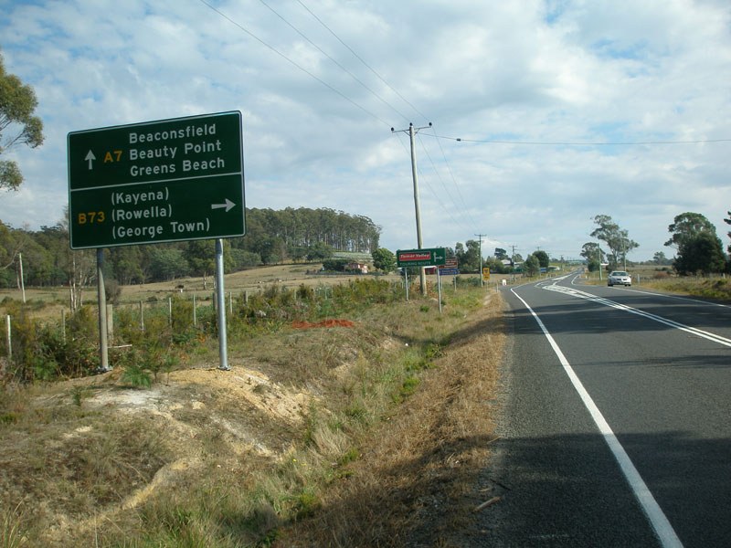 |
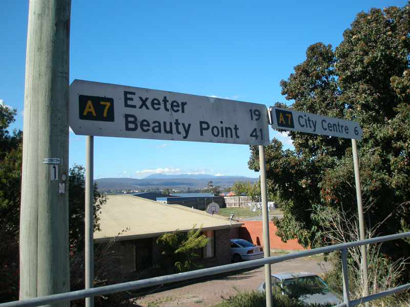
AD sign northbound on West Tamar Highway (A7) approaching the junction with Batman Highway (B73), 9km north of Exeter. Source: Peter Renshaw, April 2007. |
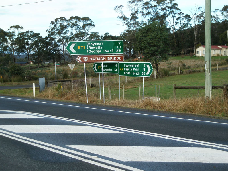 |
Fingerboard/ID sign assembly at the junction of West Tamar Highway (A7) & Batman Highway (B73), 9km north of Exeter. Note that green background is used again - this is a 'major rural junction'. Source: Peter Renshaw, July 2007. |
 |
Batman Highway (B73) looking south-west towards its junction with the West Tamar Highway (A7), 9km north of Exeter. Source: Peter Renshaw, May 2007. |
 |
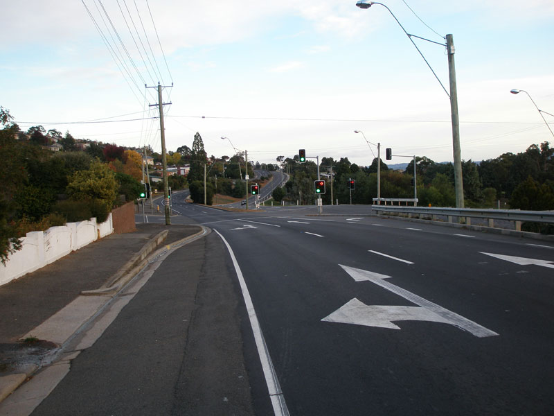
West Tamar Highway (A7) looking south at the Batman Highway (B73) junction. Source: Peter Renshaw, July 2007. |
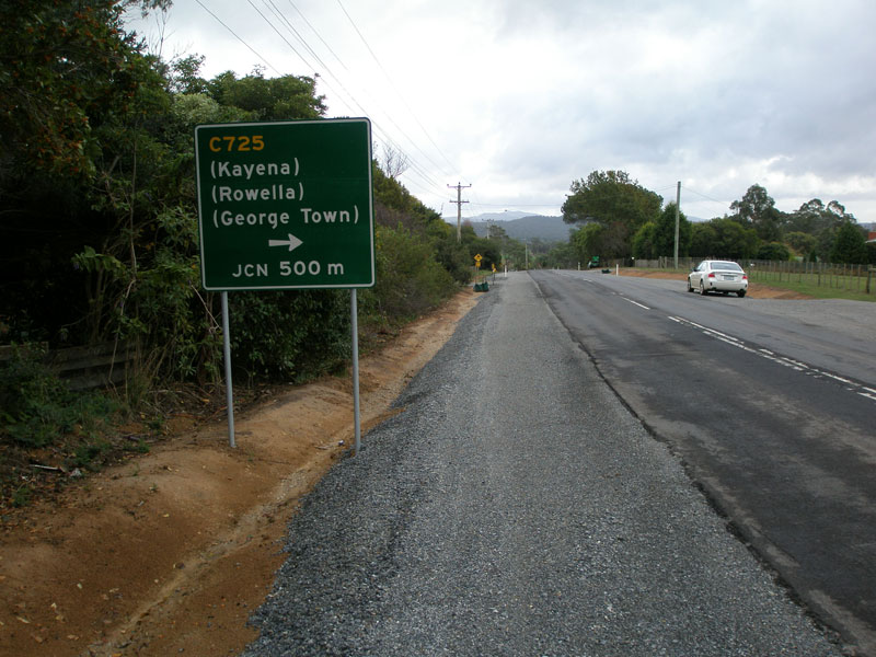 |
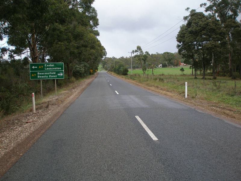
West Tamar Highway (A7) northbound approaching junction with Spring Hill Main Road (C725), 10km north of Exeter. Source: Peter Renshaw, May 2007. |
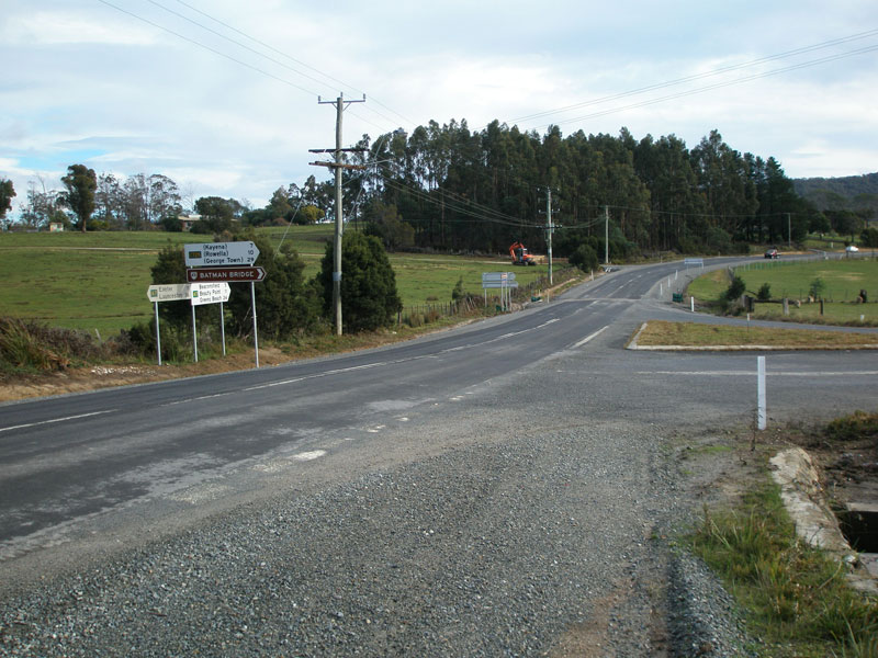 |
West Tamar Highway (A7) northbound at the triangle junction with Spring Hill Main Rd (C725). Note that the fingerboards face the left-turn from C725, despite the right-turn being the dominant movement. Source: Peter Renshaw, July 2007. |
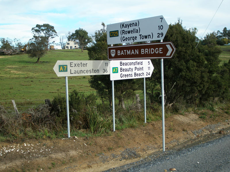 |
Fingerboard signs at the junction of West Tamar Highway (A7) & Spring Hill Main Rd (C725). Source: Peter Renshaw, July 2007. |
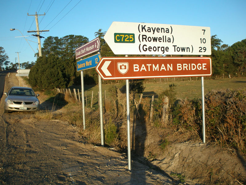 |
Fingerboard signs at the junction of West Tamar Highway (A7) & Spring Hill Main Rd (C725). Source: Peter Renshaw, April 2007. |
 |
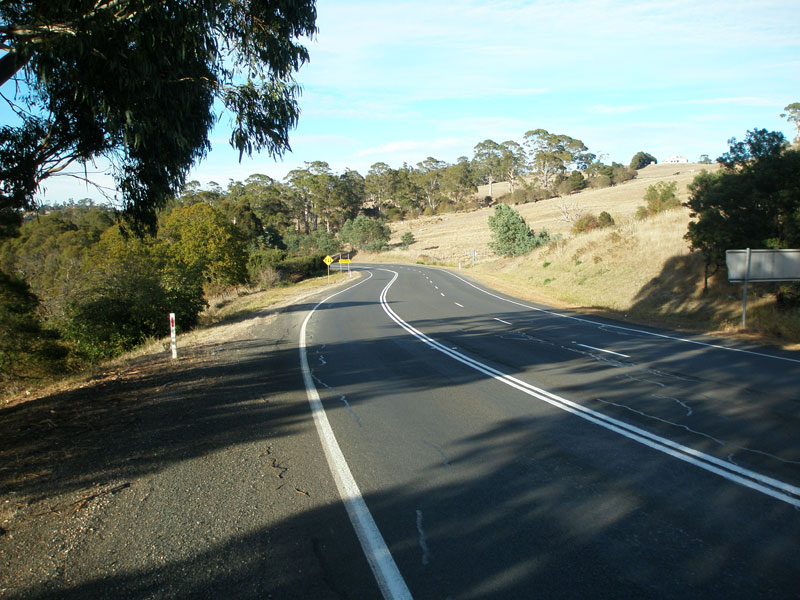
West Tamar Highway (A7) looking south approaching the junction with Spring Hill Main Rd (C725). The sign in the middle distance marks the 'Tamar Valley Touring Route'. Source: Peter Renshaw, July 2007. |
 |
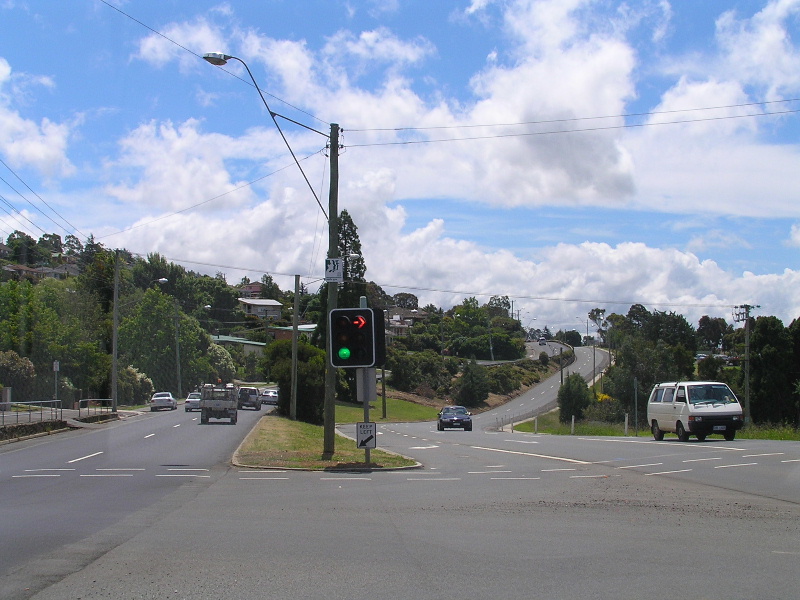
AD sign southbound on West Tamar Highway (A7) approaching Spring Hill Main Rd (C725) which leads to Batman Highway (B73). Source: Peter Renshaw, July 2007. |
 |
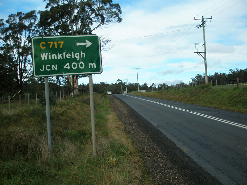
AD sign northbound on West Tamar Highway (A7) approaching Flowery Gully Rd (C717), 2km south of Beaconsfield. Source: Peter Renshaw, April 2007. |
 |
Fingerboard signs at the junction of West Tamar Highway (A7) & Flowery Gully Rd (C717), 2km south of Beaconsfield. Source: Peter Renshaw, April 2007. |
 |
Looking south at the junction of West Tamar Highway (A7) & Flowery Gully Rd (C717), 2km south of Beaconsfield. Source: Peter Renshaw, April 2007. |
 |
West Tamar Highway (A7) looking south approaching the junction with Flowery Gully Rd (C717). Source: Peter Renshaw, July 2007. |
 |
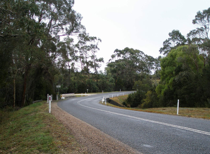
West Tamar Highway (A7) looking north into Beaconsfield. Source: Peter Renshaw, July 2007. |
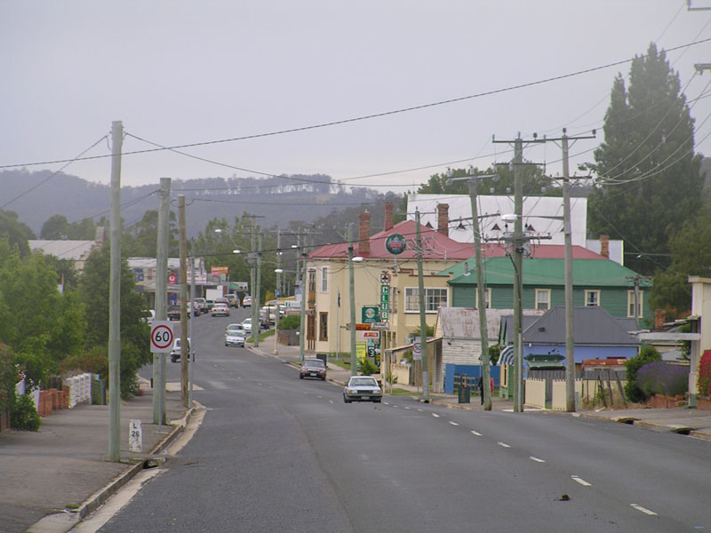 |
West Tamar Highway (Weld Street/A7) looking south through the mining township of Beaconsfield. Source: Josh Geoghegan, Dec 2004. |
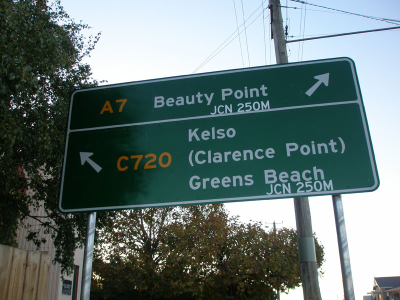 |
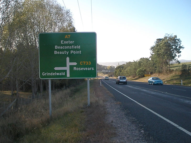
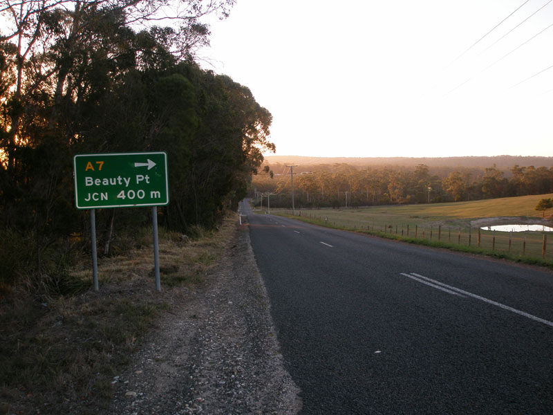
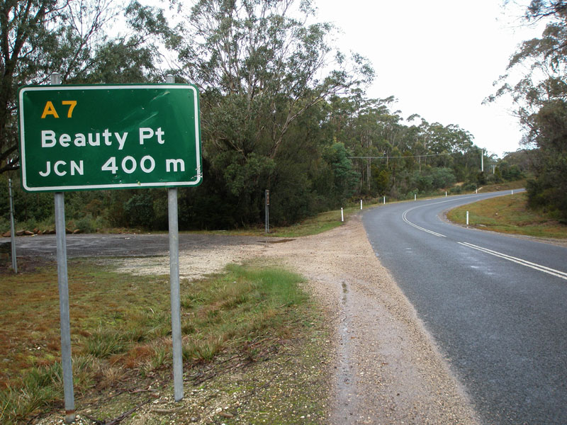
AD sign northbound on West Tamar Highway (A7) approaching the junction with Yorktown Rd (C720) at Beaconsfield. Route C720 provides a bypass of Beauty Point for through traffic towards Greens Beach and is actually constructed to a better standard than the A7 through Beauty Point. According to Peter Renshaw, the 'JCN 250m' legend was added locally after the wrong sign was delivered! Source: Peter Renshaw, April 2007. |
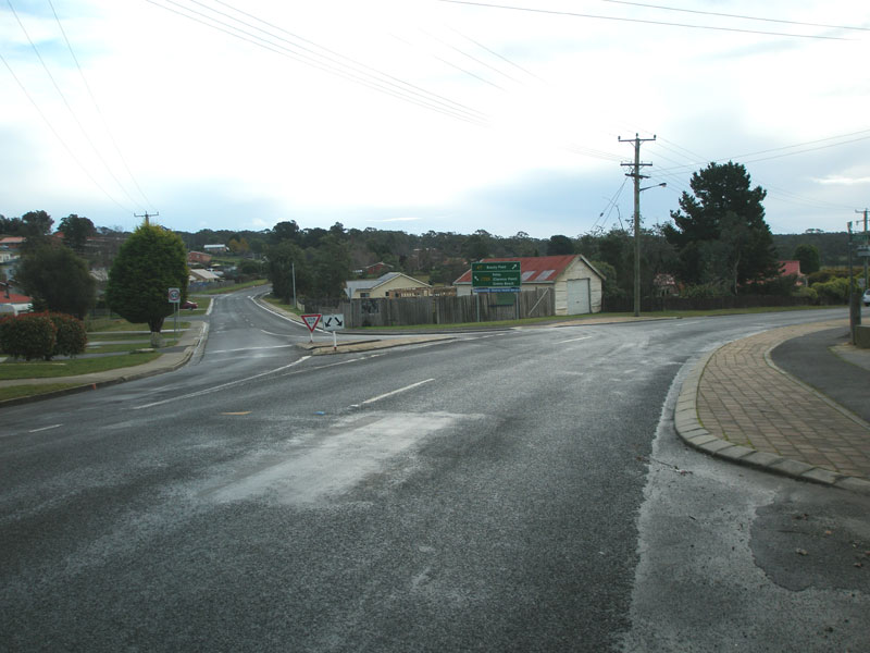 |
Looking north at the junction of West Tamar Highway (A7) & Yorktown Rd (C720), Beaconsfield. Source: Peter Renshaw, July 2007. |
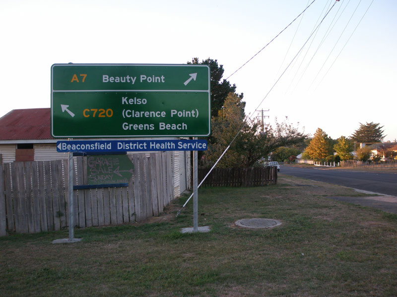 |
Matching AD sign - this time without the home improvements - at the junction of West Tamar Highway (A7) and Yorktown Rd (C720) in Beaconsfield. Source: Peter Renshaw, April 2007. |
 |
Fingerboard signs at the junction of West Tamar Hwy (A7) & Yorktown Rd (C720), Beaconsfield. Source: Peter Renshaw, July 2007. |
 |
West Tamar Highway (A7) looking north from the junction with Yorktown Rd (C720), Beaconsfield. Source: Peter Renshaw, July 2007. |
 |
Fingerboard signs at the junction of West Tamar Highway (A7) & Kellys Lookout Rd in Beaconsfield, a mere 300m north of the C720 junction. C715 originally terminated about 250m west of the A7 (at C720 Yorktown Rd) but was later extended to the West Tamar Highway. Source: Peter Renshaw, April 2007. |
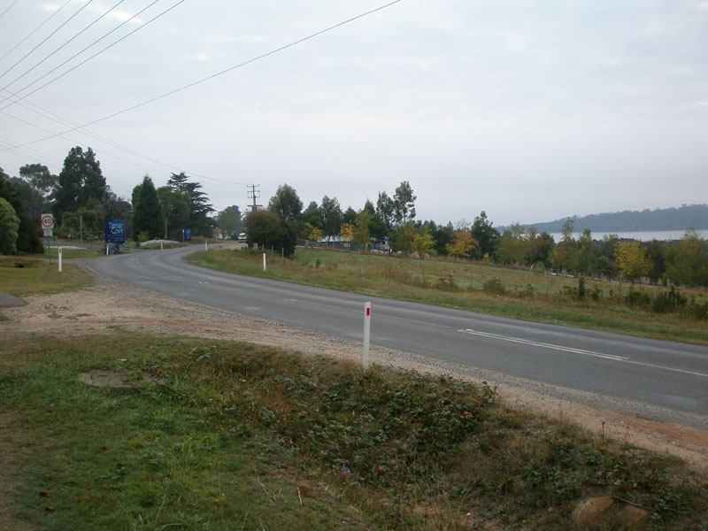 |
West Tamar Highway (A7), looking north into Beauty Point. Source: Peter Renshaw, April 2007. |
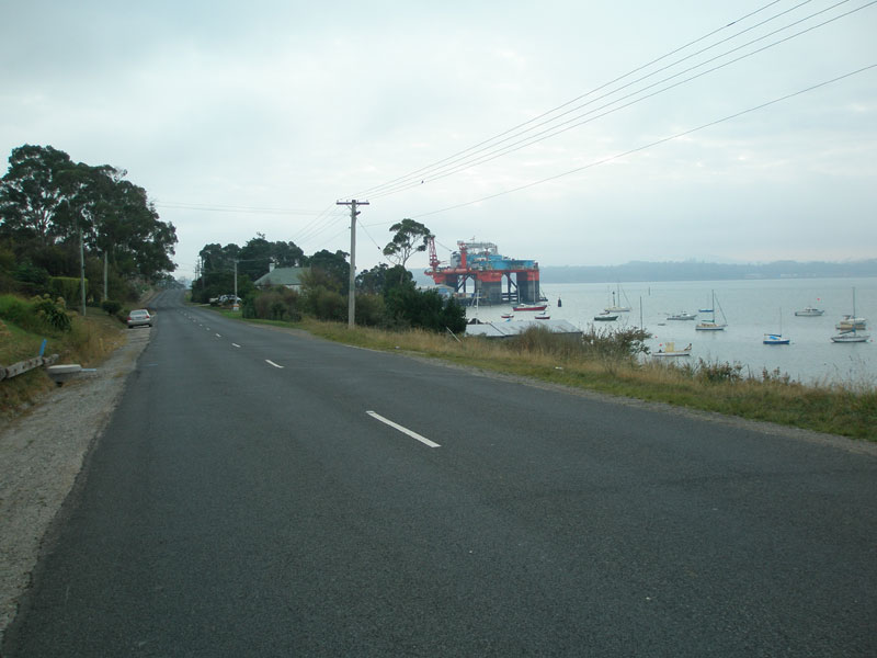 |
West Tamar Highway (A7), looking north near Beauty Point Marina. Source: Peter Renshaw, April 2007. |
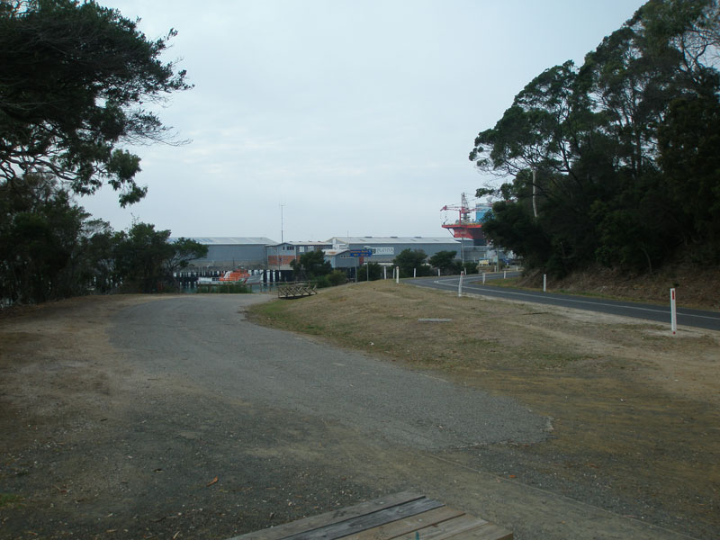 |
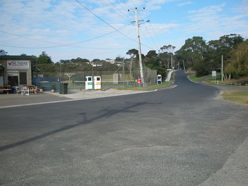
Old and new alignments of the West Tamar Highway (A7) at Inspection Head, in Beauty Point. This is the approximate location of the northern terminus of the West Tamar Highway - however, A7 continues north to Greens Beach. Source: Peter Renshaw, April 2007. |
 |
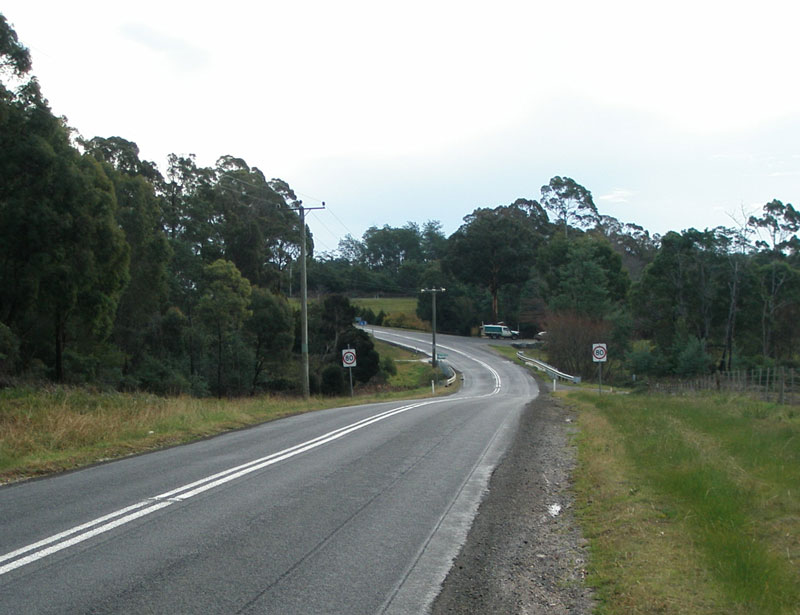
5km west of Beauty Point, route C720 rejoins route A7. This photo shows Greens Beach Rd (C720) northbound approaching the junction with West Arm Rd (A7). A7 also continues straight at this junction as Greens Beach Rd. Source: Peter Renshaw, April 2007. |
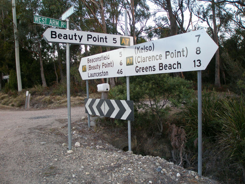 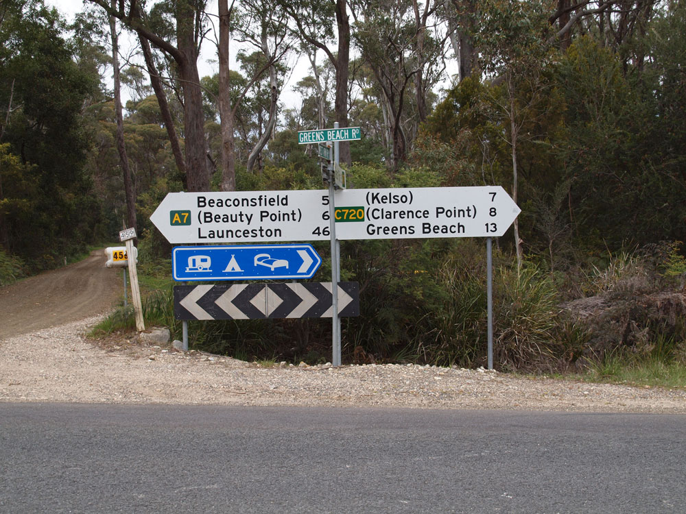 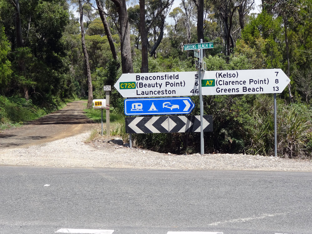 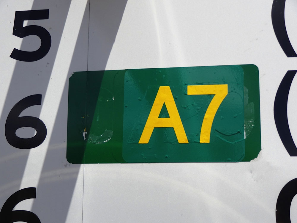 |
The top three photos show a very problematic fingerboard sign assembly at the junction of West Arm Road (A7), Kelso Road (A7) & Yorktown Road (C720). The sign assembly, as shown in the first photo, was incorrectly installed with A7 route markers in all directions. Following representations from Peter Renshaw, West Tamar Council decided to fix the sign. However, for some reason, they covered the wrong A7 route marker, resulting in the error shown in the second photo. C720 should, of course, be shown pointing left. Finally, after Peter pointed out this second error, the sign was fixed and now shows the correct route marking. The fourth photo shows a close-up of the route marker on the right-pointing fingerboard which originally showed A7, was then incorrectly changed to C720, and then changed back to A7 again. Top photo: Peter Renshaw, April 2007. Second photo: Peter Renshaw, October 2011. Bottom two photos: Peter Renshaw, November 2011. |
 |
AD sign southbound on Greens Beach Rd (A7) approaching the junction with West Arm Rd (A7), 5km west of Beauty Point. Note that there is no indication given for motorists to continue straight head along the C720 if they are travelling beyond Beauty Point. Source: Peter Renshaw, July 2007. |
 |
Greens Beach Rd (A7) looking north about 500m north of the junction with West Arm Rd (A7) & Yorktown Rd (C720) to the crossing of Andersons Creek. Source: Peter Renshaw, July 2007. |
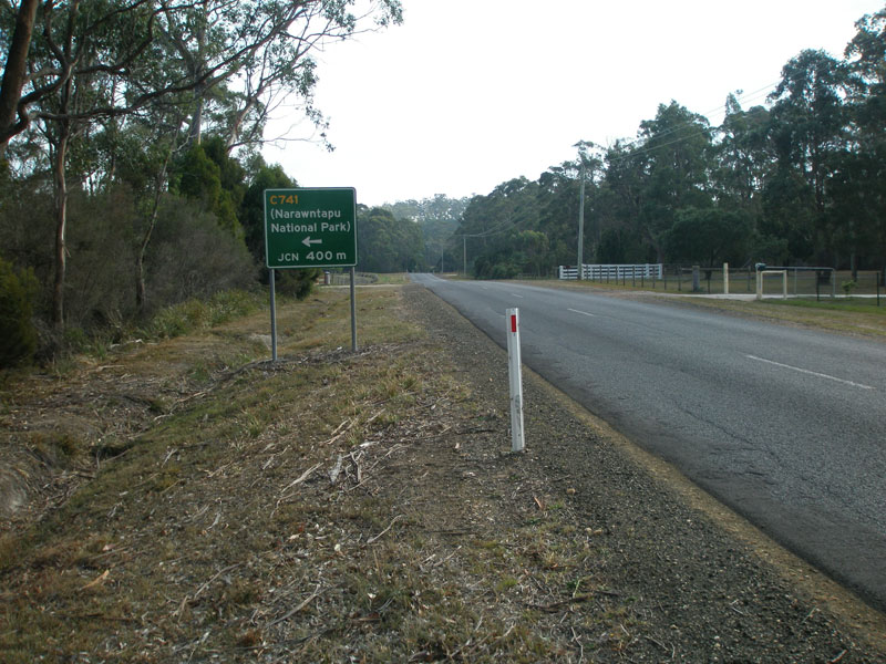 |
AD sign northbound on Greens Beach Rd (A7) approaching the junction with Asbestos Rd (C741) in York Town. Source: Peter Renshaw, April 2007. |
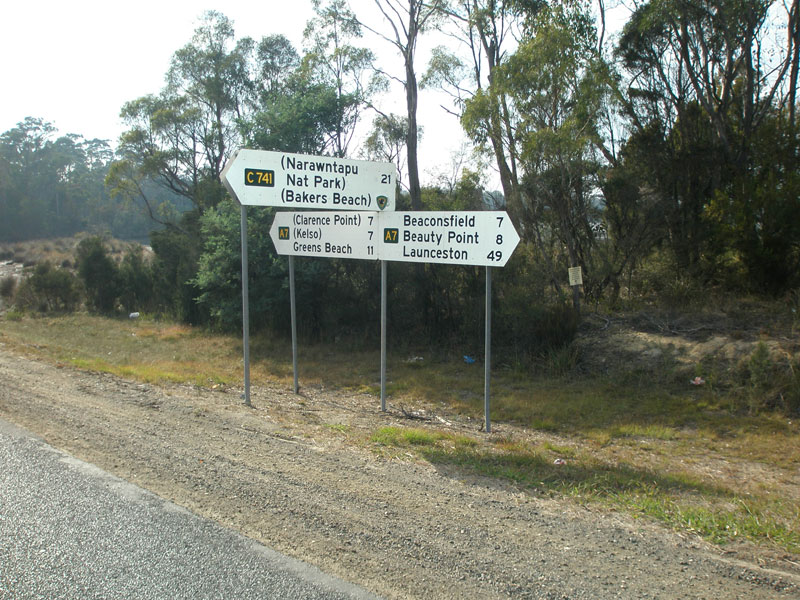 |
Fingerboard signs at the junction of Greens Beach Rd (A7) & Asbestos Rd (C741) in York Town. Note that a Tasmanian Parks & Wildlife Service logo has been placed covering the distance to Bakers Beach - this has also occurred on the southbound fingerboard. Source: Peter Renshaw, April 2007. |
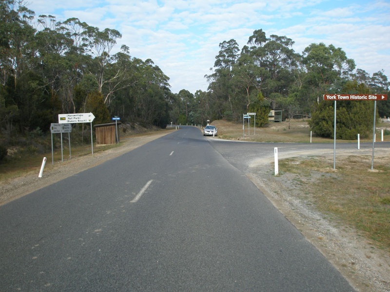 |
Looking south at the junction of Greens Beach Rd (A7) & Asbestos Rd (C741), York Town. Source: Peter Renshaw, April 2007. |
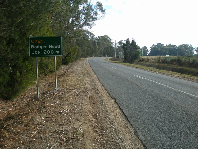 |
AD sign northbound on Greens Beach Rd (A7) approaching the junction with Badger Head Rd (C721), 6km south of Kelso. Source: Peter Renshaw, April 2007. |
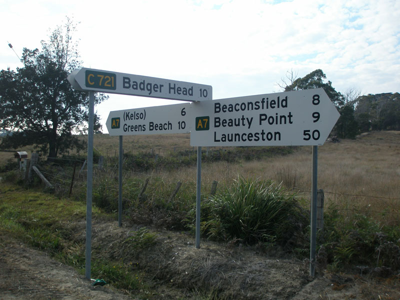 |
Fingerboard signs at the junction of Greens Beach Rd (A7) & Badger Head Rd (C721), 6km south of Kelso. Hard to believe we have ventured only 50km north from Launceston! Source: Peter Renshaw, April 2007. |
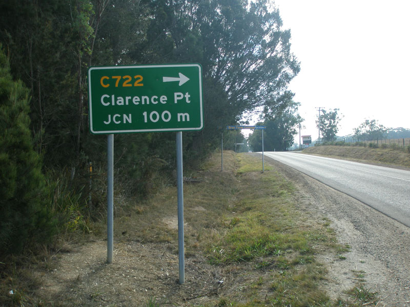 |
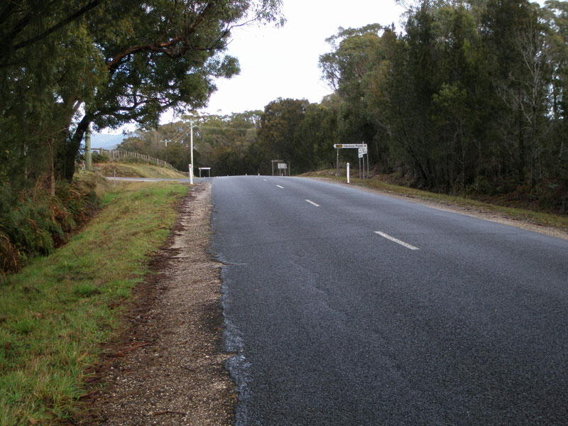
AD sign northbound on Greens Beach Rd (A7) approaching the junction with Clarence Point Rd (C722), just north of Badger Head Rd. Source: Peter Renshaw, April 2007. |
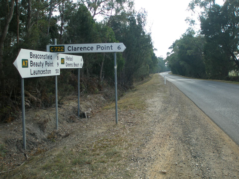 |
Fingerboard signs at the junction of Greens Beach Rd (A7) & Clarence Point Rd (C722), just north of Badger Head Rd. Source: Peter Renshaw, April 2007. |
 |
Greens Beach Rd (A7) looking south towards the junction with Clarence Point Rd (C722). Source: Peter Renshaw, July 2007. |
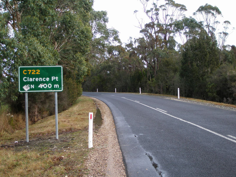 |
AD sign southbound on Greens Beach Rd (A7) approaching Clarence Point Rd (C722). Source: Peter Renshaw, July 2007. |
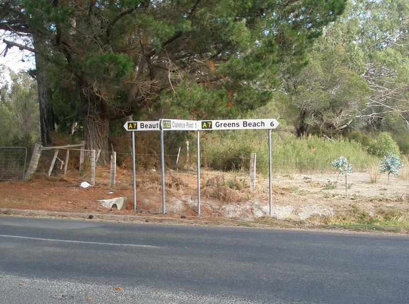 |
4km further north C722 rejoins A7 via Bevic Road. This photo shows fingerboard signs at the junction of Greens Beach Rd (A7) & Bevic Rd (C722) on the southern outskirts of Kelso. Source: Peter Renshaw, April 2007. |
 |
This fingerboard sign - at the junction of Greens Beach Rd (A7) & Kelso Jetty Rd in Kelso - is the last northbound sign to show A7. Source: Peter Renshaw, April 2007. |
 |
This fingerboard sign - at the junction of Greens Beach Rd (A7) & Kelso Jetty Rd in Kelso - is the first southbound sign to show A7, despite A7 beginning 5km further north at Greens Beach. Source: Peter Renshaw, April 2007. |
 |
Greens Beach Rd (A7), looking north Kelso. The line marking disappears here for the run into Greens Beach. Source: Peter Renshaw, April 2007. |
 |
Greens Beach Rd (A7) looking south from the southern outskirts of Greens Beach. Its a road hardly befitting of an 'A' designation is it? Source: Peter Renshaw, April 2007. |
 |
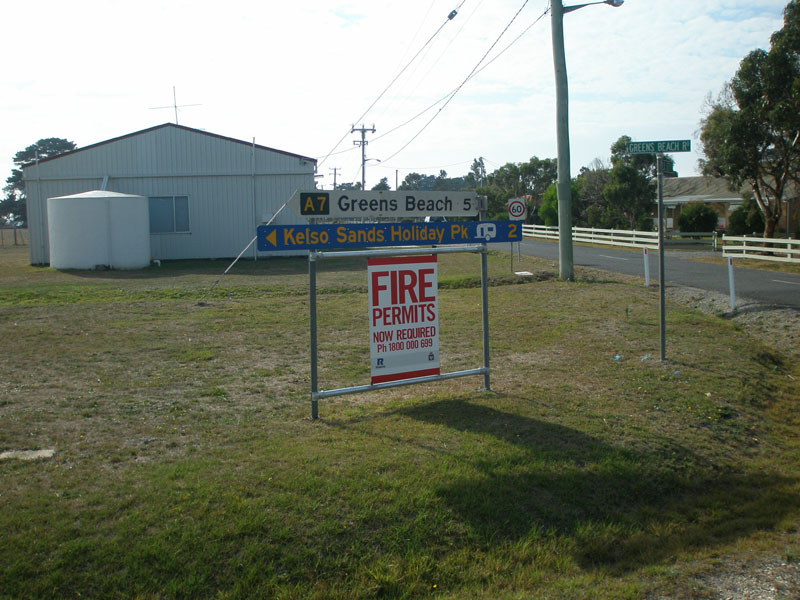
Fingerboard signs at the junction of Greens Beach Rd (A7) & Gardners Rd in Greens Beach. Note no mention of A7 on these signs - the northern terminus of A7 is defined simply as 'Greens Beach'. Source: Peter Renshaw, April 2007. |
 |
Greens Beach Rd (A7) looking south from the beach towards Gardners Road. Source: Peter Renshaw, April 2007. |
Last updated 23 December 2012 © Ozroads 2003-2012. |