Evandale - Nile - Cleveland |
C416 (High Street) at its intersection with C413 (Russell Street) in Evandale. Source: Josh Geoghegan, Dec 2004.
Introduced: 1980
Length: 42km
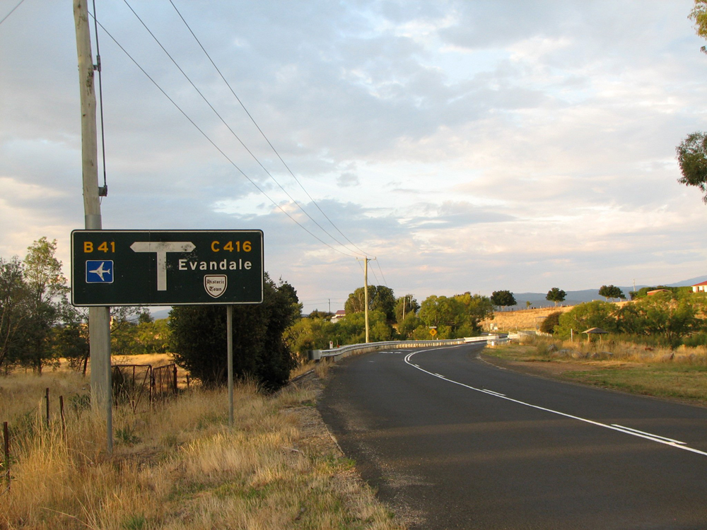
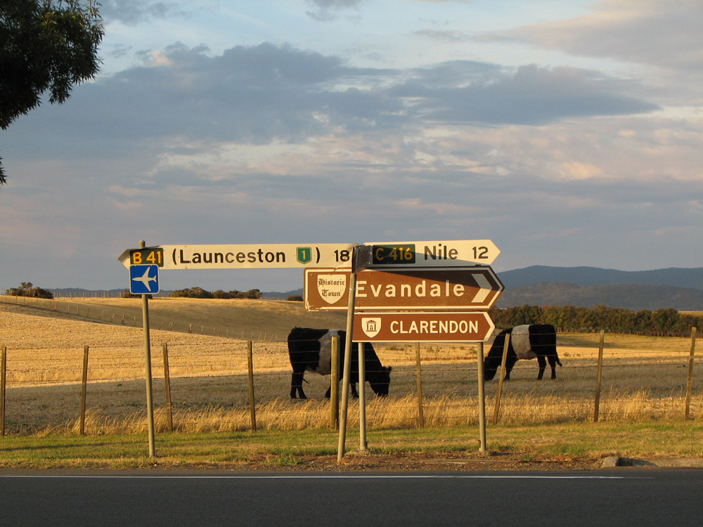
Northern Terminus: Evandale Road (B41/C416) & Leighlands Road (B41), Evandale
Southern Terminus: Midland Highway (NH1) & Glen Esk Road (C416), Cleveland
Route taken: From the intersection of Evandale Road (B41/C416) & Leighlands Road (B41), Evandale, via Evandale Road, High Street, Nile Road, Glen Esk Road to the intersection of Midland Highway (NHR1) & Glen Esk Road, Cleveland
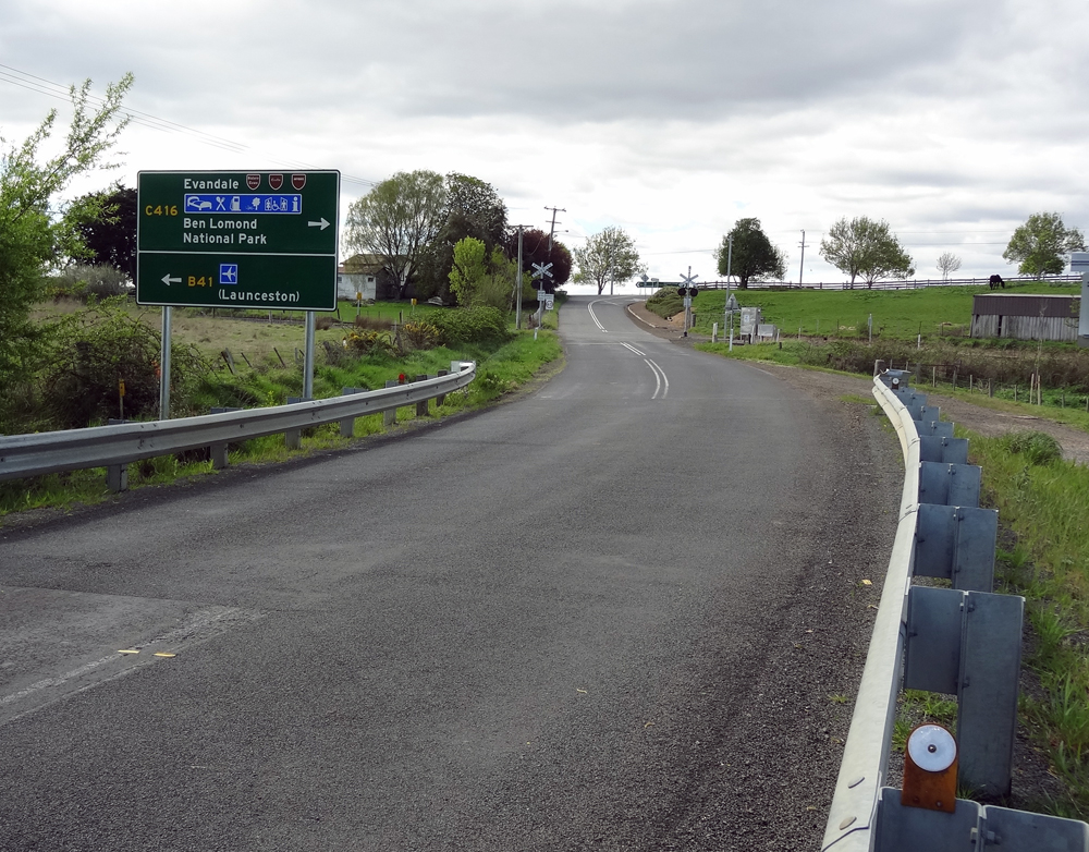
Focal Points: (Launceston), Evandale, (Ben Lomond National Park), Nile, 'To NH1'
Responsibility: State Government (Leighlands Road to Russell Street), Local Government (Evandale-Cleveland),
C416 is a minor rural route, located in north-central Tasmania. It branches from the B41 at Evandale, connecting the towns of Evandale and Nile, before joining the Midland Highway at Cleveland, 5km north of Conara Junction. A 7km section of Nile Road, between Nile and the South East River, remains unsealed and motorists are advised to use the Midland Hwy, Leighlands Rd & Evandale Rd to reach Evandale from the south.
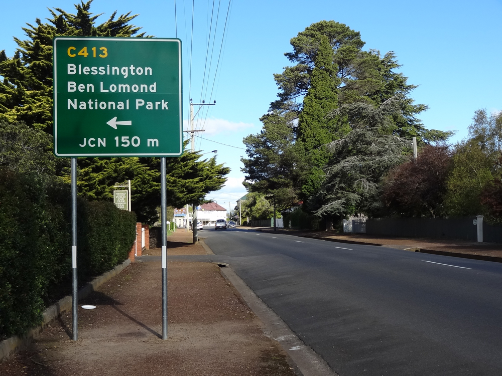
The first 1km of the route through Evandale now forms part of the signposting route from Midland Highway south to the Ben Lomond National Park.
|
Photos of route C416 |
|
  |
The top photo shows the original 1980s diagrammatic AD sign which was formerly located on Leighlands Rd (B41) approaching the junction with Evandale Rd (B41/C416) at Evandale.The bottom photo shows the standard stack AD sign which replaced it in October 2012. Top photo: March 2009. Bottom photo: Peter Renshaw, October 2012. |
 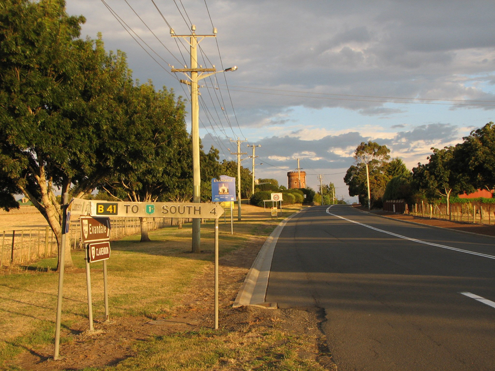 |
Original 1980s fingerboard signs at the junction of Evandale Rd (B41/C416) & Leighlands Rd (B41), the northern terminus of C416. Photos taken: March 2009. |
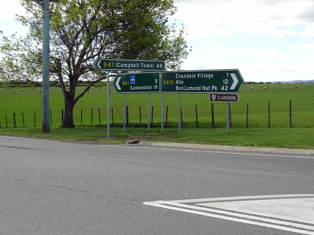 |
Brand new green ID signs installed in October 2012 to replace the original fingerboards at the junction of Evandale Rd (B41/C416) & Leighlands Rd (B41). Note the replacement of 'To NH1 SOUTH' with '(Campbell Town)' and the additional of Ben Lomond National Park as a focal point. Source: Peter Renshaw, October 2012. |
 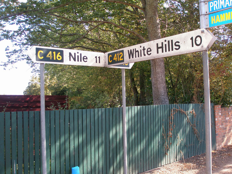 |
Original 1980s fingerboard signs at the junction of High St (C416) & Barclay St (C412) in Evandale. Evandale Main Road is also known as High Street through the town of Evandale. Source: Peter Renshaw, April 2007. |
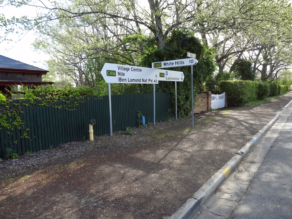 |
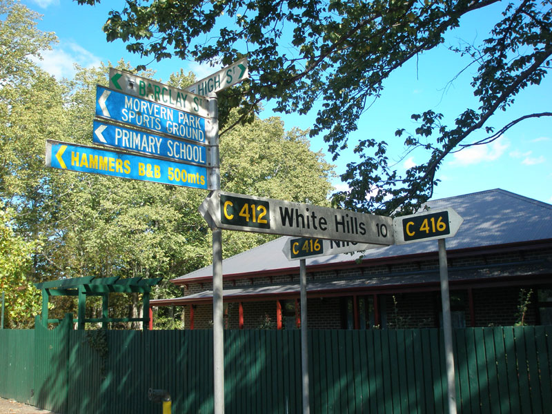
Brand new fingerboard signs at the junction of High St (C416) & Barclay St (C412), Evandale. These signs werected in October 2012 to replace the old fingerboards shown above. Source: Peter Renshaw, October 2012. |
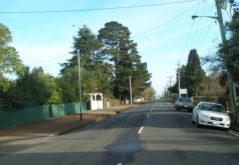 |
High St (C416) looking north from Russell St (C413) in Evandale. Source: Peter Renshaw, May 2007. |
 |
Brand new AD sign, erected in October 2012, southbound on High St (C416) approaching the junction with Russell St (C413), Evandale. Source: Peter Renshaw, October 2012. |
 |
Dodgy tourist AD sign southbound on High St (C416) approaching Russell St (C413), Evandale. Photo taken: March 2009. |
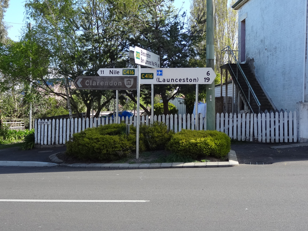 |
Old and new fingerboard sign assemblies at the junction of High St (C416) & Russell St (C413), Evandale. Note the right pointing C416 fingerboard sign has sensibly been updated to include Launceston Airport and Launceston as focal points.
Top photo: Josh Geoghegan, December 2004. Bottom photo: Peter Renshaw, October 2012. |
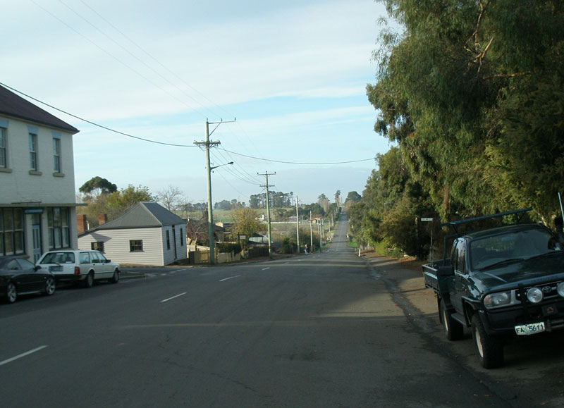 |
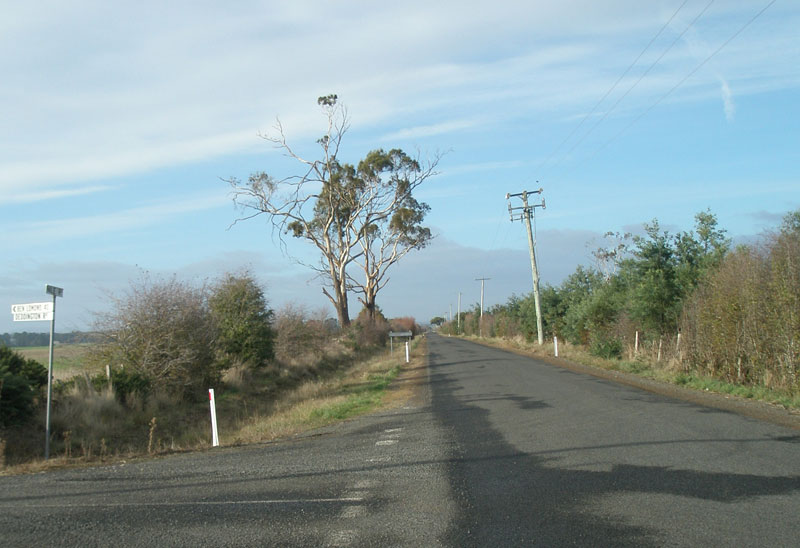
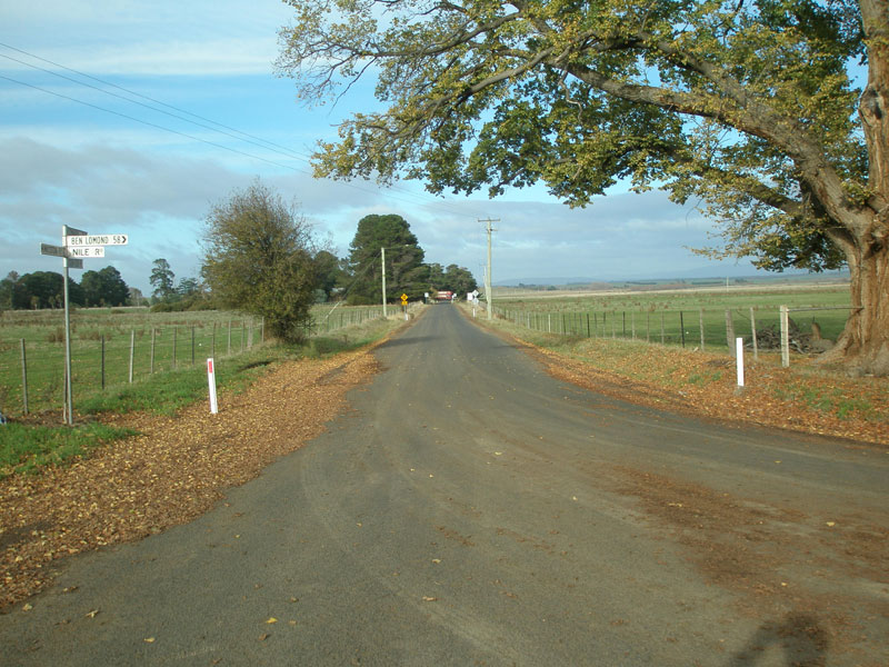
High Street (C416) looking south from Evandale Post Office and the junction with Russell St (C413). High Street becomes Nile Road at the southern boundary of the town of Evandale. Source: Peter Renshaw, May 2007. |
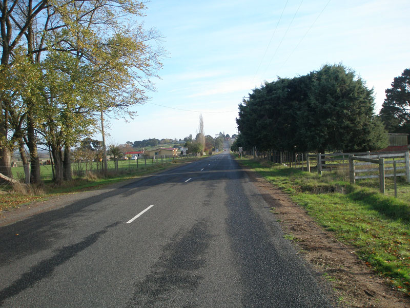 |
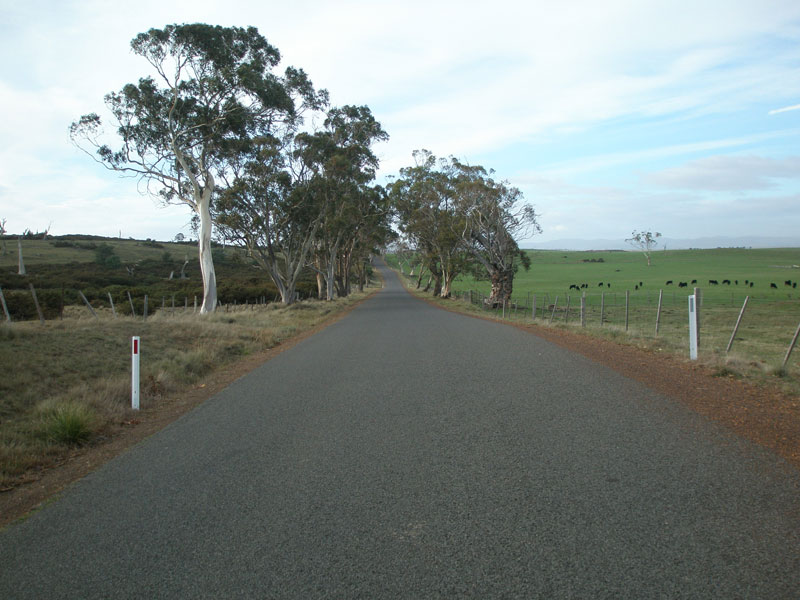
Nile Rd (C416) looking north towards the town of Evandale. C416 is a bit of a rarity amongst Tasmania's C routes as it has very few curves as it heads south across the northern midlands. Source: Peter Renshaw, May 2007. |
 |
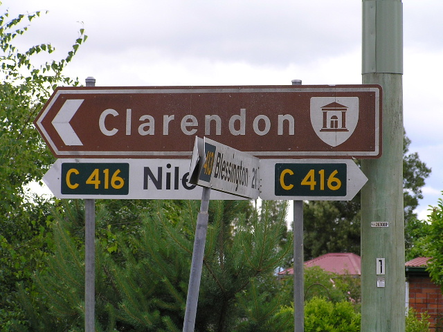
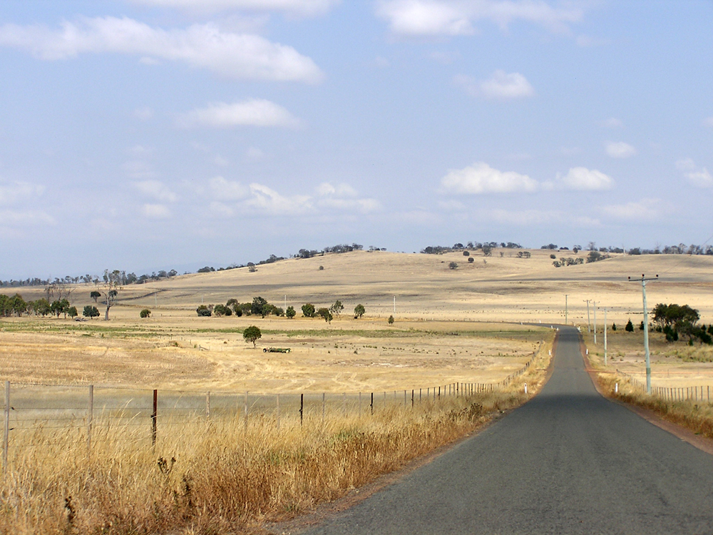
Nile Rd (C416) looking south between Evandale and Clarendon Homestead. C416 serves a rich argicultural district, including some of the most expensive fine wool in the world. Source: Peter Renshaw, May 2007. |
 |
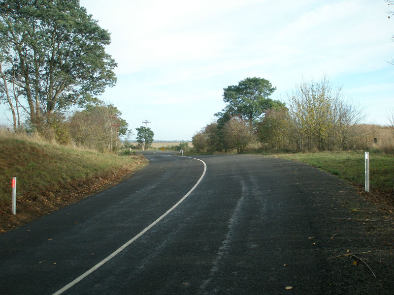
Nile Rd (C416) looking north from the northern junction with C418 (Clarendon Lodge Rd), 5km south of Evandale. Source: Peter Renshaw, May 2007. |
 |
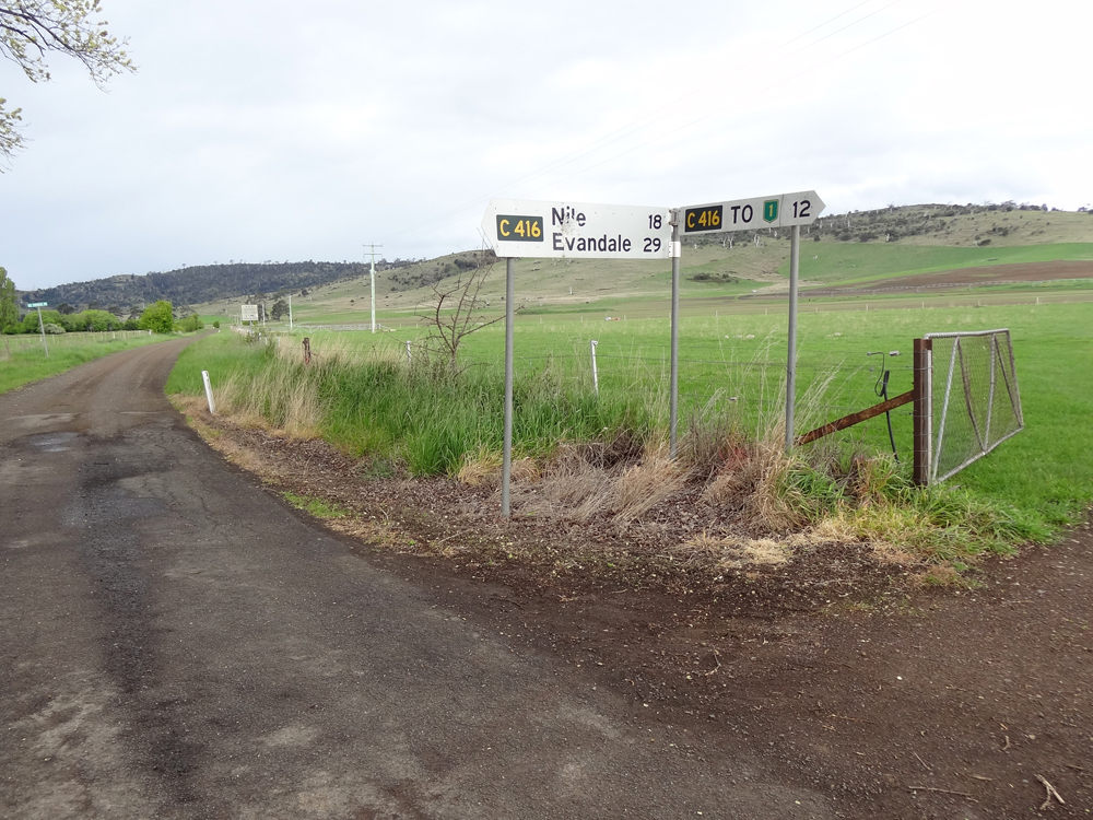
Fingerboard signs at the junction of Nile Rd (C416) & Clarendon Lodge Rd (C418), 5km south of Evandale. C418 is not signed at this junction - only at its southern junction with C416, 3km further south. Source: Peter Renshaw, May 2007. |
 |
Nile Rd (C416) looking south at the junction with Clarendon Lodge Rd (C418). Note there is no sign of C418 - the unsealed road which branches off to the right. Source: Peter Renshaw, June 2007. |
 |
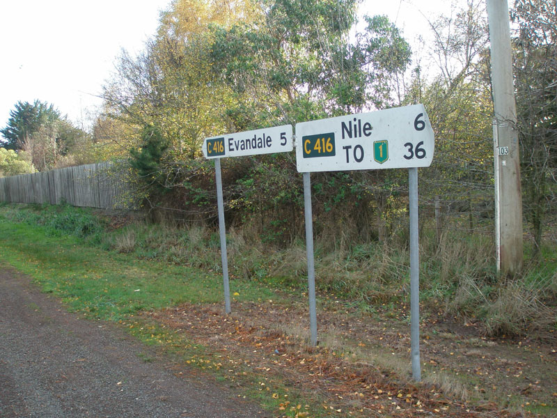
Nile Rd (C416) looking south at the junction with Bryants Lane (C419) & Clarendon Station Rd (C418), 8km south of Evandale. Source: Peter Renshaw, May 2007. |
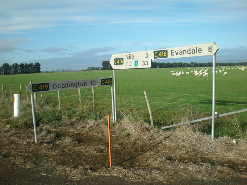 |
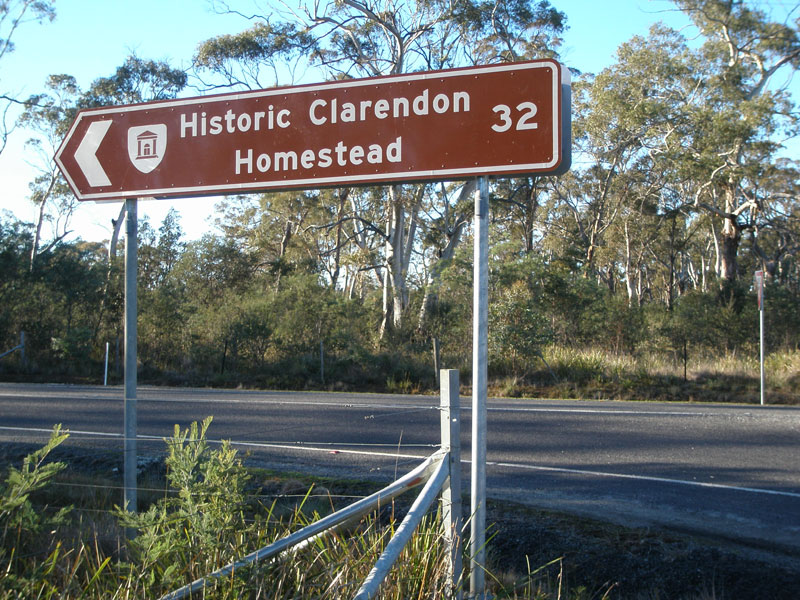
Fingerboard signs at the junction of Nile Rd (C416) & Bryants Lane (C419) & Clarendon Station Rd (C418), 8km south of Evandale. C418 is signed here and leads to the historic Clarendon Homestead. Source: Peter Renshaw, May 2007. |
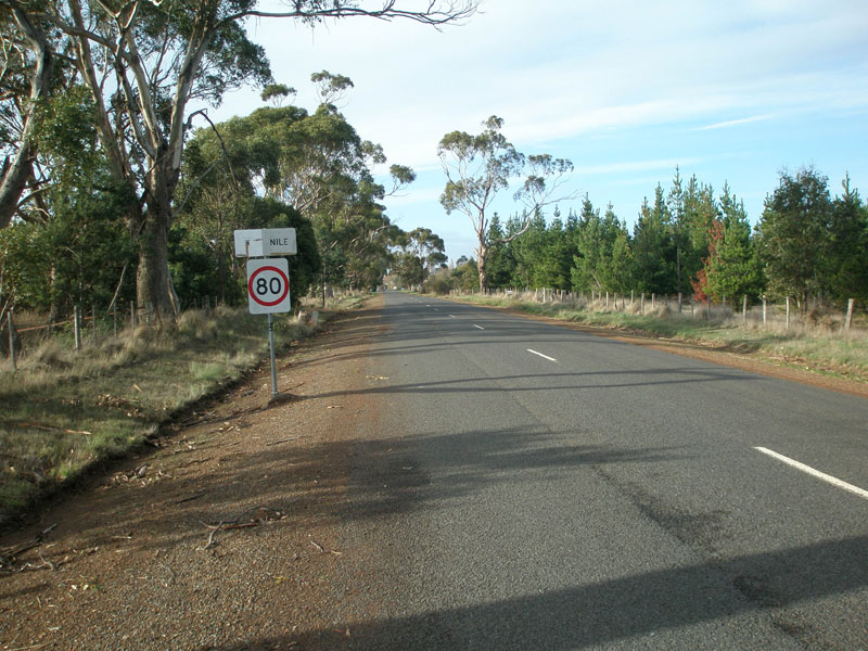 |
Nile Rd (C416) looking south into the tiny hamlet of Nile. Source: Peter Renshaw, May 2007. |
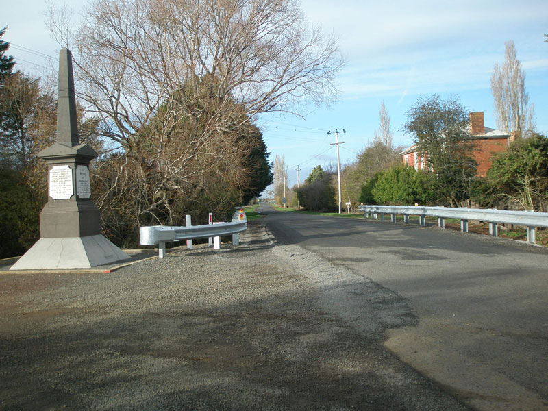 |
Nile Rd (C416) looking south in the hamlet of Nile. The war memorial and Georgian-era house give the road a very Tasmanian setting. Source: Peter Renshaw, May 2007. |
 |
Nile Rd (C416) looking north towards the hamlet of Nile. Source: Peter Renshaw, May 2007. |
 |
Nile Rd (C416) looking south, 1km south of Nile. C416 loses its line marking and gets narrower as it heads further south across the northern midlands. Source: Peter Renshaw, May 2007. |
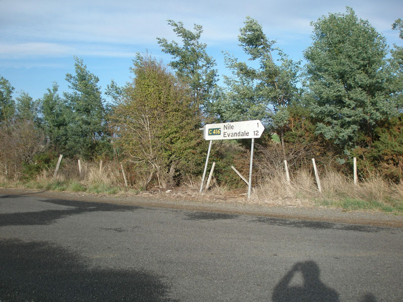 |
Fingerboard sign (with the left-pointing sign missing) at the junction of Nile Rd (C416) & Deddington Rd (C420), 1km south of Nile. Perhaps the fingerboard was intentionally removed to discourage traffic from using C416 to access the Midland Highway? Source: Peter Renshaw, May 2007. |
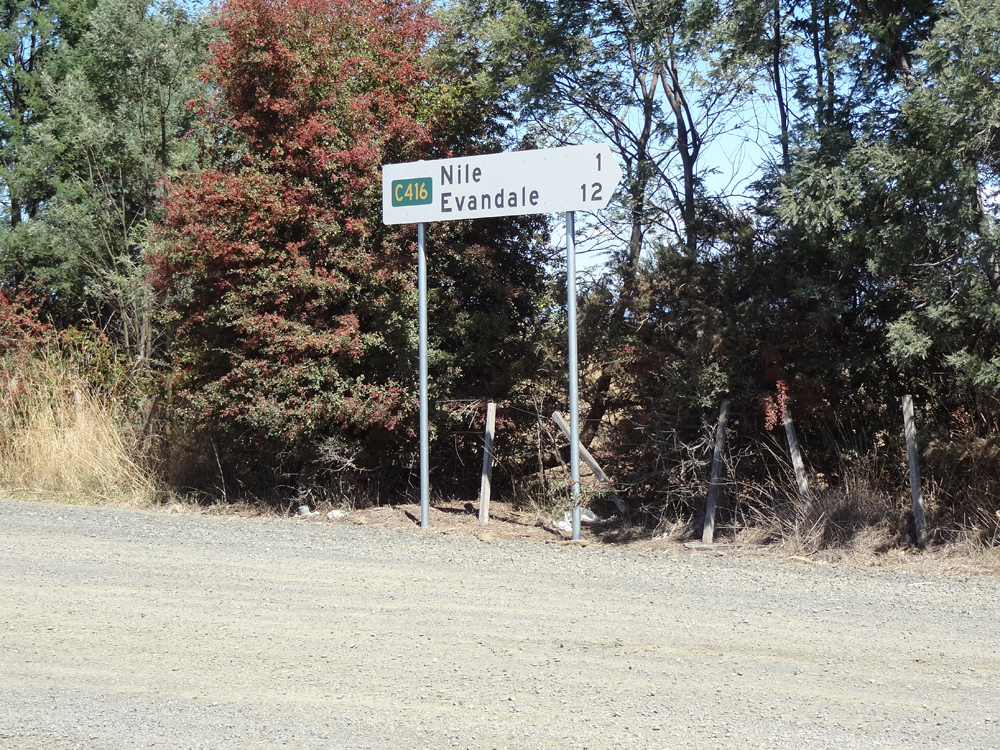 |
Replacement fingerboard sign at the junction of Nile Rd (C416) & Deddington Rd (C420). Note the left-pointing fingerboard was not replaced. Source: Peter Renshaw, October 2012. |
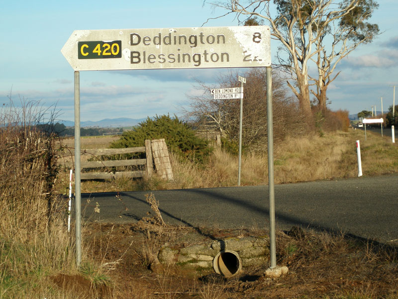 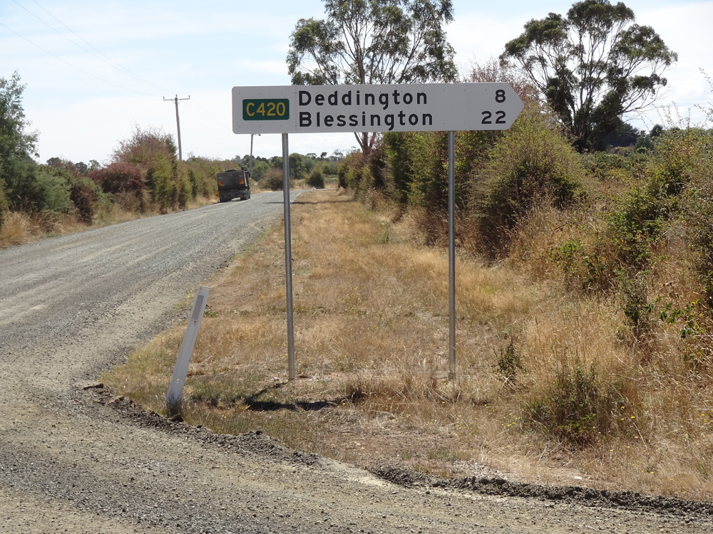 |
Old and new C420 fingerboards at the junction of Nile Rd (C416) & Deddington Rd (C420). Top photo: Peter Renshaw, July 2007. Bottom photo: Peter Renshaw, October 2012. |
 |
Nile Rd (C416) looking south from the junction with Deddington Rd (C420), 1km south of Nile. Source: Peter Renshaw, May 2007. |
 |
Nile Rd (C416) looking north near Fernhill Rd, about 4km south of Nile. C416 has regained a single centre-line for a winding section through undulating agricultural land. Source: Peter Renshaw, May 2007. |
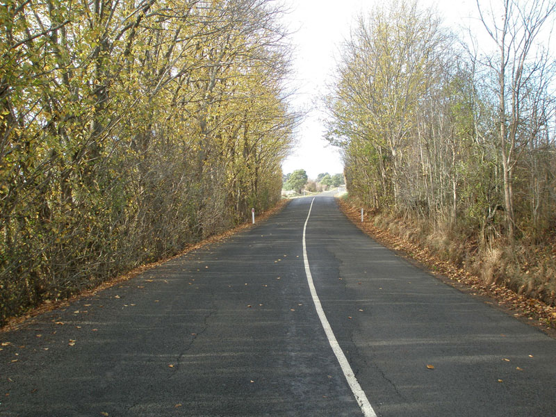 |
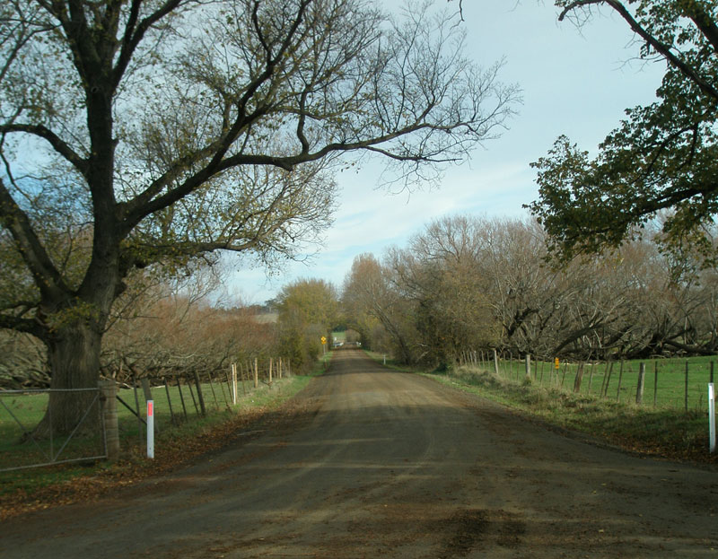
Nile Rd (C416) looking south from the location of the above photo. Autumn foliage makes for an attractive avenue. Source: Peter Renshaw, May 2007. |
 |
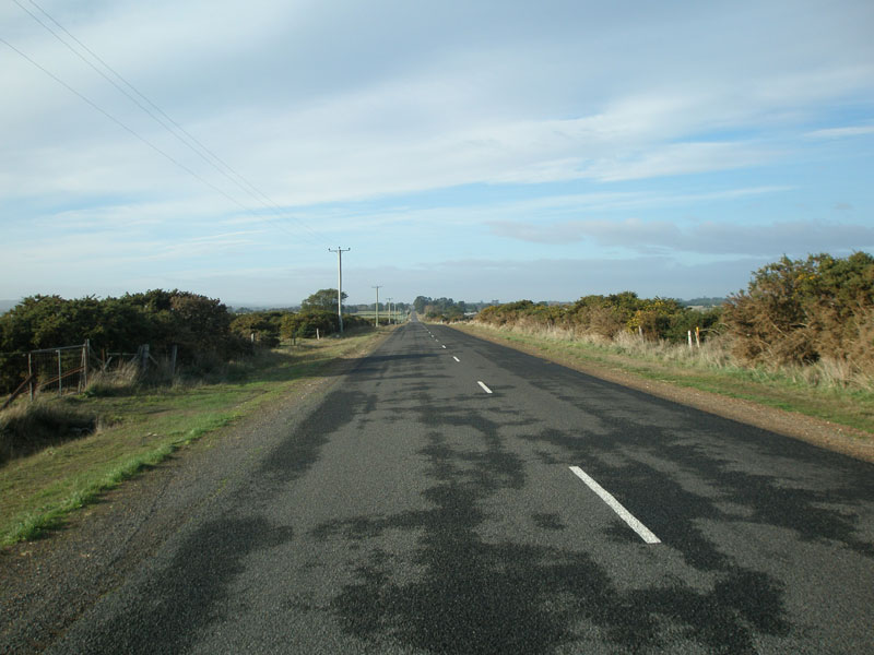
Nile Rd (C416) looking north, about 5km south of Nile. Source: Peter Renshaw, May 2007. |
 |
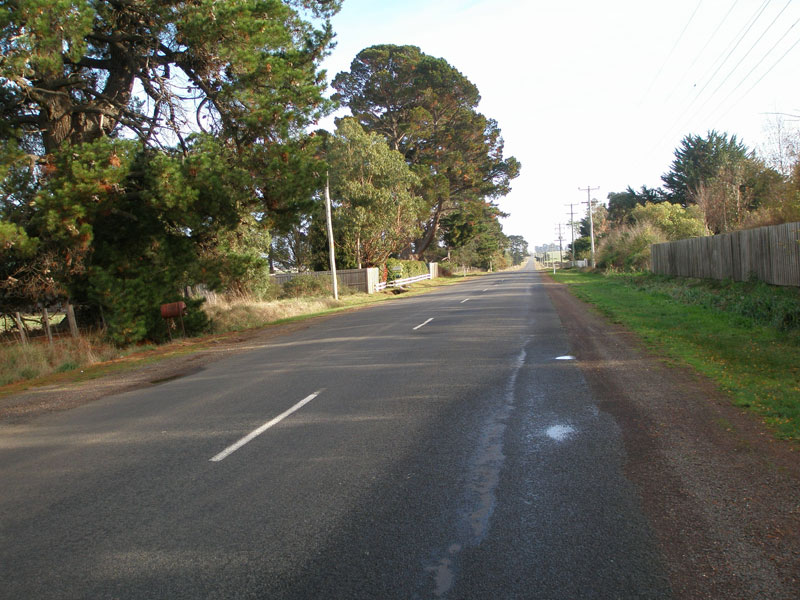
Nile Rd (C416) looking south about 9km north of Glen Esk Rd. Source: Peter Renshaw, May 2007. |
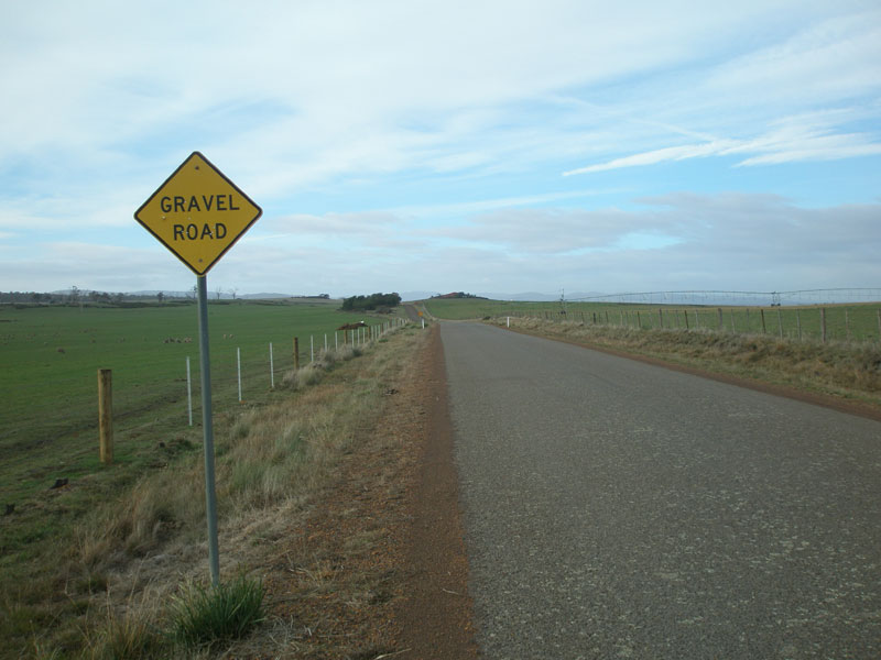 |
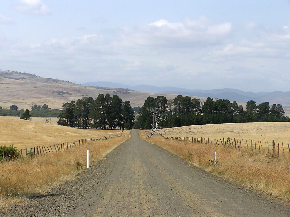
Nile Rd (C416) looking south about 7km north of Glen Esk Rd. The gravel begins here and remains until C416 reaches Glen Esk Rd. Source: Peter Renshaw, May 2007. |
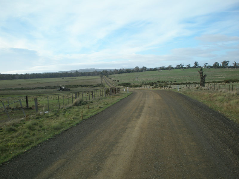 |
Nile Rd (C416) looking south, showing a typical view of the gravel section. Source: Peter Renshaw, May 2007. |
 |
Nile Rd (C416) looking south about 3km north of Glen Esk Rd, crossing a swampy tributary of the South Esk River. Source: Peter Renshaw, May 2007. |
 |
Nile Rd (C416) looking southeast about 2km from Glen Esk Rd with Ben Stewart in the background. Photo taken: March 2009. |
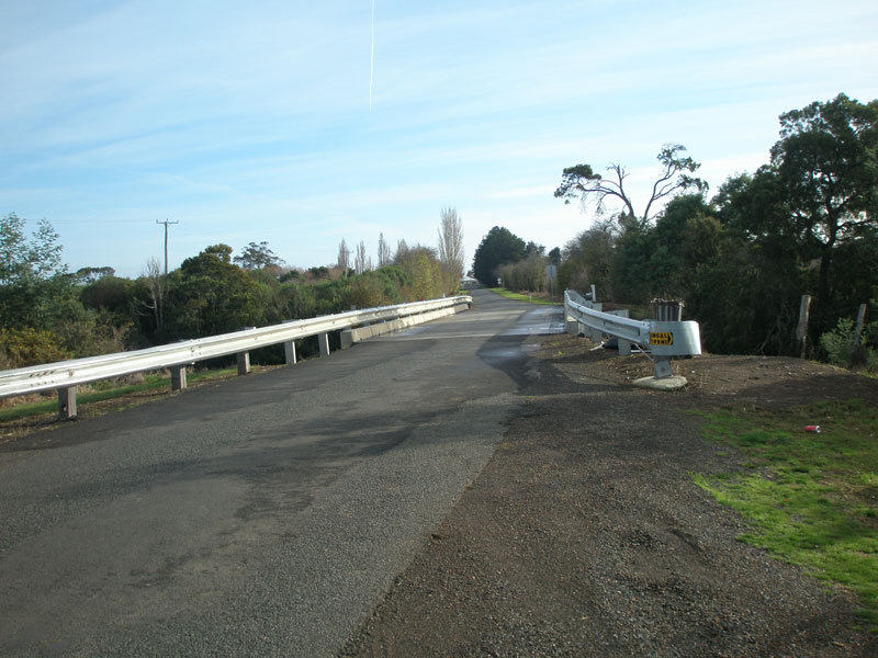
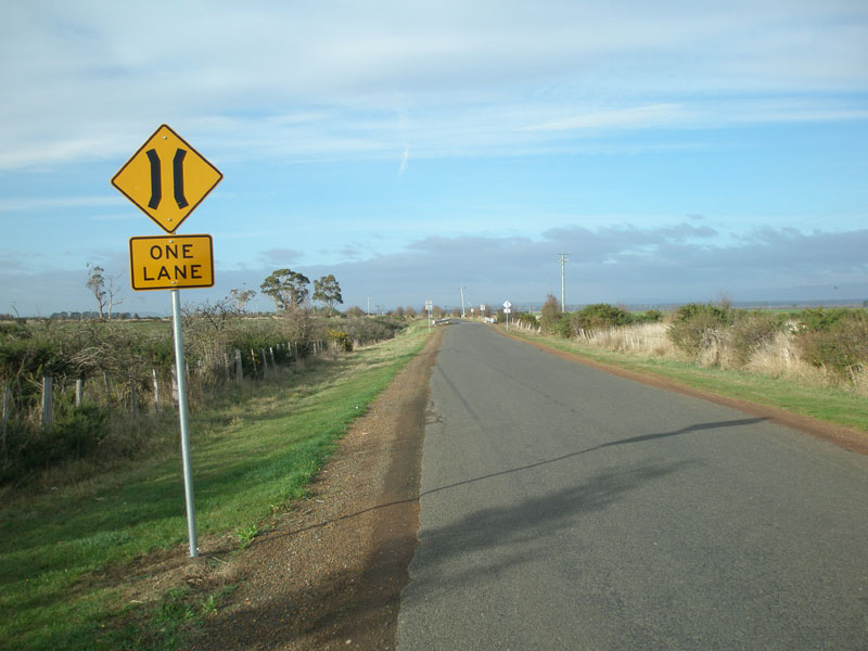
Nile Rd (C416) looking north across a single-lane bridge over a tributary of the South Esk River. Source: Peter Renshaw, May 2007. |
|
 |
Nile Rd (C416) looking north-west from the junction with Glen Esk Rd (C416) & Kingston Rd. Source: Peter Renshaw, May 2007. |
 |
Nile Rd (C416) looking south to the junction with Glen Esk Rd (C416) & Kingston Rd. This is the southern end of the gravel road. Source: Peter Renshaw, May 2007. |
 |
Fingerboard signs at the junction of Nile Rd (C416), Glen Esk Rd (C416) & Kingston Rd. Source: Peter Renshaw, October 2012. |
 |
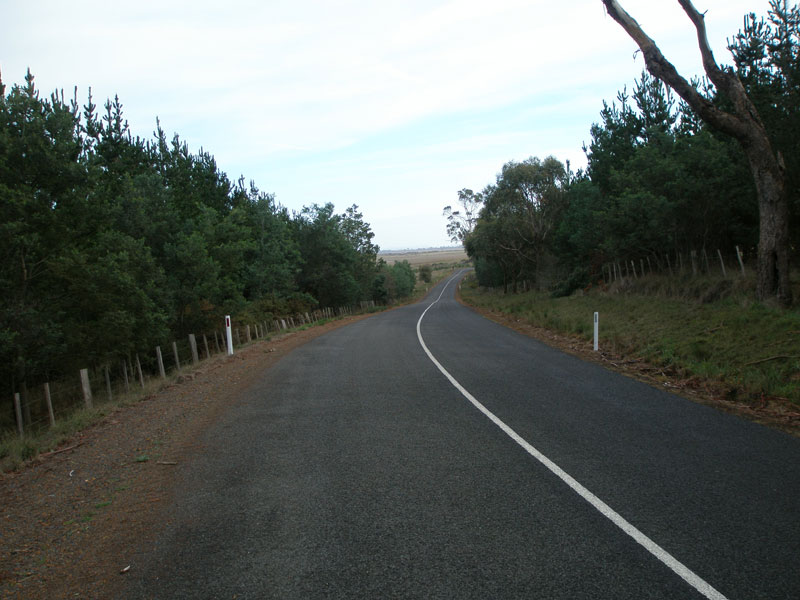
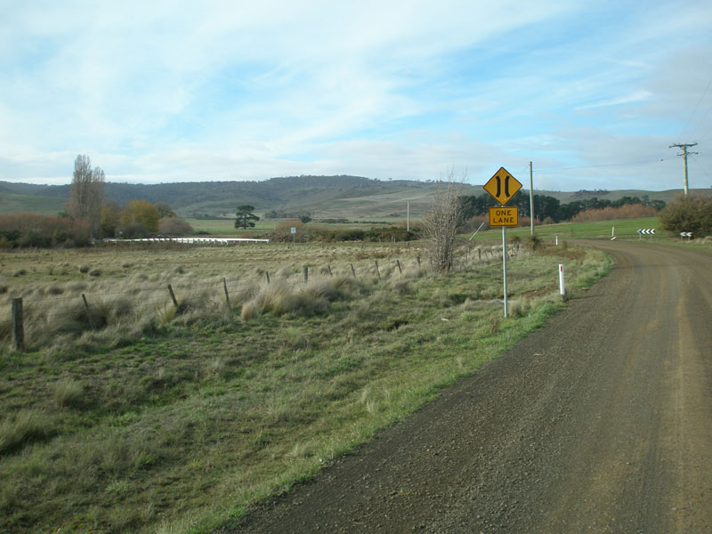
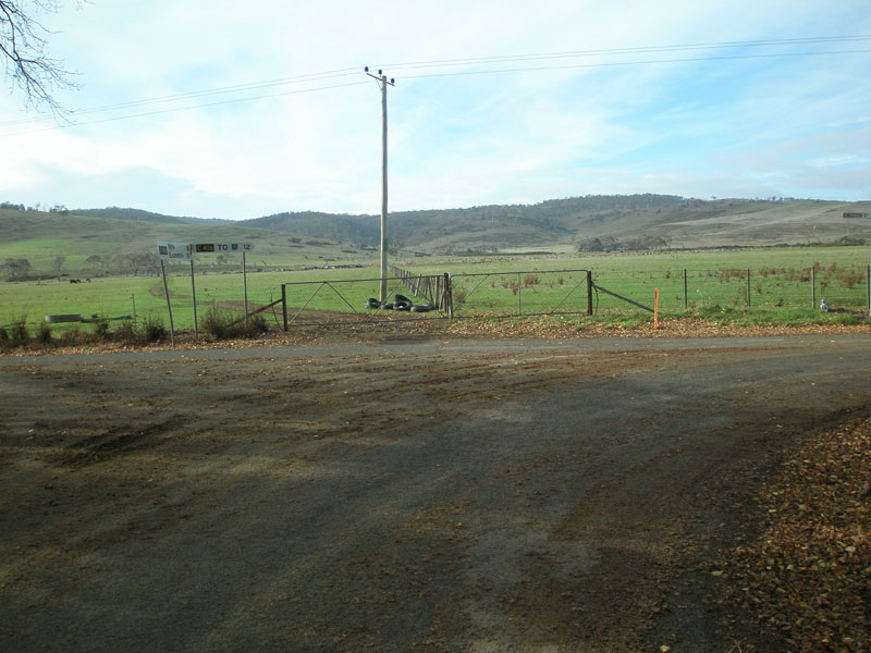
Glen Esk Rd (C416) looking south from the junction with Nile Rd (C416) & Kingston Rd. C416 continues for a further 12km of a sealed road before meeting the Midland Hwy near Conara. Source: Peter Renshaw, May 2007. |
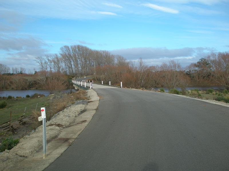 |
Glen Esk Rd (C416) looking south across the low-level bridge over the South Esk River. Source: Peter Renshaw, May 2007. |
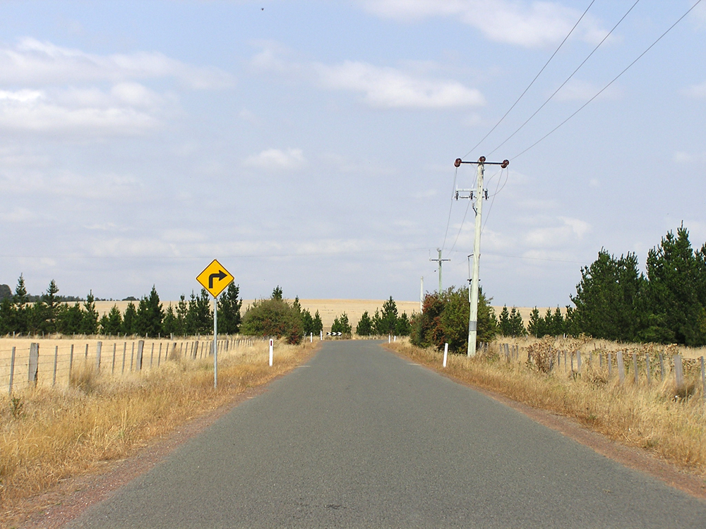 |
Glen Esk Rd (C416) looking south towards a right-angle bend approximately 1km south of the South Esk River bridge. Photo taken: March 2009. |
 |
Glen Esk Rd (C416) looking south, approximately 2.5km south of the South Esk River/6km from the Midland Highway. Photo taken: March 2009. |
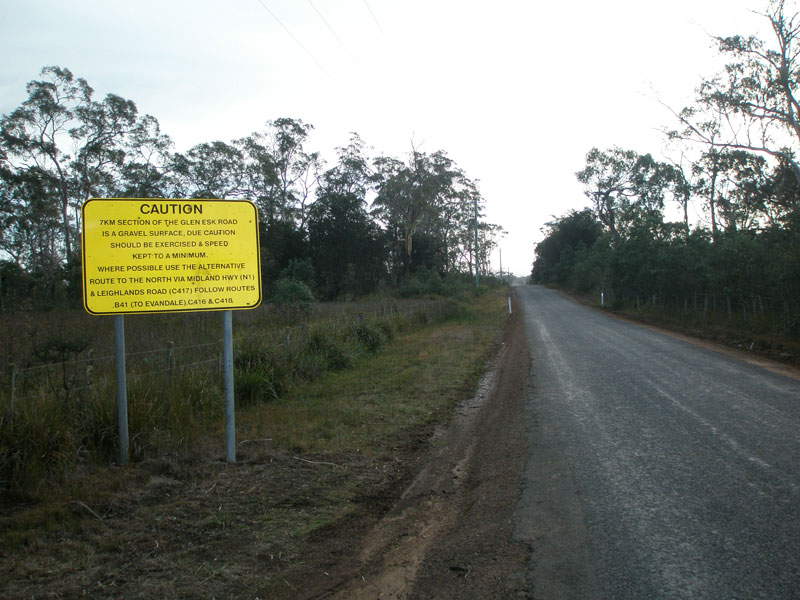 |
Warning sign northbound on Glen Esk Rd (C416) near the Midland Highway junction, advising through traffic to use an alternative route due to the 7km unsealed section of Nile Rd. This sign contains a number of errors: Nile Rd has the unsealed section, not Glen Esk Rd; and Leighlands Rd is actually B41, not C417. The inclusion of C418 suggests that the sign is mainly for tourists heading to Clarendon Homestead. Source: Peter Renshaw, May 2007. |
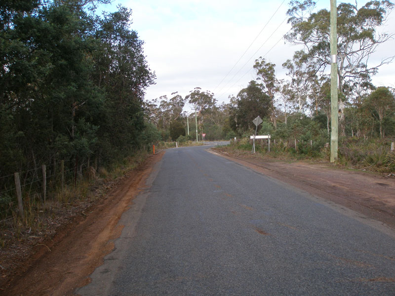 |
Glen Esk Rd (C416) looking south-west from the above sign towards the junction with Midland Highway near Conara. Source: Peter Renshaw, May 2007. |
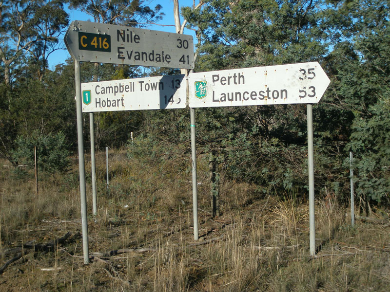  |
Original 1980s white fingerboard signs at the intersection of Midland Hwy (NHR1) & Glen Esk Rd (C416) near Conara. Source: Peter Renshaw, June 2007. |
 |
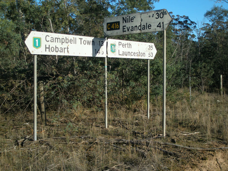
Green ID signs which replaced the above fingerboards in 2008. Source: Peter Renshaw, May 2008. |
 |
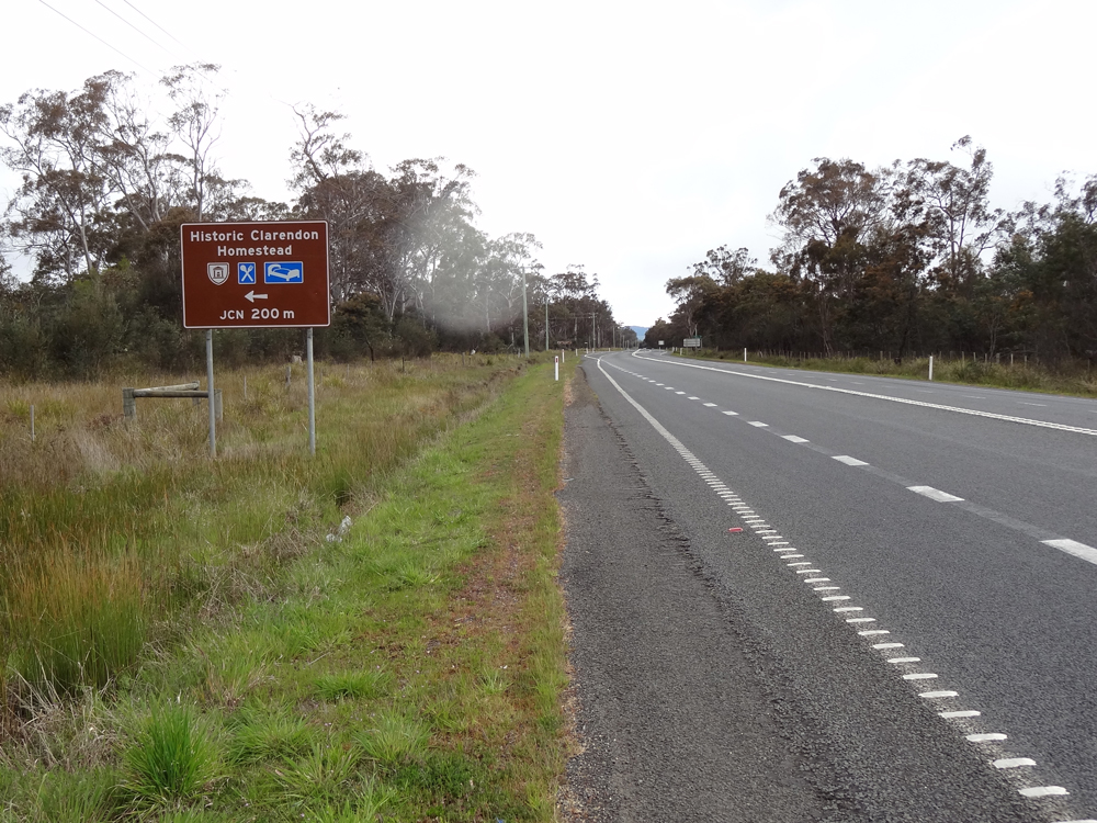
Recently-installed (2007) ID/fingerboard sign pointing traffic from Midland Highway (NH1) onto Glen Esk Rd (C416) towards Clarendon Homestead. The use of this sign seems to be incosistant with the warning sign that advises traffic not to use this road! Source: Peter Renshaw, June 2007. |
  |
Southbound signage on Midland Highway (NHR1) approaching the southern terminus of C416 - Glen Esk Rd - near Conara. The green AD sign is a typical example of AD signs installed in the early-mid-1990s on Midland Highway and other 'A' routes at minor junctions. Top photo: Peter Renshaw, May 2007. Bottom photo: Peter Renshaw, October 2012. |
Last updated 8 December 2012 © Ozroads 2003-2012. |