Oppenheim - East Sassafras - Harford |
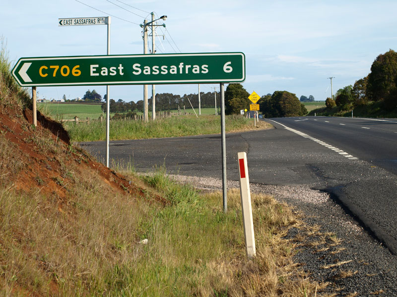
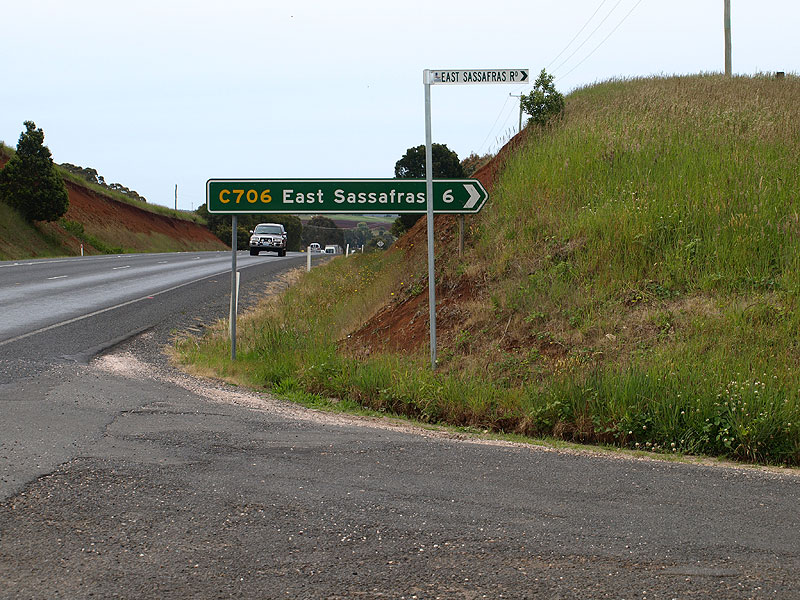
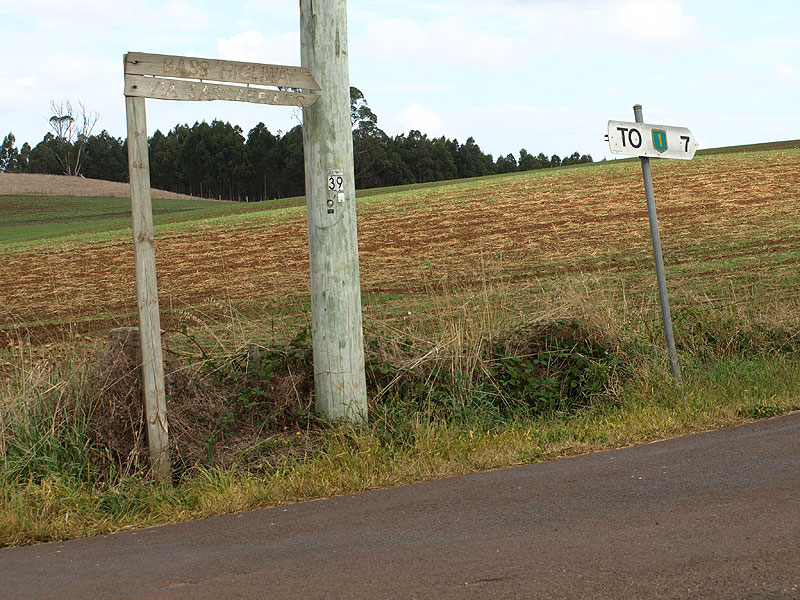
Fingerboard sign facing southbound traffic at the intersection of Bass Highway (NH1) & East Sassafras Rd (C706), 8km southeast of Latrobe. Source: Peter Renshaw, November 2008.
Introduced: 1980
Length: 9km
Eastern Terminus: Chapel Rd (C713) & Greens Creek Rd (C706), 1km south of Harford
Western Terminus: Bass Highway (NH1) & Greens Creek Rd (C706), 8km south east of Latrobe
Route taken: Greens Creek Rd, East Sassafras Rd
Focal Points: East Sassafras
Responsibility: Local Government
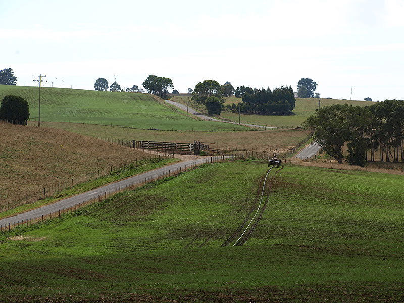
C706 is a minor rural route in northern Tasmania, linking the locality of East Sassafras with Bass Highway (NH1) in the west and the Port Sorell district in the north. It is sealed throughout its length, however it is not of a high standard of alignment, following the countours of the countryside with many vertical crests and steep grades.
In the past few years, it appears that Latrobe Council has made a concerted attempt to discourage through traffic along C706. In particular, signage installed in 2006 at the western junction with Chapel Rd (C713) directs travellers to Latrobe and Devonport via C713 south, which adds another 2.5km to the journey.
|
Photos of route C706 |
|
 |
Bass Highway (NH1) southbound approaching the intersection with East Sassafras Rd (C706), 8km southeast of Latrobe. |
 |
Bass Highway (NH1) northbound approaching the intersection with East Sassafras Rd (C706), 8km southeast of Latrobe. |
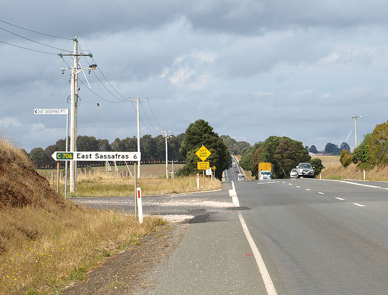 |
Top: Fingerboard sign facing southbound traffic at the intersection of Bass Highway (NH1) & East Sassafras Rd (C706), 8km southeast of Latrobe. Bottom: New green fingerboard sign - installed in November 2008 as part of a programme to eliminate white fingerboard signs on NH1. |
 |
Fingerboard sign facing northbound traffic at the intersection of Bass Highway (NH1) & East Sassafras Rd (C706), 8km southeast of Latrobe. Source: Peter Renshaw, March 2008. |
  |
Top: White fingerboard sign assembly facing C706 traffic at the intersection of Bass Highway (NH1) & East Sassafras Rd (C706), 8km southeast of Latrobe. Bottom: Caught in the act of replacing signs - the old white and new green fingerboard sign assemblies both in situ during the sign upgrade programme. |
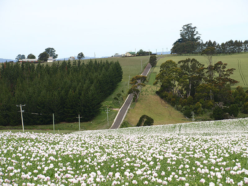 |
East Sassafras Rd (C706) looking east from near the Bass Highway (NH1) junction with a poppy field in the foreground. |
 |
East Sassafras Rd (C706) looking west approximately 1km east of the Bass Highway junction, which is marked by the white fingerboard signs in the top left of the photo. Source: Peter Renshaw, March 2008. |
 |
East Sassafras Rd (C706) looking east approximately 1km east of Bass Highway (NH1), showing a pair of reverse curves at the 'Forrabury' property. Source: Peter Renshaw, March 2008. |
 |
East Sassafras Rd (C706) looking east approximately 1.4km east of Bass Highway (NH1) just beyond the reverse curves in the above photo. The first Chapel Rd (C713) intersection is located midway up the second rise. Source: Peter Renshaw, March 2008. |
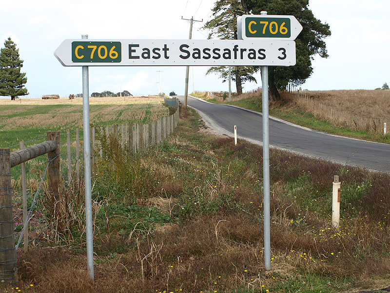 |
Fingerboard sign assembly at the intersection of Chapel Rd (C713) & East Sassafras Rd (C706). Note the absence of a focal destination for westbound C706 traffic - not even a "To NH1". |
|
East Sassafras Rd (C706) looking west at the intersection with Chapel Rd (C713), 2.5km east of Bass Highway (NH1). Note that Latrobe and Devonport traffic is directed via C713 south, despite C706 being 2.5km (50%) shorter! |
 |
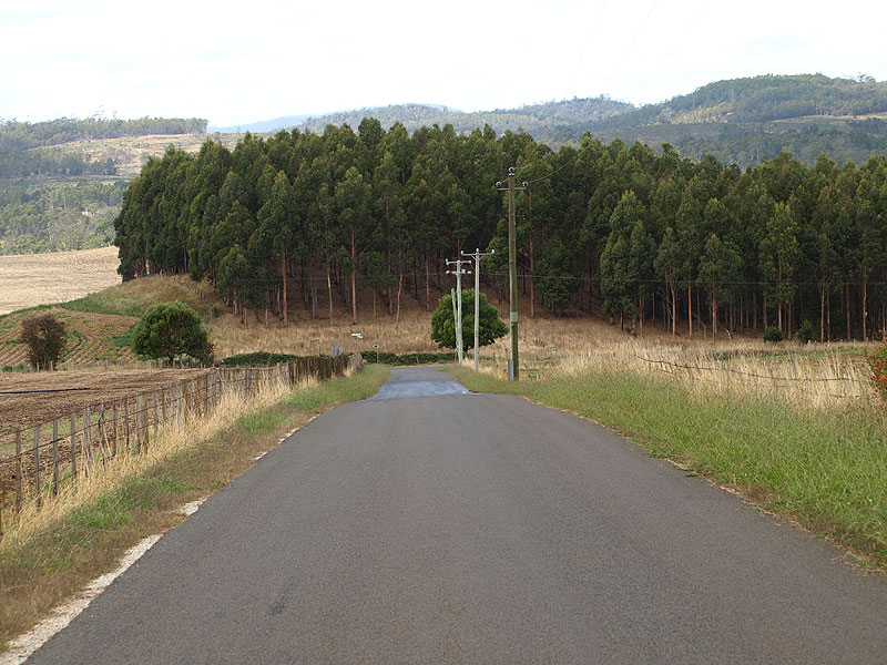
East Sassafras Rd (C706) looking east approximately 250m east of Chapel Rd (C713), as the route skirts the southern flanks of Rockliffs Hill. Source: Peter Renshaw, March 2008. |
 |
East Sassafras Rd (C706) looking east along the southern side of Rockliffs Hill, 1.5km east of Chapel Rd (C713). This is the locality known as East Sassafras. Source: Peter Renshaw, March 2008. |
 |
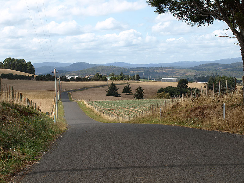
East Sassafras Rd (C706) looking west from the rise in the distance in the above photo, 500m west of Greens Creek Rd (C706). Source: Peter Renshaw, March 2008. |
 |
East Sassafras Rd (C706) looking east towards the intersection with Greens Creek Rd (C706). Note the mini-fingerboard at the intersection, pointing C706 traffic to the left - C706 turns north here onto Greens Creek Rd. Source: Peter Renshaw, March 2008. |
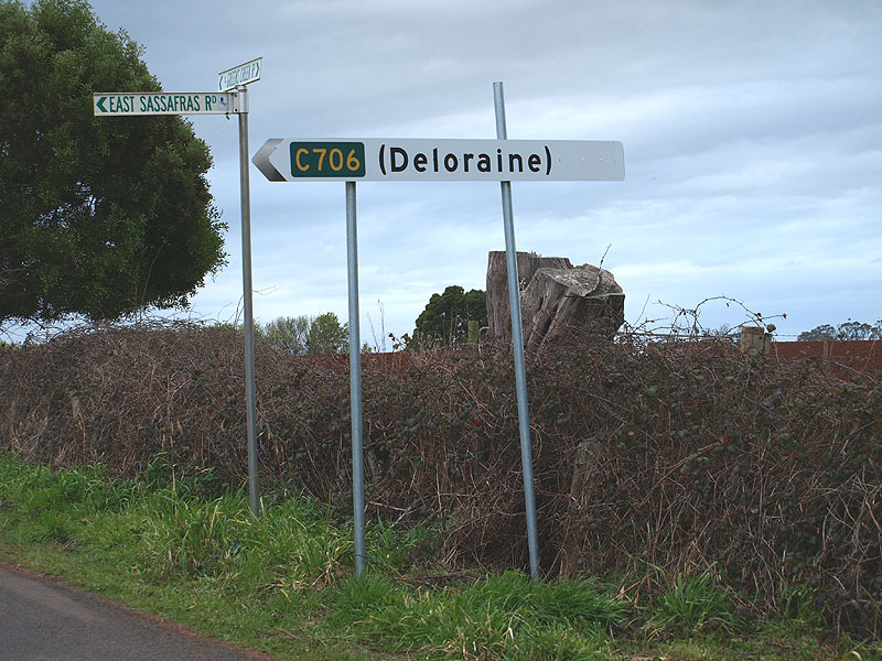
Top: Fingerboard and wooden Council signage at the intersection of East Sassafras Rd (C706) & Greens Creek Rd (C706). The wooden sign reads "Bass Highway via Sassafras". Middle: The C706 mini-fingerboard sign at the intersection of East Sassafras Rd (C706) & Greens Creek Rd (C706). Note that it is now pointing towards Sassafras - this sign was observed pointing in three different directions in the space of six months! Bottom: Another shot of the mini C706 fingerboard, this time pointing traffic northwards along Greens Creek Rd (C706). |
|
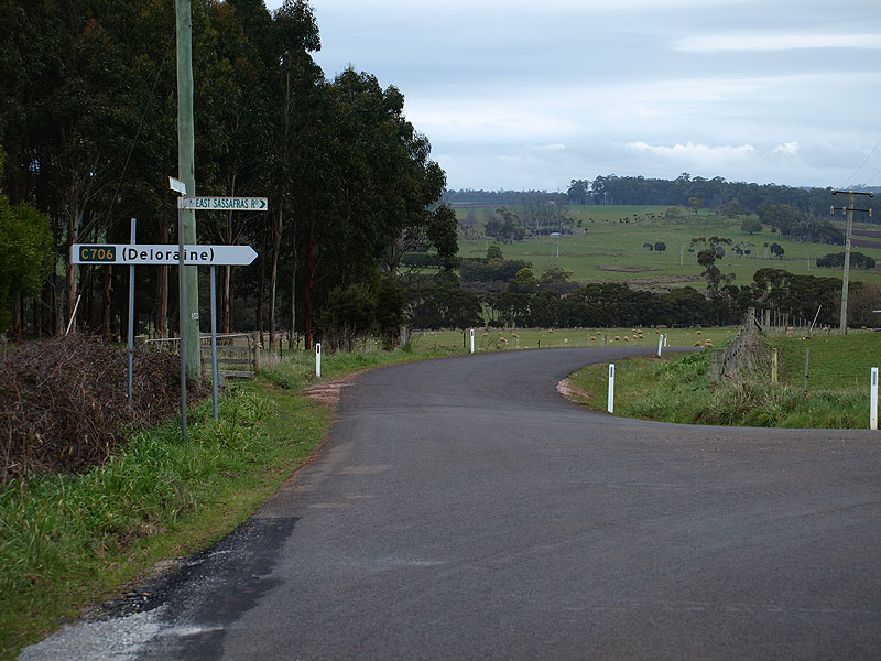  |
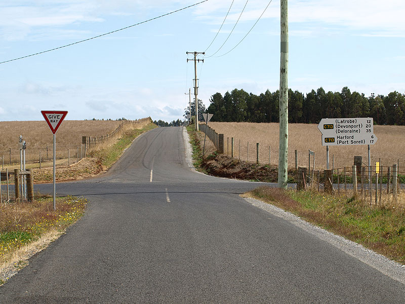
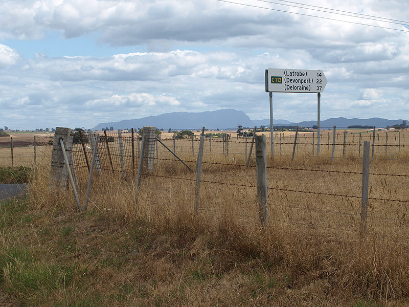
In winter 2008, Latrobe Council removed the fingerboards and the wooden sign at this intersection, replacing the four signs with this double-sided fingerboard sign pointing traffic along East Sassafras Rd (C706). Note, however, that the distance to Deloraine (38km via C706 and C713). The longer pole looks set to accommodate a fingerboard sign facing traffic from East Sassafras Rd. Source: Peter Renshaw, September 2008. |
 |
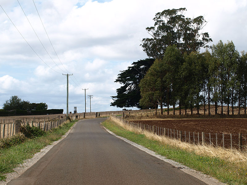
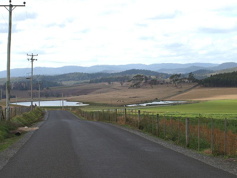
Greens Creek Rd (C706) looking south to the intersection with East Sassafras Rd (C706). Greens Creek Rd continues south towards the Bass Highway, which can be reached via Smith and Others Rd. It would appear that Latrobe Council is trying to direct stranger traffic to the Bass Highway via C706 and C713 instead. Source: Peter Renshaw, March 2008. |
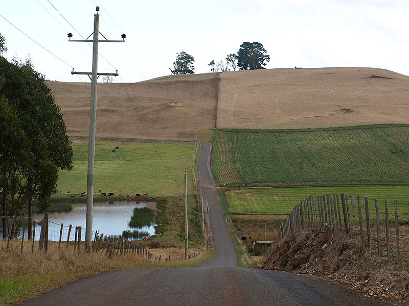
Greens Creek Rd (C706) looking north approximately 1.2km north of East Sassafras Rd (C706). |
|
 |
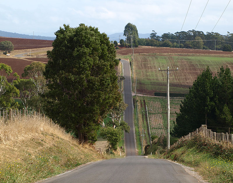
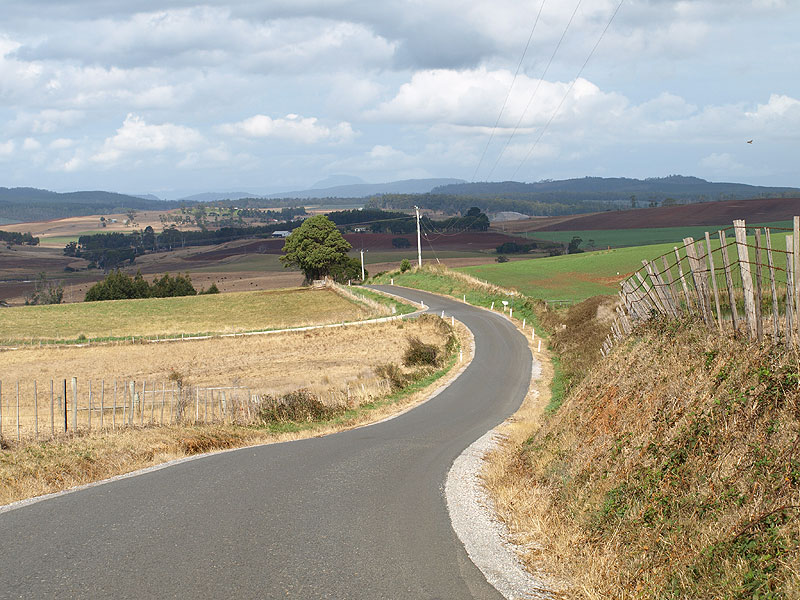
Greens Creek Rd (C706) looking north at Torrington Rd, with the Chapel Rd (C713) intersection at the top of the hill in the distance. Source: Peter Renshaw, March 2008. |
 |
Greens Creek Rd (C706) looking south towrds Torrington Rd from approximately 200m south of the Chapel Rd (C713) intersection. Source: Peter Renshaw, March 2008. |
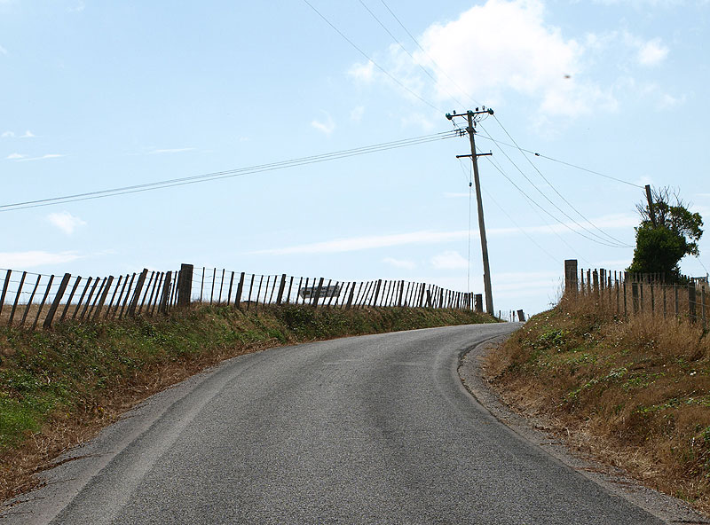 |
Greens Creek Rd (C706) looking north to the Chapel Rd (C713) intersection, which is located at the top of this crest. You can just make out the fingerboard sign pointing traffic west along C713. Source: Peter Renshaw, March 2008. |
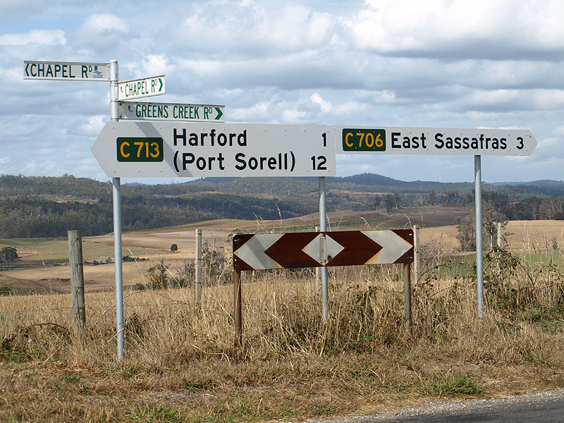 |
Fingerboard signs at the intersection of Greens Creek Rd (C706/C713) & Chapel Rd (C713). Greens Creek Rd continues north towards Frankford Main Rd (B71) and Port Sorell as C713. |
 |
Fingerboard sign assembly at the intersection of Greens Creek Rd (C706/C713) & Chapel Rd (C713). The C713 fingerboards are strangely off-set from the intersection. Source: Peter Renshaw, February 2009. |
Last updated 21 February 2009 © Ozroads 2004-2009. |