Hagley to Legana |
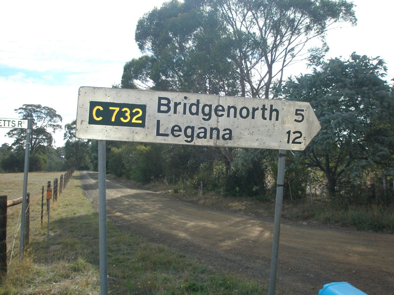
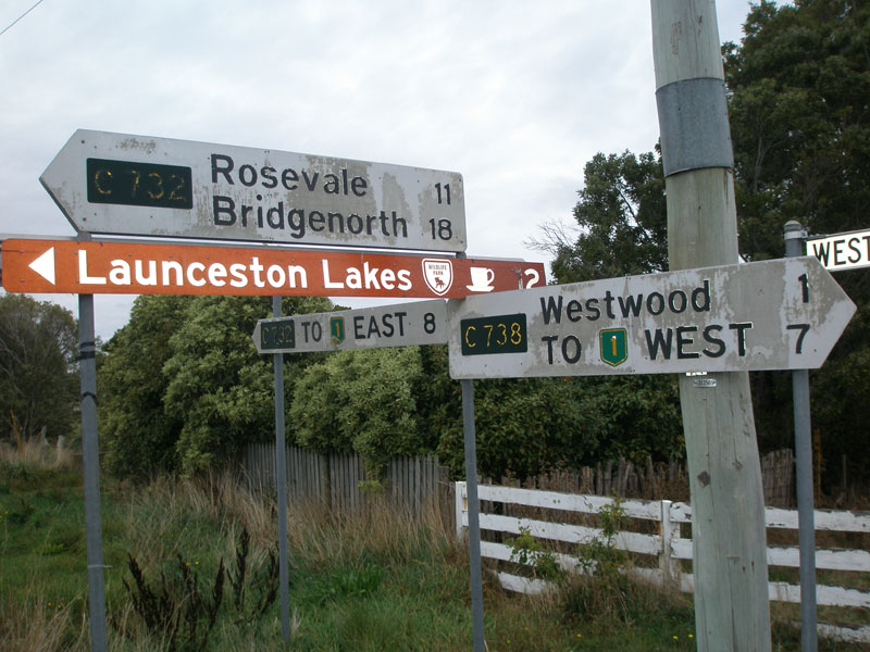
Fingerboard signs at the junction of Bridgenorth Rd (C732) & Ecclestone Rd (C734), 8km north of Westwood. Source: Peter Renshaw, April 2007.
Introduced: 1980
Length: 32km
North-eastern Terminus: West Tamar Highway (A7) & Bridgenorth Rd (C732), Legana
South-western Terminus: Meander Valley Secondary Rd (B54) & Westwood Rd WEST (C732), Hagley
Route taken: Westwood Rd, Bridgenorth Rd
Focal Points: National Higwhay 1, Westwood, Rosevale, Bridgenorth, Legana
Responsibility: Local Government
C732 is one of the longer C routes in the West Tamar region, running in a north-east to south-west loop between the Tamar and Meander Valleys. It primarily serves argicultural and rural residential traffic, however also provides access to the tourist destinations of Launceston Lakes and Notley Fern Gorge. It is sealed throughout its length.
|
Photos of route C732 |
|
 |
New AD sign northbound on West Tamar Highway (A7) approaching Bridgenorth Rd (C732) at Legana. Source: Peter Renshaw, December 2012. |
  |
Old and new AD signs southbound on West Tamar Highway (A7) approaching Bridgenorth Rd (C732), Legana. Note the inclusion of Notley Fern Gorge as a focal point. Top photo: Peter Renshaw, July 2007. Bottom photo: Peter Renshaw, December 2012. |
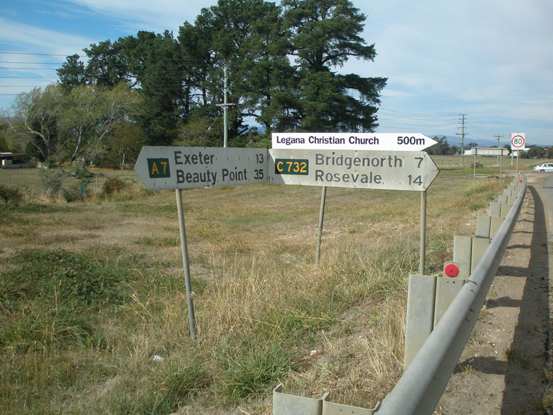 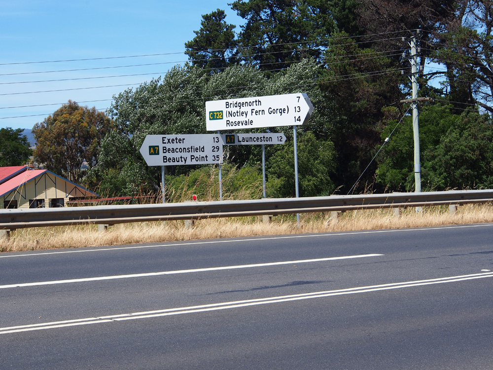 |
Old and new fingerboard signs at the junction of West Tamar Highway (A7) & Bridgenorth Rd (C732), Legana. Note the inclusion of Notley Fern Gorge as a focal point. Top photo: Peter Renshaw, April 2007. Bottom photo: Peter Renshaw, December 2012. |
 |
Bridgenorth Rd (C732) looking west from the junction with West Tamar Highway (A7) at Legana. Source: Peter Renshaw, December 2012. |
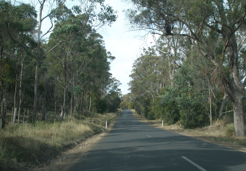 |
Bridgenorth Rd (C732) looking east between Bridgenorth and Legana. Source: Peter Renshaw, April 2007. |
 |
Fingerboard sign facing northbound traffic at the junction of Bridgenorth Rd (C732), Long Plains Rd (C730) & Stokes Lane, Bridgenorth. Source: Peter Renshaw, April 2007. |
 |
Fingerboard signs facing southbound traffic at the junction of Bridgenorth Rd (C732), Long Plains Rd (C730) & Stokes Lane, Bridgenorth. Source: Peter Renshaw, April 2007. |
 |
Fingerboard sign facing northbound traffic at the junction of Bridgenorth Rd (C732), Long Plains Rd (C730) & Stokes Lane, Bridgenorth. Source: Peter Renshaw, April 2007. |
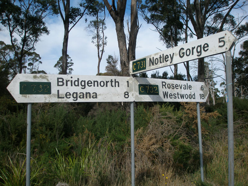 |
Fingerboard signs at the junction of Bridgenorth Rd (C732) & Notley Gorge Rd (C731), 1km west of Bridgenorth. Note what two decades of exposure to the elements has done to the painted fingerboard signs. Source: Peter Renshaw, April 2007. |
 |
5km west of Bridgenorth, Bridgenorth Rd (C732) takes a 90 degree turn to the south at its junction with Hodgetts Rd. Source: Peter Renshaw, April 2007. |
 |
Close-up of the fingerboard sign that faces northbound traffic at the junction of Bridgenorth Rd (C732) & Hodgetts Rd. Source: Peter Renshaw, April 2007. |
 |
Close-up of the fingerboard sign that faces westbound traffic at the junction of Bridgenorth Rd (C732) & Hodgetts Rd. Source: Peter Renshaw, April 2007. |
 |
Bridgenorth Rd (C732) looking north to the single-lane bridge across Pipers Lagoon Creek, just north of Rosevale. Source: Peter Renshaw, April 2007. |
 |
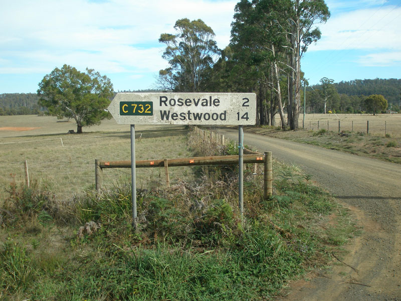
South of Rosevale, Bridgenorth Rd (C732) meets Roseburn Rd. This photo shows recently-installed fingerboard signs that incorrectly omit a C732 shield for the left-turn (really a through southbound movement) and also omit the 'To NH1' that is present on subsequent fingerboards. Source: Peter Renshaw, April 2007. |
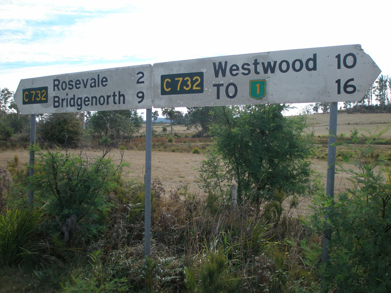 |
Fingerboard signs facing Roseburn Rd at its junction with Bridgenorth Rd (C732), 2km south of Rosevale. Note that the NH1 shield now refers to the B54 - the sign has not been updated since the Bass Highway was relocated. Source: Peter Renshaw, April 2007. |
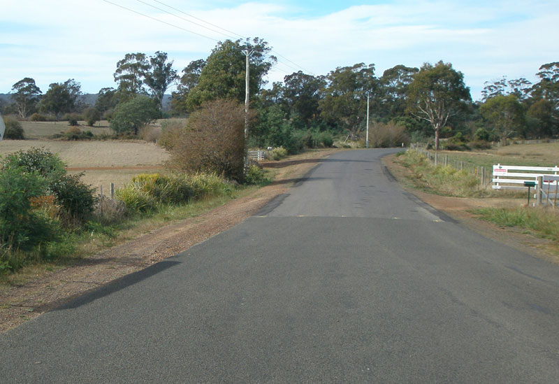 |
Bridgenorth Rd (C732) looking south-east from Roseburn Rd, 2km south of Rosevale. Source: Peter Renshaw, April 2007. |
 |
Bridgenorth Rd (C732) looking south-east to another single-lane crossing of Pipers Lagoon Creek, 3km south of Rosevale. Source: Peter Renshaw, April 2007. |
|
Fingerboard signs at the junction of Bridgenorth Rd (C732) & Ecclestone Rd (C734). Note that C734 is unmarked at this end - the only fingerboards are for C732. Also, note again that the distance to NH1 actually reflects the distance to B54 - this sign has not been updated to reflect the relocation of Bass Highway between Launceston and Deloraine. Source: Peter Renshaw, April 2007. |
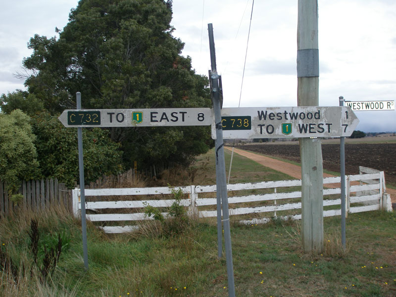 |
7km south of Ecclestone Rd, Bridgenorth Rd terminates at the junction with Westwood Rd. Here, C732 turns west towards Hagley and C738 provides a link to the east towards Hadspen. Unfortunately, these two very old fingerboards have the route markers the wrong way around! Source: Peter Renshaw, April 2007. |
 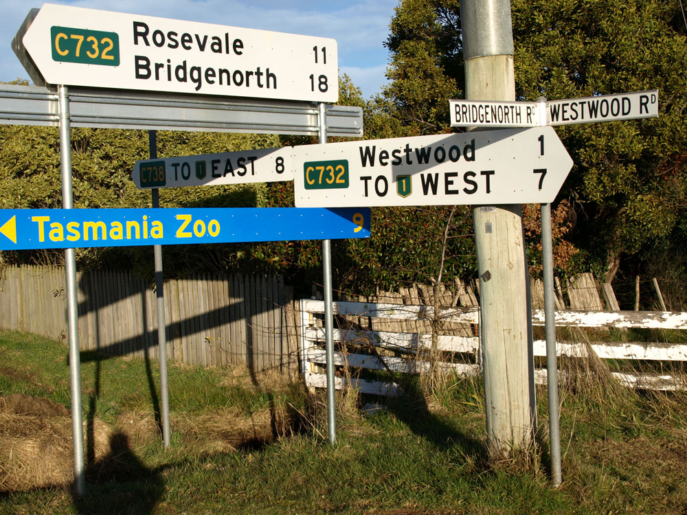 |
Another view of the original fingerboards at the junction of Bridgenorth Rd (C732) & Westwood Rd (C732/C738), 11km south of Rosevale. Note the contrast between the extremely weathered fingerboard signs and the brand-new tourism sign. Renewed fingerboard sign assembly at the above intersection, installed in 2010. Note that the 'To NH1' focal point has not been updaed to reflect either the longer distance or the new route marker following the reloction of NH1 many years ago. |
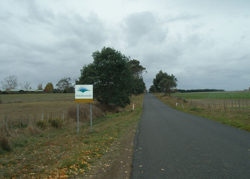 |
Westwood Rd (C732) looking east into the locality of Westwood. Source: Peter Renshaw, April 2007. |
 |
Westwood Rd (C732) looking south-east towards Knights Bridge over the Meander River. Source: Peter Renshaw, April 2007. |
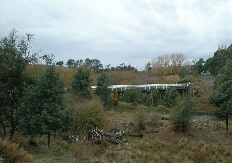 |
A side-on view of Knights Bridge, which carries Westwood Rd (C732) across the Meander River. Source: Peter Renshaw, April 2007. |
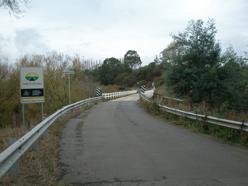 |
Westwood Rd (C732) looking north-east at Knights Bridge, which crosses the Meander River. Source: Peter Renshaw, April 2007. |
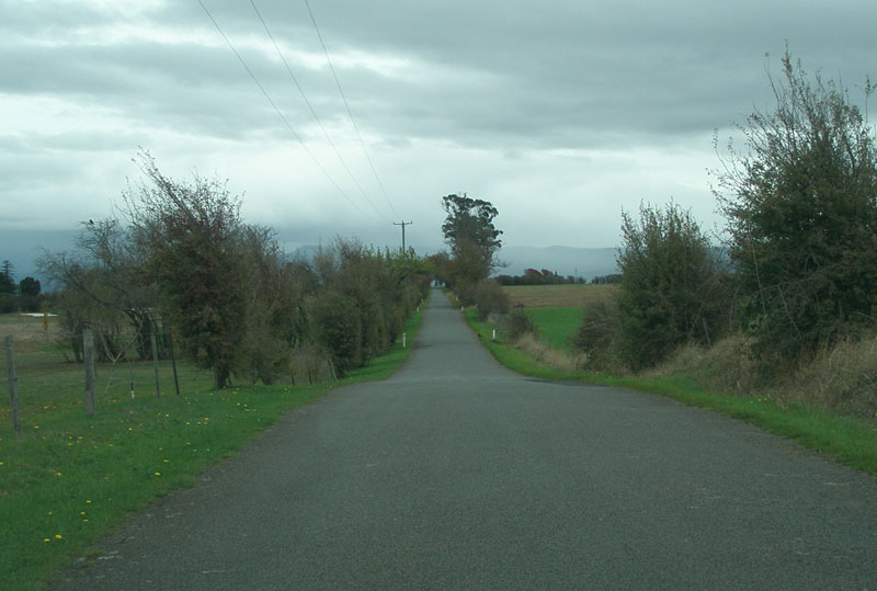 |
Westwood Rd (C732) looking south near Quamby Country Club, between the Meander River and Meander Valley Secondary Rd (B54). Source: Peter Renshaw, April 2007. |
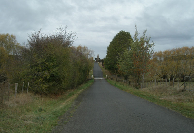 |
Westwood Rd (C732) looking north from Meander Valley Secondary Rd (B54). Source: Peter Renshaw, April 2007. |
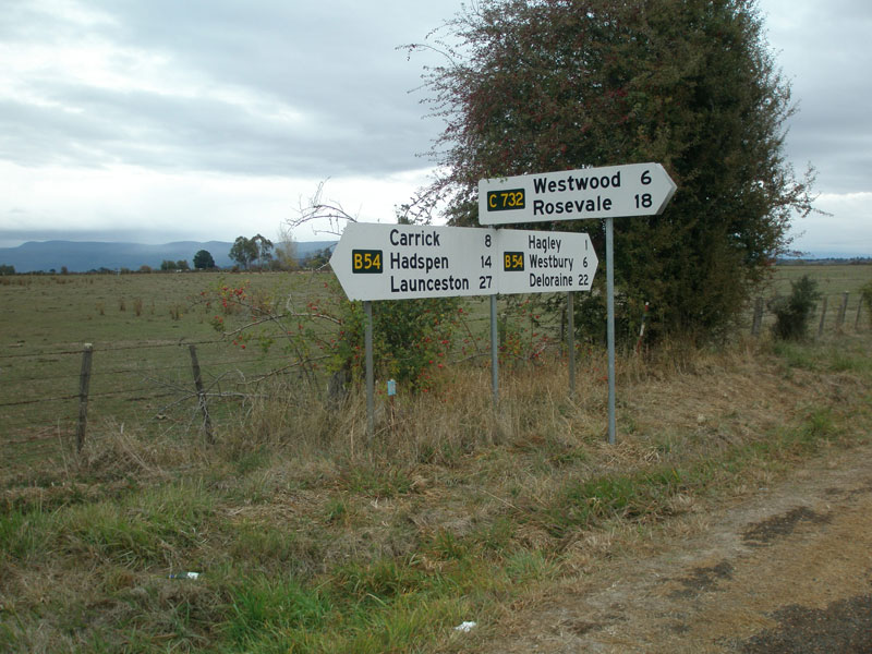 |
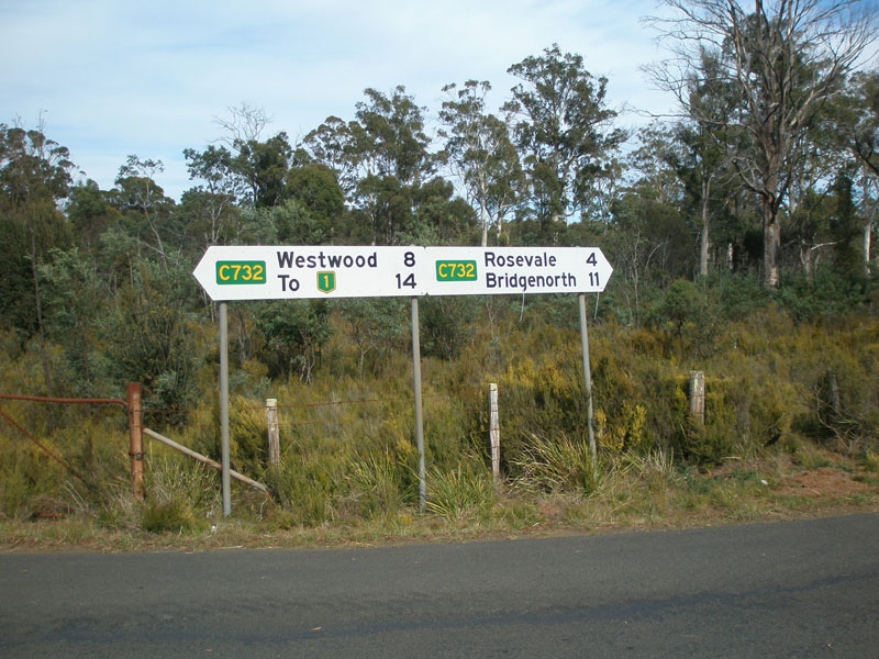
Fingerboard signs at the junction of Westwood Rd (C732) & Meander Valley Secondary Rd (B54), 1km east of Hagley. Source: Peter Renshaw, April 2007. |
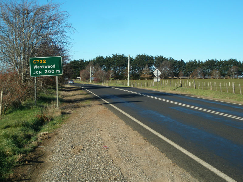 |
AD sign eastbound on Meander Valley Secondary Rd (B54) approaching Westwood Rd (C732), 1km west of Hagley. Source: Peter Renshaw, July 2007. |
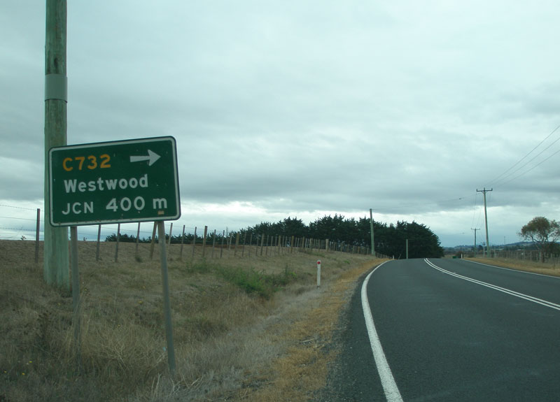 |
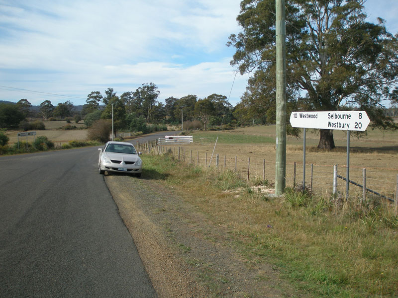
AD sign westbound on Meander Valley Secondary Rd (B54) westbound approaching Westwood Rd (C732), 1km west of Hagley. Source: Peter Renshaw, April 2007. |
Last updated 23 December 2012 © Ozroads 2003-2012. |