Priory to Binalong Bay |
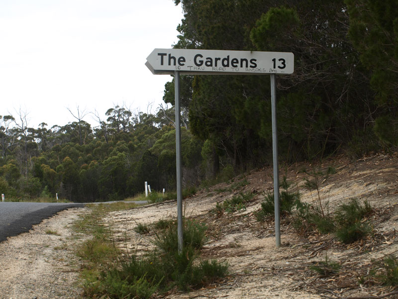
Fingerboard sign with no focal point at the intersection of The Gardens Rd (C848) & Reids Rd (C849), 2km west of Binalong Bay. Source: Peter Renshaw, April 2008.
Introduced: 1980
Length: 8km
Eastern Terminus: The Gardens Rd (C848) & Reids Rd (C849), 2km west of Binalong Bay
Western Terminus: Ansons Bay Rd (C843) & Reids Rd (C849), 3km north of St Helens
Route taken: Reids Rd
Focal Points: Binalong Bay
Responsibility: Local Government
C849 is a minor rural route in north eastern Tasmania, providing an east-west link between C843 Ansons Bay Road and the holiday village of Binalong Bay. The route is mostly unsealed with only two short sealed sections adjacent to timber bridges over George River and Fletchers Creek.
With no access provided between The Gardens and Ansons Bay, it is surprising that signposting at the eastern end of the route does not refer to Ansons Bay - showing the route marker only. Signage at the western end of the route refers to Binalong Bay.
|
Photos of route C849 |
|
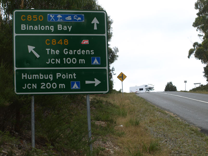 |
AD sign northbound on Binalong Bay Rd (C850) approaching the junction with The Gardens Rd (C848), 2km west of Binalong Bay. Note no mention of C849 despite the turnoff being located immediately beyond the intersection on C848. |
 |
Fingerboard sign for C848 at the intersection of Binalong Bay Rd (C850) & The Gardens Rd (C848). This time C848 is omitted as well! |
|
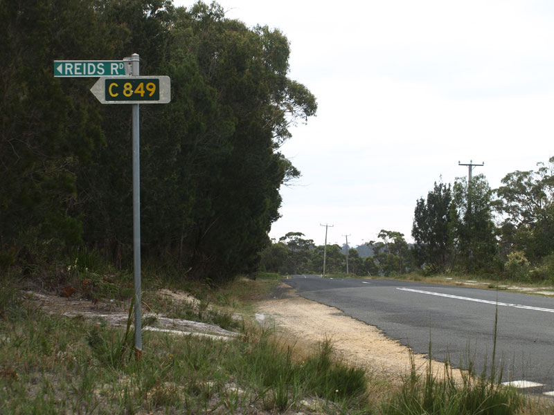
The lone C849 fingerboard sign at the junction of The Gardens Rd (C848) & Reids Rd (C849) which faces northbound traffic. There is no sign to advise southbound traffic from The Gardens that they can use C849. |
 |
Reids Rd (C849) looking west towards the junction with The Gardens Rd (C848). Note how close the junction of The Gardens Rd (C848) & Binalong Bay Rd (C850) is in the background. |
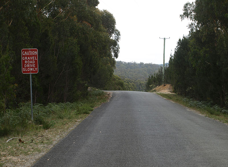 |
Reids Rd (C849) looking west from the junction with The Gardens Rd (C848) showing a non-standard warning of the upcoming gravel road. Source: Peter Renshaw, April 2008. |
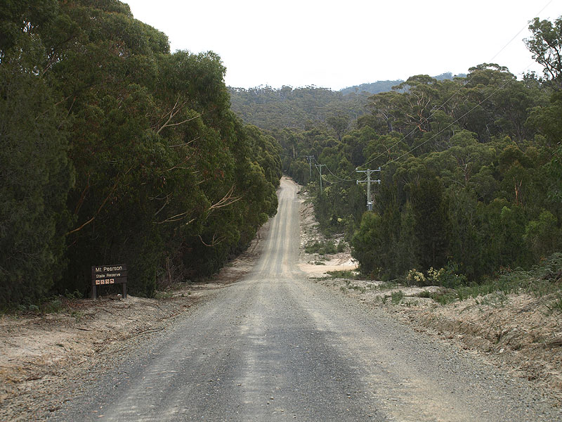 |
Reids Rd (C848) looking west at the beginning of the gravel road as you enter the Mount Pearson State Reserve. Source: Peter Renshaw, April 2008. |
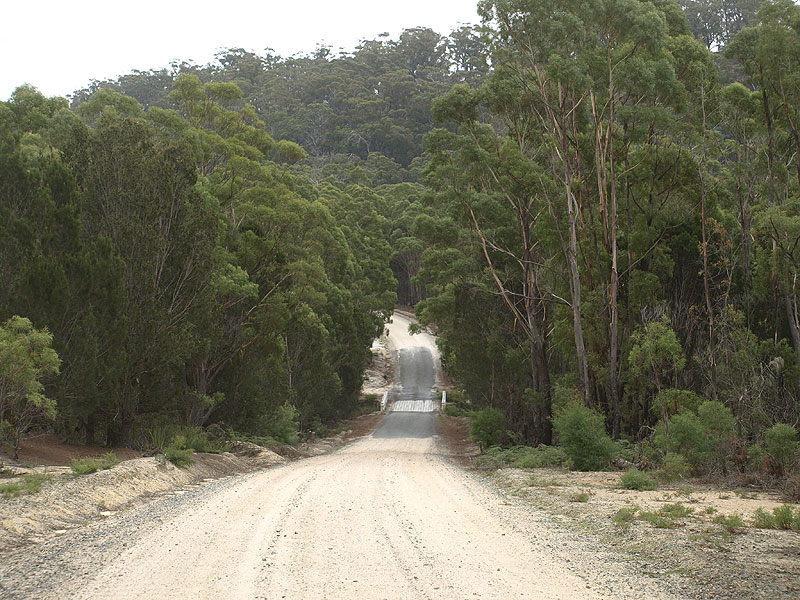
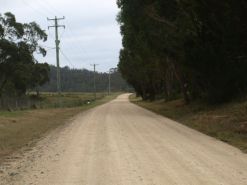
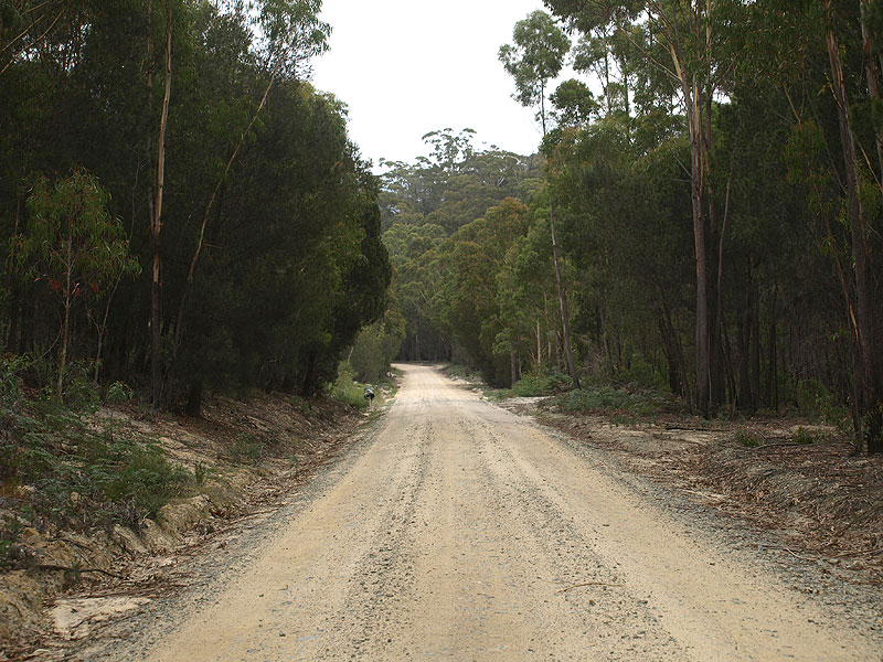
Reids Rd (C849) looking west approximately 2km west of The Gardens Rd (C848). |
|
 |
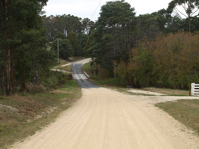
Reids Rd (C849) looking west to the timber bridge over Fletchers Creek, 4km west of The Gardens Rd (C848). Note the sealing of the bridge approaches, allowing traffic to safely slow down and give way if larger vehicles are on the bridge. Source: Peter Renshaw, April 2008. |
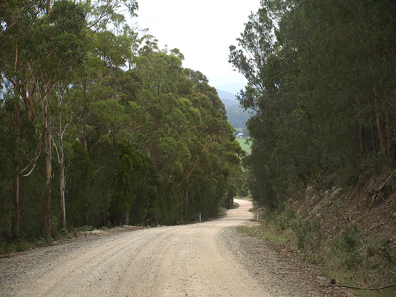 |
Reids Rd (C849) looking west as you descend from Mt Pearson State Reserve into the George River valley. Source: Peter Renshaw, April 2008. |
 |
Reids Rd (C849) looking north across the George River valley. Source: Peter Renshaw, April 2008. |
 |
Reids Rd (C849) looking south across the timber bridge over the George River, 1km east of Ansons Bay Rd (C843). Source: Peter Renshaw, April 2008. |
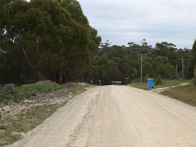 |
Reids Rd (C849) looking west towards the junction with Ansons Bay Rd (C843). Source: Peter Renshaw, April 2008. |
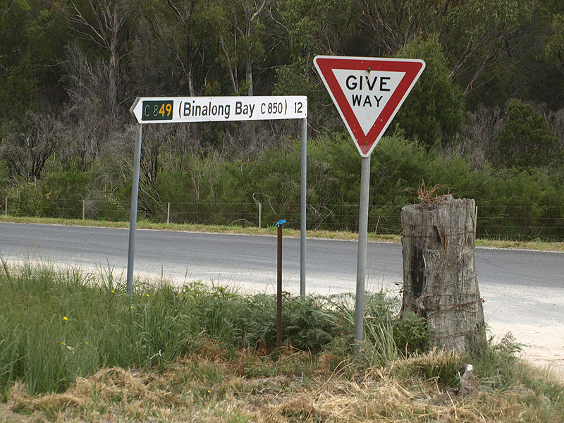 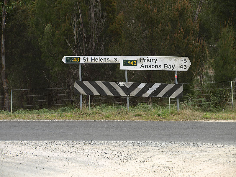 |
Fingerboard signs at the intersection of Ansons Bay Rd (C843) & Reids Rd (C849), 3km north of St Helens. This is the western terminus of the route. Source: Peter Renshaw, April 2008. |
Last updated 17 April 2011. © Ozroads 2004-2011. |