PACIFIC HIGHWAY
Section: Wardell to Ballina

Looking south between Bruxner Highway and Wardell. Jan 2005.
This 14km section of the Pacific Highway stretches from just south of River Drive at Wardell to Burns Point Ferry Road at Ballina.
Originally, the Pacific Highway crossed the Richmond River via a punt at Burns Point (which is still in operation today), near Ballina. Another car ferry was also in operation at Wardell, taking traffic across the Richmond River between the Pacific Highway and Fitzroy Street .
When the time came to replace the second last ferry on the state highway system, the Department of Main Roads selected the Wardell site because it would provide a shorter crossing of the river and, whilst lengthy approach deviations would be required, it would greatly improve flood immunity. The old alignment of the highway ( River Street , River Drive and Burns Point Ferry Road ) was subject to flooding at a number of locations and Burns Point Ferry Road was constructed in cement concrete during the 1930s to provide a durable pavement, even under flood. The bridge - with its bascule opening span - and the 11km of approaches were opened to traffic in April 1964. The 3km section of the highway between Burns Point Ferry Road and Emigrant Creek was formerly part of the Bruxner Highway , but was re-declared as part of the Pacific Highway upon opening of the bridge at Wardell.
It is interesting to note the foresight of the Department of Main Roads who, instead of simply routing the northern approach to the bridge along Pimlico Road, which had existed for many years prior to the construction of the bridge, the northern approach was located along a completely new, flood-free alignment to the west of Pimlico Road. The Burns Point Ferry remained in service to serve the communities of South Ballina, Keith Hall and Empire Vale which would otherwise have had their routes to/from Ballina extended by up to 30km.
In November 2004 planning commenced for the upgrade of the Pacific Highway to dual carriageways between Woodburn and Ballina. On 30 November 2005 the preferred route option was announced, incorporating bypasses of Woodburn, Broadwater and Wardell. A new crossing of the Richmond River - twin 850m long bridges - will be constructed in the vicinity of the end of Back Channel Road, with the highway bypassing Wardell to the west along the foot of the Blackwall Range and rejoining the existing highway 4km north of Wardell. From there, the existing highway will be duplicated for a further 6.5km until it reaches the already-approved Ballina Bypass, which will leave the existing highway at Teven Road . The Ballina Bypass has been approved for a number of years and has been awaiting funds from either tier of government, however it has recently been put on hold as part of investigations for the upgrading of the highway between Ballina and Ewingsdale. According to the RTA website1 development works have been commenced in the SEPP 14 wetland and ongoing property negotiations and geotechnical investigations are continuing. Possible alignments for the upgrade of the highway between Ballina and Ewingsdale will only affect the bypass north of Tintenbar.
|
Current route of Pacific Highway |
|
 |
Looking north with the Wardell bridge in the background. The track leading off to the left of the highway is River St - the original alignment of the highway prior to the construction of the bridge over the Richmond River. Nov 2005. |
 |
Fingerboard sign pointing down River Dr - the original route of Pacific Hwy. Nov 2005. |
 |
The bridge over the Richmond River at Wardell. The car ferry floating beneath the bridge is the Burns Point Ferry, on its way back to work after repairs. Unfortunately this meant I didn't have the chance to follow the old alignment on the south side of the river because the ferry wasn't working! Nov 2005. |
 |
Looking south to the Richmond River bridge at Wardell. Nov 2005. |
 |
Looking north from Wardell. Nov 2005. |
 |
Rest Area distance sign and wire rope median fencing between Wardell and the Bruxner Hwy. Nov 2005. |
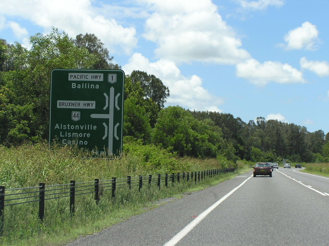 |
The first northbound mention of the Bruxner Hwy. Unusual style of diagrammatic sign, showing the two bridges over Pimlico and Emigrant Creeks. Jan 2005. |
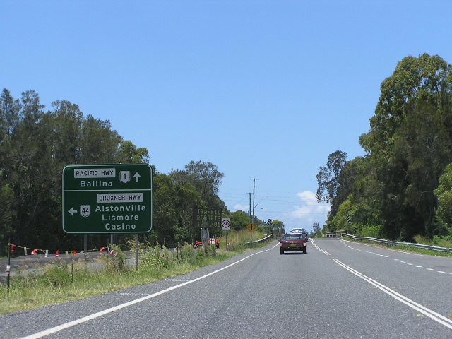 |
Second northbound AD sign for Bruxner Hwy. Not much traffic would turn left here as there a numerous routes from Wardell and further south to Alstonville, Lismore and Casino. Jan 2005. |
 |
Distance sign heading south from Bruxner Hwy. Jan 2005. |
 |
Distance sign heading north (east) from Bruxner Hwy. This section of the Pacific Hwy was part of the Bruxner Hwy until 1964 when the Pacific Hwy was re-routed between Wardell and Ballina in conjunction with the bridging of the Richmond River. Nov 2005. |
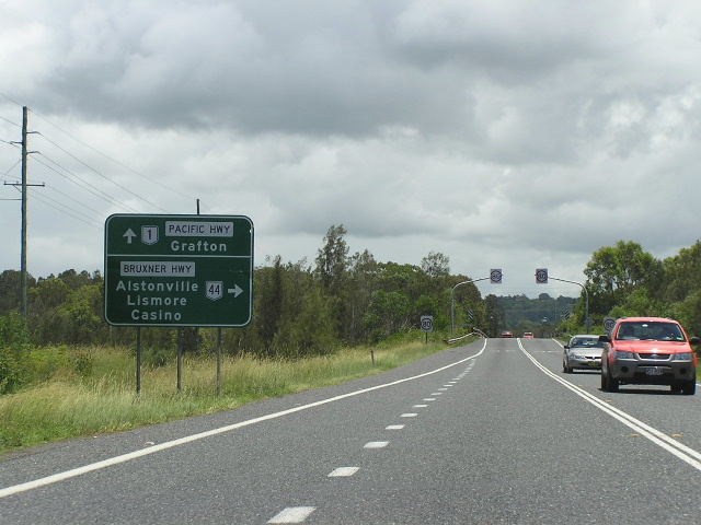 |
Second southbound AD sign for Bruxner Hwy. Jan 2005. |
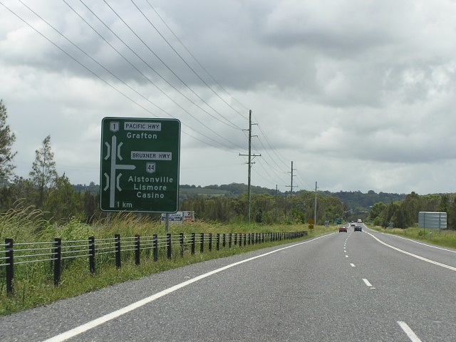 |
First southbound AD sign for Bruxner Hwy. Jan 2005. |
 |
Distance sign heading south (west) from Ballina. Jan 2005. |
 |
Northbound AD sign for Burns Point Ferry Rd on the western outskirts of Ballina. Nov 2005. |
|
Old Pacific Highway (River St, River Dr & Burns Point Ferry Rd) |
|
 |
The Burns Point Ferry northern landing. Unfortunately the ferry wasn't working this day so I didn't get the chance to use it. Nov 2005. |
 |
Looking south along the original pavement to the original ferry landing. By the time the Richmond River was bridged, two ferrys were working at this location and the newer ferry landing (probably added in the late 1940s) is the one still in use. Nov 2005. |
 |
Looking north along Burns Point Ferry Rd towards Pacific Hwy. Note the yellow line-marking remnants and the 1930s cement concrete pavement. Nov 2005. |
 |
Looking south along Burns Point Ferry Rd from Pacific Hwy, showing widening of the original surface to cope with additional local traffic. Nov 2005. |
1. http://www.rta.nsw.gov.au/constructionmaintenance/majorconstructionprojectsregional/pacifichighwayupgrade/programdetails/ballinabypass.html Accessed: 9 December 2005