State Route 89 the former route of Hume Highway |
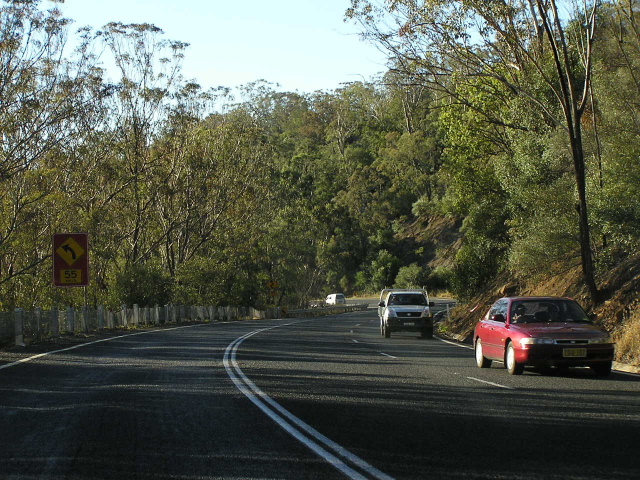
Camden Bypass, looking north from Old Hume Highway at Camden South. The Macarthur Bridge over the Nepean River is in the background. June 2006.
In 2013, RMS will be implementing a new alpha-numeric route numbering system. For more information, visit the RMS Website. |
RMS have advised that this route will be decommissioned and not replaced by an alpha-numeric route number. |
Length: 83km
Northern Terminus: Hume Highway & South Western (M5) Motorway & Camden Valley Way, Prestons
Southern Terminus: Hume Highway & Church Ave & Old Hume Highway, Alpine
Route taken: Camden Valley Way, Narellan Road, Camden Bypass, Old Hume Highway, Remembrance Driveway, Argyle Street (Picton), Remembrance Driveway, Old Hume Highway
Focal Points: Liverpool, Leppington (nb only), Camden, Picton, Mittagong, Yanderra/Yerrinbool
RTA Internal Classification: Main Road No. 620 (except Narellan Road section), Main Road No. 178 (Narellan Road)
Route Overview:
State Route 89 is a north-south route in Sydney's outer south-west, paralleling the Hume Highway (Metroad 5 & National Highway 31) from Prestons, near Liverpool, to Alpine, near Mittagong. As this description suggests, State Route 89's major role is as a parallel route to the Hume Highway for local traffic between Liverpool, Camden, Picton, Bargo, Yerrinbool and Mittagong. It largely follows the former gazetted route of Hume Highway, immediately prior to the Hume Highway being moved onto the South Western Freeway in 1984.
State Route 89 is made up largely of two-lane undivided roads that formerly comprised the Hume Highway, however there are several sections of four-lane dual carriageway conditions, namely at Prestons, Narellan Road, the Camden Bypass, Camden South, and Tahmoor.
A highlight of the route is the Macarthur Bridge, a 26-span, 3380 feet (approximately 1.12km) long concrete structure that carries the Camden Bypass across the Nepean River and its flood plain. The bridge was built between 1971 and 1973, originally to carry Hume Highway traffic, on a flood-free alignment around Camden.
History:
As previously mentioned, State Route 89 functions as a paralleling route for National Highway 31 (the Hume Highway) between The Cross Roads and Alpine, near Mittagong. Thus, its history is closely linked with the construction of that section of the Hume Highway. I have been able to narrow down the date when State Route 89 was introduced to either 1977 or 1980.
In May 1977 the section of Hume Highway (then South Western Freeway) between Yanderra and Alpine was opened to traffic. There is little doubt that National Highway 31 was moved onto the new freeway, however it is not known whether State Route 89 signs were erected along the old route via Yerrinbool immediately or whether they came later.
In December 1980 the section of Hume Highway (then South Western Freeway) between Narellan Road and Yanderra was opened to traffic creating, for the first time, a continuous through route from Liverpool to Mittagong that avoided the original Hume Highway alignment. There is little doubt that National Route 31 was moved onto the freeway (and upgraded to National Highway status) at this time. With an 83-kilometre old alignment leftover, this time seems the most ideal to have introduced State Route 89. Indeed, commercial maps from the era seem to support this theory. So, in the absence of any further evidence, I will take 1980 as the time of introduction for State Route 89.
At the time of introduction, State Route 89 basically resembled its current alignment, from Prestons to Alpine via Camden and Picton, with one exception. There was a direct connection from Camden Valley Way (then Hume Highway) and the Camden Bypass (then Hume Highway), avoiding the current dog-leg at Narellan Road in Narellan. However, following the opening of the South Western Freeway (now Hume Highway) between Narellan Road and Yanderra, through traffic via Picton, Camden and the Camden Valley Way was discouraged, and the direct connection between Camden Bypass and Camden Valley Way was removed sometime during the 1980s - approximately 1986.
Despite State Route 89 remaining largely in its original form, it has had several changes at its southern end.
In March 1989, the Berrima Bypass on Hume Highway was opened to traffic and State Route 89 was assigned to the old highway route. However, apart from being separated from the remainder of State Route 89 by 10km, this section of State Route 89 was only signposted at either end of the bypass, and at the junction with Medway Road. All these intersections necessitated new signposting as part of the bypass opening, whilst the other sections of the old highway were left untouched by State Route 89 shields.
In August 1992, the Mittagong Bypass on Hume Highway was opened to traffic. This project effectively completed construction of the South Western Freeway/Hume Highway south of Liverpool and State Route 89 was also introduced along the old Hume Highway through Mittagong, forming a continuous 25km southern leg of State Route 89 from Aylmerton to south of Berrima. The southern section of State Route 89 was linked to the original section at Alpine via the Hume Highway, however the connection (a NH31/SR89 duplex) was never signed and, as far as any motorist was concerned, they could well have been separate routes.
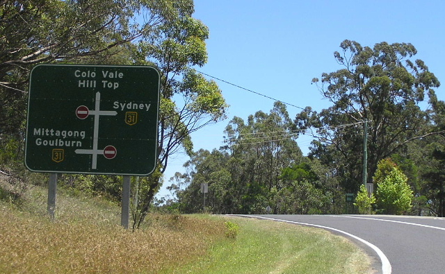
Furthermore, State Route 79, a major north-south route connecting the Hume and Princes Highways, splits off the former Hume Highway in Mittagong and seemed worthy of continuation northwards from Mittagong to meet Hume Highway at Aylmerton. Perhaps the RTA realised this, because in 1996 several changes to the classified road network in the Mittagong/Berrima area were made, including the extension of Main Road No. 260 (the Mittagong - Bowral - Moss Vale route) from Mittagong along the old Hume Highway to Aylmerton. It is fairly safe to assume that, along with this extension, came the extension of State Route 79 (as per new signage on the route) and the decommissioning of State Route 89 through Mittagong, Welby and Berrima. The old route of State Route 89 from Aylmerton to Berrima was replaced by a Tourist Drive - No. 17 - however, this route is not particularly well signposted even 11 years after its introduction in 1996.
Future:
The future of State Route 89 is very uncertain. Recent signage erected in 2005 and onwards omits the State Route 89 shield, indicating that it may well be completely decommissioned with the introduction of alpha-numeric route marking in NSW. In all fairness, the route does serve little purpose as a through route (except as a tourist drive, which is catered for adequately by Tourist Drive 12) and should probably be decommissioned. It is place, a route from Narellan Road to Picton via Razorback Range, thence to the Bargo could be used to replace it.
Notable events:
1977 - South Western Freeway opens between Yanderra and Alpine, SR89 possibly introduced
1980 - South Western Freeway opens between Narellan Rd & Yandrra, SR89 most probably introduced along former route of National Route 31
1984 - Route of State Route 89 becomes Main Road No. 620, Hume Highway redeclared to follow freeway
c.1986 - Direct connection between Camden Valley Way & Camden Bypass closed, SR89 routed via Narellan Road
1989 - Berrima Bypass opens, State Route 89 introduced along former route of Hume Highway
1992 - Mittagong Bypass opens, State Route 89 introduced along former route of Hume Highway
1996 - State Route 89 decommissioned between Alpine and Berrima, replaced by State Route 79 and Tourist Drive 17
2005 - Signs erected along Camden Valley Way omit SR89 shield, placing the route's future in doubt
Further information:
The history of the roads that State Route 89 takes is covered in depth in the Hume Highway section.
 |
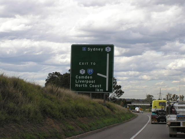
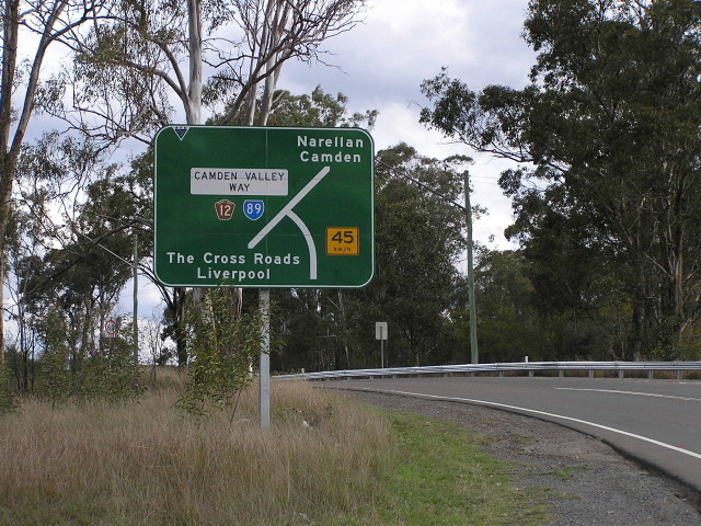
Hume Highway (currently unnumbered, formerly Metroad 7) southbound approaching the beginning of State Route 89 signage at The Cross Roads. The section of Hume Highway (local name: Camden Valley Way) between The Cross Roads and the junction with the M5 Motorway is actually technically unnumbered, but State Route 89 signage begins early to provide easy guidance for Hume Highway traffic. Dec 2004. |
 |
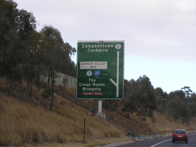
Hume Highway (Campbelltown Rd) northbound approaching The Cross Roads. Similar to the sign in the above photo, State Route 89 signage begins early. Jan 2004. |
 |
Hume Highway (Camden Valley Way) westbound approaching the junction with the M5 South Western Motorway at Prestons. This interchange is the official starting point of State Route 89. Also, note how the last three signs have each used different focal points for SR89 - how confusing! July 2006. |
 |
Old southbound AD sign on the South Western (M5) Motorway, approaching the Camden Valley Way exit. Note that this interchange was the former southern terminus of Metroad 7 as well as the beginning of State Route 89. With SR89 seemingly to be decommissioned upon the introduction of alpha-numeric route marking, the replacement sign has no State Route 89 shield. July 2004. |
 |
Signage for State Route 89 northbound on Hume Highway approaching the Camden Valley Way interchange at Prestons. New signage erected following the opening of the Westlink M7 does not include the State Route 89 shield. Notice how this sign has 'EXIT TO' rather than a proper road name. Oct 2004. |
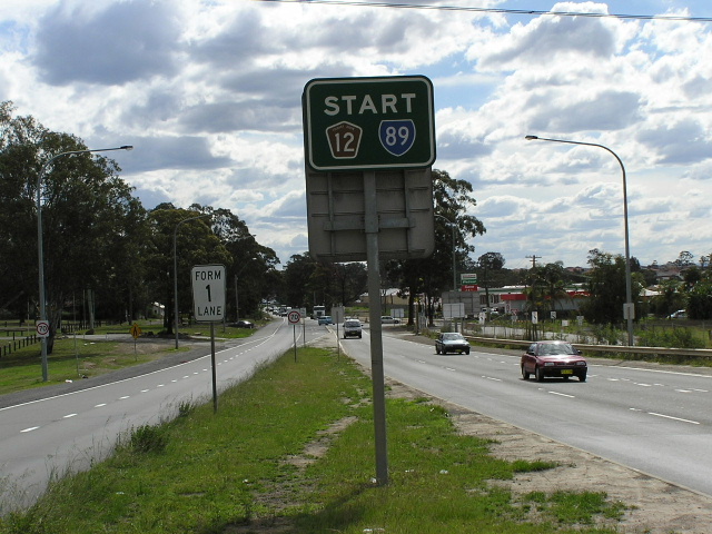 |
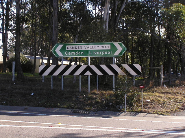
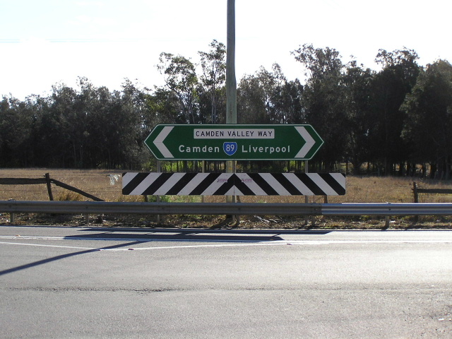
Unusual sign acknowledging the beginning of both State Route 89 and Tourist Drive 12 at the Camden Valley Way/SW Motorway junction. Oct 2004. |
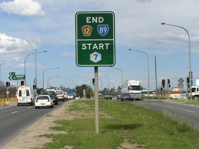 |
The opposite side of the above sign, showing the end of State Route 89/Tourist Drive 12 and the beginning of Metroad 7. Oct 2004. |
 |
The first southbound distance sign on State Route 89 (now replaced by one excluding the State Route 89 shield), heading west along Camden Valley Way at Prestons. This section of road was upgraded to a four-lane dual carriageway configuration in conjunction with the construction of the Westlink M7. Oct 2004. |
 |
New AD sign, installed as part of the upgrade of Camden Valley Way, southbound on Bernera Rd approaching Camden Valley Way at Prestons. Note the exclusion of both the State Route 89 and Tourist Drive 12 shields. July 2006. |
 |
Camden Valley Way looking east at the intersection with Bernera Rd, Prestons, showing completed upgrade work. July 2006. |
 |
Camden Valley Way looking west approaching Cabramatta Creek. The section of road between Bernera & Cowpasture Roads was not upgraded to complement the Westlink M7. July 2006. |
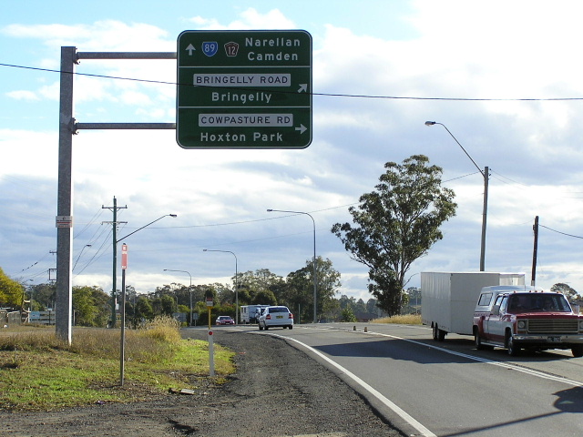 |
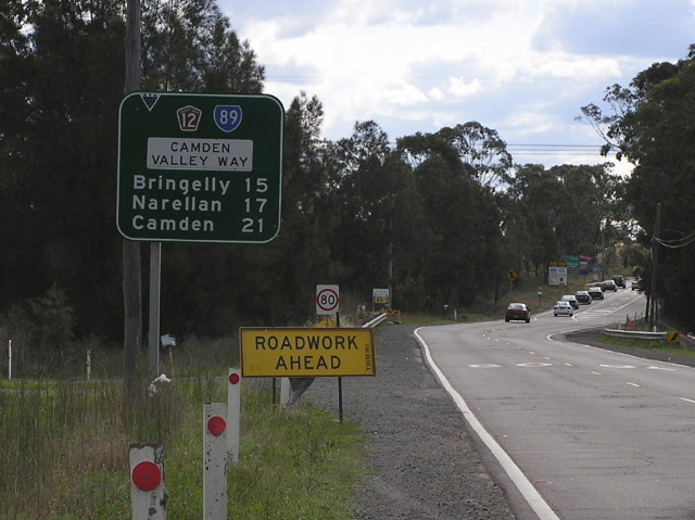
AD sign westbound on Camden Valley Way approaching Cowpasture & Bringelly Roads. July 2006. |
 |
Distance sign on Camden Valley Way, heading east from Cowpasture & Bringelly Roads. July 2006. |
 |
AD sign southbound on Cowpasture Road approaching Camden Valley Way and Bringelly Road. July 2006. |
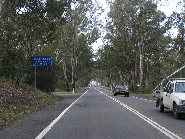 |
Camden Valley Way looking north-west alongside the Forest Lawn Cemetery at Leppington. This section of road was constructed as a deviation of the Hume Highway in the late 1920s. Oct 2004. |
 |
Unusual diagrammatic AD sign southbound on Cowpasture Road approaching Camden Valley Way at Leppington. Note that Camden Valley Way junctions with two separate sections of Cowpasture Road. Oct 2004. |
 |
Camden Valley Way, looking north through the tiny village of Leppington. Leppington is used as a focal point for northbound traffic to discourage through traffic between Narellan and Liverpool from using Camden Valley Way. July 2006. |
 |
New ID sign at the junction of Camden Valley Way & Denham Court Rd in Leppington. Note the lack of a State Route 89 or Tourist Drive 12 shield. July 2006. |
 |
Camden Valley Way looking south between Park Road and St Andrews Road, Leppington. The road is made up of a cement concrete base that was constructed in the late 1920s/early 1930s, an asphalt wearing course and shoulders that were added later. Dec 2005. |
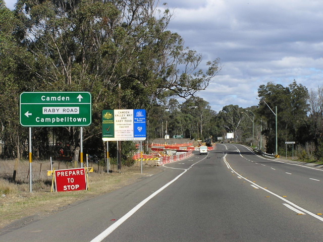 |
Camden Valley Way looking south towards Raby Road, showing new AD sign with no State Route 89 shield. The roadworks in the background are the reconstruction and signalisation of the intersection. July 2006. |
 |
ID sign facing Raby Road traffic at the junction of Camden Valley Way & Raby Road, Leppington. July 2006. |
 |
Hybrid ID/fingerboard sign on Camden Valley Way at the junction with Deepfields Rd, Catherine Field. July 2006. |
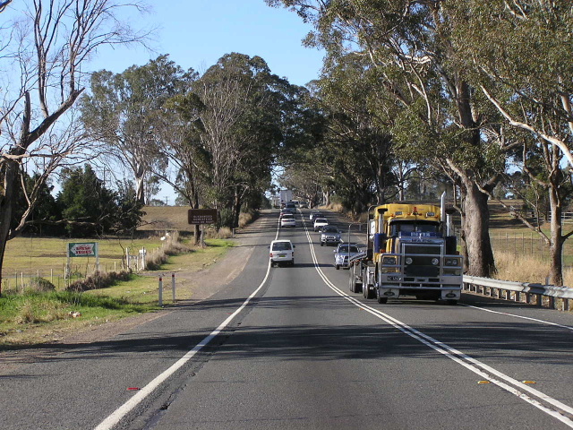 |
Camden Valley Way looking north between Springfield Rd and Catherine Field Rd, Catherine Field, showing heavy afternoon traffic bound for Narellan. Aug 2005. |
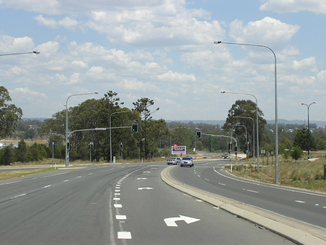 |
Camden Valley Way looking south at Anderson Rd & Sir Warwick Fairfax Dr, Smeaton Grange, showing recent upgrading in connection with urban development north of Narellan. Nov 2006. |
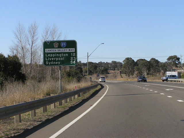 |
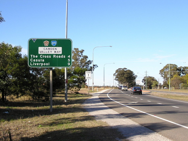
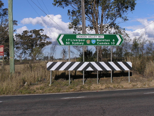
Northbound distance sign on Camden Valley Way, heading north from Narellan Rd. Note the focal points of Liverpool and Sydney still correspond to the route's days as part of the Hume Highway. Aug 2005. |
 |
New (2004) AD sign southbound on Camden Valley Way approaching Narellan Rd at Narellan. Note the use of 'Camden Bypass' as a focal point - a relic from the closure of the direct connection from Camden Valley Way to Camden Bypass in the 1980s. Also note the 'C5' kilometre plate - something not seen very often in Sydney these days. May 2005. |
 |
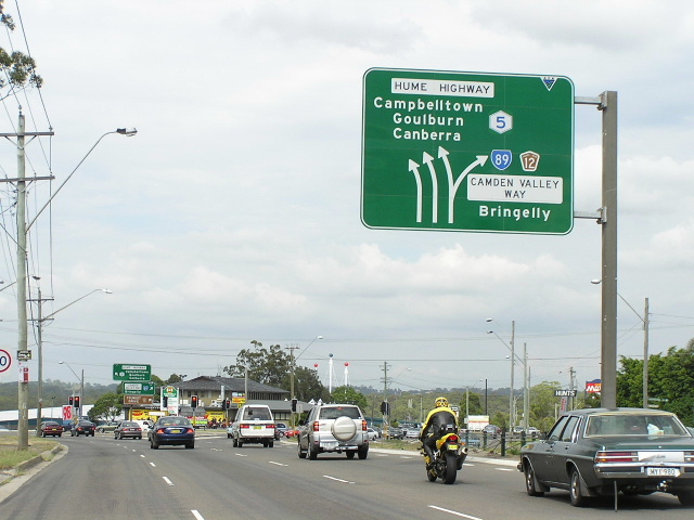
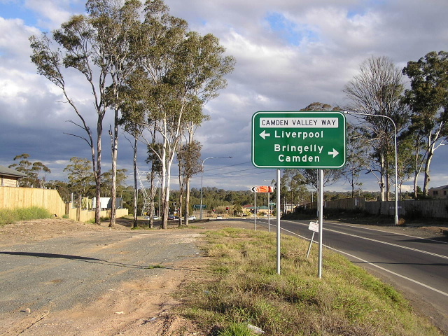
Camden Valley Way northbound approaching Narellan Rd at Narellan. Note how State Route 89 is signed for 'Leppington' to discourage through traffic to Liverpool from using this road. June 2006. |
 |
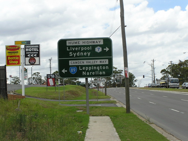
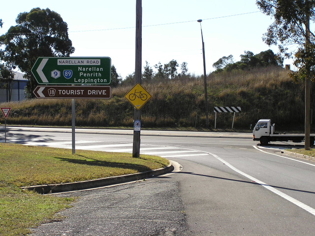
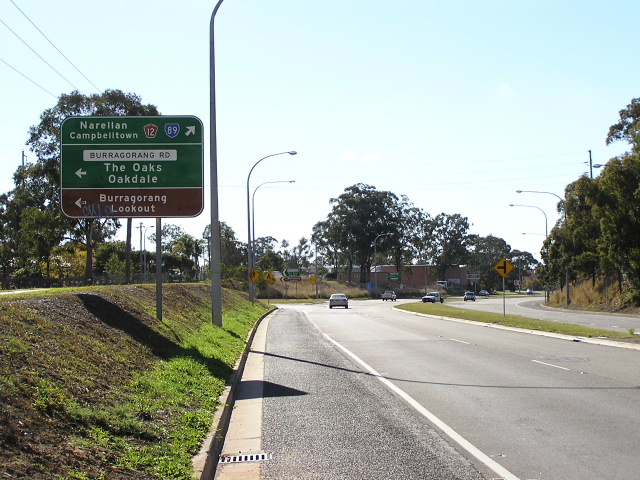
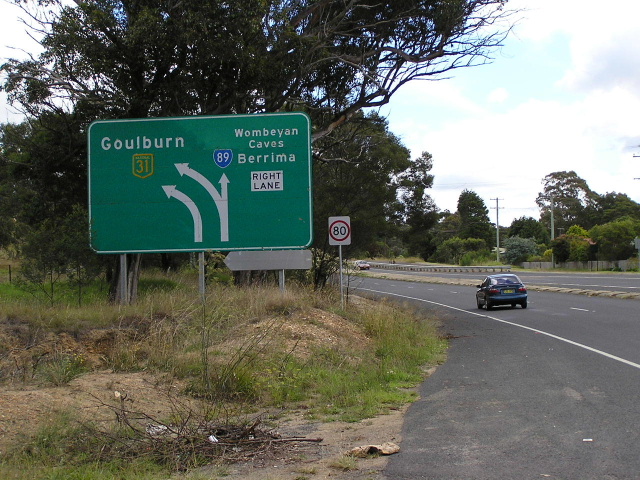
Narellan Rd eastbound approaching the junction with Camden Bypass at Narellan. Due to 1980s the closure of a direct connection between Camden Valley Way and the Camden Bypass, State Route 89 traffic encounters this short dog-leg between the two. June 2006. |
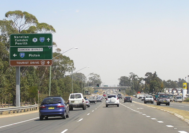 |
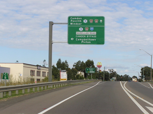
Narellan Rd westbound approaching the junction with Camden Bypass at Narellan. Note that, unlike in the opposite direction, Camden is not signed via the bypass. 'Camden/Penrith' on the top panel is on a coverplate covering 'Penrith/Leppington' - this is a recent change (spring 2006). Nov 2006. |
 |
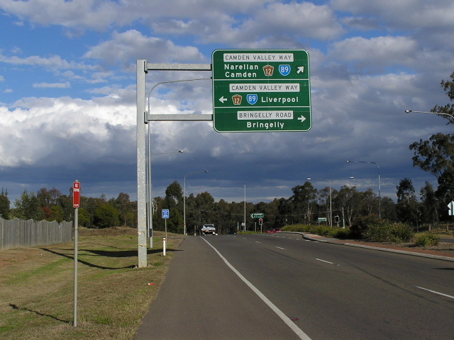
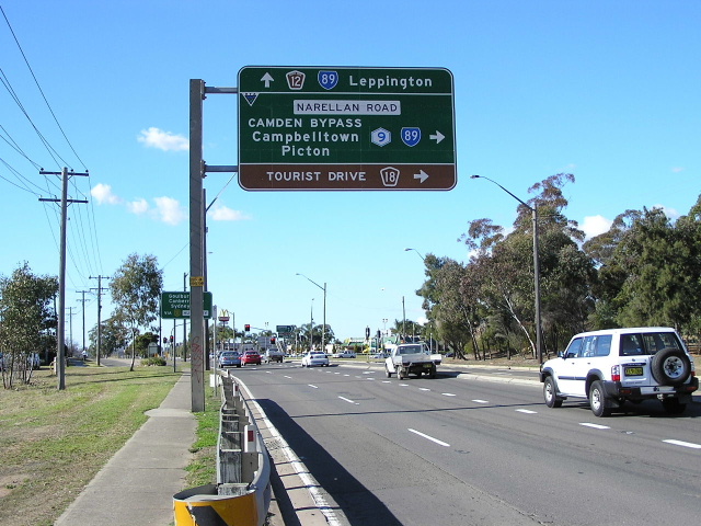
ID sign assembly at the junction of Narellan Rd & Camden Bpass. Note again the use of Leppington as a focal point for northbound State Route 89 traffic. June 2006. |
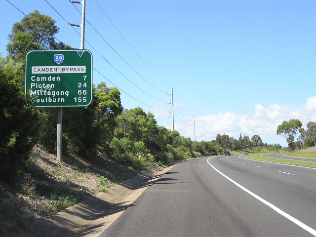 |
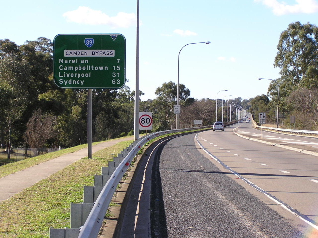
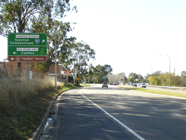
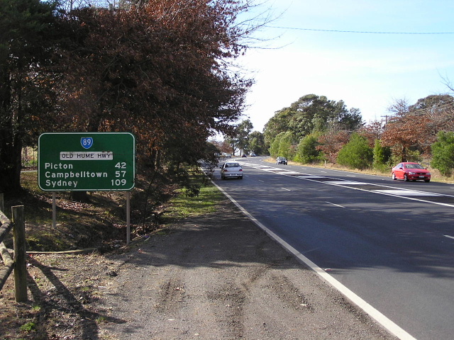
Distance sign southbound on Camden Bypass. Note the focal points - I wouldn't be surprised if this sign ahd the same focal points back when it was part of the Hume Highway. Dec 2005. |
 |
Looking south along Camden Bypass. Dec 2005. |
 |
Camden Bypass southbound approaching the grade-separated junction with Macarthur Bridge. It is here that the four-lane dual carriageway road becomes a two-lane single carriageway across the Nepean River. Dec 2005. |
 |
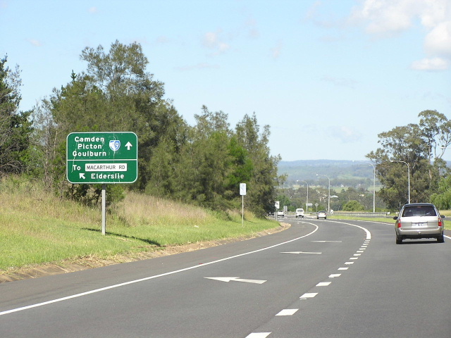
Sign assembly on the ramp from Macarthur Road to Camden Bypass at Elderslie. The access from Macarthur Rd to Camden Bypass southbound involves crossing the northbound carriageway at-grade. May 2005. |
 |
ID sign at the junction of Macarthur Rd and the on-ramp to Camden Bypass, Elderslie. The northern end of Macarthur Bridge can be seen in the background. May 2005. |
 |
Looking south across Macathur Bridge, which carries Camden Bypass across Macarthur Road, Belgenny Ave, the Nepean River and its large floodplain. July 2004. |
 |
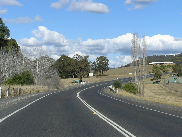
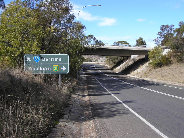
Old Hume Highway northbound approaching the junction with Camden Bypass at Camden South. Here we see the split of two generations of Hume Highway alignments - the route through Camden (1928-1973) and the Camden Bypass (1973-1984). June 2006. |
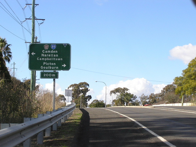 |
AD sign eastbound on Burragorang Rd approaching Old Hume Highway at Camden South. Note the focal point of 'Goulburn' - a throwback to the route's days as part of the Hume Highway. June 2006. |
 |
AD sign northbound on Old Hume Highway approaching Burragorang Rd, Camden South. Why doesn't Camden get a mention straight ahead, when it is the focal point? June 2006. |
 |
Distance sign on Old Hume Highway, heading south in Camden South. Note the focal points still pertain to the old route of Hume Highway. This section of road (through Camden South) used to be 'Former Hume Highway' but this was changed to 'Old Hume Highway' in 2004. Dec 2005. |
 |
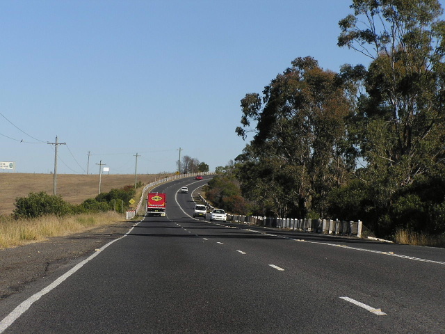
Looking south along Old Hume Highway through Camden South. This section of four-lane dual carriageway road was constructed to complement the Camden Bypass in the early 1970s. June 2006. |
 |
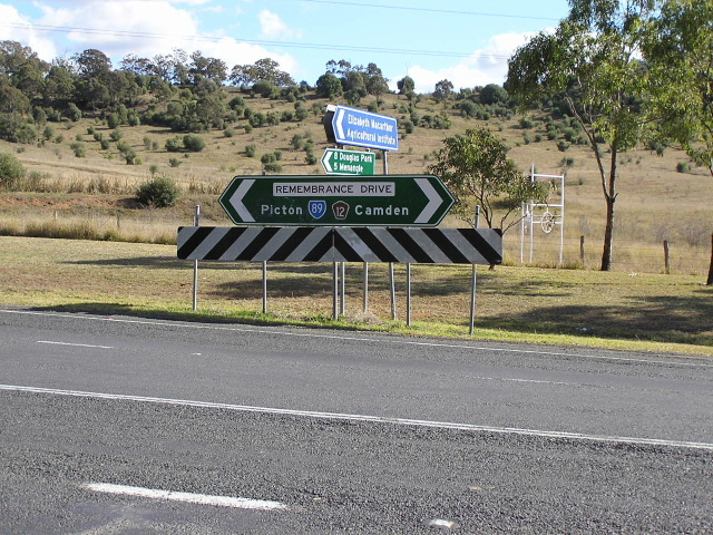
Dual ID signs at the intersection of Remembrance Drive & Cawdor Rd, Cawdor. Note the focal point of 'Goulburn' - a definite relic of the Hume Highway days. The focal point should actually be Picton. June 2006. |
 |
Remembrance Dr looking south towards the junction with Finns Road. As you can see, Finns Road branches off at an acute angle, indicating it was once the original through route - which it was, prior to the construction of this route of the Hume Highway in the late 1920s. June 2006. |
 |
Perfectly design ID sign at the intersection of Remembrance Dr & Finns Rd. June 2006. |
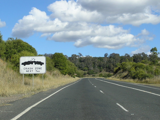 |
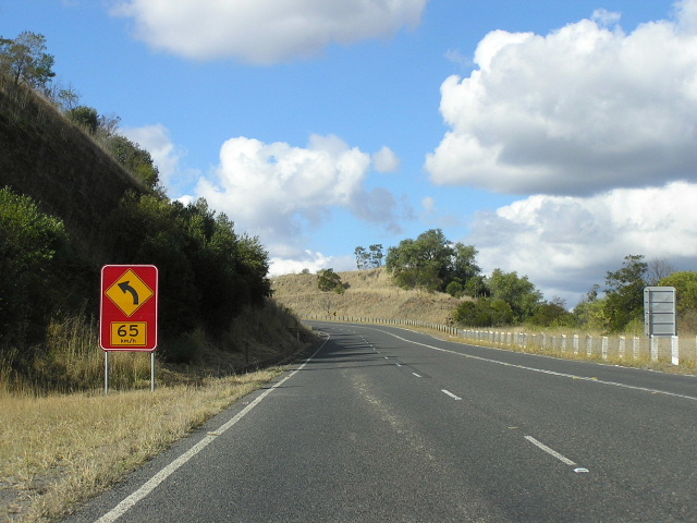
'Crash Zone' warning sign, southbound on Remembrance Drive as you begin to ascend the Razorback Range, south of Finns Road. Prior to the opening of the current Hume Highway route, Razorback Range was notorious for landslides and crashes. June 2006. |
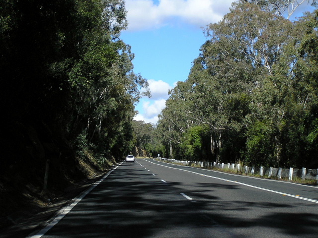 |
Looking south along Remembrance Drive, about midway up the ascent of Razorback Range. Note the old chain wire fence and wooden posts, its like a step back into the mid 20th century. June 2006. |
 |
Looking north along Remebrance Drive, showing the descent of Razorback Range towards Camden. June 2006. |
 |
Looking south along Remembrance Driuve approaching the top of Razorback Range. Note how the last four photos have all had climbing lanes in them - following major landslides on this route in the 1970s, the then Highway was reconstructed to mostly three lanes along the length of Razorback Range. June 2004. |
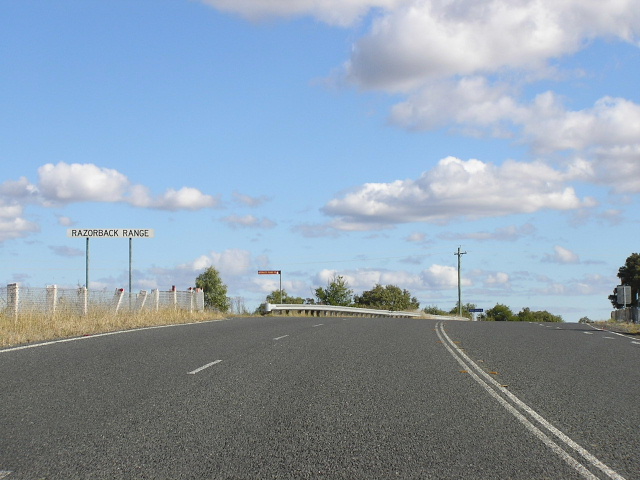 |
Sign announcing the top of Razorback Range for southbound traffic, at the intersection of Remembrance Drive & Donalds Range Rd. June 2006. |
 |
On the southern side of Razorback Range, this view shows the northbound ascent. June 2006. |
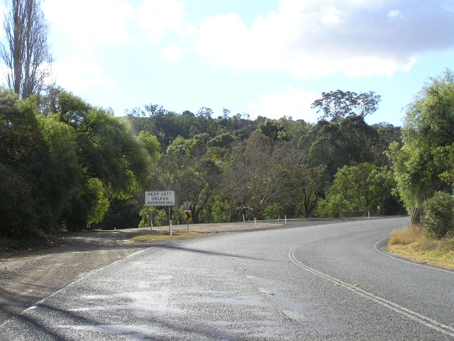 |
Looking north at the southern end of Razorback Range, just north of Racecourse Creek. This is the beginning of the climb for northbound traffic and the original Hume Highway route can be seen branching off to the left at the 'Keep Left Unless Overtaking' sign. June 2006. |
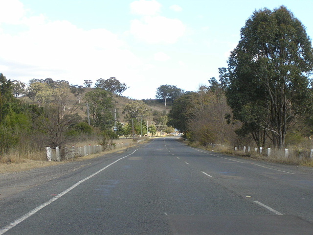 |
Looking south between Razorback Range and Picton. The chain wire fencing and wooden posts again give the road a heritage quality. June 2006. |
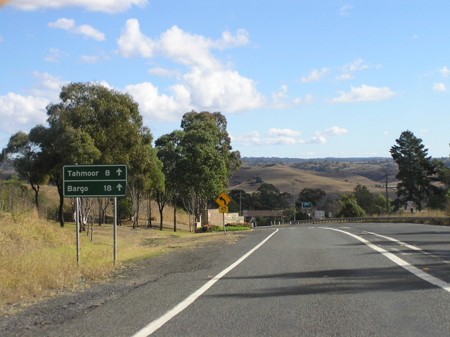 |
Unusual AD(?) sign on the southbound approach to Picton, showing distances for Tahmoor and Bargo. June 2006. |
 |
Non-standard distance sign heading north from Picton at the intersection with Jarvisfield Road (an old alignment of Hume Highway). June 2006. |
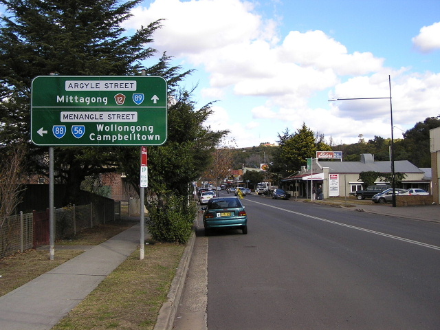 |
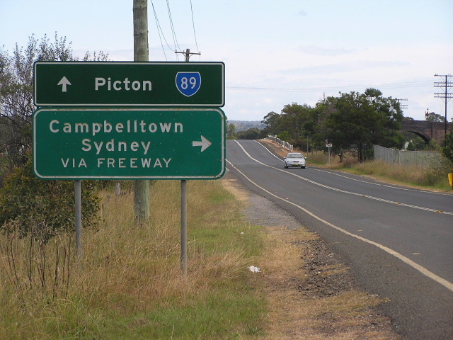
Through Picton, State Route 89 becomes Argyle Street. This sign is southbound approaching the junction with Menangle Street in Picton town centre. June 2006. |
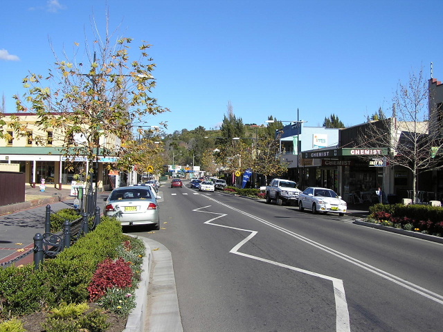 |
Argyle Street looking south through Picton town centre. June 2006. |
 |
Non-standard AD sign northbound on Argyle Street approaching Menangle St, Picton. June 2006. |
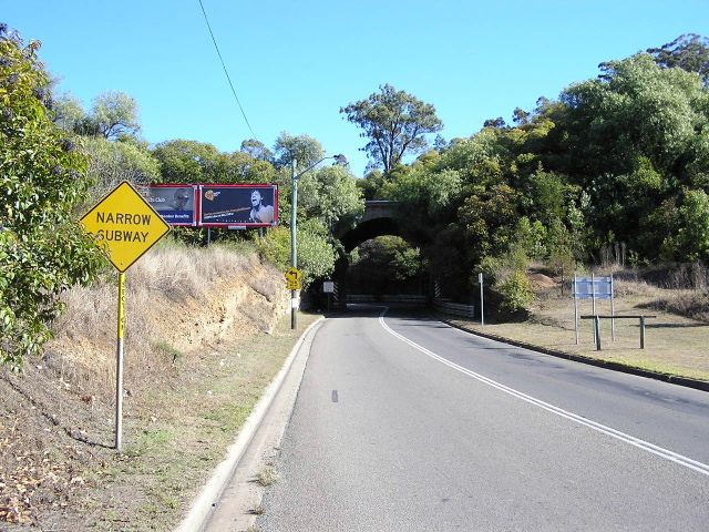 |
Argyle St looking south to the narrow subway, complete with right-angle bend afterwards, which takes State Route 89 under the Main Southern Railway Line. June 2006. |
 |
Argyle Street looking south through the southern part of Picton, approaching the junction with Thirlmere Way. Note the wide pavement - once upon a time planned to carry dual carriageways of Hume Highway traffic. June 2006. |
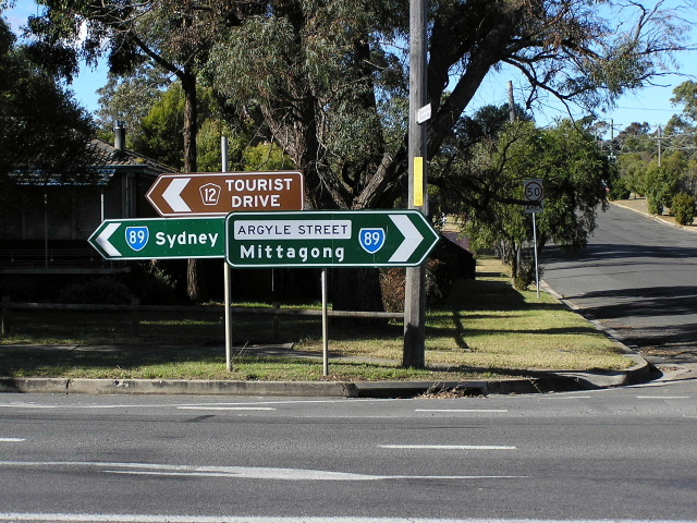 |
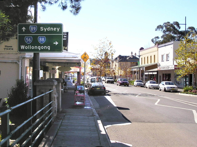
ID sign assembly at the intersection of Argyle Street & Thirlmere Way. Note the long distance focal point (Sydney) that has remained, despite the southbound focal being changed to Mittagong (formerly Goulburn). June 2006. |
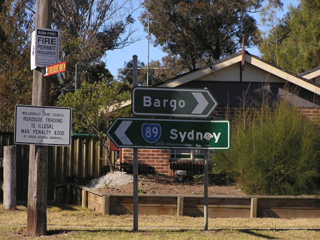 |
Unusual black ID sign without a State Route 89 shield and with the focal point of 'Bargo' along with a non-standard ID sign showing the old focal point of Sydney, at the intersection of Remembrance Drive & Thirlmere Way, Tahmoor. June 2004. |
 |
Remembrance Drive looking south through the commercial centre of Tahmoor, showing reconstruction underway by Wollondilly Shire Council. June 2006. |
 |
ID sign assembly at the junction with Bargo River Rd, south of Tahmoor. Again note the remaining 'Sydney' focal point. June 2004. |
 |
Looking south along Remembrance Drive through Bargo. Dec 2005. |
 |
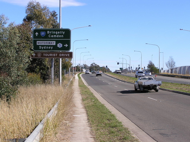
Remembrance Driveway northbound approaching Avon Dam Road, Bargo. Note the freeway green sign guiding traffic to Sydney via the Freeway (now Hume Highway). March 2005. |
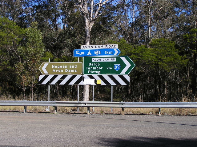 |
A remote mention of State Route 89 at the junction of Hume Highway & Avon Dam Rd near Bargo. June 2006. |
 |
Distance sign heading north on Remembrance Drive near Lupton Rd, Bargo. June 2006. |
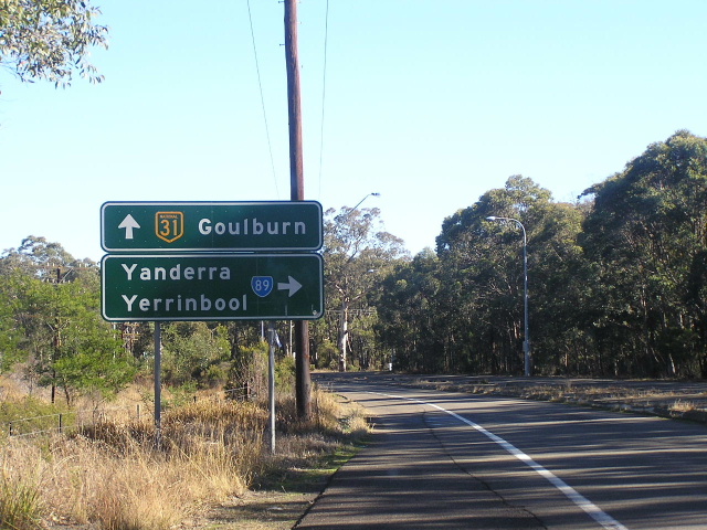 |
Very non-standard AD sign assembly southbound on Remebrance Drive, approaching the on-ramp to Hume Highway at Yanderra. Note that there is no mention of Mittagong, despite it being featured on most signs south of Picton. June 2006. |
 |
Looking south at one of the many railway crossings between Yanderra and Alpine. This bridge dates from the construction of the Picton-Mittagong deviation of the Main Southern Railway line in 1919. July 2006. |
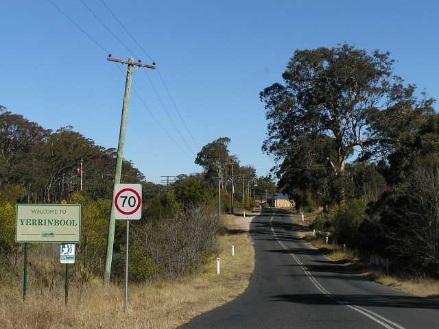 |
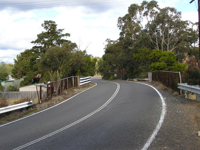
Looking south along Old Hume Highway into Yerrinbool. July 2004. |
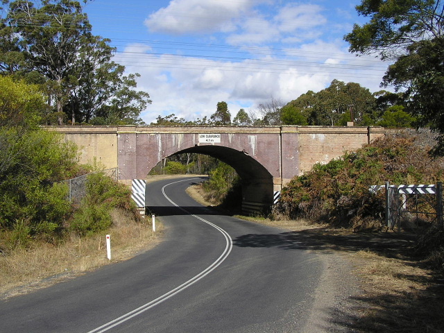 |
Looking south at the subway that take Old Hume Highway under the Main Southern Railway Line at Yerrinbool. This bridge also dates from the construction of the railway in 1919. July 2006. |
 |
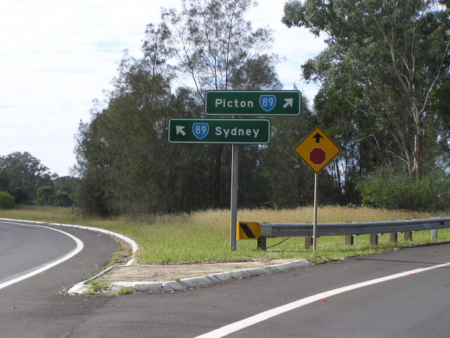
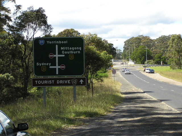
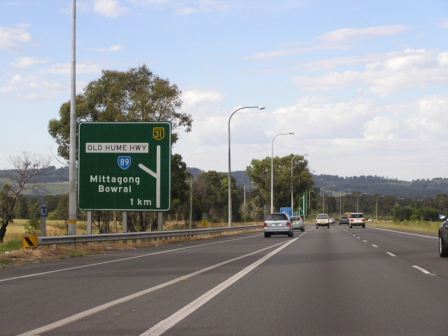
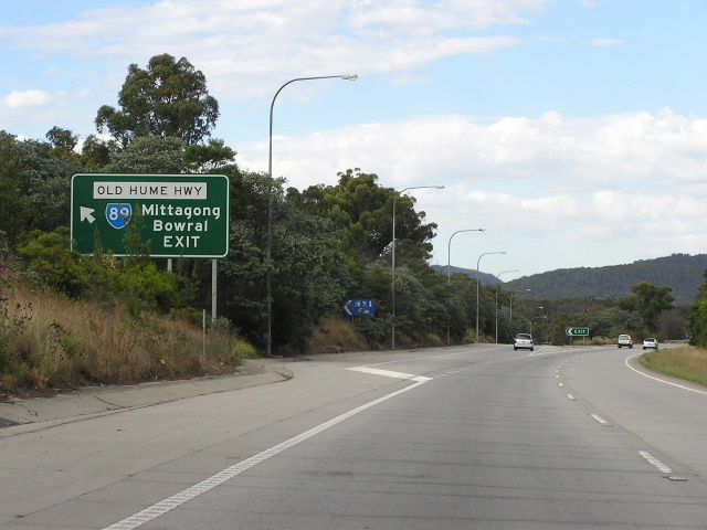
AD sign southbound on Old Hume Highway approaching the junction with Church Ave & Hume Highway at Alpine. This is the southern terminus of State Route 89, however there are plenty of remnants showing State Route 89 through Mittagong and Berrima. Dec 2005. |
 |
AD sign eastbound on Church Ave, approaching Hume Hwy & Old Hume Hwy, showing the beginning of State Route 89. Note the focal point of Yerrinbool - all traffic heading to Bargo and points further north is encouraged to use the Hume Highway. March 2005. |
 |
Hume Highway southbound approaching the interchange with Church Ave & Old Hume Highway at Alpine. Feb 2006. |
 |
AD sign on the northbound ramp from Hume Highway to Church Ave, showing the beginning of State Route 89 at Alpine. Dec 2005. |
 |
Hume Highway northbound approaching the beginning of State Route 89 at Alpine. Dec 2005. |
Former alignment: Alpine to Berrima |
|
 |
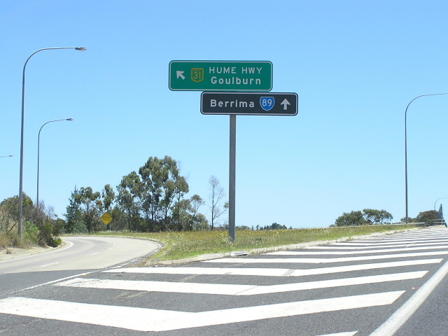
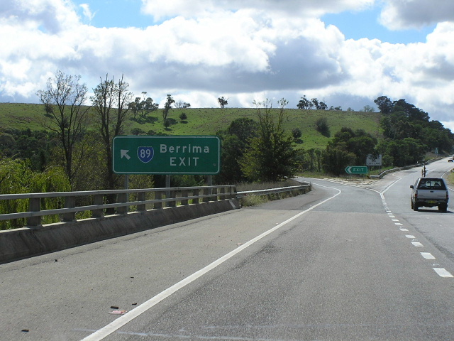
Despite the State Route 89/National Highway 31 duplex never being signed, as far as I know, between Alpine and Aylmerton, State Route 89 continued south along the Old Hume Highway through Mittagong and Berrima. This sign is southbound on Hume Highway approaching the junction with Old Hume Highway at Aylmerton. Feb 2006. |
 |
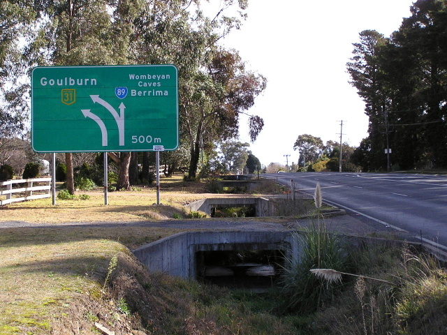
Remnant State Route 89 shield on the ID sign for the Old Hume Highway exit. This sign should actually show State Route 79, which was extended (somewhat secretively) north from Mittagong to Aylmerton in 1996. Feb 2006. |
 |
Remnant State Route 89 distance sign, northbound on Old Hume Highway on the outskirts of Mittagong. This sign has got to be one of the most well-designed signs I have seen in NSW - its a shame the SR89 is still there, making the sign incorrect. July 2006. |
 |
Love this sign! This is an original sign from the Berrima Bypass, which was opened to traffic in March 1989, complete with freeway green colour scheme. It is interesting that between the opening of the Berrima and Mittagong bypasses, State Route 89 was in two sections - north and south of Mittagong. July 2006. |
 |
Another old freeway green sign with State Route 89 shield, on Old Hume Highway approaching Hume Highway at Welby. Note the unusual 'RIGHT LANE' patch which would have been included to assist motorists with the changed traffic conditions in 1989. March 2005. |
 |
Sign assembly at the Old Hume Highway/Hume Highway junction, complete with old style road name, freeway green and standard green sign backgrounds, and, of course, a remnant State Route 89 shield! Dec 2005. |
 |
AD sign northbound on Hume Highway approaching the junction with Old Hume Highway at Welby, complete with remnant State Route 89 shield. March 2005. |
 |
AD sign on the northbound off-ramp from Hume Highway to Old Hume Highway at Welby, showing State Route 89 towards Mittagong but not Berrima - how odd. March 2005. |
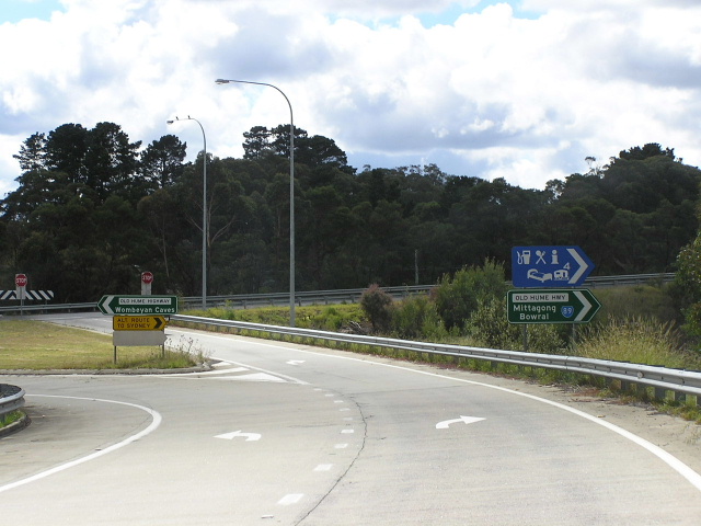 |
ID signs just beyond the above AD sign, also showing State Route 89 via Mittagong but not Berrima. I would say this is an error, done so that traffic would not think SR89 went to Wombeyan Caves. March 2005. |
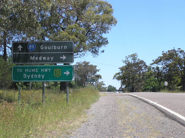 |
AD sign southbound on Old Hume Highway, approaching Medway Road, showing State Route 89 complete with a non-standard black AD sign and freeway green sub-sign. Dec 2005. |
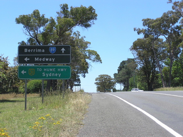 |
AD sign assembly northbound on Old Hume Highway approaching Medway Road. As per the above photo, note the non-standard black AD sign with standard freeway-green sub-sign. Berrima is quite a haven for old roads signs - it adds to the heritage significance of the area :-) Dec 2005. |
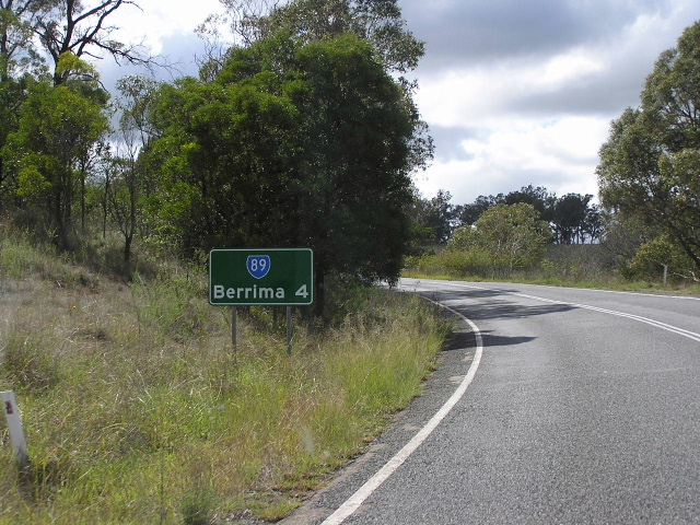 |
Extremely non-standard distance sign, heading north on Old Hume Highway from the old southern terminus of State Route 89 at Hume Highway south of Berrima. This sign is probably a council-designed replacement of an old black RD sign dating from 1989. March 2005. |
 |
Black AD sign eastbound on Mereworth Rd at the junction of Hume Highway, Old Hume Highway and Mereworth Rd - formerly the southern terminus of State Route 89. Note how all the sign is black, indicating this is the southern end of the South Western Freeway (part of Hume Highway). July 2006. |
 |
ID sign facing northbound traffic that has exited Hume Highway onto the former State Route 89. Note the Mereworth Rd name plate - the section of road underpassing Hume Highway at this junction is technically part of Mereworth Rd. March 2005. |
 |
Freeway-green ID sign northbound on Hume Highway at the Mereworth Rd exit - formerly the southern end of State Route 89. This sign dates from the 1989 opening of the Berrima Bypass. March 2005. |
 |
AD sign northbound Hume Highway approaching Mereworth Road near Berrima. Note the freeway green sign background and the remnant State Route 89 shield - this sign hasn't changed since 1989. March 2005. |
 |
AD sign northbound on Hume Highway approaching Mereworth Road near Berrima. The use of the flash shows how freeway green signs were manufactured using reflective polyurethane paint due to the lack of streetlighting. March 2005. |
Last updated 11 December 2012 © Ozroads 2003-2012. |