NATIONAL ROUTE 1
Former Alignments through Sydney
Prior to October 1993, National Route 1 passed through the heart of Sydney. National Route 1 was signposted through Sydney - as part of a larger project between Brisbane and Adelaide - in 1955. The original routing through Sydney was: from the Hawkesbury River, south along Pacific Hwy to North Sydney, then south along Bradfield Highway, York Street, George Street, Broadway and then the Princes Highway (including City Rd and King St) to Waterfall - where it continued south to Melbourne.
Two minor changes in alignment were made in association with construction of new approaches to the Sydney Harbour Bridge. In 1968, southbound NR1 traffic in North Sydney was routed onto Berry, Arthur and Mount Streets to reach the Bradfield Highway, when the Pacific Hwy became one-way northbound. In 1972, the reconstruction of the southern approach to the bridge culminated in the introduction of a one-way street system in the CBD, southbound traffic using York St and northbound traffic using Clarence St.
The first major alignment shift came in December 1986 - the Western Distributor and Harris Street taking National Route 1 around the CBD between the Harbour Bridge and Broadway. In December 1990 a minor alteration was made to this route, with the opening of the Fig Street Connection providing a Wattle St/Fig Street for northbound traffic - Harris Street being made on-way southbound for most of its length.
This alignment was only temporary as soon afterwards it was replaced with an eastern bypass route around the CBD and Airport. In August 1992 the route of National Route was shifted entirely between Lane Cove and Kogarah, making use of the newly-opened Gore Hill Freeway and Sydney Harbour Tunnel. The route was made up of the Gore Hill, Warringah Freeway, Sydney Harbour Tunnel, Cahill Expressway, Palmer St/Bourke St (southbound), Campbell St/Crown St/Sir John Young Crescent (northbound), Flinders St, South Dowling St, Southern Cross Dr, General Holmes Dr, The Grand Pde and President Ave. This new route also made use of other significant works completed in the 1980s, including the William Street Underpass and the Southern Cross Drive extension. I assume the reason that this alignment change was not made until now is that the Cahill Expressway may not have been able to handle the expected traffic volumes across Circular Quay.
However, this new alignment only lasted a year before being completely replaced by Metroad 1 in October 1993. No remnants remain to this day.
Evidence of National Route 1 on its former alignments in Sydney |
|
 |
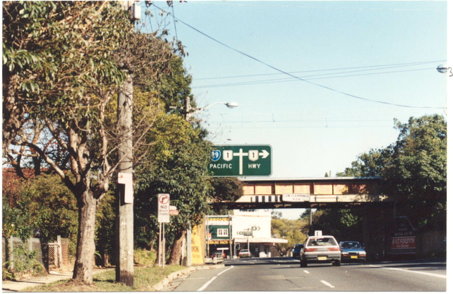
Very old non-reflective AD sign approaching the Pacific Hwy from Berowra Waters Rd in Berowra. This sign became obsolete in March 1989 when the extension of the Sydney-Newcastle Freeway to Wahroonga opened to traffic - relegating this section of the Pacific Hwy to State Route 83 status. Oct 1993. |
 |
ID sign showing NR1 at the Wahroonga Interchange with the Sydney-Newcastle Freeway. April 1993. |
 |
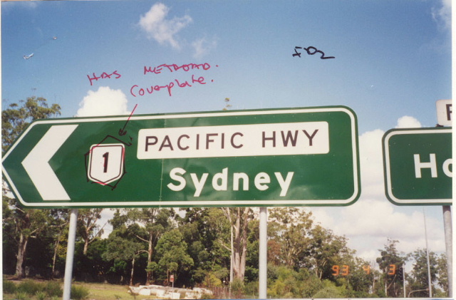
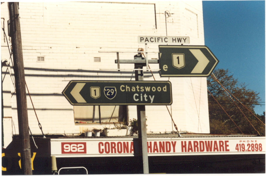
I have to say i LOVE these old signs - they are just so quaint. This particular one is southbound on Pacific Hwy at Boundary St, Roseville. The only place I have seen these is on the Pacific Hwy near Chatswood so perhaps they were a one-off experiment? c.1990. |
 |
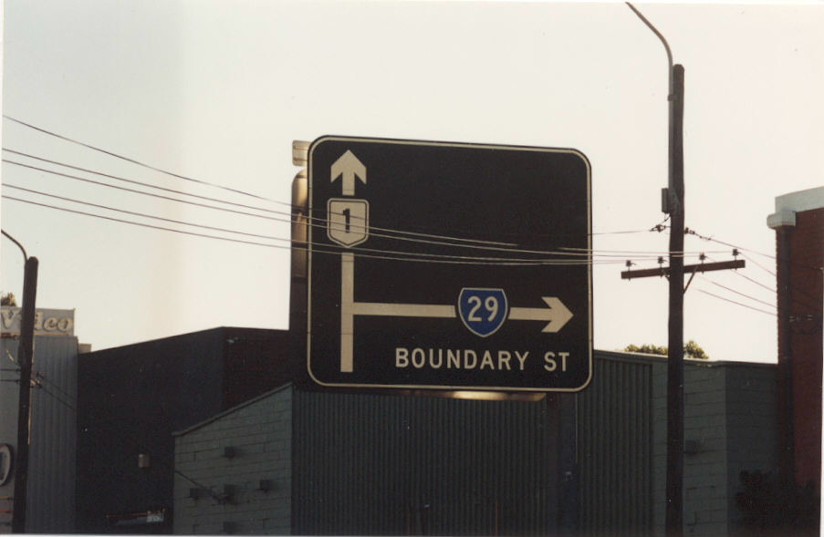
Westbound on Boundary St approaching Pacific Hwy, Roseville. c.1990. |
 |
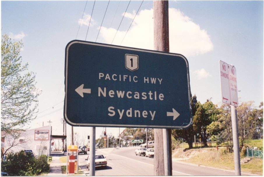
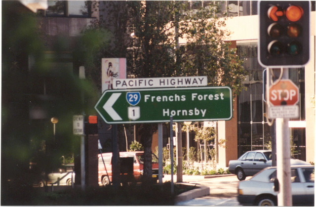
Someone didnt like the focal points of Hornsby and Newcastle :p Same intersection, same time. |
 |
More beautiful unusual diagrammatic signage at the same intersection. c.1990. |
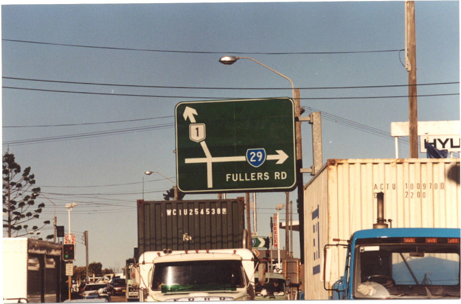 |
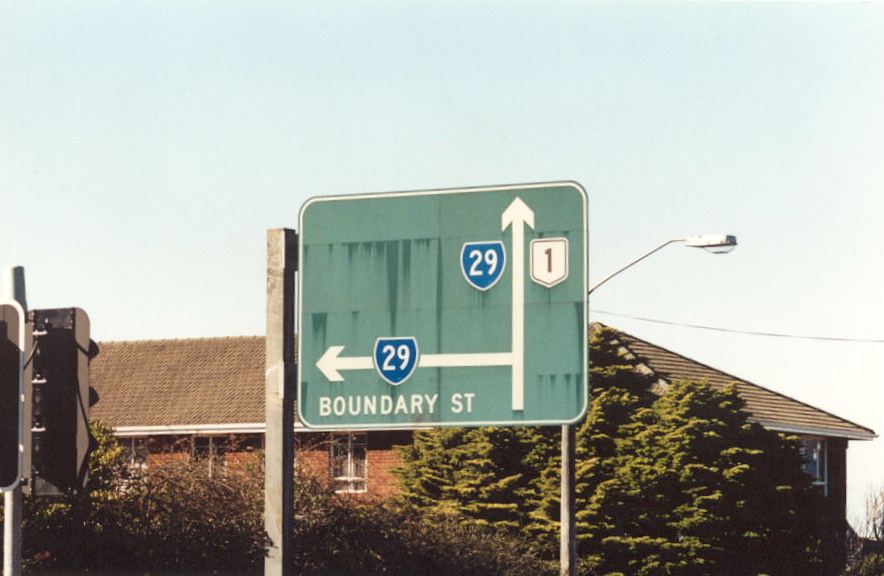
More of the same, this time at Fullers Rd in Chatswood. I suggest that these signs may have been installed in 1974 when SR29 was signposted. c. 1990. |
 |
More great diagrammatic signage, same intersection but this time westbound on Help Street which continues at Fullers Rd. c. 1990. |
 |
Unusual AD sign westbound on Fullers Rd approaching the Pacific Hwy at Chatswood. c. 1990. |
 |
Rare National Route 1 trailblazer at the same intersection. c. 1990. |
 |
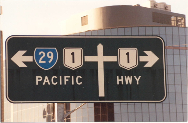
ID sign showing NR1 duplexed with SR29 at the same intersection. c.1990. |
 |
Same intersection. c. 1990. |
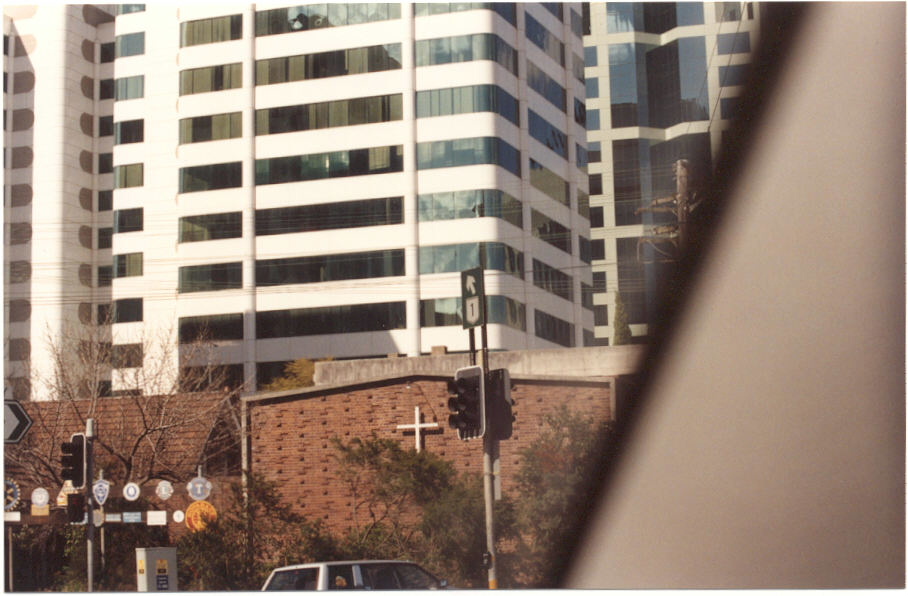
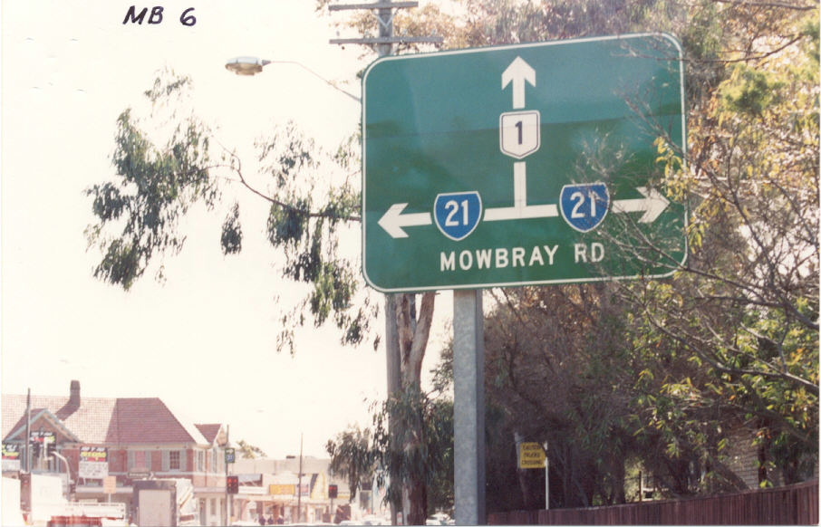
Southbound Pacific Hwy approaching Mowbray Road. c. 1990. |
|
Westbound Mowbray Rd approaching Pacific Hwy. This sign may outdate the introduction of SR21 in 1974 or it could just be an error. c. 1990. |
|
 |
Northbound Pacific Hwy approaching Mowbray Rd, Chatswood. c. 1990. |
Trailblazer southbound on Pacific Hwy at Mowbray Rd. c. 1990. |
|
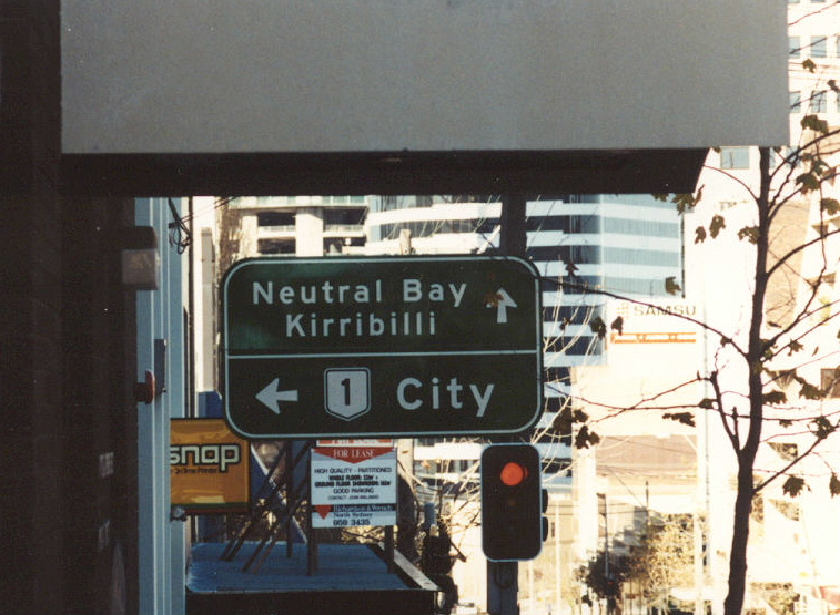 |
Pacific Hwy southbound at Berry St, North Sydney. 1990. |
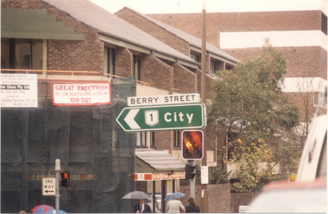 |
ID sign at Pacific Hwy/Berry St intersection. 1990. |
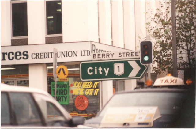 |
Same intersection, this time northbound Pacifc Hwy. 1990. |
Not a NR1 remnant but still a very cool photograph. This was taken sometime between 1959 and 1966, during which time route shields were not yet included on directional signage. Thanks to Viseth Uch for this pic, scanned from the book "Around Australia on Highway 1". |
|
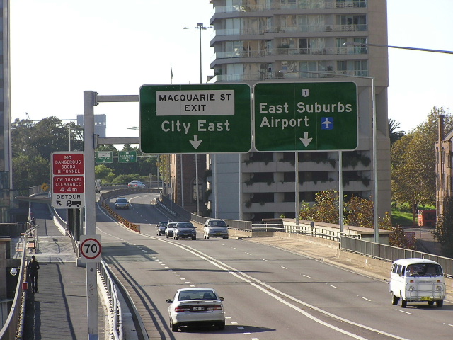 |
Not a remnant, but a National Route 1 shield erroneously on these new (2003) overhead signs on Cahill Expressway. April 2004. |
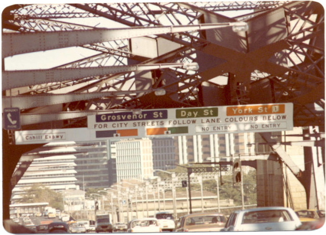 |
Very old gantry sign southbound on the Harbour Bridge, taken in 1974. You can see National Route 1 signed for York St. |
More changeable gantry signage, this time at the southern approach to the bridge. Again note NR1 with York Street. 1974. Scanned from Main Roads Journal. |
|
 |
Close-up of the changeable message signage showing NR1. Scanned from Main Roads Journal. |
 |
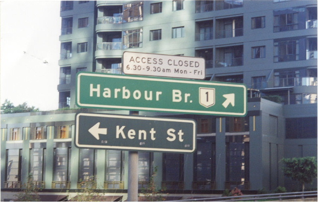
NR1 ID sign with freeway green background at the Kent St onramp to the Harbour Bridge. 1990. |
 |
NR1 ID sign at the same intersection, this time northbound. 1990. |
 |
Clarence St northbound ramp onto the Harbour Bridge showiing NR1 on a freeway green background. 1990. |
 |
This very very old AD sign is northbound on Lee Street at Railway Square, showing NR1 along George Street. 1990. |
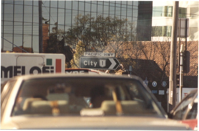
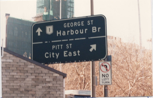
George St southbound approaching Broadway, with a SR66 coverplate over a NR1 shield. 1992. |
|
 |
ID signs at the intersection of Harbour St and Bathurst St. 1990. |
 |
Same intersection but this time northbound on Harbour Street. 1990. |
 |
Again northbound Harbour Street. 1990. |
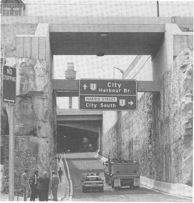 |
NR1 signage on the Fig Street connection. Dec 1990. |
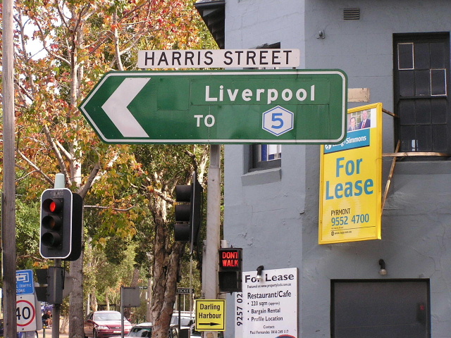 |
Coverplated NR1 shield (among others) on Harris St, Ultimo. April 2004. |
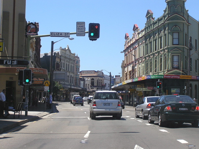 |
The former NR1 route through Newtown (King St). April 2004. |
Back to National Route 1
Back to Metroad 1
Back to Pacific Hwy
Back to Princes Hwy