Pacific Highway New South Wales section: North Sydney to Tweed Heads West |
Pacific Highway heading south near Bulahdelah. Aug 2004.
Length: 841km (approximate, as at November 2011)
Northern Terminus: NSW/QLD Border, Tweed Heads Bypass
Southern Terminus: Warringah Fwy & Bradfield Hwy, North Sydney
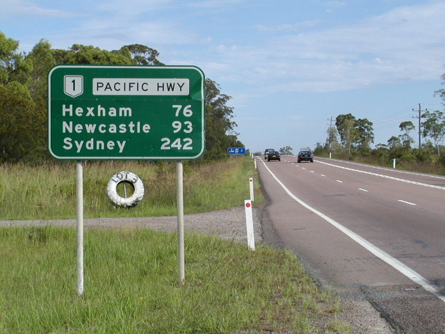
Route Markers: Metroad 1 (Artarmon to Wahroonga), State Route 83 (Wahroonga to Somersby, Wyoming to Ourimbah & Tuggerah to Doyalson), State Route 111 (Doyalson to Newcastle West & Mayfield West to Hexham), National Route 1 (Hexham to Gold Coast Highway), M1 (Gold Coast Highway to Queensland State Border)
Interstate Continuation: Pacific Highway continues into Queensland, terminating at the Brisbane City Council boundary at Underwood. However direction signs display the name 'Pacific Motorway'.
Roads Act 1993 Classification: Highway No. 10 (formerly State Highway No. 101)
Proclaimed a State Highway: 7th August 1928 (originally named North Coast Highway)
Named Pacific Hwy: May 1931
The Pacific Highway, once a continuous link from North Sydney to the Queensland State Border, is now made up of four disconnected sections. These are:
-
Section 1 - From the Warringah Freeway at North Sydney northerly (with a loop along Arthur Street and then westerly along Berry Street, North Sydney) to George Street at Hornsby, then via George Street, Bridge Road and Jersey Street North at Asquith, then via Berowra, Cowan, Peats Ferry Bridge over the Hawkesbury River, Calga and bridge over Mooney Mooney Creek to the junction with Wisemans Ferry Road and Central Coast Highway west of the Sydney - Newcastle Freeway at Gosford Interchange near Kariong;
-
Section 2 - From the intersection of Henry Parry Drive, Pemell Street and Mann Street at Wyoming via Niagara Park, Narara, Lisarow and Ourimbah to the Sydney - Newcastle Freeway at Ourimbah Interchange;
-
Section 3 - From Wyong Road at Tuggerah via Wyong, Wadalba, Charmhaven, Doyalson, Swansea, Belmont and Charlestown to City Road at South Adamstown, then via City Road and Stewart Avenue to the intersection of Hunter Street and Stewart Avenue at Wickham;
-
Section 4 - From the intersection of Maitland Road and Industrial Drive at Warrabrook via Maitland Road to Hexham, then via Raymond Terrace bypass Freeway, Karuah bypass Freeway, Bulahdelah Freeway, Taree bypass Freeway, Coopernook bypass, Moorland bypass, Kew bypass, Telegraph Point, Kempsey, Frederickton, Clybucca, Eungai Creek, Warrell Creek, Macksville, Urunga, Bonville bypass, Coffs Harbour, Woolgoolga, South Grafton, Ulmarra, Cowper bypass, Tyndale bypass, Woodburn, Wardell, Ballina, Bangalow bypass, Brunswick-Yelgun Freeway, Yelgun-Chinderah Freeway, Chinderah bypass, Tweed Heads bypass and Tugun bypass Freeway to the Queensland Border.2
The Pacific Highway carries no route number between the Warringah Freeway and Gore Hill Freeway, the Metroad 1 shield thence to Pearces Corner, the State Route 83 shield from Pearces Corner to Motorway Link at Doyalson, the State Route 111 marker from there to Hexham and the National Route 1 shield for the remainder of the route in New South Wales.
Brief History of the Pacific Highway as a legal entity:
On 7 August 1928 the newly-formed Main Roads Board proclaimed the main North Coast road, running from Hexham through Gloucester, Taree, Port Macquarie, Kempsey, Macksville, Nambucca Heads, Coffs Harbour, South Grafton, Maclean, Woodburn, Ballina, Bangalow, Byron Bay, Mullumbimby, and Murwillumbah to Tweed Heads, as State Highway No. 10 and named it ‘North Coast Highway’. The Highway was renamed ‘Pacific Highway’ in May 1931, following Queensland naming their section of the Brisbane-Sydney coastal route Pacific Highway, and it was extended south from Hexham to North Sydney. The section south of Hexham was previously part of State Highway No. 9 – Great Northern (now New England) Highway.
Since this time, two major changes in the alignment of the highway have occurred, that did not involve the construction of a deviation.
On 29 May 1931, the route of the highay was altered to take a direct route between Bangalow and Ewingsdale, via St Helena Hill. This would shorten the highway by 9km, as the former route was circuitous and passed through Byron Bay.
On 9 March 1945 the Pacific Highway was again altered, this time between Tyagarah and Billinudgel. A new route via Brunswick Heads replaced the former alignment through Mullumbimby and along Coolamon Scenic Drive.
Three smaller changes also took place in much more recent times, making the Pacific Highway no longer a continuous legal entity from North Sydney to the Queensland Border.
-
On 22 November 1996 two gaps were created in the Pacific Highway on the Central Coast, with the decommissioning of the following sections: Calga Interchange to Kariong Interchange; and from Brian McGowan Bridge to Etna Street, Gosford.
-
On 11 August 2006 the short section of highway that remained between Kariong Interchange and Brian McGowan Bridge was reclassified as part of the newly-proclaimed Central Coast Highway (Highway No. 30), thus creating one gap approximately 12km long.
-
And, finally, on 23 April 2010 the Calga to Kariong section was reproclaimed as part of the highway; the section between Burns Road at Ourimbah and Wyong Road at Tuggerah was decommissioned; and the section between Hunter Street at Newcastle West and Industrial Drive at Mayfield West was also decommissioned. The present four discontinuous sections of the Pacific Highway were thus created.
Between August 1946 and January 1989 the Pacific Highway also had a spur – State Highway No. 10A – which consisted of King Street, Newcastle, between Stewart Ave and Darby Street. This spur has since been incorporated into Main Road No. 188. The spur was not named 'Pacific Highway', retaining its local street names.
Other changes to the Highway alignment have been due to the construction of bypasses, deviations and river crossings and are covered in the pages below. The development of the Pacific Highway is also divided into the respective route marker pages.
Explore the Pacific Highway:
Click HERE to see the un-numbered section of the Pacific Hwy (Crows Nest-North Sydney)
Click HERE to see the Metroad 10 section of Pacific Hwy
Click HERE to see the Metroad 1 section of Pacific Hwy
Click HERE to see the State Route 83 section of Pacific Hwy
Click HERE to see the State Route 111 section of Pacific Hwy
Click HERE to see the National Route 1 section of Pacific Hwy
References:
1. An amendment to the Roads Act 1993 via the Statute Law (Miscellaneous Provisions) Act (No 2) 2005, gazetted on 24 November 2005, replaced the road classification of 'State Highway' with 'Highway'
2. Roads and Traffic Authority, Schedule of Classified Roads and State & Regional Roads, as at 31 January 2011
Last updated 8 November 2011 © Ozroads 2004-2011. |